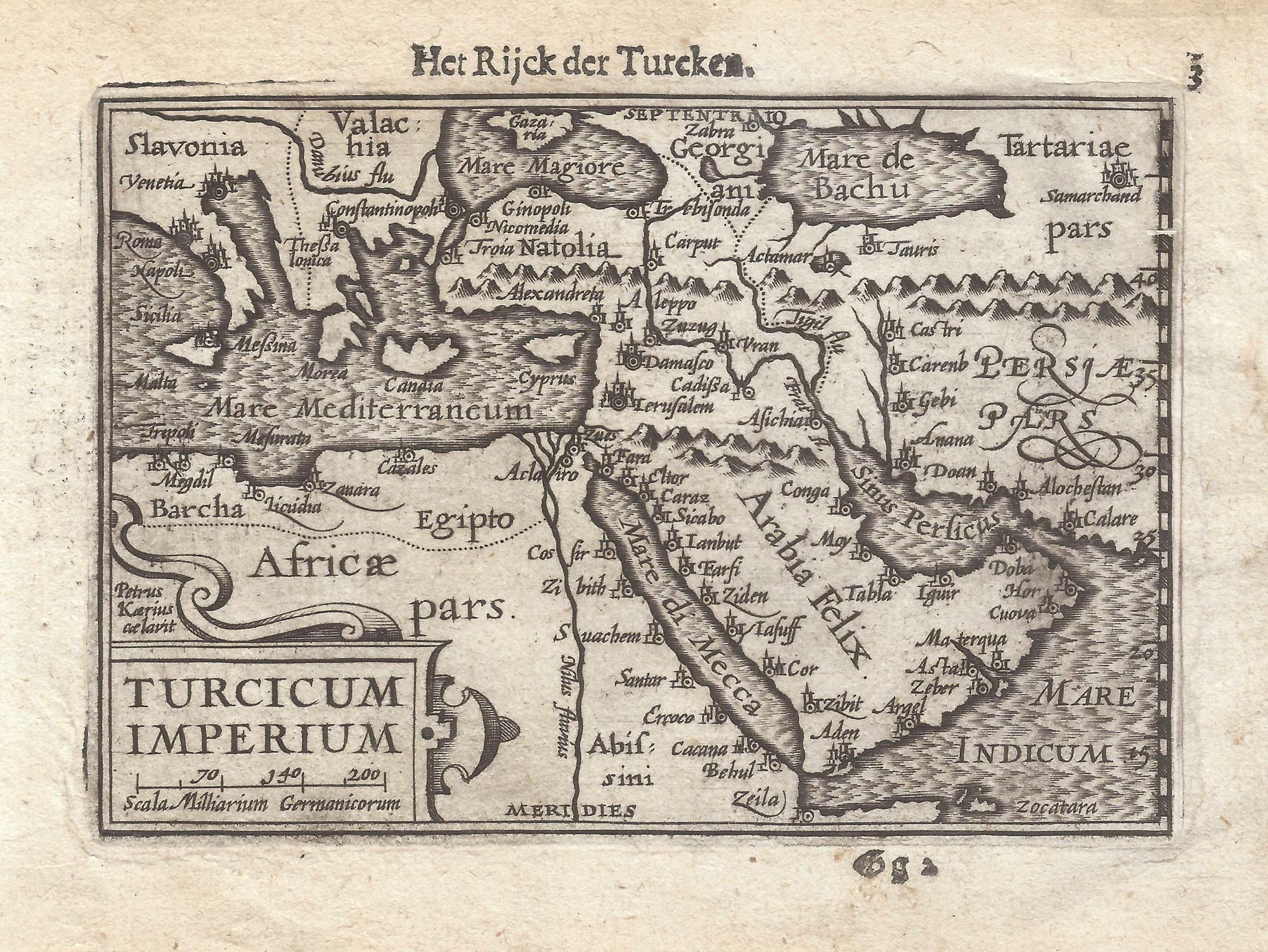


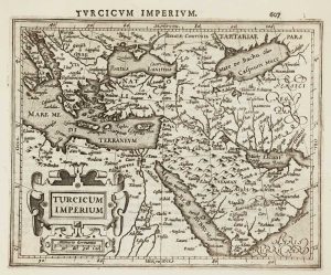
A 16th century miniature map of the Turkish Empire
Turcicum Imperium.
Amsterdam, Cornelis Claez, 1599, Dutch text edition. 85 x 125mm, with letterpress surtitle and pagination.
£160.00
1 in stock
x
Question About This Item?
A 16th century miniature map of the Turkish Empire & LANGENES, Barent.Stock #: 21264Similar to Sell?
Description
A scarce map of the Turkish Empire, engraved by either Jodocus Hondius or Pieter van den Keere for the 1598 'Caert-Thresoor', with a text by an unknown author. Despite being published only a year after the first edition, this is a second state: the right border has been re-engraved with latitude graduations.
By 1600 this map was being published in the 'Tabularum Geographicarum Contractarum' with a text by Petrus Bertius, and in 1616 a new plate was engraved by Jodocus Hondius II, slightly larger and with wider borders with scales of longitude and latitude.
Condition:
A good example.Related products
-
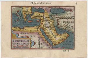
Early 17th century miniature map of the Turkish Empire
BERTIUS, Petrus. Date: 1609Stock #: 24846 £250.00 -
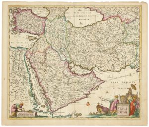
A 17th century map of the Middle East & Arabia
DE WIT, Frederick. Date: 1666Stock #: 25256 £950.00 -
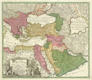
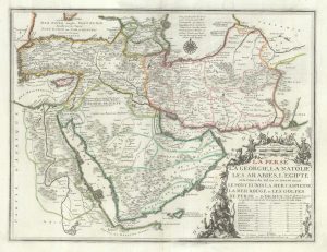
18th century map of the Turkish Empire
HOMANN, Johann Baptist. Date: 1720Stock #: 25258 £650.00 -
A two-sheet map of the Turkish Empire
JAILLOT, Alexis-Hubert. Date: 1681Stock #: 14632 £1,200.00 -
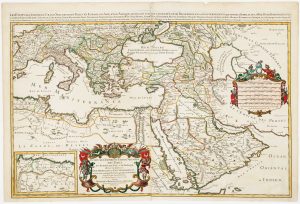
De Fer’s large format of Western Asia centred on Arabia
FER, Nicolas de. Date: 1720Stock #: 25114 £1,250.00 -
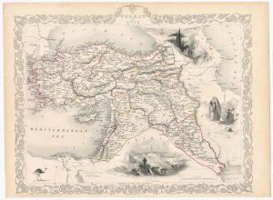
Map of the Ottoman Empire with decorative vignettes
TALLIS, John. Date: 1851Stock #: 23499 £150.00 -
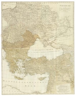
The theatre of the Russo-Turkish War of 1787
SCHRAEMBL, Franz Anton. Date: 1787Stock #: 25060 £500.00 -
Early 17th century map of the Turkish Empire
HONDIUS, Jodocus. Date: 1607Stock #: 11990 £300.00 -
17th century map of the Turkish Empire
JANSSON, Jan. Date: 1636Stock #: 25257 £750.00
Items by the same author
[ti_wishlists_addtowishlist]

[ti_wishlists_addtowishlist]

A 16th century miniature map of Saxony, Thuringia & Meissen
LANGENES, Barent. Date: 1599 Stock #: 21173 £50.00
[ti_wishlists_addtowishlist]

[ti_wishlists_addtowishlist]

[ti_wishlists_addtowishlist]

A 16th century miniature map of the Comtat Venaissin
LANGENES, Barent. Date: 1599 Stock #: 21137 £55.00
[ti_wishlists_addtowishlist]
