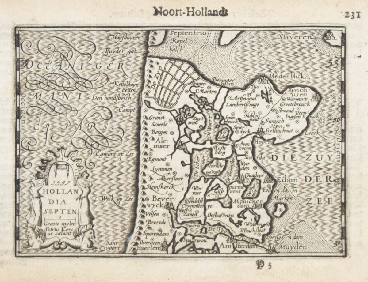


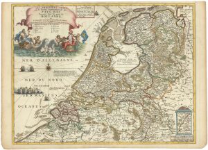
A 16th century miniature map of North Holland
1597. Hollandia Septen.
Amsterdam, Cornelis Claez, 1599, Dutch text edition. 85 x 125, with letterpress surtitle and pagination.
£70.00
1 in stock
x
Question About This Item?
A 16th century miniature map of North Holland & LANGENES, Barent.Stock #: 21160Similar to Sell?
Description
A scarce map of North Holland, engraved by either Pieter van den Keere or Jodocus Hondius for the 1598 'Caert-Thresoor', with a text by an unknown author. Despite being published a year after the first edition, this is a second state: the lateral borders have been re-engraved with latitude graduations.
By 1600 this map was being published in the 'Tabularum Geographicarum Contractarum' with a text by Petrus Bertius, and in 1616 a new plate was engraved by Jodocus Hondius II, slightly larger and with wider borders with scales of longitude and latitude.
Condition:
Some age toning.Related products
-
Holland with an Inset of its colonies in the East Indies
SEUTTER, Matthaus. Date: 1744Stock #: 11407 £280.00 -
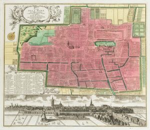
17th century townplan of Haarlem
BLAEU, Johannes. Date: 1649Stock #: 22683 £750.00 -
Scarce map of the Netherlands, with a fine maritime cartouche
CORONELLI, Vincenzo Maria. Date: 1690Stock #: 23087 £900.00 -
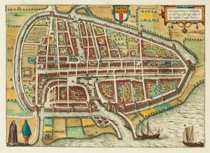
16th century town plan of Rotterdam
BRAUN, Georg & HOGENBERG, Frans. Date: 1588Stock #: 22691 £650.00 -
Classic carte-à-figure map of the Netherlands & Belgium
SPEED, John. Date: 1665Stock #: 23992 £1,300.00 -
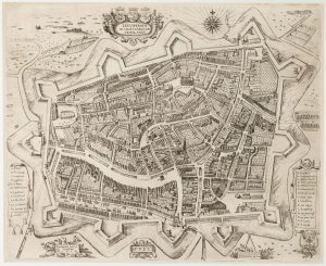
An early 17th century plan of Leeuwarden
FEDDES, Pieter. Date: 1622Stock #: 22688 £1,000.00 -
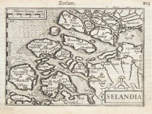
A 16th century miniature map of Zeeland
LANGENES, Barent. Date: 1599Stock #: 21159 £70.00 -
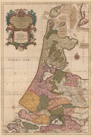
A two-sheet map of Holland in fine original colour
JAILLOT, Alexis-Hubert. Date: 1696Stock #: 22713 £1,100.00 -
18th century town plan of the Hague
SEUTTER, Matthaus. Date: 1760Stock #: 22693 £1,300.00
Items by the same author
[ti_wishlists_addtowishlist]

[ti_wishlists_addtowishlist]

A 16th century miniature map of Saxony, Thuringia & Meissen
LANGENES, Barent. Date: 1599 Stock #: 21173 £50.00
[ti_wishlists_addtowishlist]

[ti_wishlists_addtowishlist]

[ti_wishlists_addtowishlist]

A 16th century miniature map of the Comtat Venaissin
LANGENES, Barent. Date: 1599 Stock #: 21137 £55.00
[ti_wishlists_addtowishlist]