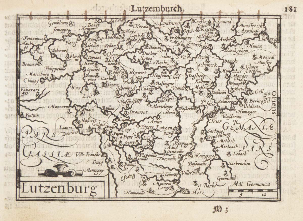


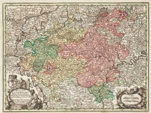
A 16th century miniature map of Luxembourg
Lutzenburg.
Amsterdam, Cornelis Claez, 1599, Dutch text edition. 85 x 125, with letterpress surtitle and pagination.
£70.00
1 in stock
x
Question About This Item?
A 16th century miniature map of Luxembourg & LANGENES, Barent.Stock #: 21155Similar to Sell?
Description
A scarce map of Luxembourg, engraved by either Pieter van den Keere or Jodocus Hondius for the 1598 'Caert-Thresoor', with a text by an unknown author. Despite being published a year after the first edition, this is a second state: the lateral borders have been re-engraved with latitude graduations.
By 1600 this map was being published in the 'Tabularum Geographicarum Contractarum' with a text by Petrus Bertius, and in 1616 a new plate was engraved by Jodocus Hondius II, slightly larger and with wider borders with scales of longitude and latitude.
Condition:
Some age toning; old ink graduations on top border.Related products
Items by the same author
[ti_wishlists_addtowishlist]

[ti_wishlists_addtowishlist]

A 16th century miniature map of Saxony, Thuringia & Meissen
LANGENES, Barent. Date: 1599 Stock #: 21173 £50.00
[ti_wishlists_addtowishlist]

[ti_wishlists_addtowishlist]

[ti_wishlists_addtowishlist]

A 16th century miniature map of the Comtat Venaissin
LANGENES, Barent. Date: 1599 Stock #: 21137 £55.00
[ti_wishlists_addtowishlist]