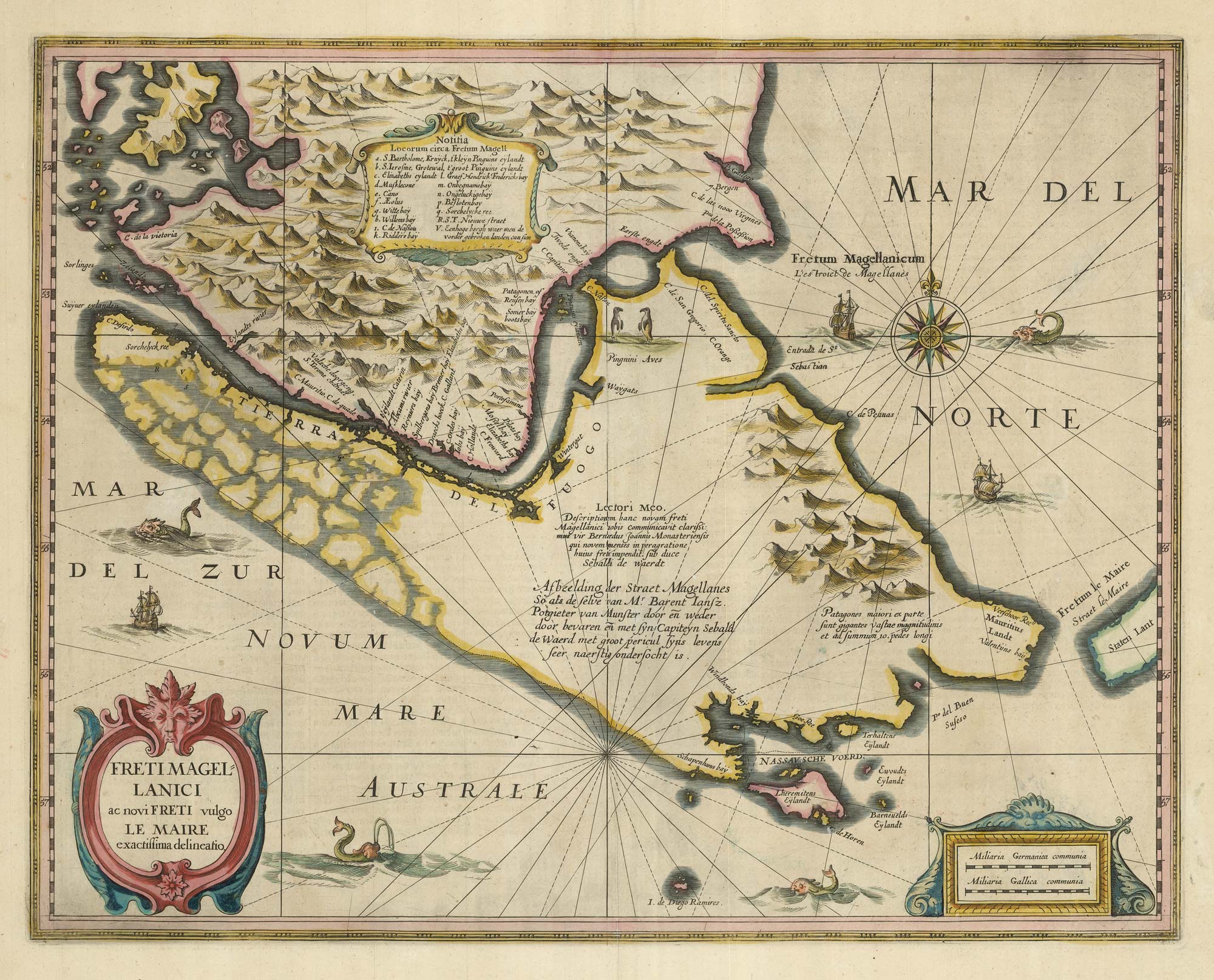


A 17th century map of the Magellan Strait
Freti Magellanici ac novi Freti vulgo Le Maire exactissima delineatio.
Amsterdam, 1638-42, German text edition. Original colour. 385 x 490mm.
£600.00
Description
An important map of the Magellan Strait, expanded from the Hondius map of 1606 to include the discoveries of the Le Maire Strait and Cape Horn, but still guessing about the Pacific coastline of Tierra del Fuego.
Two penguins stand near the eastern end of the Magellan Strait.
Condition:
Worm holes in margins.References:
VAN DER KROGT: 1:421.Related products

Items by the same author
[ti_wishlists_addtowishlist]

A magnificent example of the first folio sea atlas of the World
JANSSON, Jan. Date: 1650 Stock #: 23074 £47,500.00
[ti_wishlists_addtowishlist]
[ti_wishlists_addtowishlist]

[ti_wishlists_addtowishlist]

[ti_wishlists_addtowishlist]

[ti_wishlists_addtowishlist]
