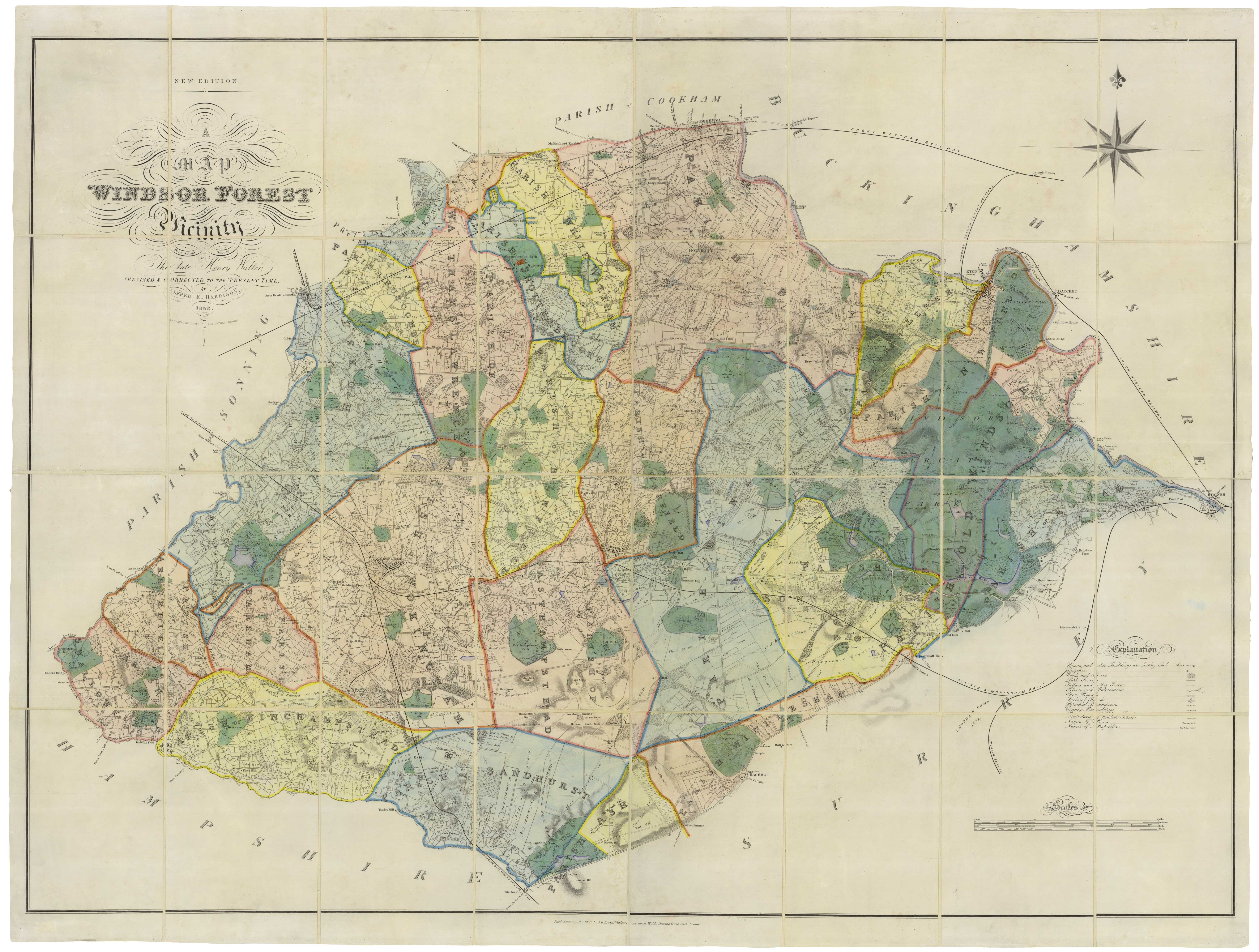


A scarce 19th century large-scale map of Windsor Forest
A Map of Windsor Forest and its Vicinity from Actual Survey by The late Henry Walter, Revised & Corrected to the Present Time, by Alfred E. Harrison. 1856.
Windsor: J.B. Brown & London; James Wyld, 1856. Old colour. Dissected and laid on linen, total 965 x 1270mm.
£3,250.00
1 in stock
x
Question About This Item?
A scarce 19th century large-scale map of Windsor Forest & HARRISON, Alfred E.Stock #: 18982
Add to Wishlist
Export as PDFEnquireSimilar to Sell?Add to Wishlist
Description
A large folding map of Windsor Forest, a large area of Berkshire, divided into parishes. The extent of the map is Maidenhead in the north, clockwise to Windsor (with the Great Park), Staines, Virginia Water, Bagshot, Sandhurst, Swallowfield and Twyford. The military college at Sandhurst is marked, with the large heathland that they use for their exercises.