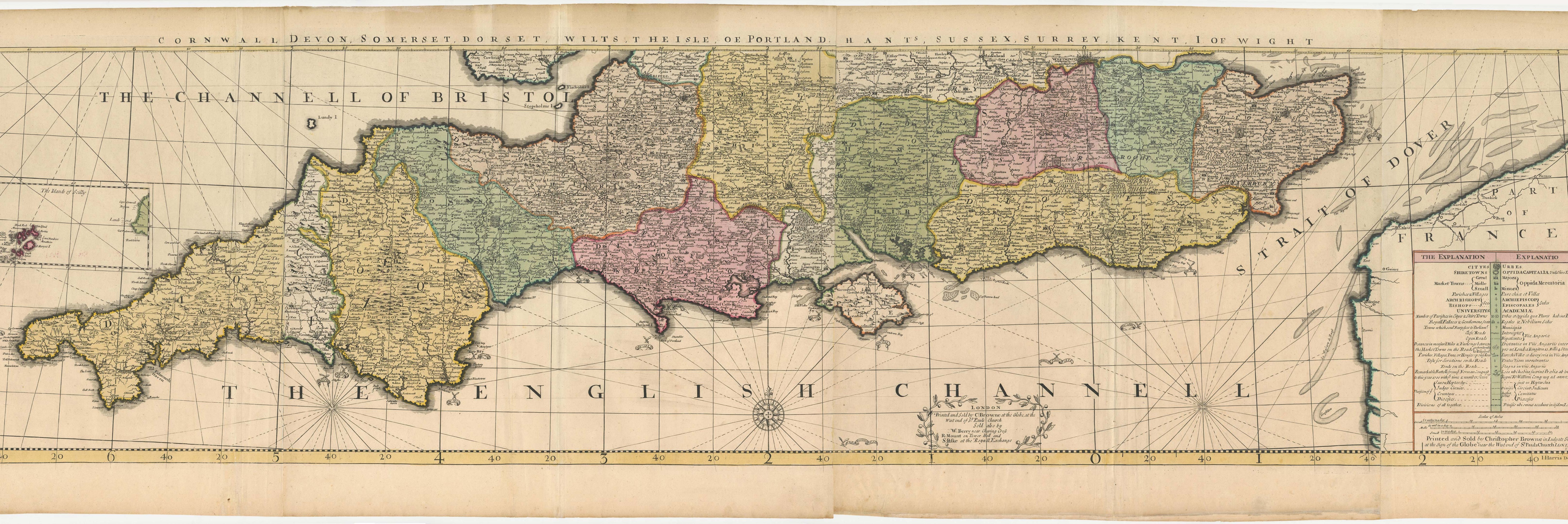


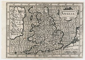
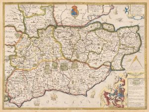
The southern counties of England from a 1700 wall map of England
[Surtitle] Cornwall Devon, Somerset, Dorset, Wilts, The Isle of Portland, Hants, Sussex, Surrey, Kent, Isle of Wight. London. Printed and Sold by C: Browne at the Globe, at the West end of S:t Pauls Church. Sold Also by W: Berry near Charing Cross,, R: Mount on Tower Hill and S: Paske at the Royall Exchange
London: Christopher Browne, 1700. Fine original colour. Four sheets conjoined, total 455 x 1660mm.
£3,000.00
1 in stock
x
Question About This Item?
The southern counties of England from a 1700 wall map of England & HARRIS, John.Stock #: 25108
Add to Wishlist
Export as PDFEnquireSimilar to Sell?Add to Wishlist
Description
Four sheets comprising the complete bottom row of a rare 16-sheet wall map of England, ''Nova Totius Angliae Tabula. A New Mapp of the Kingdom of England Shewing Its Antient and Present Government'', drawn and engraved by John Harris. They come from the first state of the map, with the date 1700 and Browne's address at the Globe (pre-1712). The condition of the sheets and the presence of the surtitle suggest they were never joined to make the complete map but were issued in a composite atlas.
The map shows as far north as Bristol and London. with the Scilly Islands shown in an inset and Ogilby's Roads marked. Around the coasts the sites of several sea battles are marked and dated.
John Harris (fl 1686-1730) worked for many different publishers, including engraving the Thames chart for of Greenville Collins' 'Coastal Pilot' (1693) and Gascoigne's map of Cornwall (1699).
Shirley describes this map as 'one of the most popular wall maps of England'. Certainly it had a long life, with states published by Philip Overton, Thomas Bowles, John Bowles and Robert Sayer, the last being c.1760.
Condition:
A good example.References:
SHIRLEY: British Isles 1650-1750, Browne 2.Related products
-
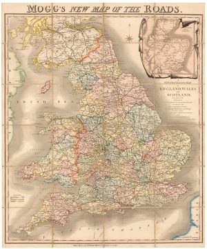
A colourful Georgian map of the roads of England & Wales
MOGG, Edward Slatford. Date: 1838Stock #: 22986 £250.00 -
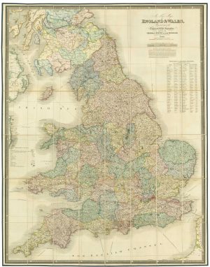
A large folding map of England and Wales in fine colour
FADEN, William. Date: 1830Stock #: 21859 £500.00 -

A decorative wall map of England & Wales with panelled borders
SEATON, Robert. Date: 1835Stock #: 25898 -
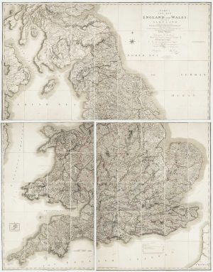
Georgian wall map of England & Wales
CARY, John. Date: 1820Stock #: 22666 £1,250.00 -
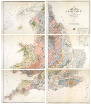
An important geological map of England and Wales on six sheets
GREENOUGH, George Bellas. Date: 1820Stock #: 20885 £25,000.00 -
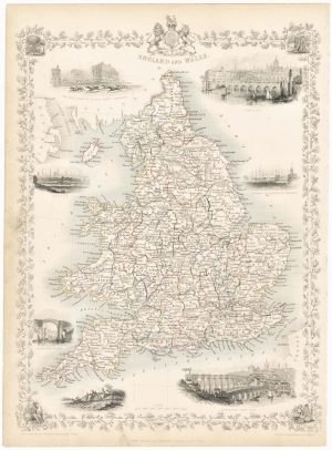
Map of England and Wales with vignettes
TALLIS, John. Date: 1851Stock #: 23491 £180.00 -
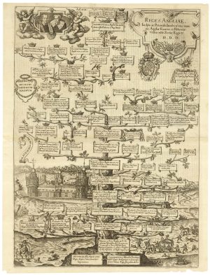
A family tree of the English Royal Family
CUSTOS, Dominicus. Date: 1625Stock #: 25204 £500.00 -
A scarce miniature map of England and Wales
ROGIERS, Salomon. Date: 1807Stock #: 22084 £160.00 -
An unrecorded state of Saxton’s map of South East England
SAXTON, Christopher. Date: 1690Stock #: 22260 £3,000.00
Items by the same author
Add to Wishlist
Add to Wishlist
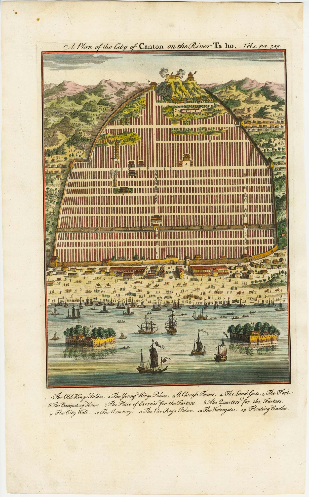
An 18th century town plan of Canton in China
HARRIS, John. Date: 1746 Stock #: 23675 £350.00
Add to Wishlist
Add to Wishlist
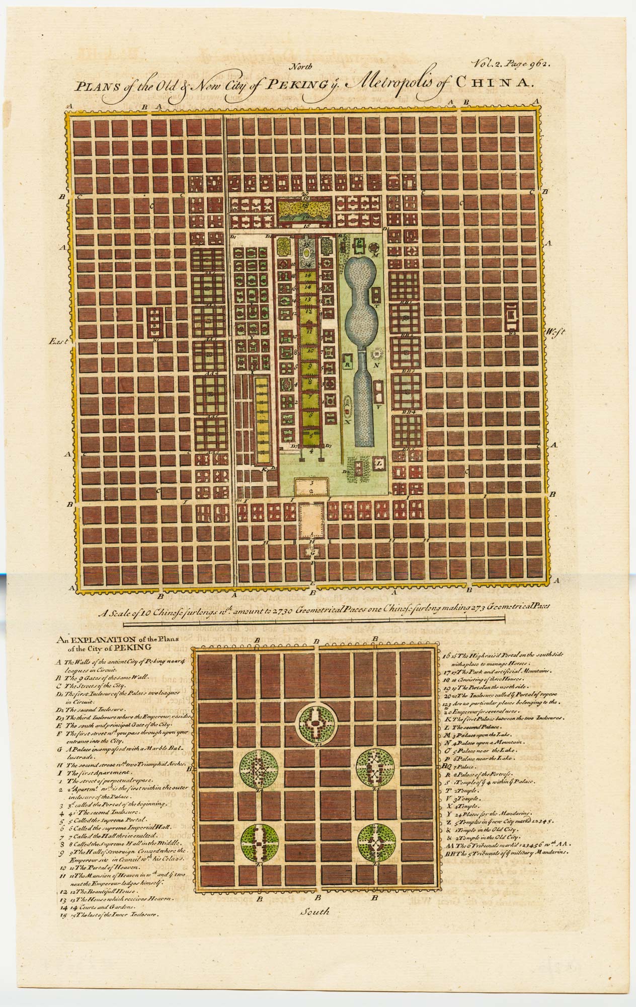
18th century town plan of Peking
HARRIS, John. Date: 1748 Stock #: 23674 £450.00
Add to Wishlist
Add to Wishlist
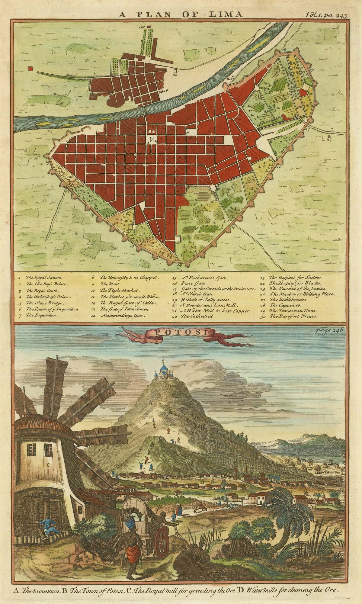
A plan of Lima and a view of the silver mines of Potosi
HARRIS, John. Date: 1746 Stock #: 21869 £150.00
Add to Wishlist
Add to Wishlist
