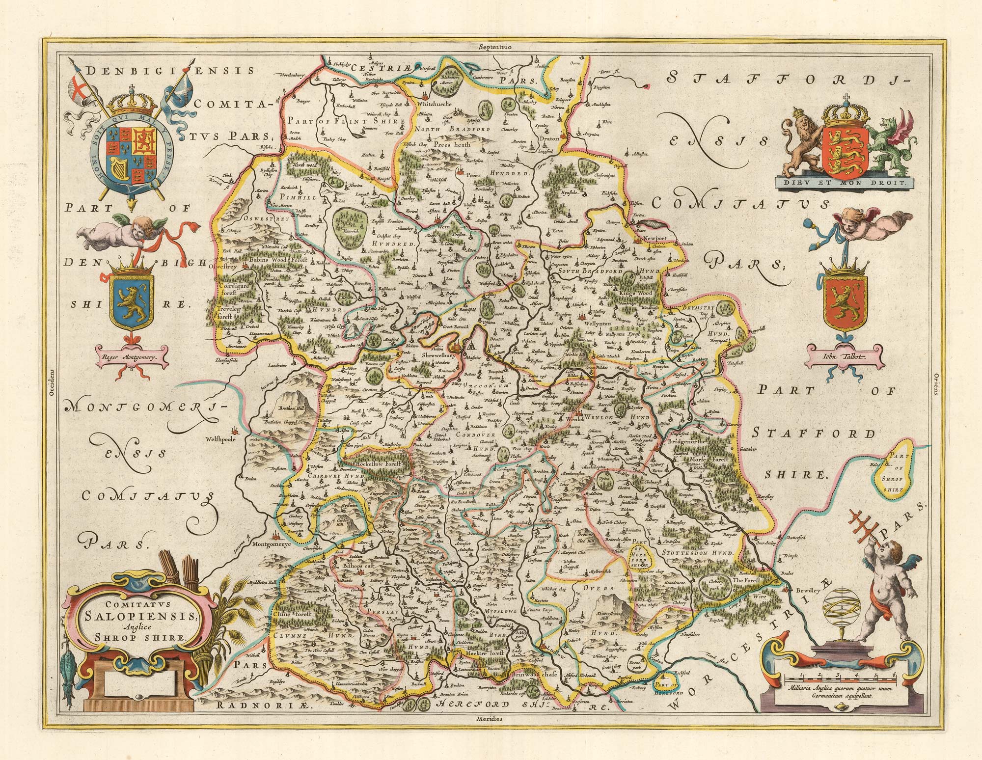


17th century map of Shropshire with fine colour
Comitatus Salopiensis, Anglice Shrop Shire
Amsterdam, 1662, Latin text edition. Fine original colour with gold highlights. 385 x 500mm, with exceptionally wide margins.
£500.00
1 in stock
x
Question About This Item?
17th century map of Shropshire with fine colour & BLAEU, Johannes.Stock #: 23043
Add to Wishlist
Export as PDFEnquireSimilar to Sell?Add to Wishlist
Description
Decorative map of Shropshire, with two royal crests, decorative cartouches for title and scale and two arms of the local nobility.
First published in 1645, during the English Civil War, this example comes from the 'Atlas Major'. The quality of the colour is exceptional.
Condition:
A good example.References:
KOEMAN: 2:302-3.Related products
Items by the same author
Add to Wishlist
Add to Wishlist
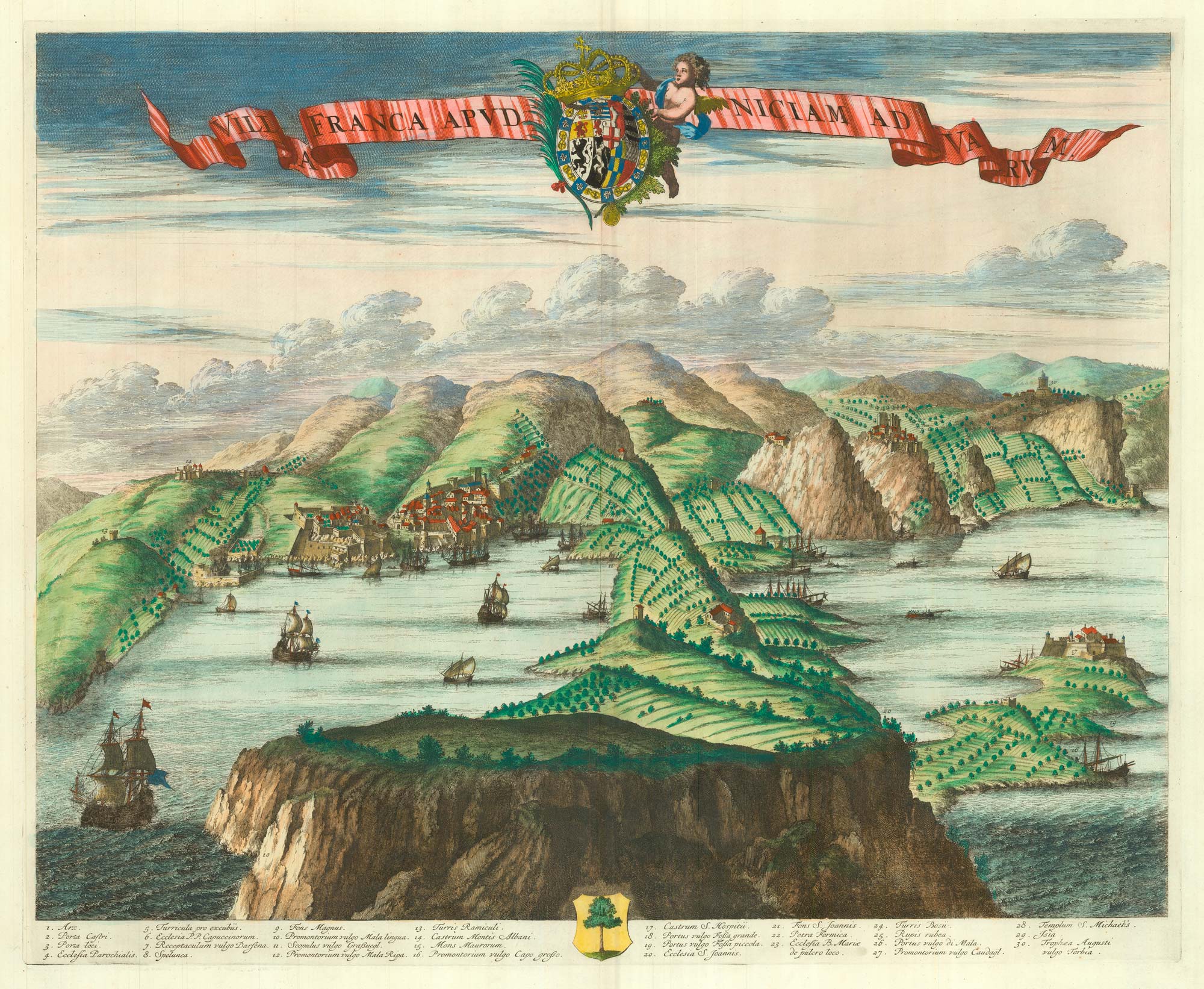
A scarce 17th century prospect of Villefranche-sur-Mer
BLAEU, Johannes. Date: 1682 Stock #: 24159 £1,500.00
Add to Wishlist
Add to Wishlist

A scarce 17th century prospect of Evian-les-Bains in superb colour
BLAEU, Johannes. Date: 1682 Stock #: 23265 £1,250.00
Add to Wishlist
Add to Wishlist
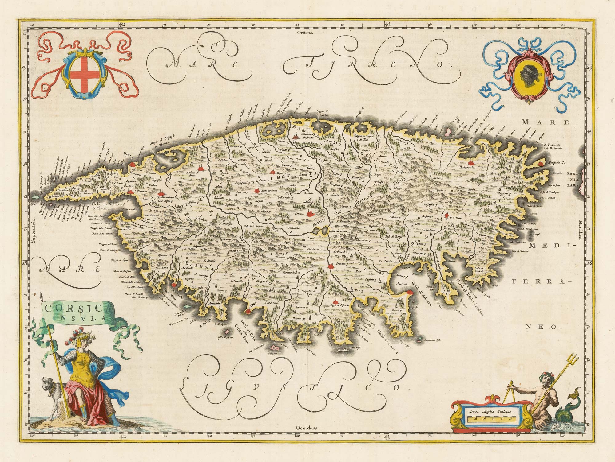
A scarce 17th century map of Corsica
BLAEU, Johannes. Date: 1663 Stock #: 22580 £1,100.00
Add to Wishlist
Add to Wishlist
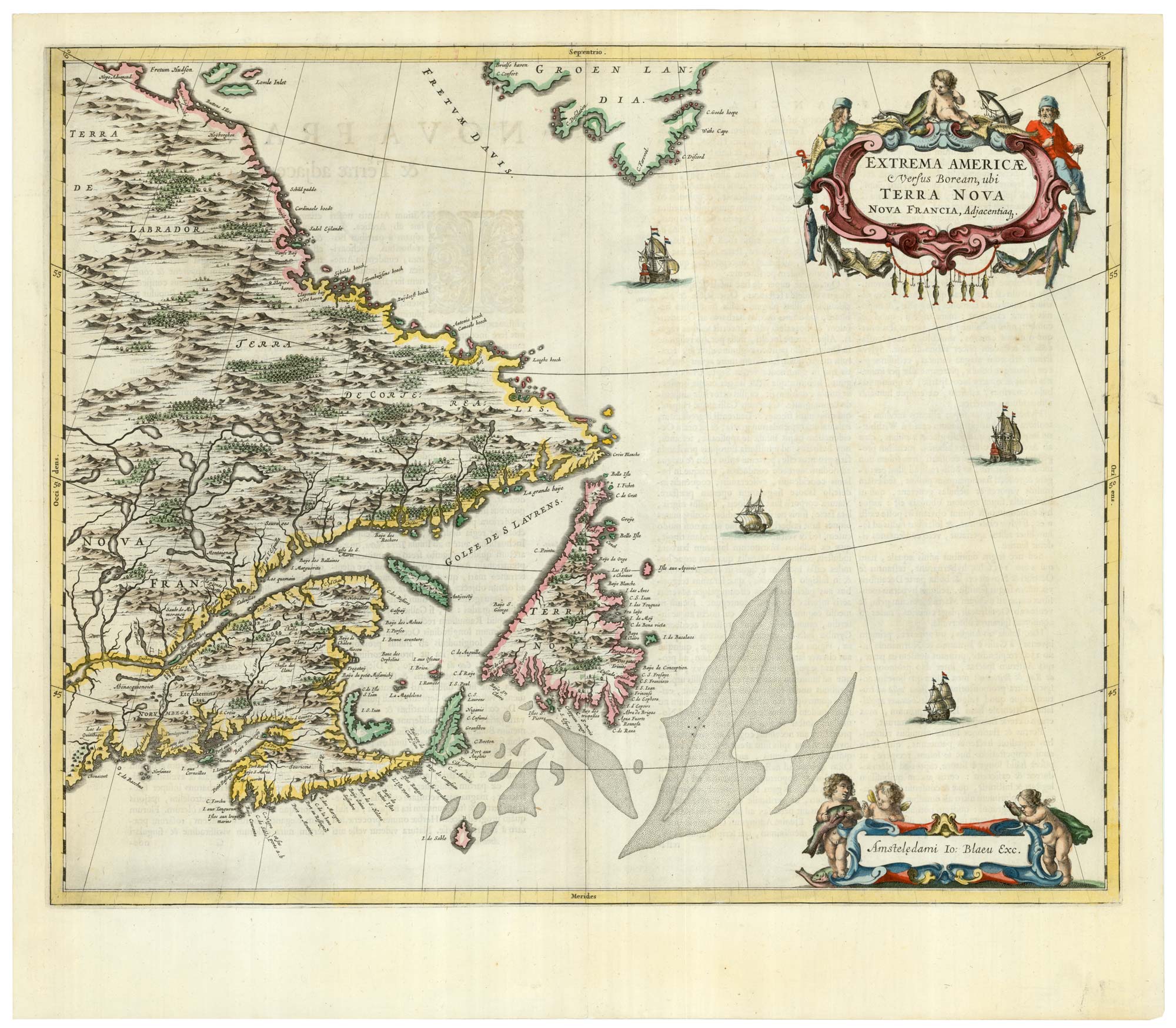
A scarce 17th century map of Newfoundland and Nova Scotia
BLAEU, Johannes. Date: 1662 Stock #: 22716 £1,500.00
Add to Wishlist
Add to Wishlist
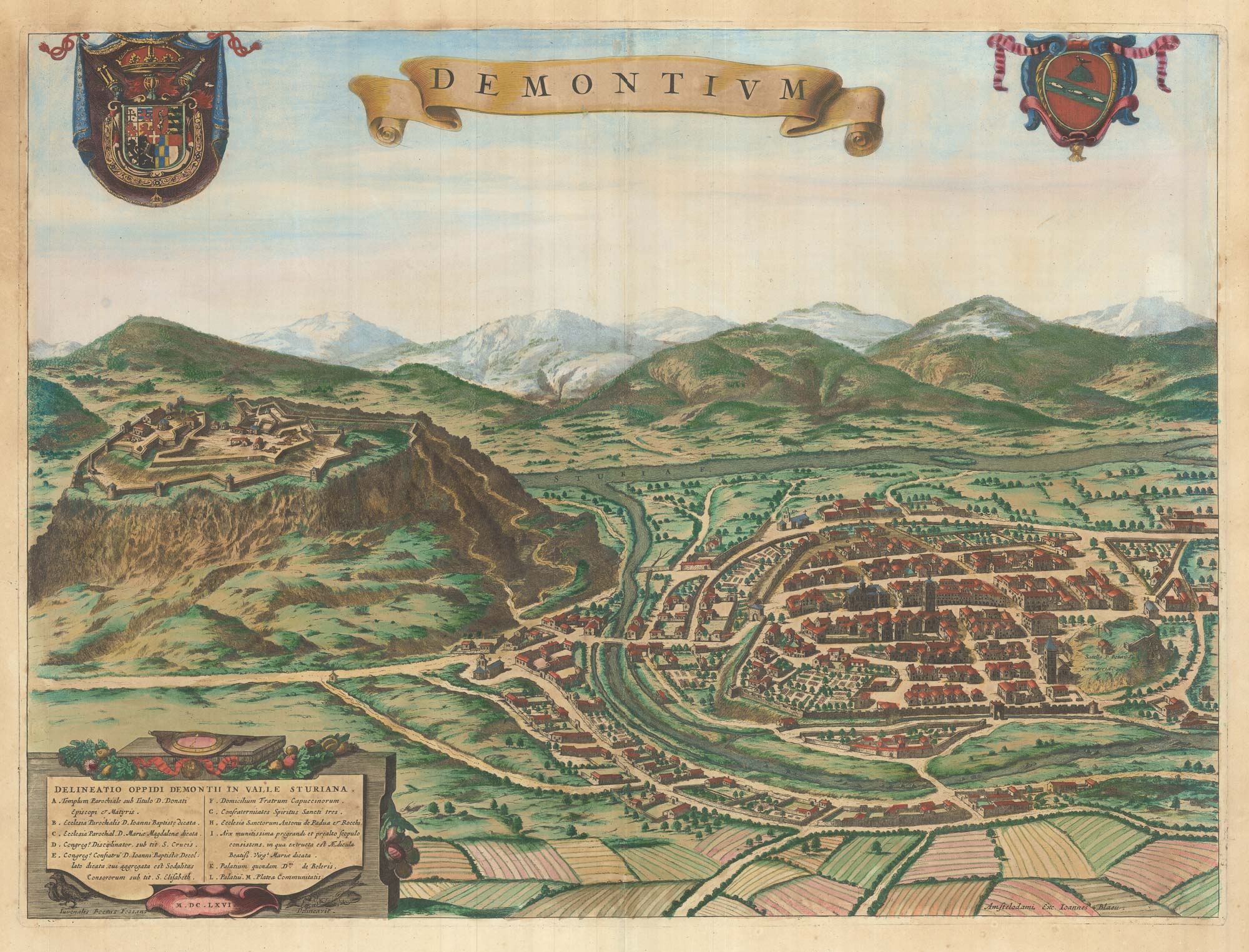
A scarce 17th century prospect of Demonte in superb colour
BLAEU, Johannes. Date: 1682 Stock #: 23267 £500.00
Add to Wishlist
Add to Wishlist