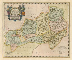
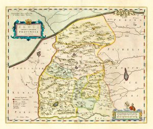
The first western map of the Chinese province of Shandong
Xantung, Sinarum Imperii Provincia Quarta.
Amsterdam, 1658, Spanish text edition. Coloured, with gold highlights. 400 x 495mm.
£1,200.00
1 in stock
x
Question About This Item?
The first western map of the Chinese province of Shandong & BLAEU, Johannes.Stock #: 18174
Add to Wishlist
Export as PDFEnquireSimilar to Sell?Add to Wishlist
Description
A 17th century map of Shandong, published in the 'Novus Atlas Sinensis', the first Western atlas of China, compiled from the maps supplied by Martino Martini, a Jesuit missionary who travelled through China 1643-1650.
Condition:
A good example.References:
KOEMAN: Bl 60a.Related products
-
The first western map of the Chinese province of Guangxi
BLAEU, Johannes. Date: 1658Stock #: 18177 £850.00 -
Sea chart of the East China Sea
BRYANT, Tomas. Date: 1864Stock #: 12452 £900.00 -
19th century map of Hainan
FREMIN, A.R. Date: 1827Stock #: 19928 £400.00 -
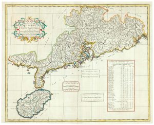
The English edition of Du Halde’s map of Guangdong
DU HALDE, Johann Baptiste. Date: 1738Stock #: 24558 £1,600.00 -
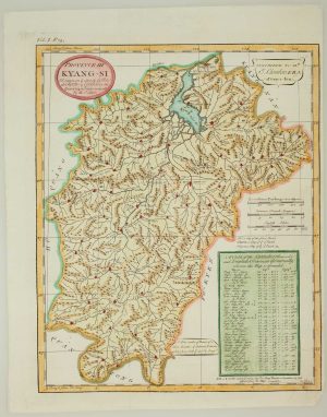
The Chinese Province of Kyang-Si
DU HALDE, Johann Baptiste. Date: 1738Stock #: 16301 £120.00 -
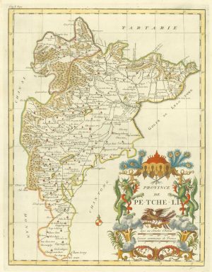
18th century map of Beizhili, with Beijing
ANVILLE, Jean Baptiste B. D'. Date: 1735Stock #: 18178 £750.00 -
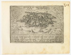
A 16th century Italian plan of Hangzhou
VALEGIO, Francesco. Date: 1598Stock #: 24153 £650.00 -
The first western map of the Chinese province of Shanxi
BLAEU, Johannes. Date: 1658Stock #: 18173 £750.00 -
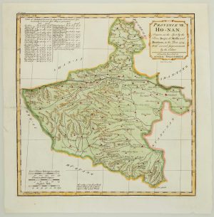
The Chinese Province of Henan
DU HALDE, Johann Baptiste. Date: 1738Stock #: 16299 £120.00
Items by the same author
Add to Wishlist
Add to Wishlist
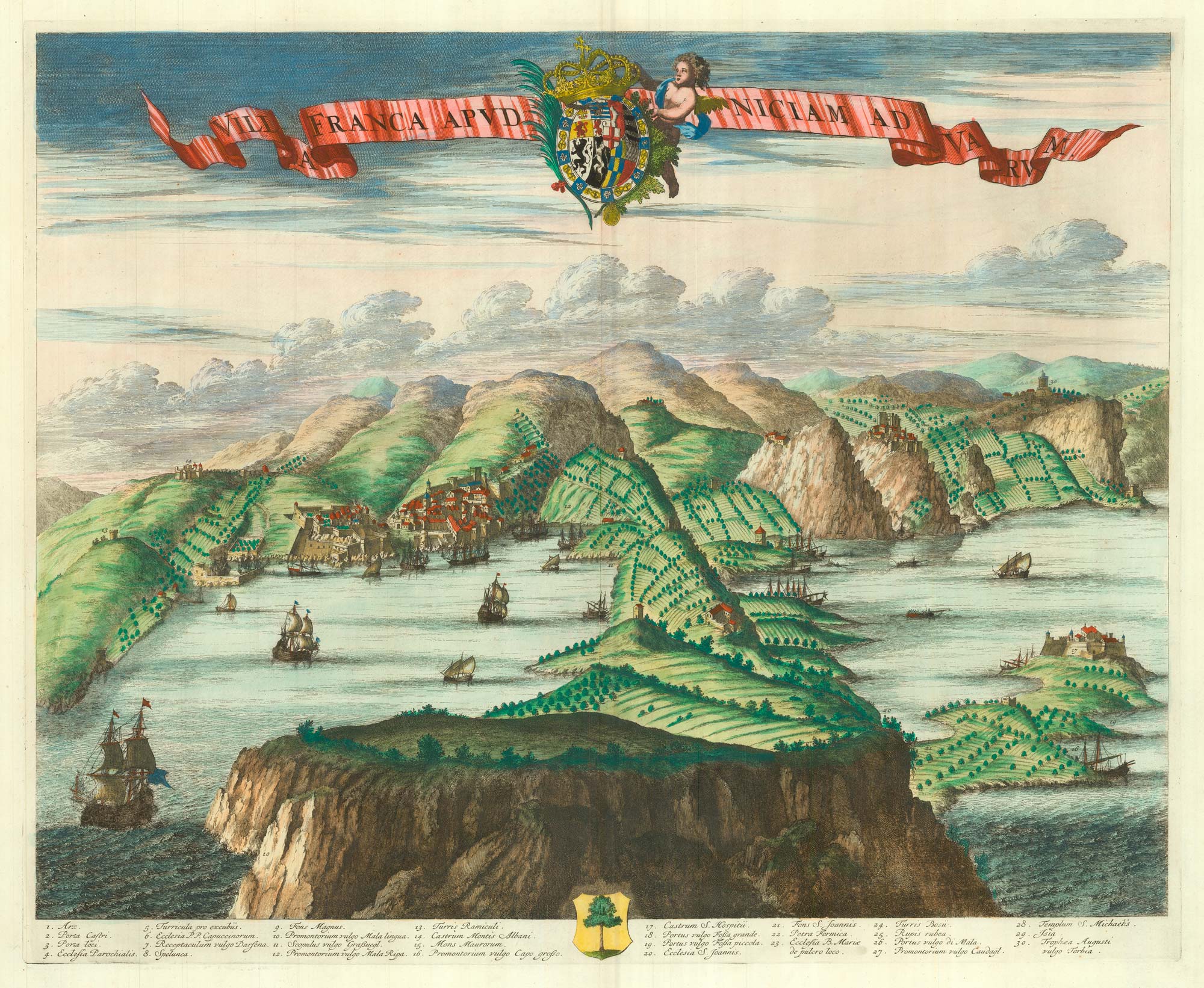
A scarce 17th century prospect of Villefranche-sur-Mer
BLAEU, Johannes. Date: 1682 Stock #: 24159 £1,500.00
Add to Wishlist
Add to Wishlist

A scarce 17th century prospect of Evian-les-Bains in superb colour
BLAEU, Johannes. Date: 1682 Stock #: 23265 £1,250.00
Add to Wishlist
Add to Wishlist
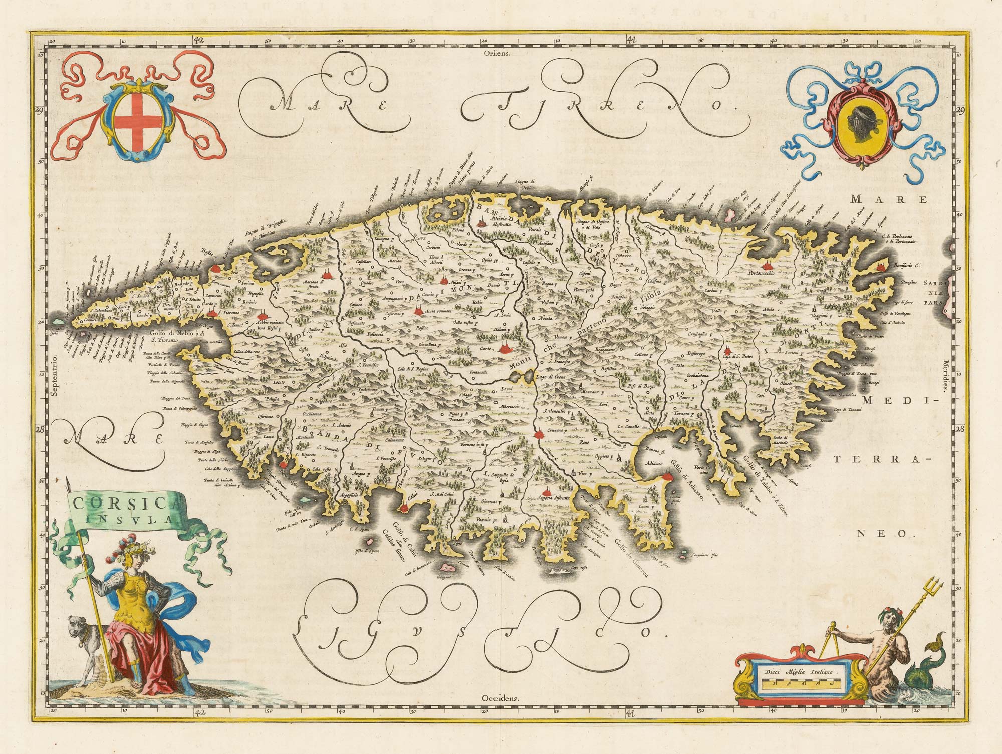
A scarce 17th century map of Corsica
BLAEU, Johannes. Date: 1663 Stock #: 22580 £1,100.00
Add to Wishlist
Add to Wishlist
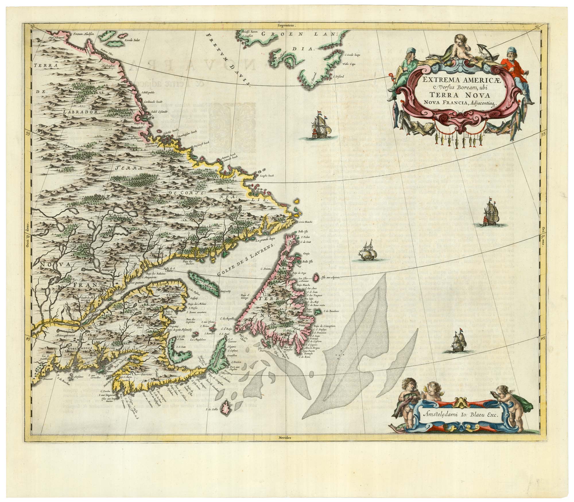
A scarce 17th century map of Newfoundland and Nova Scotia
BLAEU, Johannes. Date: 1662 Stock #: 22716 £1,500.00
Add to Wishlist
Add to Wishlist
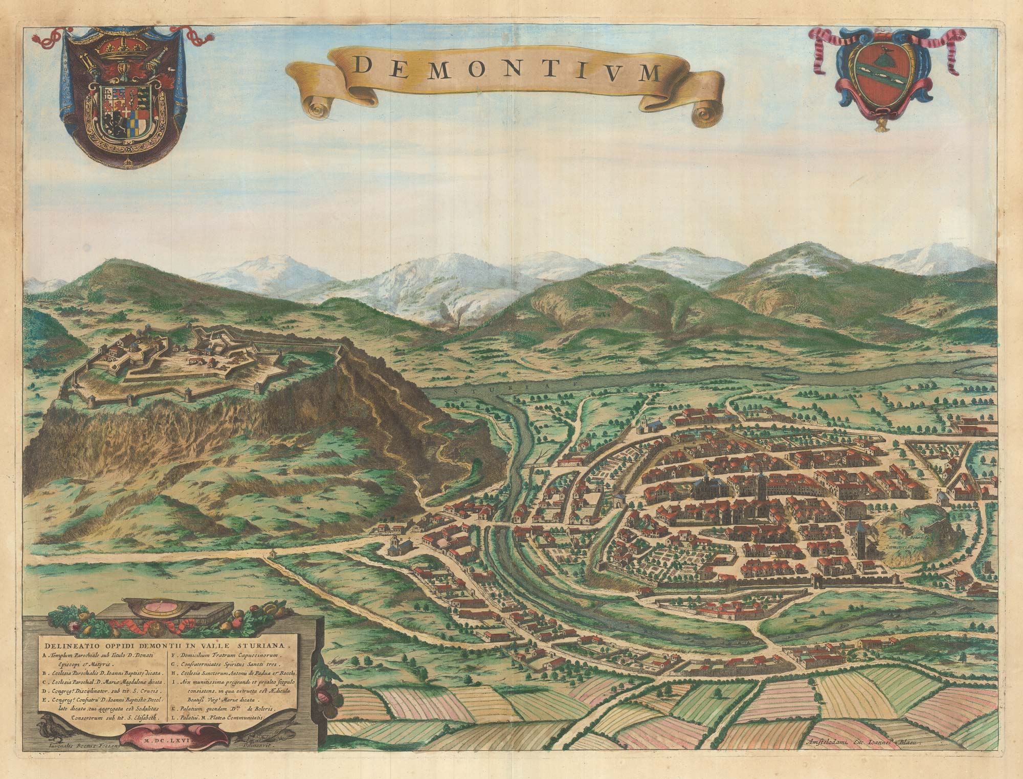
A scarce 17th century prospect of Demonte in superb colour
BLAEU, Johannes. Date: 1682 Stock #: 23267 £500.00
Add to Wishlist
Add to Wishlist