Antique Maps of English Counties
Showing 31–60 of 120 products
Sort by:
Add to Wishlist
Add to Wishlist
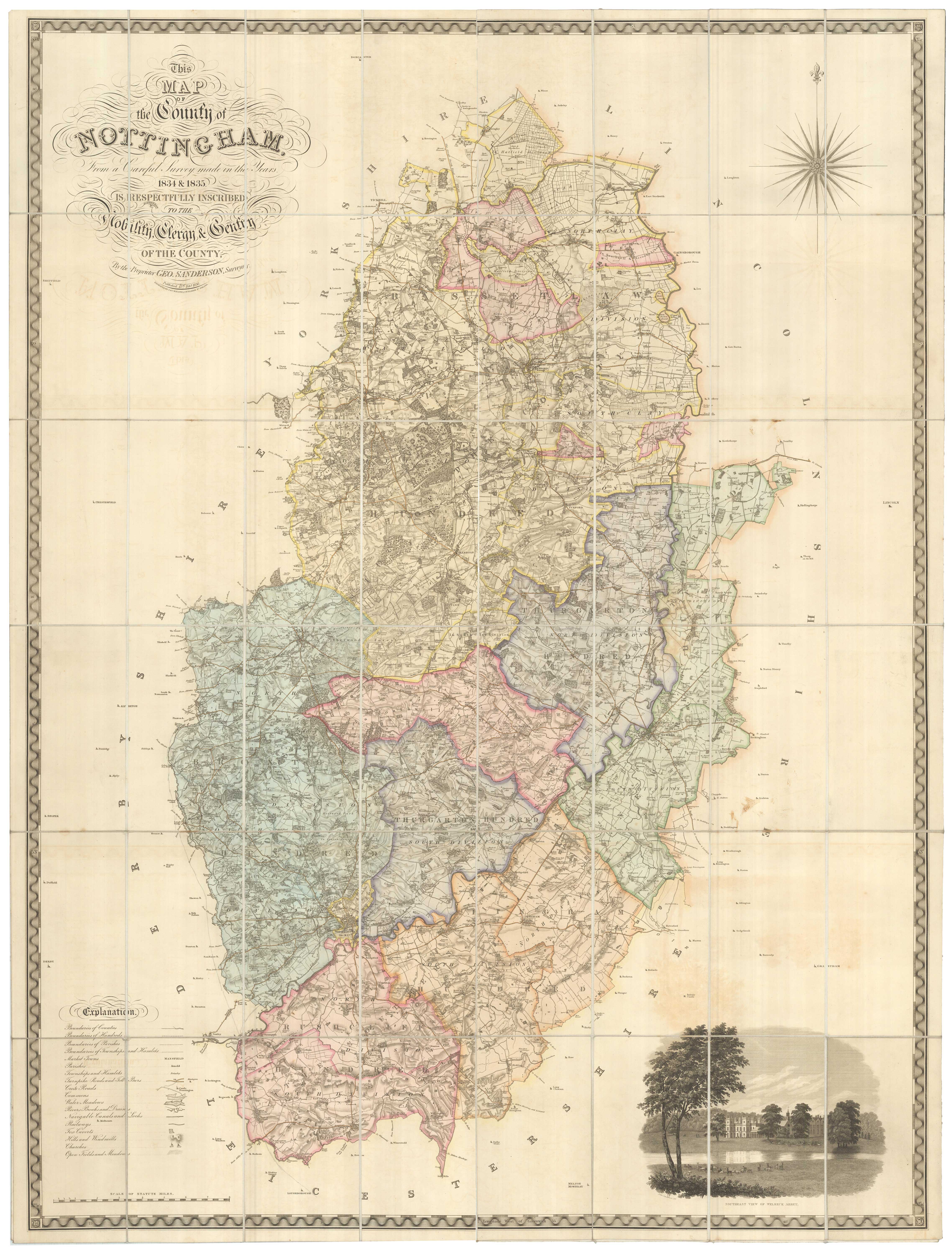
A large scale map of Nottinghamshire in fine colour
SANDERSON, George. Date: 1836 Stock #: 24067 £1,800.00
Add to Wishlist
Add to Wishlist
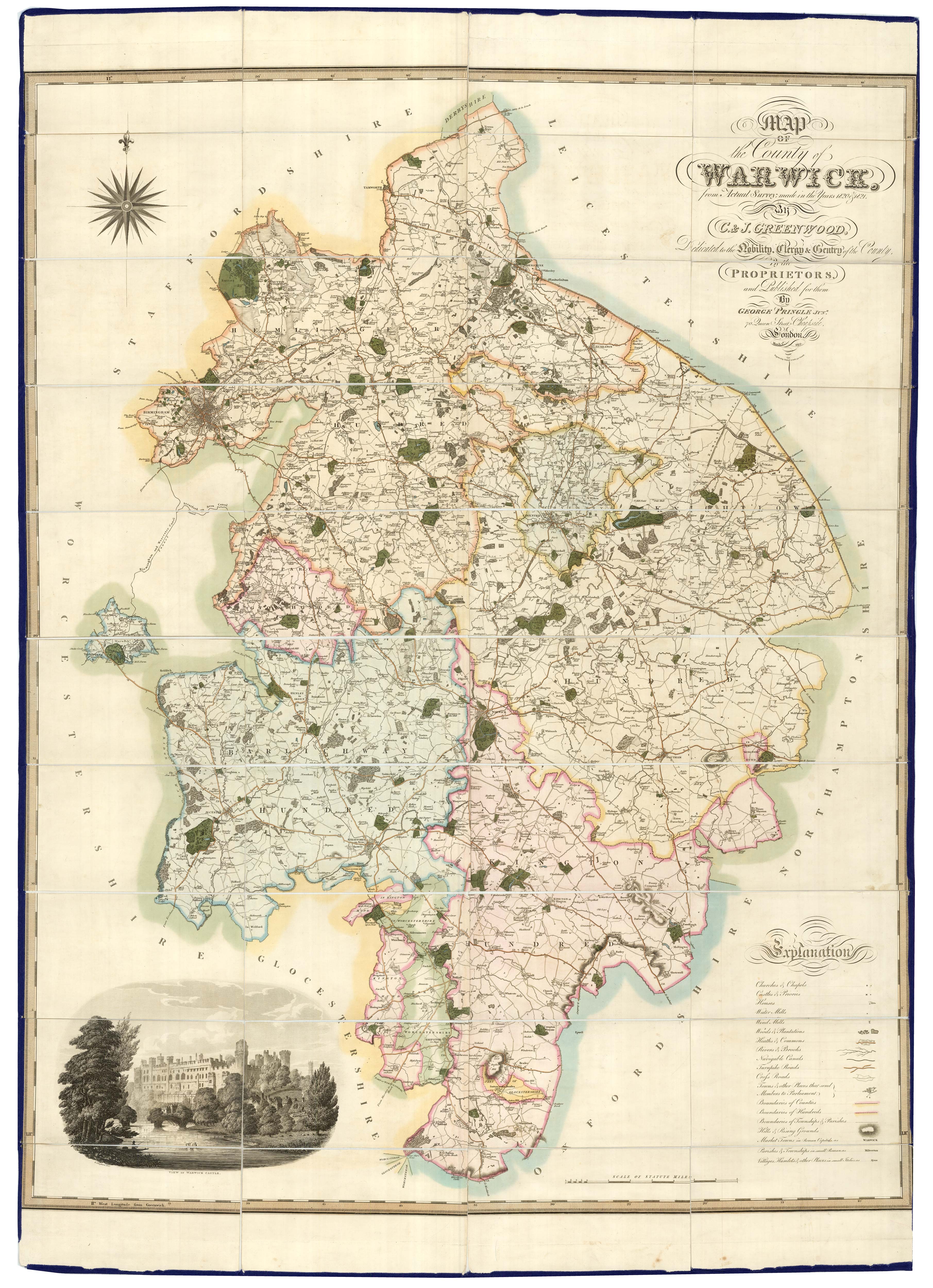
A large scale map of Warwickshire in fine colour
GREENWOOD, C. & J. Date: 1838 Stock #: 24068 £1,600.00
Add to Wishlist
Add to Wishlist

A large scale map of Westmorland in fine colour
GREENWOOD, C. & J. Date: 1824 Stock #: 24069 £1,500.00
Add to Wishlist
Add to Wishlist
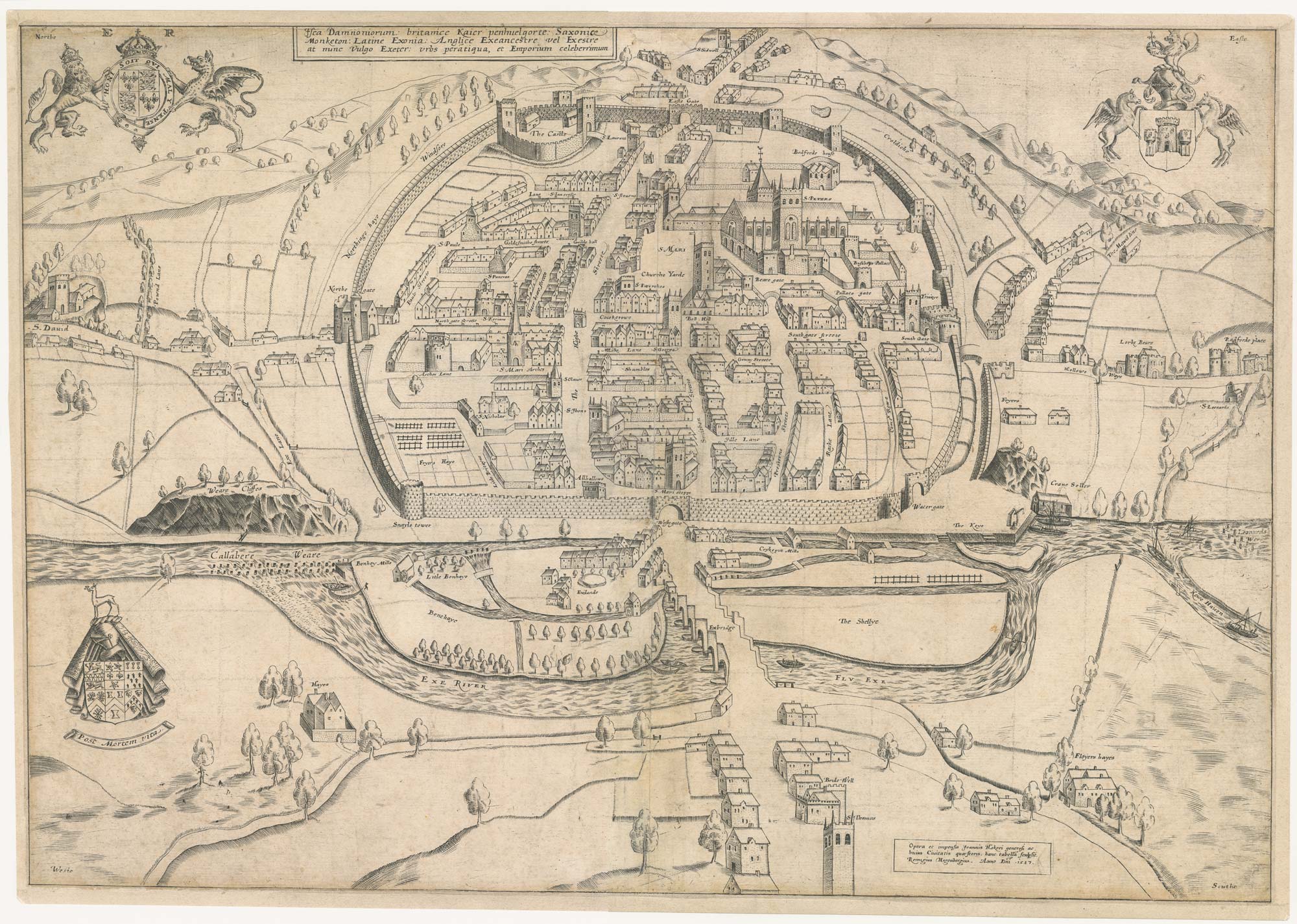
An extremely rare example of the first printed plan of Exeter
HOOKER, John. Date: 1587 Stock #: 24437 £4,500.00
Add to Wishlist
Add to Wishlist
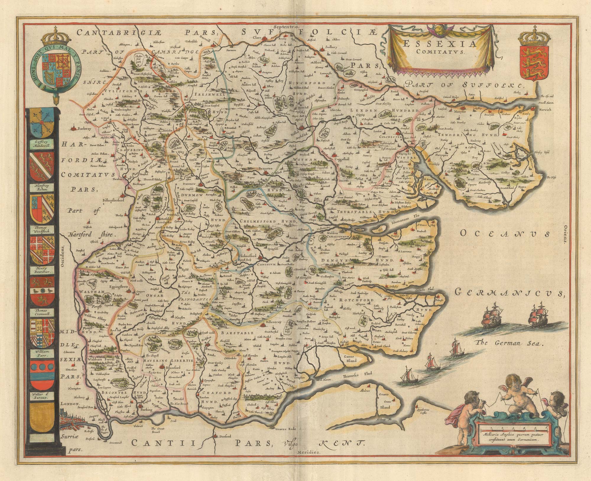
A map of Essex published during the English Civil War
BLAEU, Johannes. Date: 1646 Stock #: 23924 £650.00
Add to Wishlist
Add to Wishlist
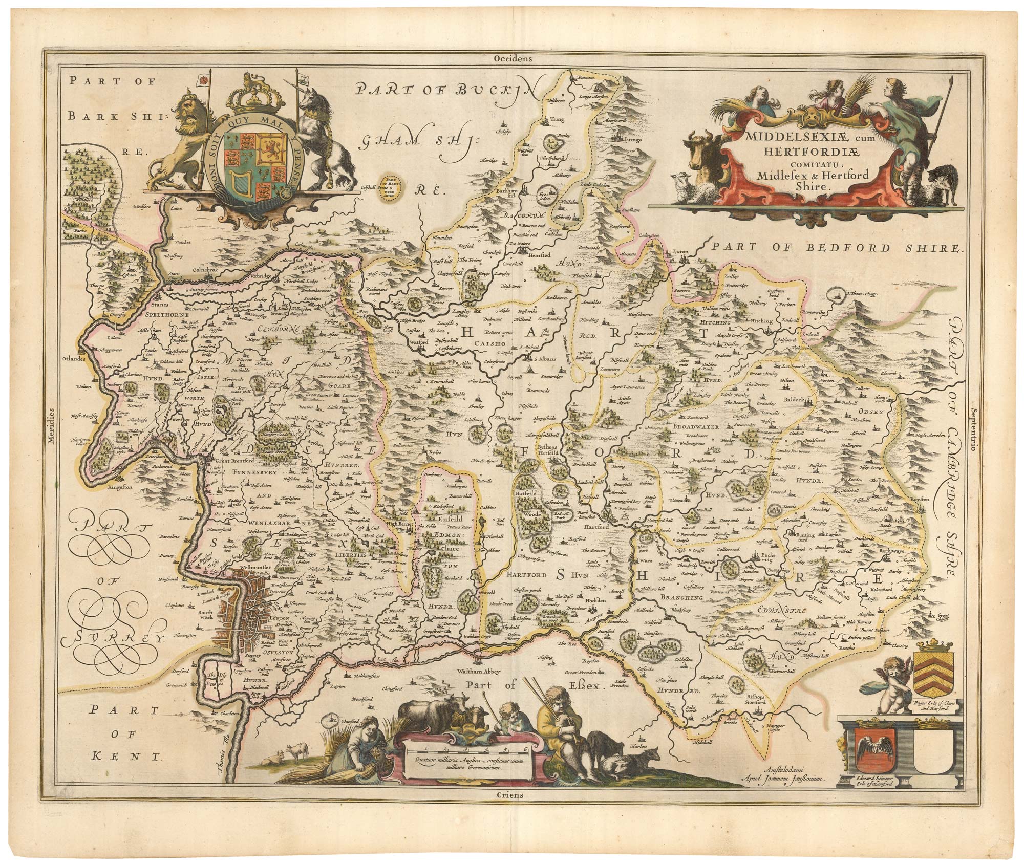
17th century map of Middlesex & Hertfordshire
JANSSON, Jan. Date: 1646 Stock #: 23925 £750.00
Add to Wishlist
Add to Wishlist

A balloon-view of Victorian Liverpool in full colour
BREWER, H.W. & WYLLIE, W.L. Date: 1885 Stock #: 23922 £450.00
Add to Wishlist
Add to Wishlist

A large and detailed map of Yorkshire
HOBSON, William Colling. Date: 1873 Stock #: 23850 £550.00
Add to Wishlist
Add to Wishlist
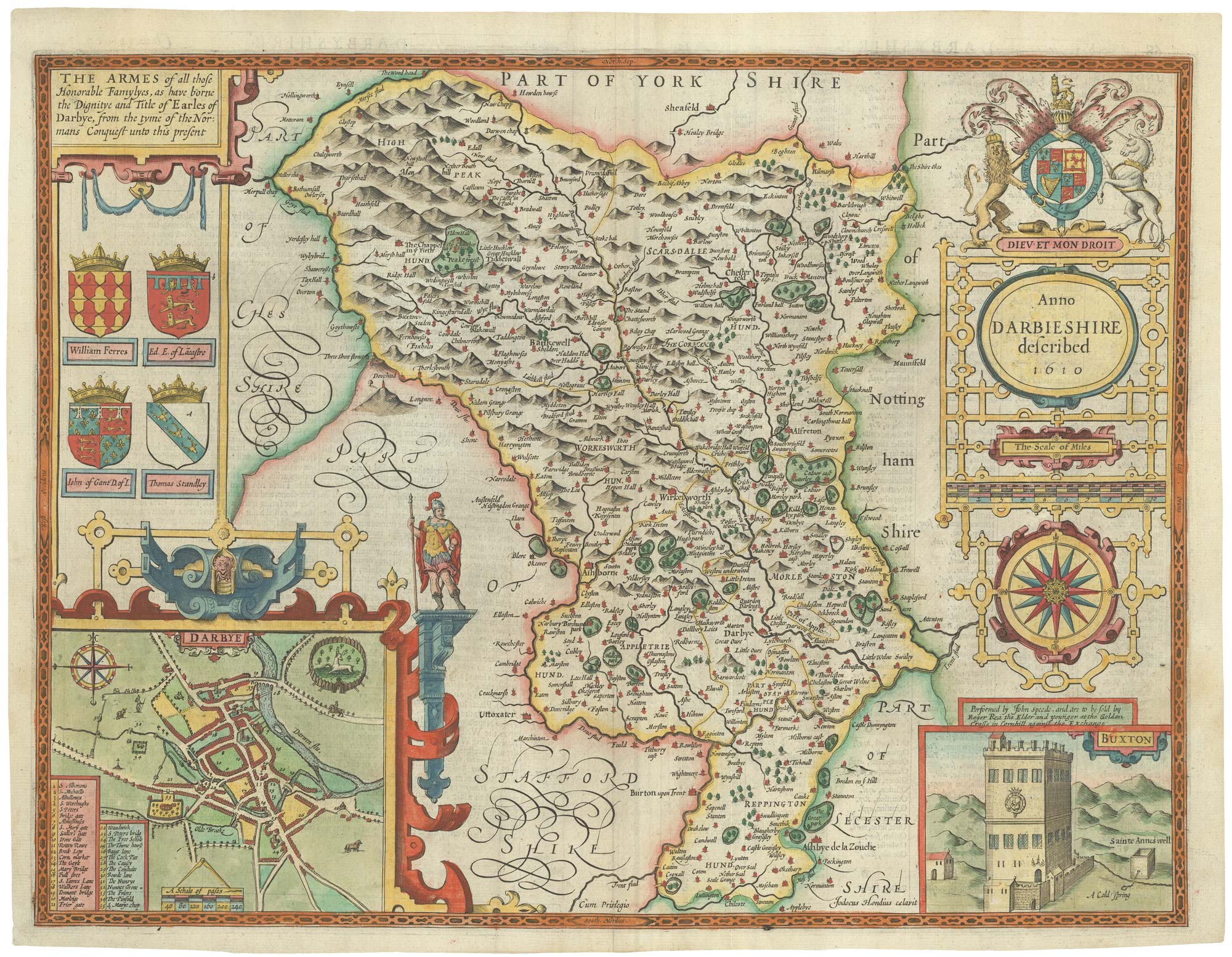
A scarce issue of Speed's map of Derbyshire
SPEED, John. Date: 1676 Stock #: 23821 £950.00
Add to Wishlist
Add to Wishlist
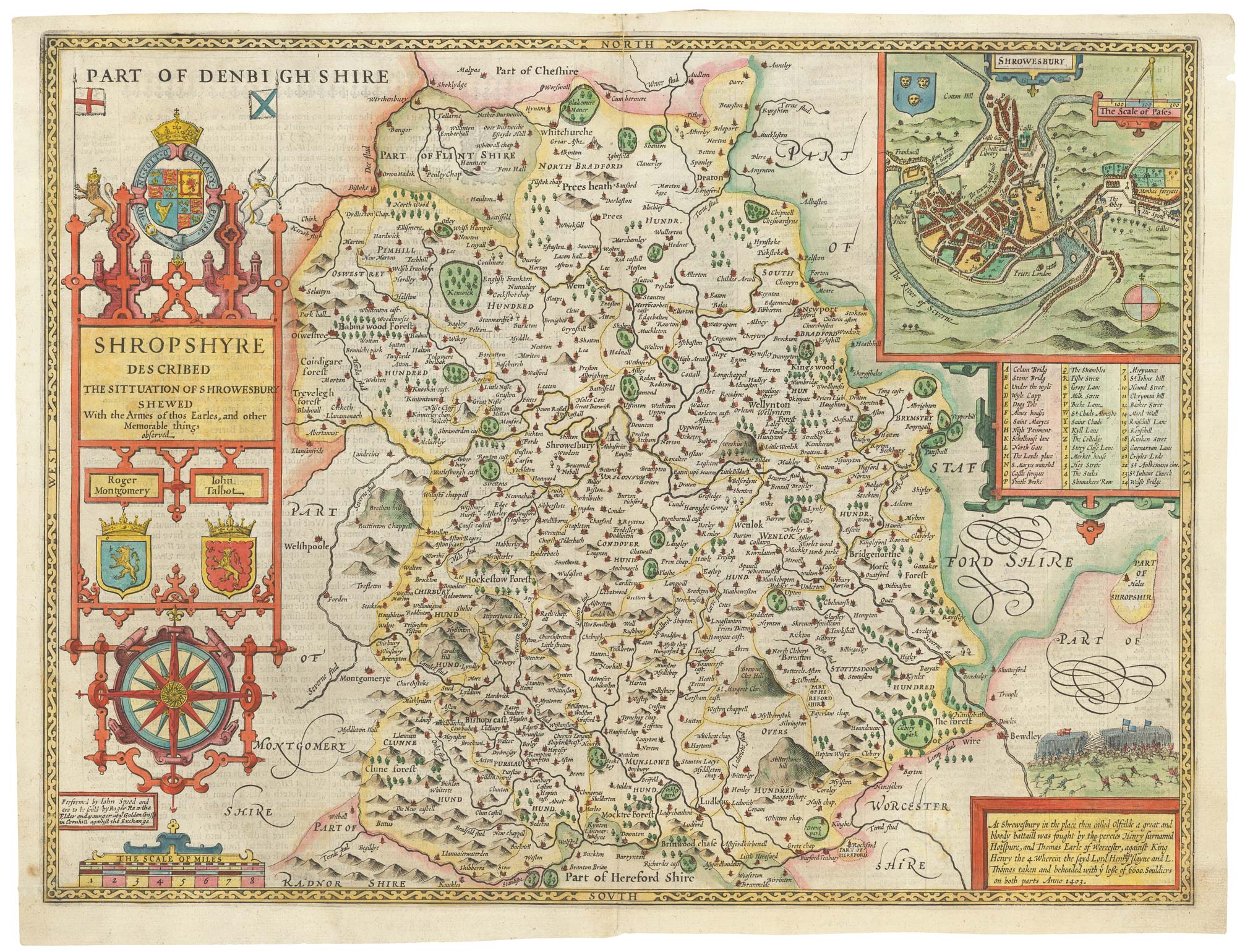
An uncommon edition of Speed's county map of Shropshire
SPEED, John. Date: 1665 Stock #: 23832 £800.00
Add to Wishlist
Add to Wishlist
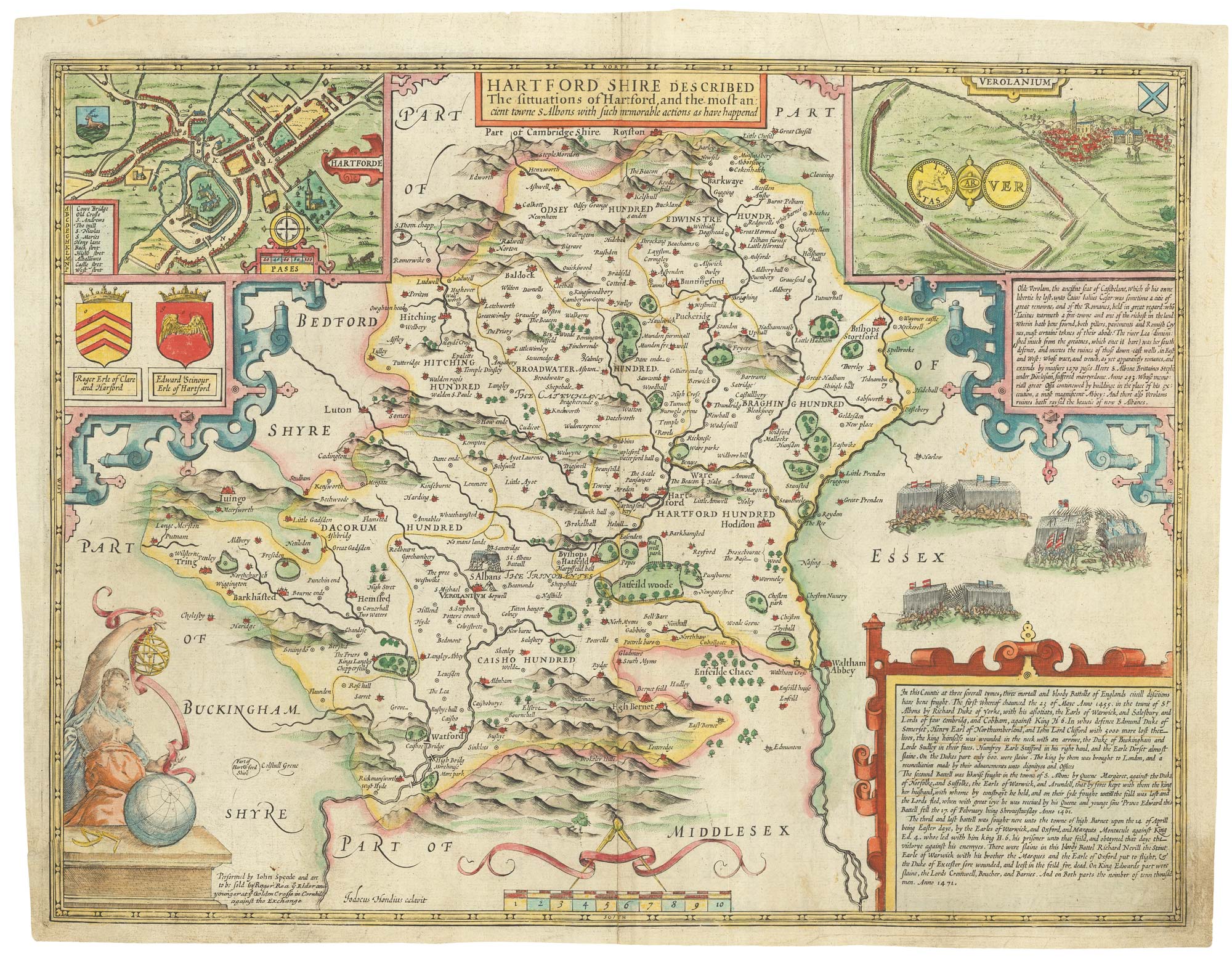
A scarce issue of Speed's map of Hertfordshire
SPEED, John. Date: 1665 Stock #: 23801 £850.00
Add to Wishlist
Add to Wishlist
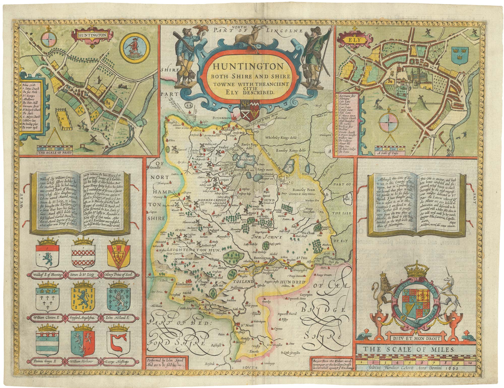
Rare edition of Speed's map of Huntingdonshire
SPEED, John. Date: 1665 Stock #: 23819 £650.00
Add to Wishlist
Add to Wishlist
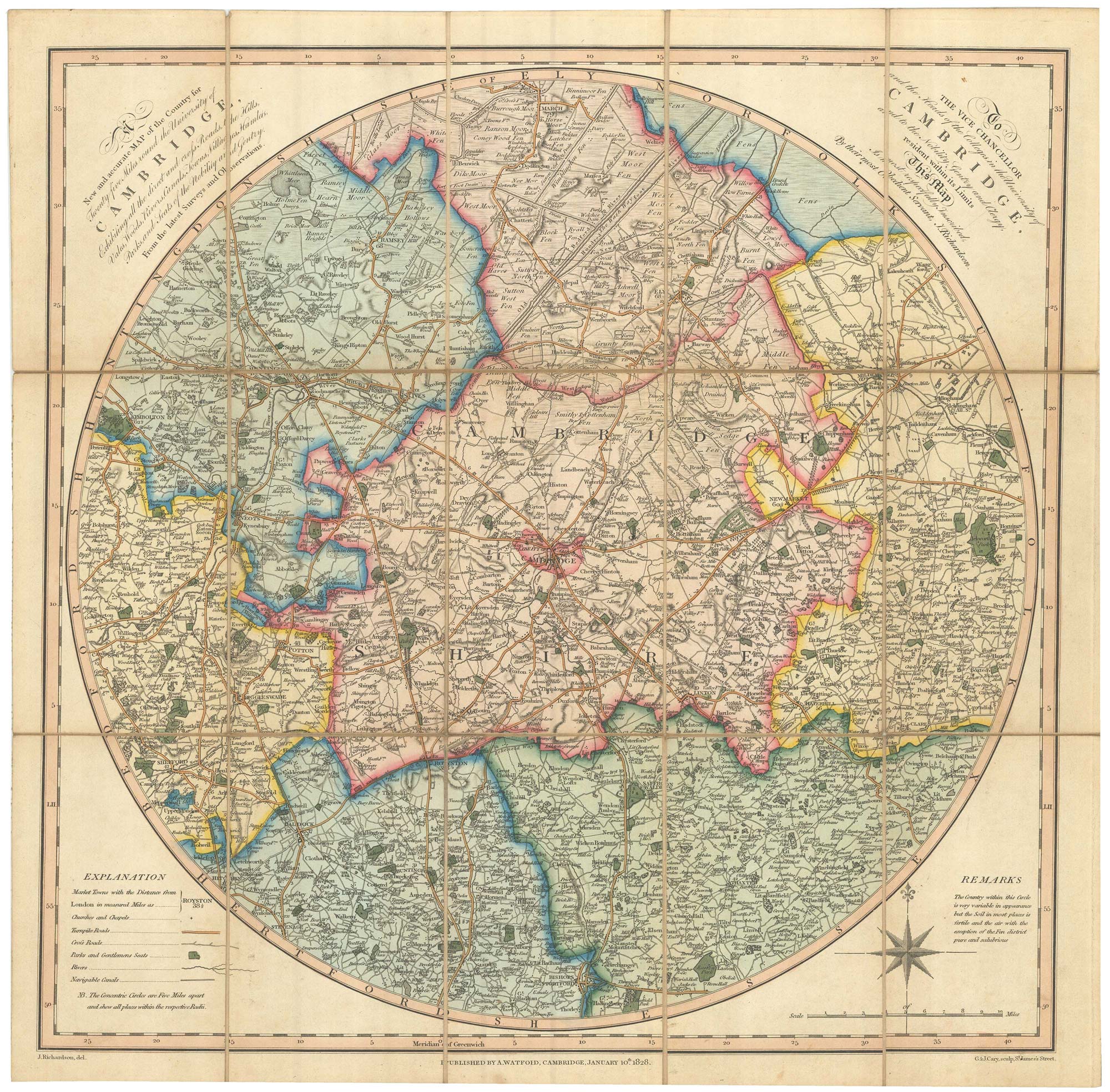
An early 19th century circular map of the environs of Cambridge
RICHARDSON, J. Date: 1828 Stock #: 23649 £400.00
Add to Wishlist
Add to Wishlist

A map of Oxford in Elizabethan times
AGAS, Ralph. Date: 1935 Stock #: 23589 £1,250.00
Add to Wishlist
Add to Wishlist
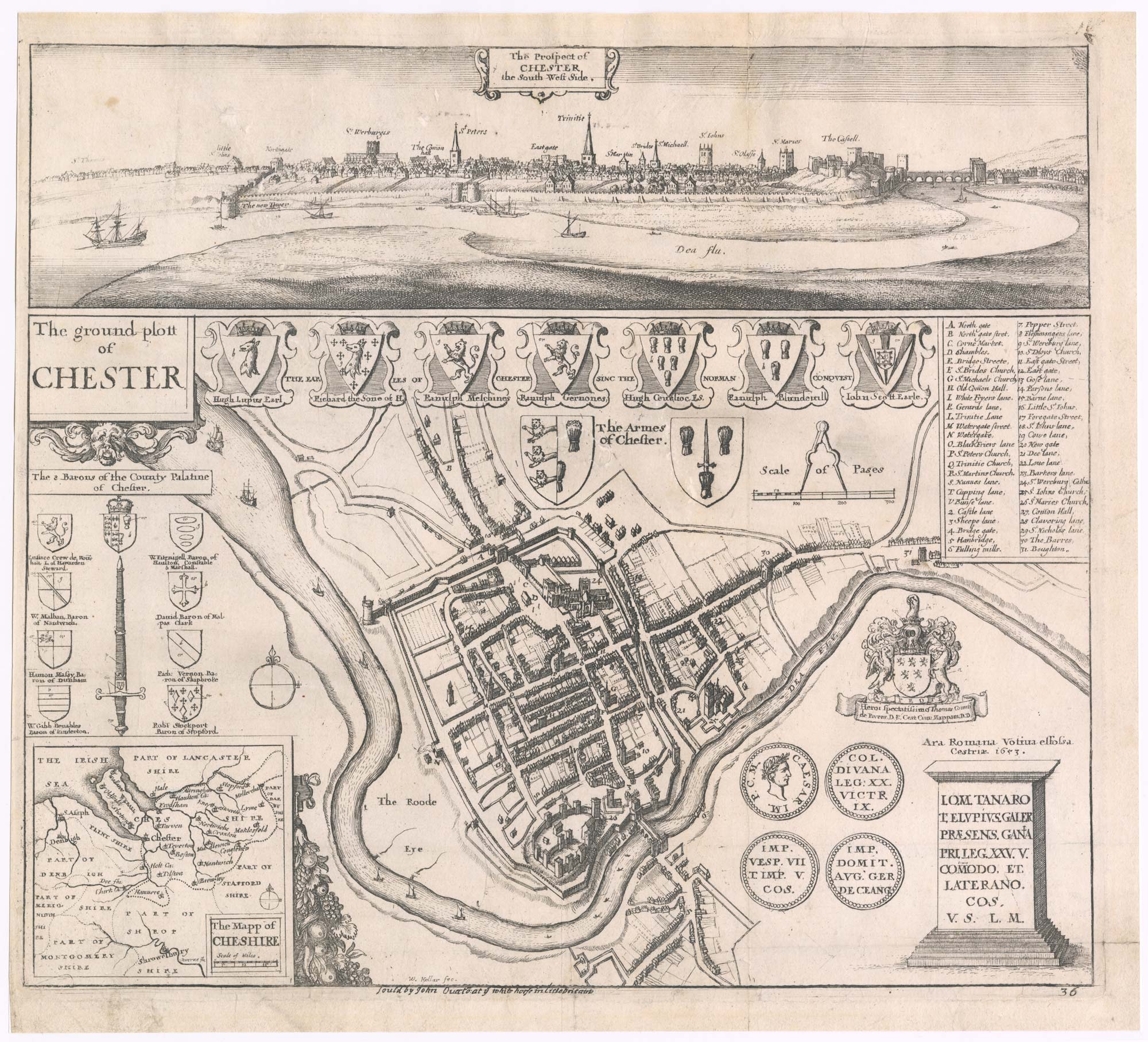
A scarce 17th century plan and prospect of Chester
HOLLAR, Wenceslaus. Date: 1668 Stock #: 23328 £750.00
Add to Wishlist
Add to Wishlist

A 16th century town plan of Bristol
VALEGIO, Francesco. Date: 1598 Stock #: 23177 £280.00
Add to Wishlist
Add to Wishlist
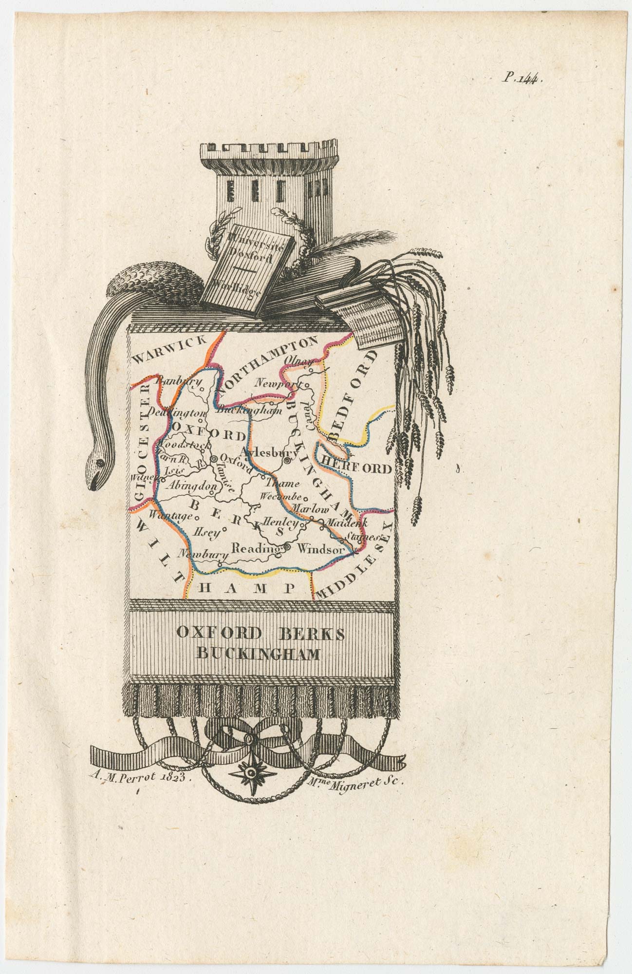
Miniature map of Oxfordshire and Buckinghamshire
PERROT, Aristide Michel. Date: 1828 Stock #: 23133 £100.00
Add to Wishlist
Add to Wishlist
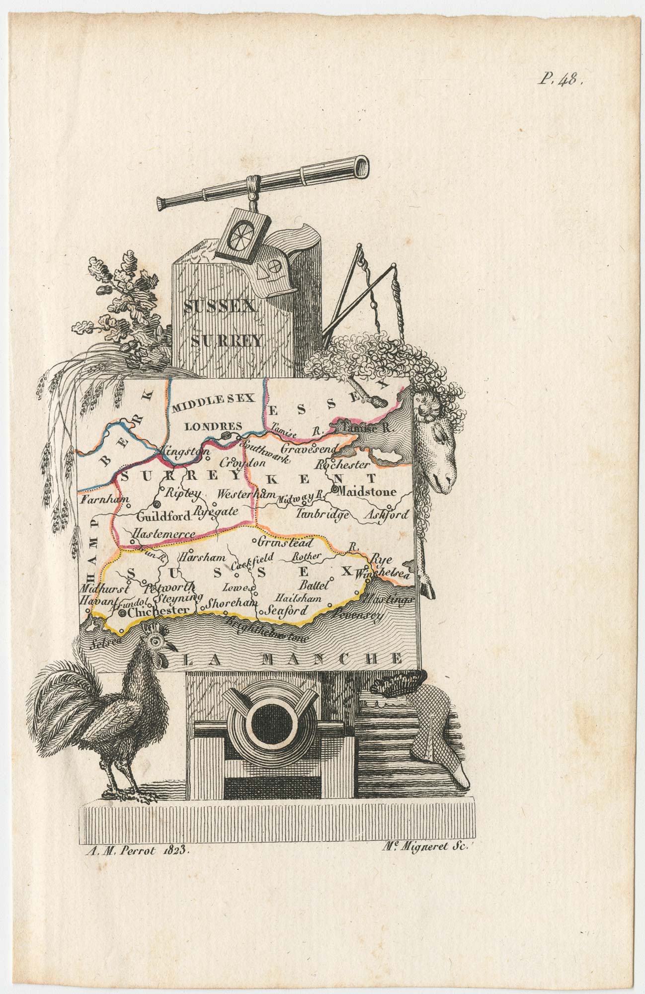
Miniature map of Surrey, Sussex and Kent
PERROT, Aristide Michel. Date: 1828 Stock #: 23134 £140.00
Add to Wishlist
Add to Wishlist
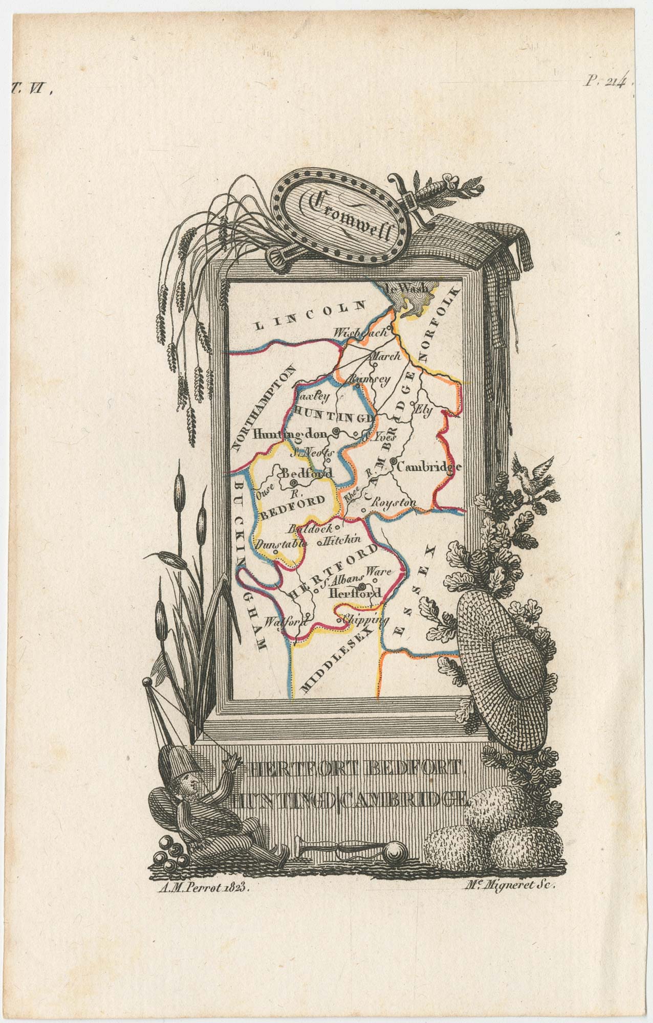
Miniature map of Hertfordshire, Bedfordshire and Cambridgeshire
PERROT, Aristide Michel. Date: 1828 Stock #: 23136 £75.00
Add to Wishlist
Add to Wishlist
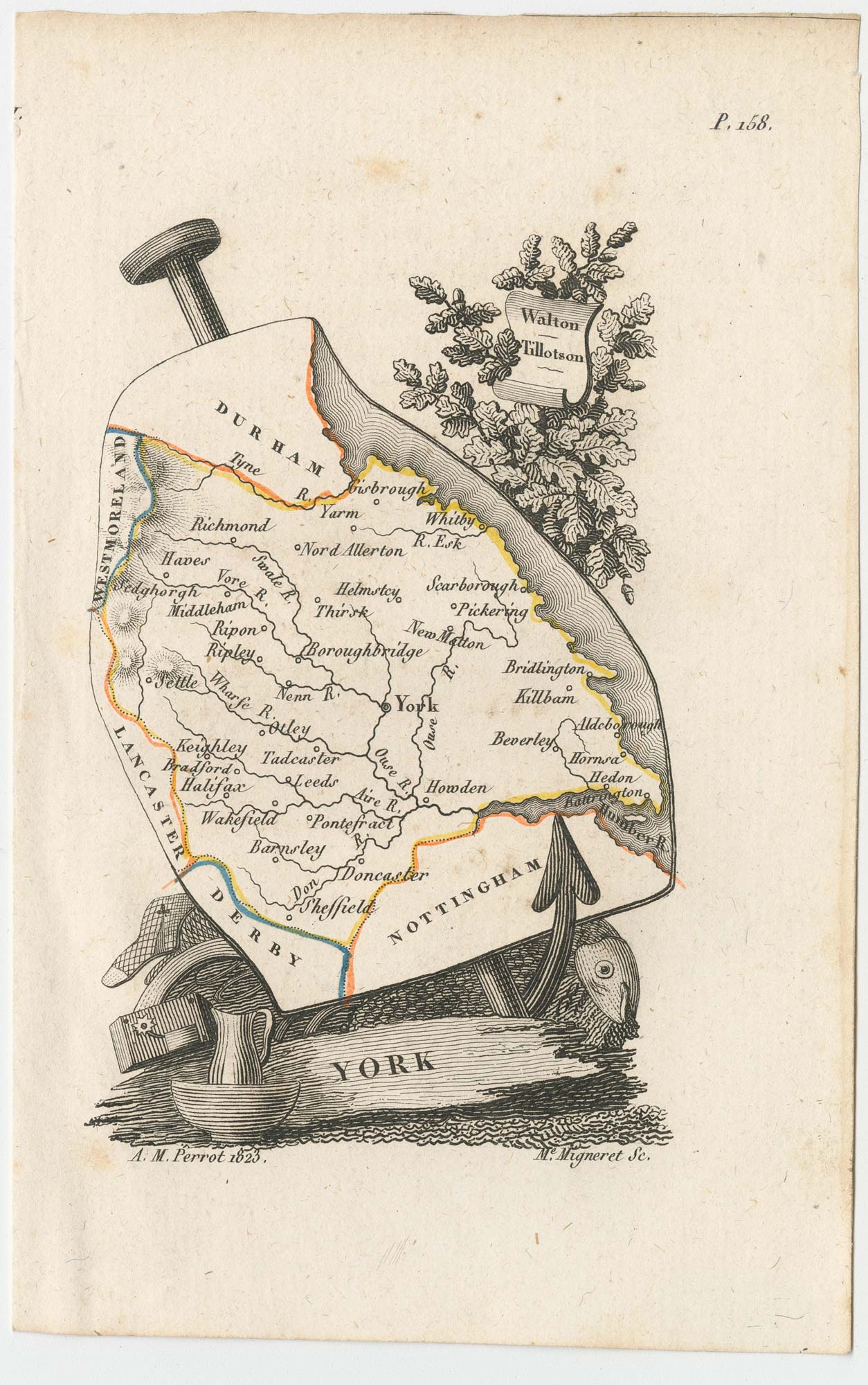
Miniature map of Yorkshire
PERROT, Aristide Michel. Date: 1828 Stock #: 23138 £100.00
Add to Wishlist
Add to Wishlist

Miniature map of Cheshire and Lancashire
PERROT, Aristide Michel. Date: 1828 Stock #: 23139 £125.00
Add to Wishlist
Add to Wishlist
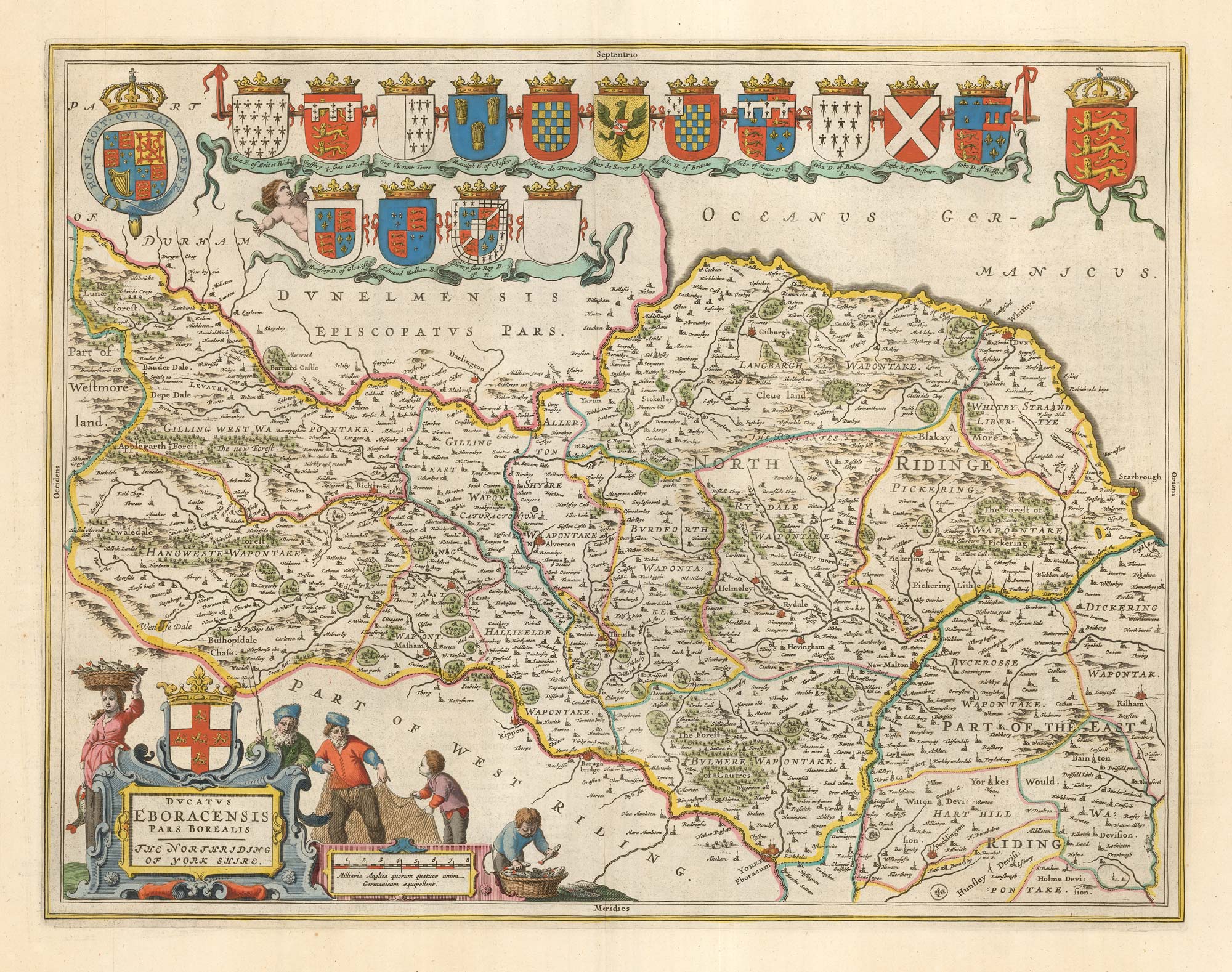
17th century map of the North Riding of Yorkshire in fine colour
BLAEU, Johannes. Date: 1662 Stock #: 23040 £650.00
Add to Wishlist
Add to Wishlist
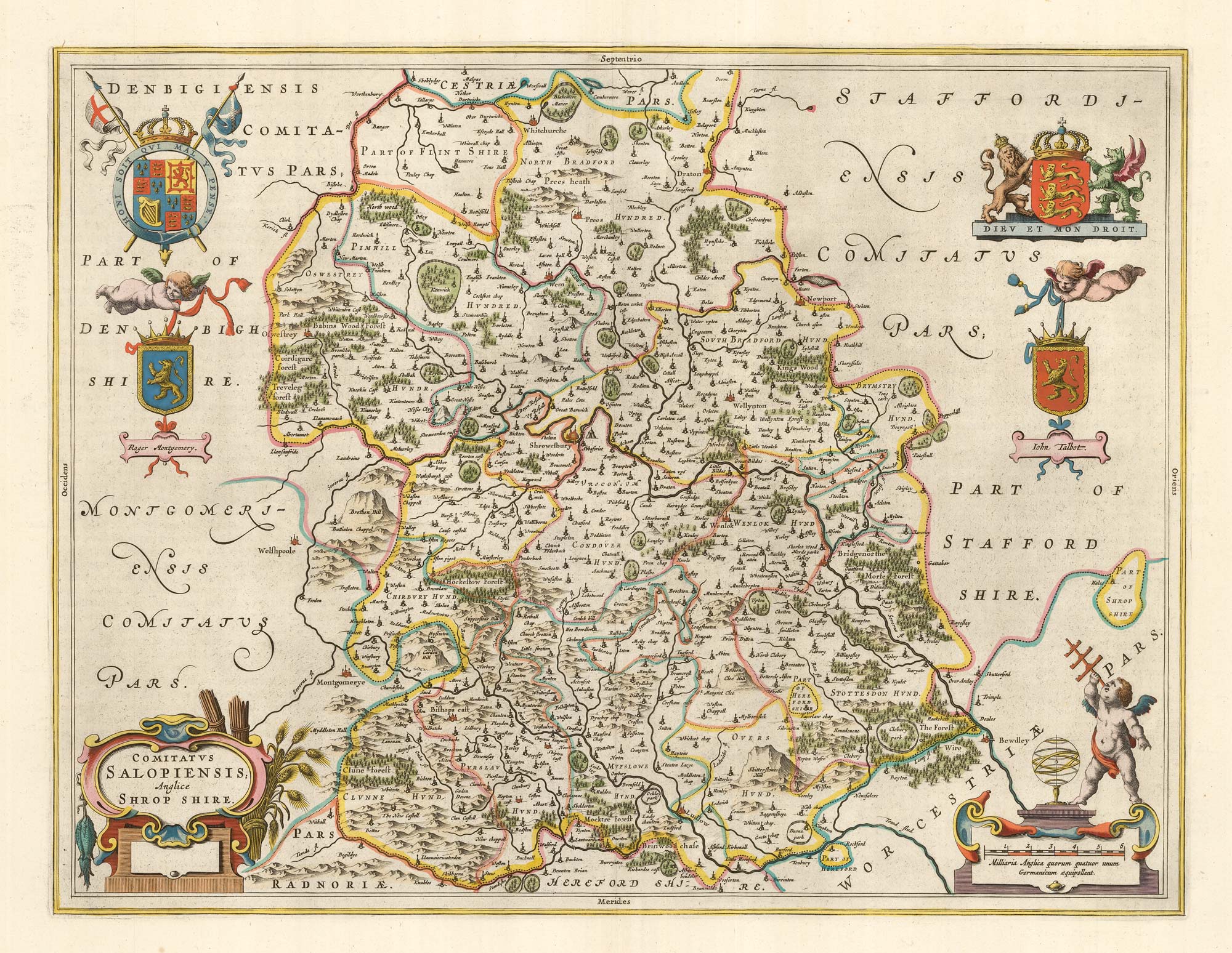
17th century map of Shropshire with fine colour
BLAEU, Johannes. Date: 1662 Stock #: 23043 £500.00
Add to Wishlist
Add to Wishlist
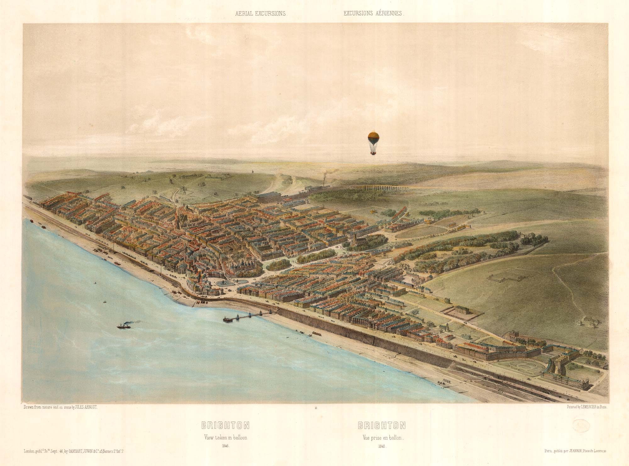
An unusual balloon view of Brighton in the 1840s
ARNOUT, Jules. Date: 1756 Stock #: 23159 £650.00
Add to Wishlist
Add to Wishlist
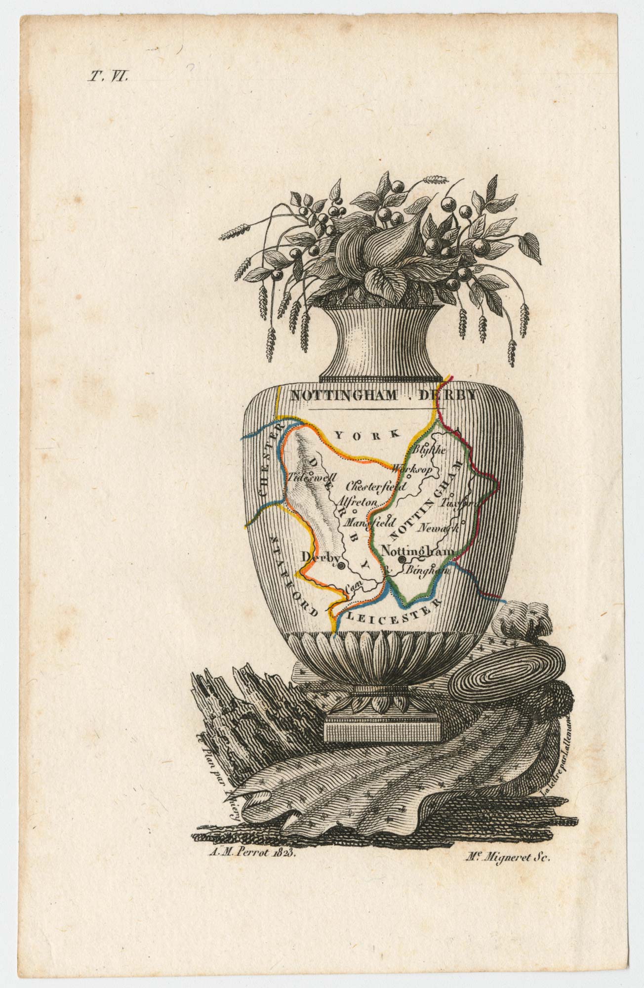
Miniature map of Nottinghamshire and Derbyshire
PERROT, Aristide Michel. Date: 1828 Stock #: 23301 £65.00
Add to Wishlist
Add to Wishlist
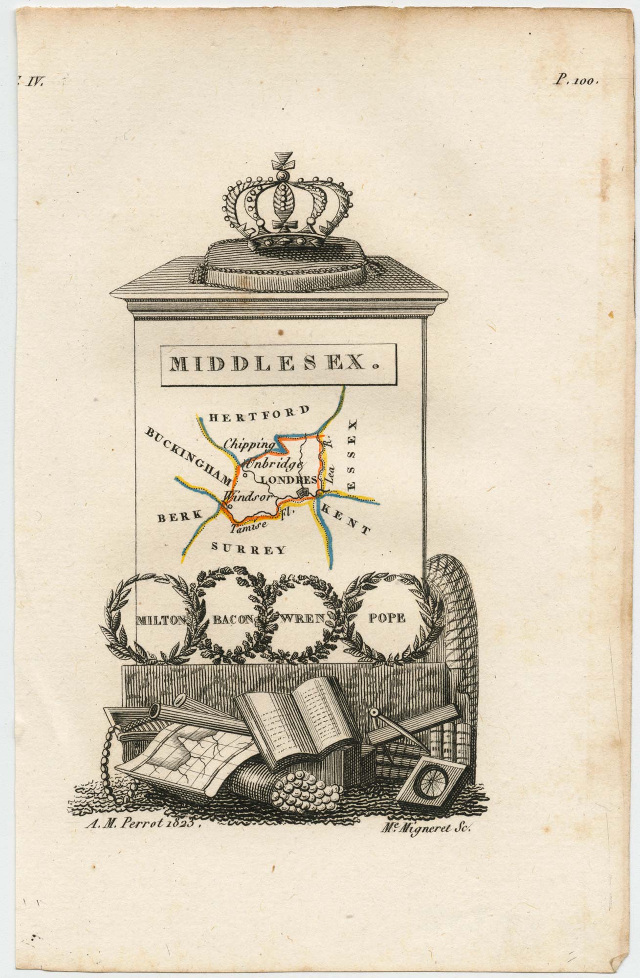
Miniature map of Middlesex
PERROT, Aristide Michel. Date: 1828 Stock #: 23302 £45.00
Add to Wishlist
Add to Wishlist
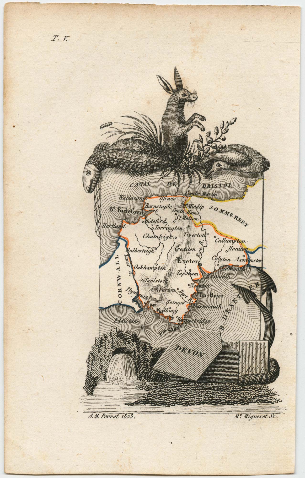
Miniature map of Devon
PERROT, Aristide Michel. Date: 1828 Stock #: 23303 £80.00
Add to Wishlist
Add to Wishlist
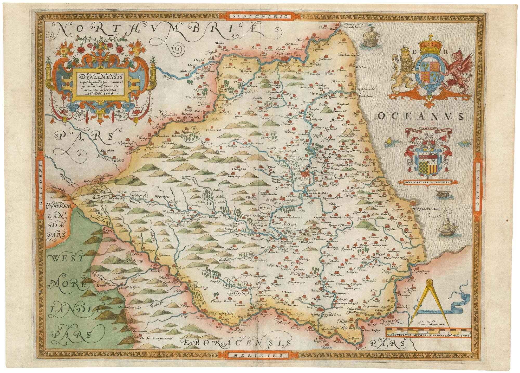
The first printed map of County Durham
SAXTON, Christopher. Date: 1579 Stock #: 22583 £3,000.00
Add to Wishlist
Add to Wishlist
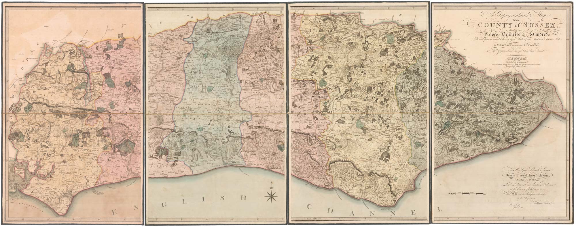
The deluxe edition of an important large scale map of Sussex
GARDNER, William, YEAKELL, Thomas & GREAM, Thomas. Date: 1795 Stock #: 22942 £2,000.00
Add to Wishlist
Add to Wishlist
