Antique Maps of New York
Showing 1–9 of 9 products
Sort by:
Add to Wishlist
Add to Wishlist
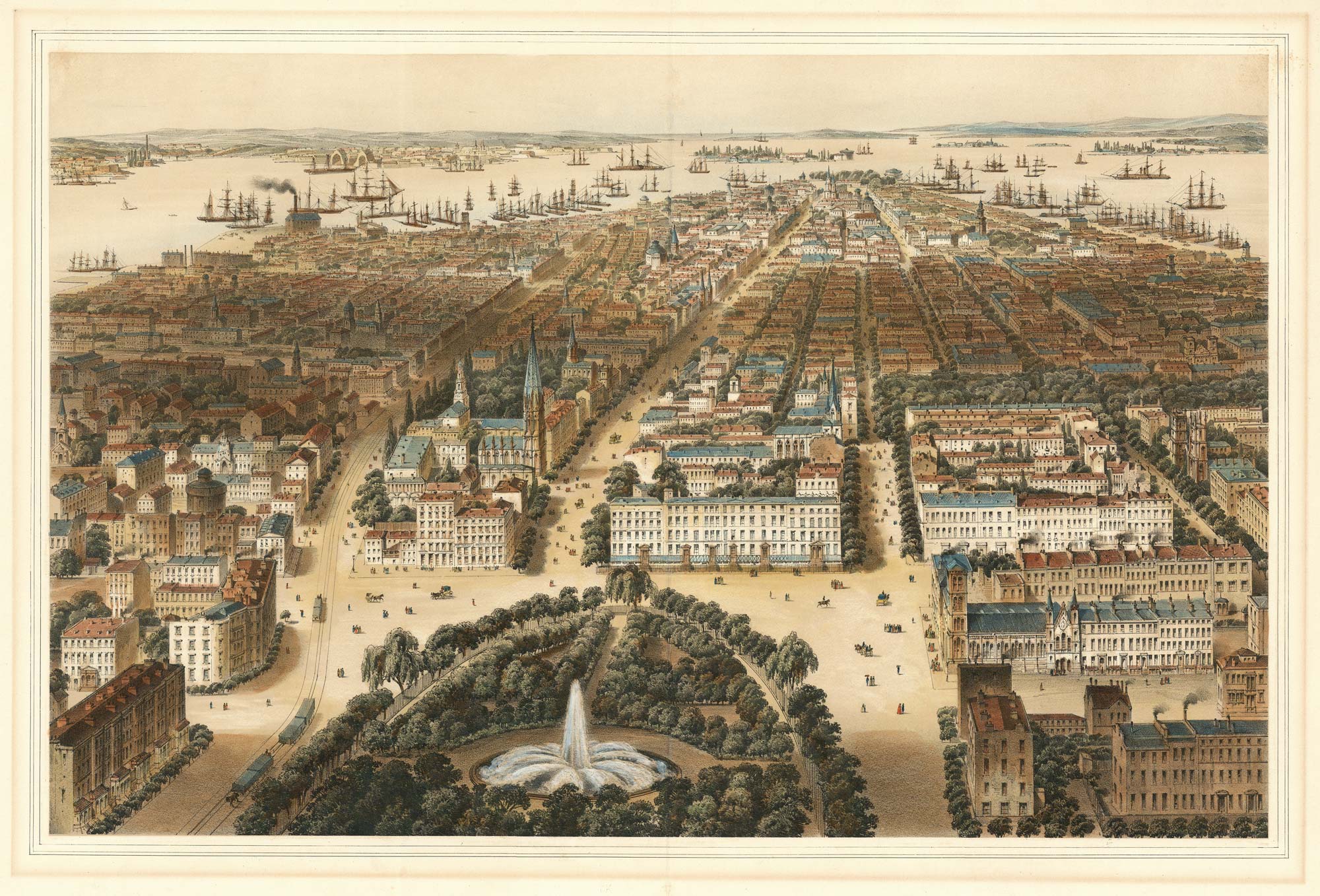
A prospect of New York from Union Square
BACHMANN, C. Date: 1849 Stock #: 24751 £4,000.00
Add to Wishlist
Add to Wishlist
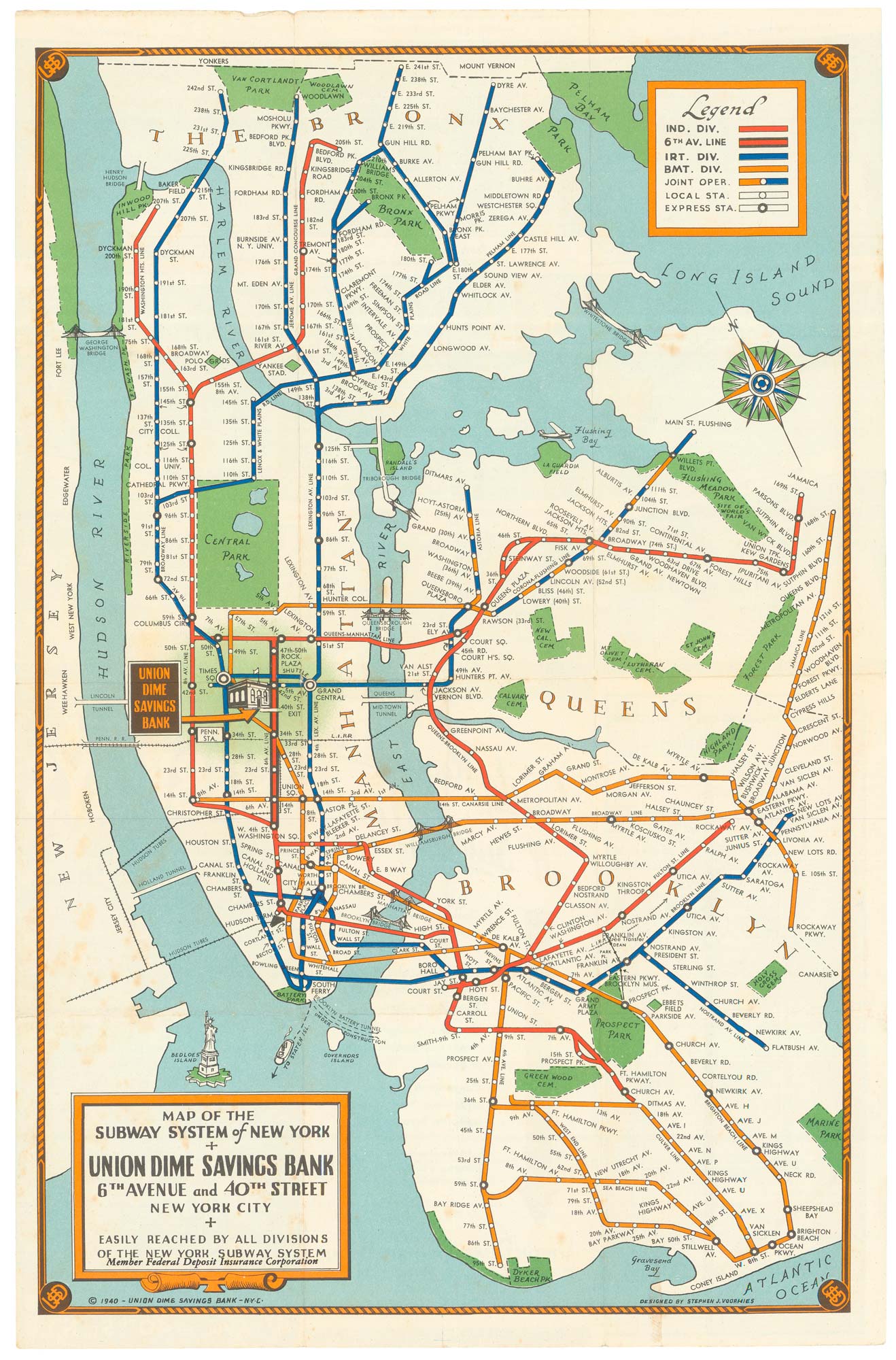
Map of the New York Subway System in 1940
VOORHIES, Stephen Jerome. Date: 194 Stock #: 24773 £480.00
Add to Wishlist
Add to Wishlist
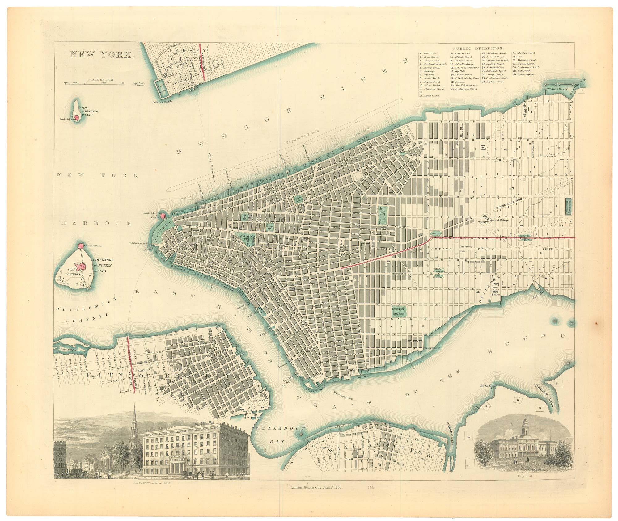
19th century town plan of New York
Society for the Diffusion of Useful Knowledge. Date: 1853 Stock #: 24871 £485.00
Add to Wishlist
Add to Wishlist
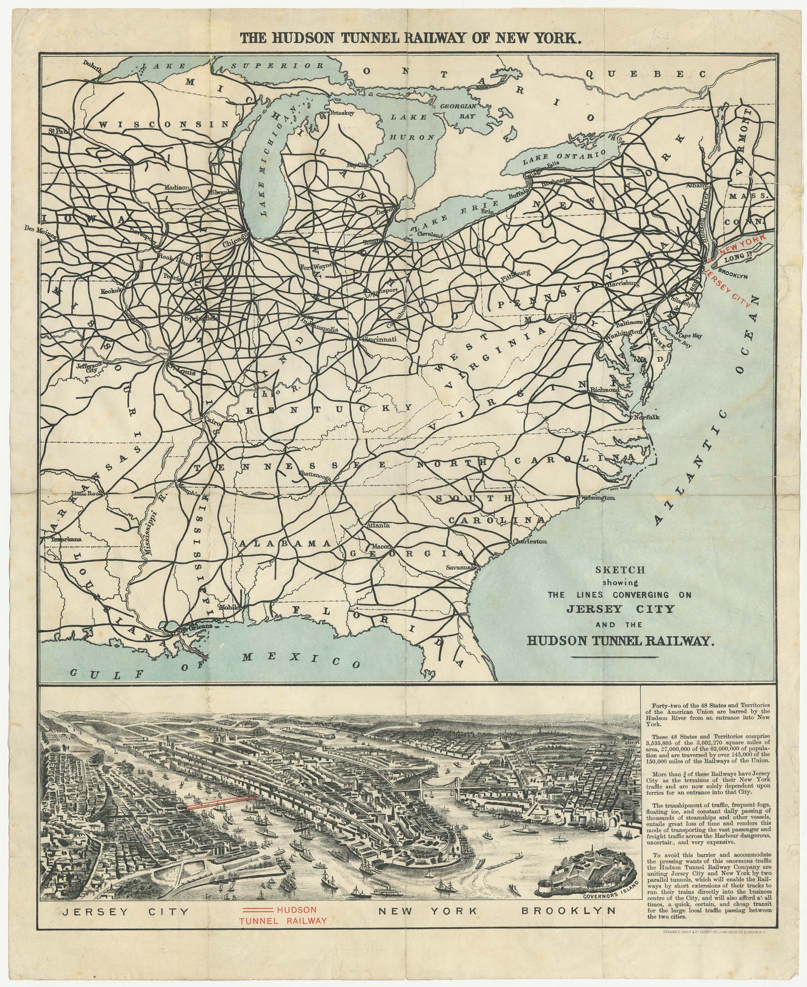
The building of the Uptown Hudson Tubes in New York
Anonymous. Date: 1890 Stock #: 24556 £450.00
Add to Wishlist
Add to Wishlist
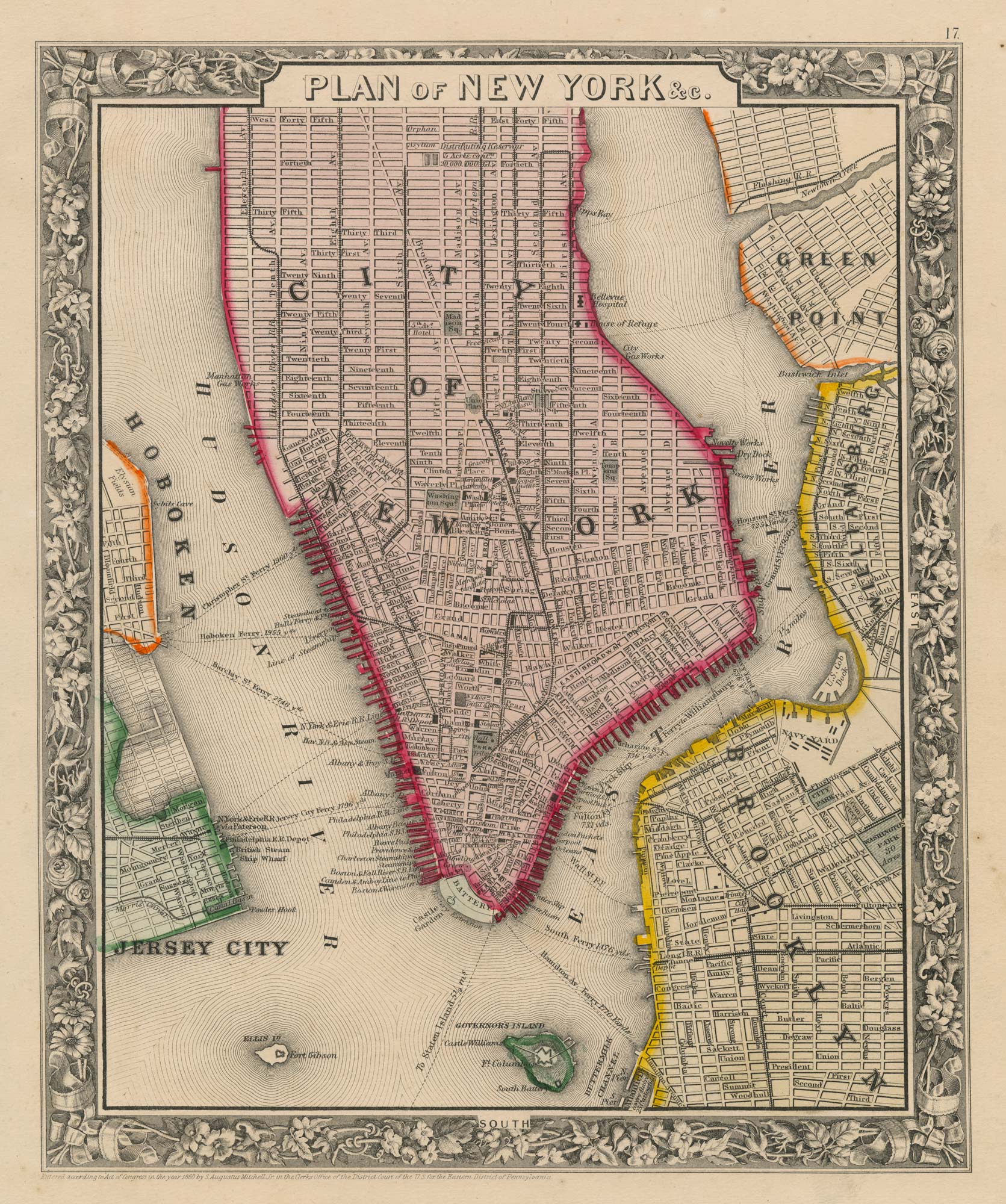
Detailed plan of New York City
MITCHELL, Samuel Augustus. Date: 1860 Stock #: 23834 £350.00
Add to Wishlist
Add to Wishlist
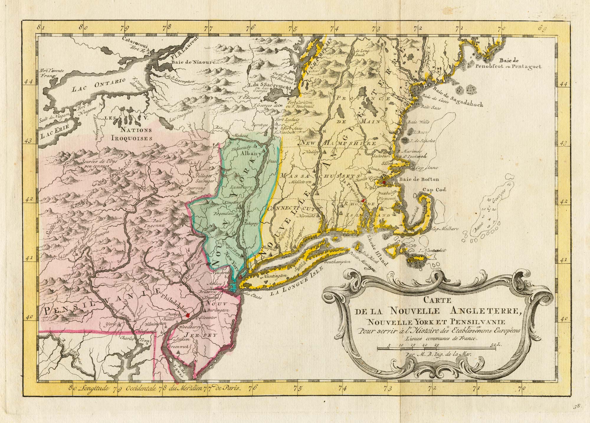
18th century map of New England and New York in original colours
BELLIN, Jacques-Nicolas. Date: 1773 Stock #: 23227 £380.00
Add to Wishlist
Add to Wishlist
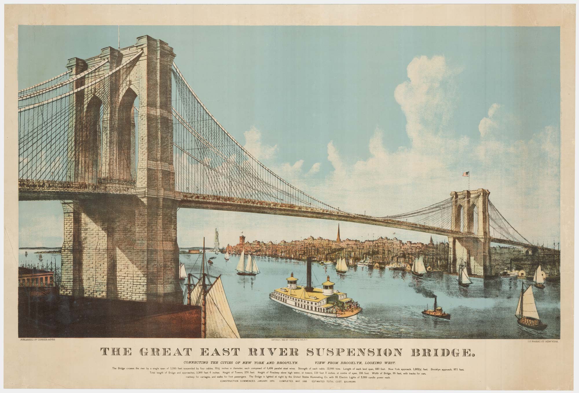
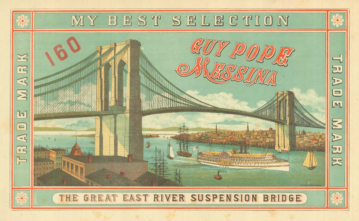
A large view of the newly-completed Brooklyn Bridge
CURRIER & IVES. Date: 1886 Stock #: 22791 £5,000.00
Add to Wishlist
Add to Wishlist
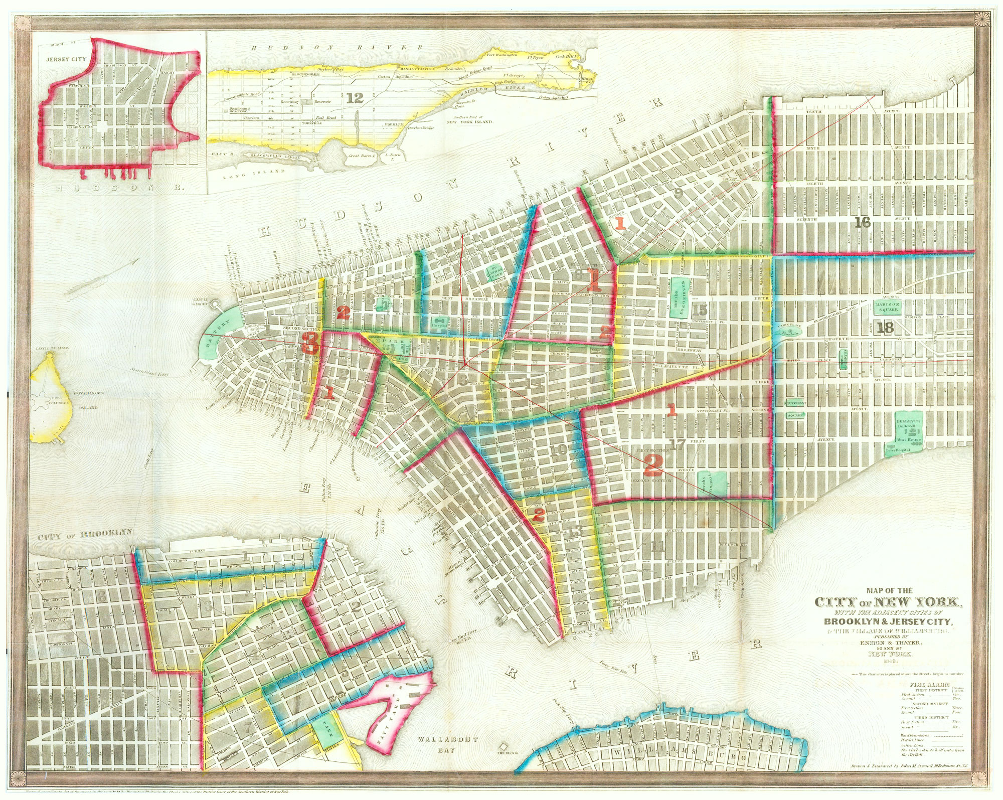
Mid-19th century town plan of New York City
ATWOOD, John M. Date: 1849 Stock #: 20672 £875.00
Add to Wishlist
Add to Wishlist