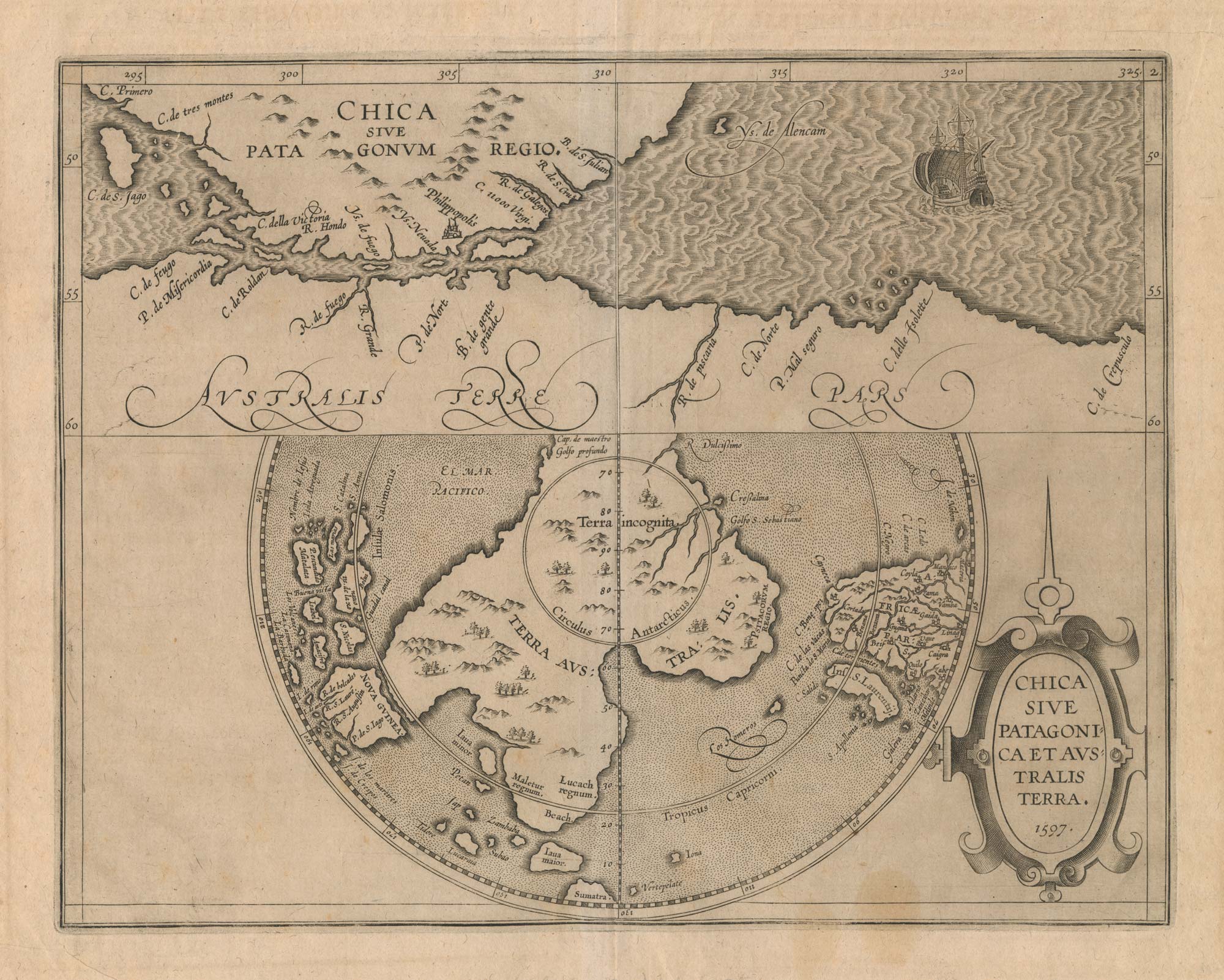


A scarce 16th century map of the South Pole and the Strait of Magellan
Chica sive Patagonica et Australis Terra. 1597.
Louvain: J. Bogard, 1597. 230 x 295mm.
£3,000.00
1 in stock
x
Question About This Item?
A scarce 16th century map of the South Pole and the Strait of Magellan & WYTFLIET, Cornelis van.Stock #: 23439
Add to Wishlist
Export as PDFEnquireSimilar to Sell?Add to Wishlist
Description
Two maps on one sheet. The upper section shows the tip of the South American mainland, with the Strait of Magellan separating it from 'Terra Incognita', the mythical Great Southern Continent. The lower shows the Southern Hemisphere, with the South Pole and the Terra Australis, with promontories reaching towards Africa, Java and New Guinea.
Wytfliet's 'Descriptionis Ptolemaicae Augmentum', describing those parts of the world unknown to Ptolemy, had a world map and eighteen map of regions of America. Philip Burden, in his Mapping of North America, writes 'this book can be truly called the first atlas of America'.