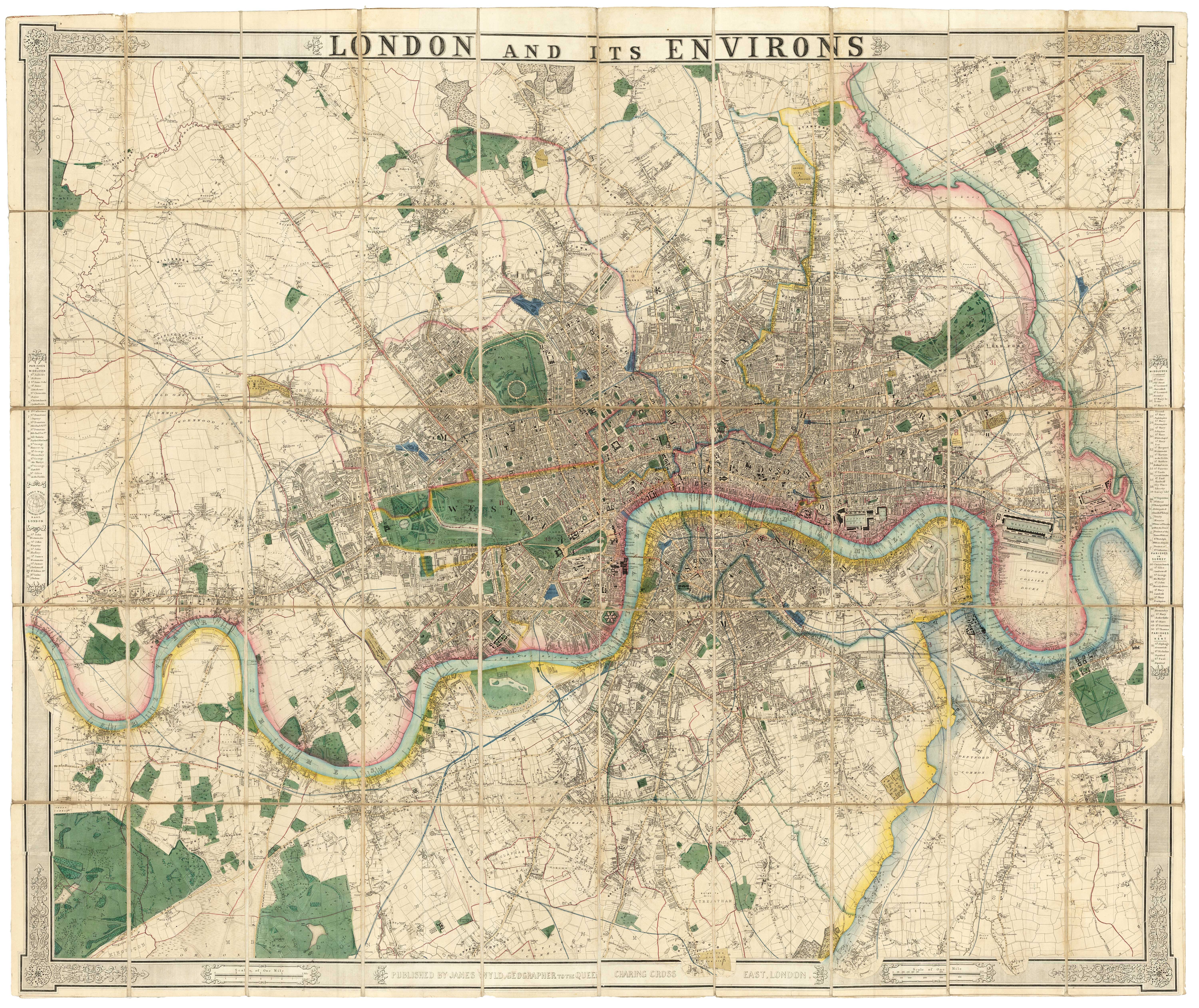


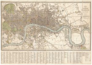
A fine 19th century wall map of London
London and its Environs.
London, c.1872. Coloured. Dissected & laid on linen as issued, 1090 x 1300mm.
£4,800.00
Description
A very large and detailed map of London in fine original colour, extending from Kew Bridge in the west, clockwise to Highgate, Leytonstone, Canning Town, Greenwich & Blackheath, Norwood and Richmond Park. The map is within a printed frame, pasted on, which contains the title and lists of parishes.
Condition:
Repairs to linen folds.References:
HYDE: D & H 415.Related products
-
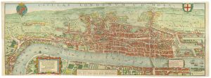
The so-called ‘Agas’ plan of Elizabethan London on eight sheets
AGAS, Ralph. Date: 1737Stock #: 25408 £13,500.00 -
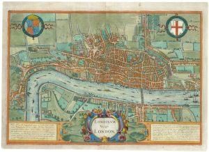
The rare Jansson edition of the earliest available map of London
BRAUN, Georg & HOGENBERG, Frans. Date: 1657Stock #: 25199 £6,500.00 -
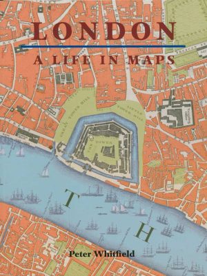
A history of London through maps
WHITFIELD, Peter. Date: 2006Stock #: 12441 £20.00 -
A rare broadsheet map of the Great Fire of London of 1666
DE WIT, Frederick. Date: 1666Stock #: 24892 £7,500.00 -
London at the beginning of the 18th century
FER, Nicolas de. Date: 1700Stock #: 25641 £550.00 -
A map of Elizabethan London
AGAS, Ralph. Date: 1738Stock #: 24491 £780.00 -
Detailed plan of London under William IV
FADEN, William. Date: 1830Stock #: 22893 £3,000.00 -
Facsimile of Rocque’s 16-Sheet Map of London
ROCQUE, John. Date: 1971Stock #: 15133 £400.00 -
London during the Great Exhibition of 1851
TALLIS, John. Date: 1851Stock #: 25662 £2,400.00
Items by the same author
Add to Wishlist
Add to Wishlist

A contemporary map of the Siege of Sevastopol
WYLD, James. Date: 1855 Stock #: 24098 £350.00
Add to Wishlist
Add to Wishlist

A contemporary map of the Siege of Sevastopol
WYLD, James. Date: 1854 Stock #: 24099 £350.00
Add to Wishlist
Add to Wishlist

A contemporary map of the Siege of Sevastopol
WYLD, James. Date: 1854 Stock #: 24100 £350.00
Add to Wishlist
Add to Wishlist
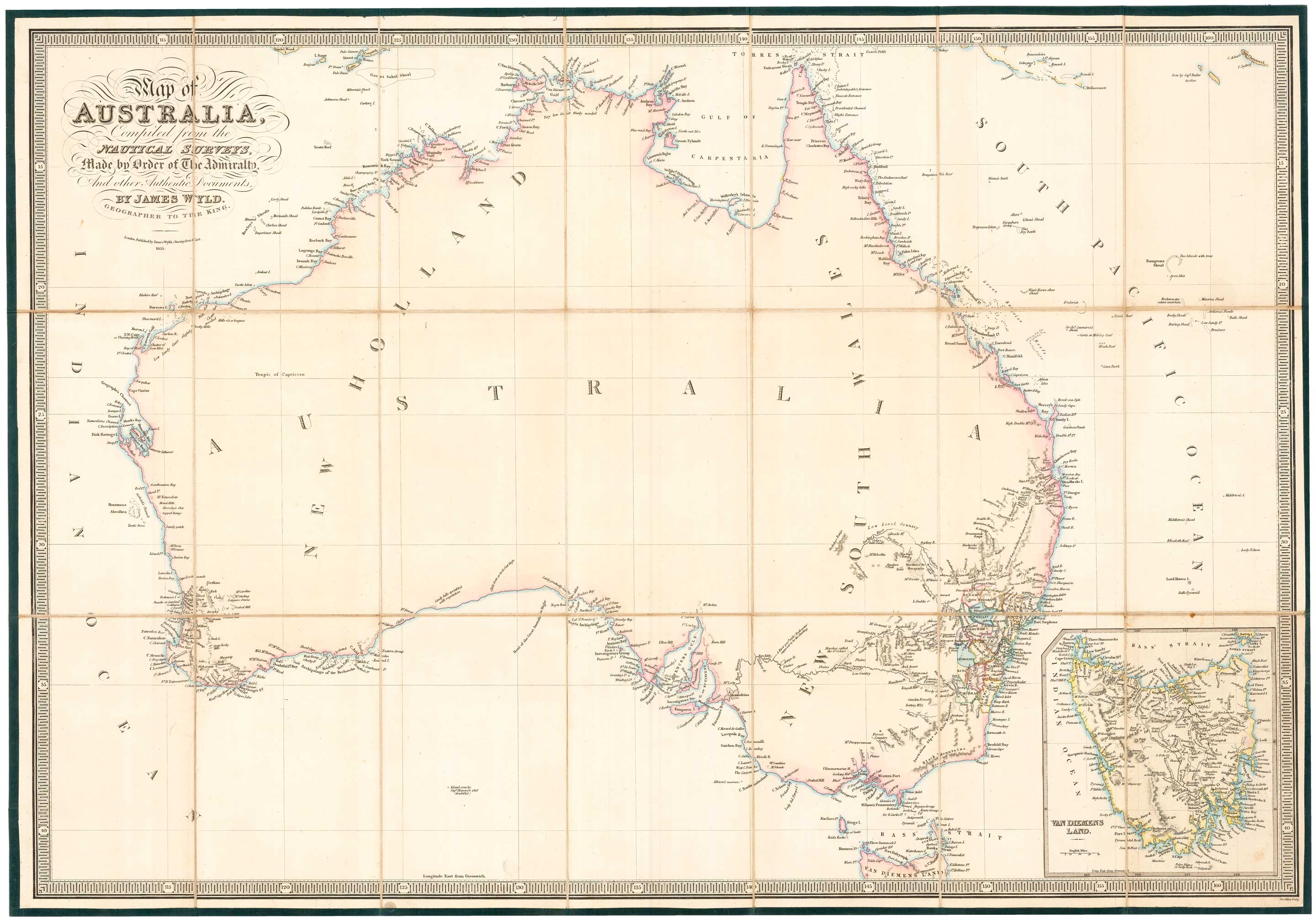
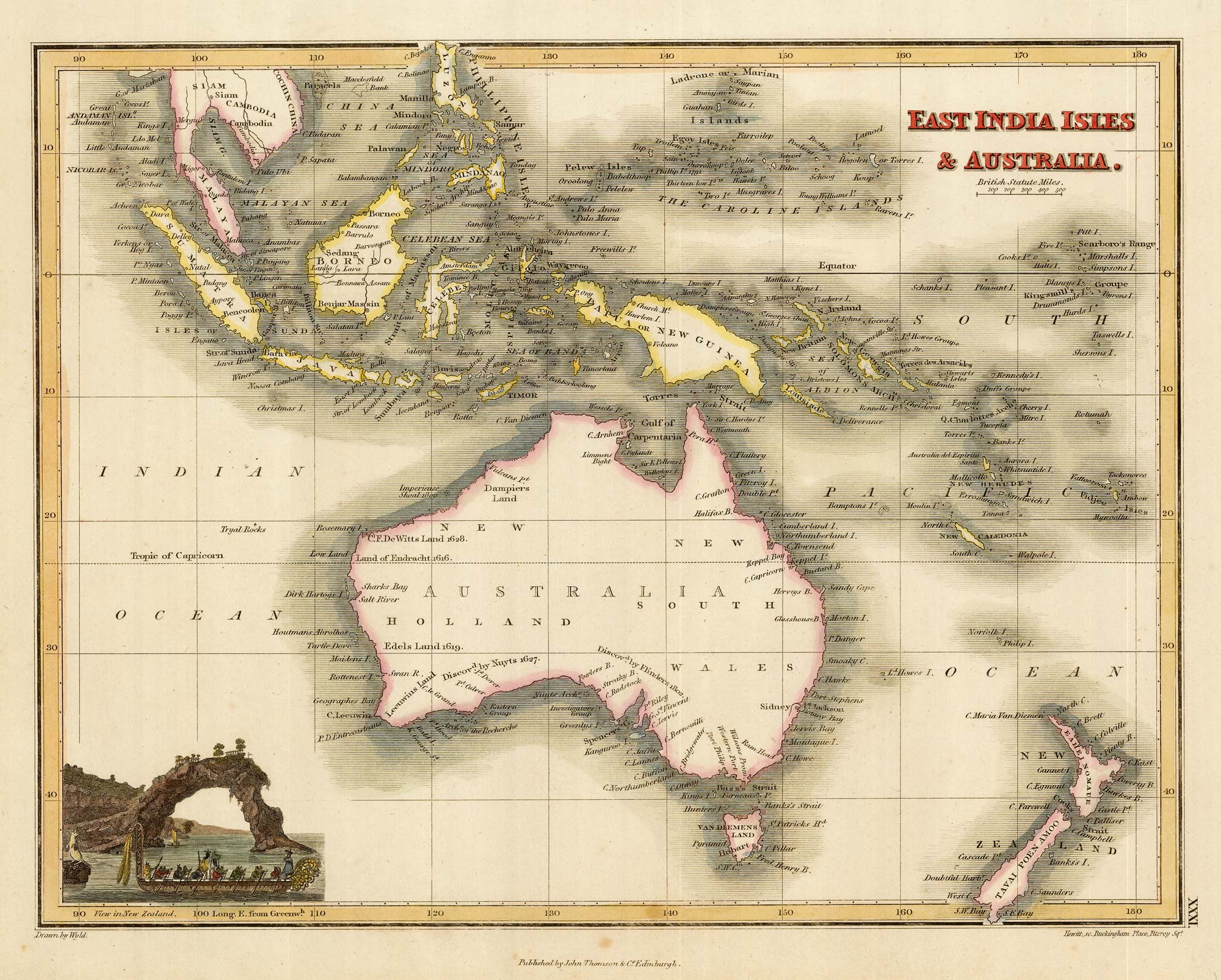
Folding map of Australia with fine colour
WYLD, James. Date: 1833 Stock #: 24071 £980.00
Add to Wishlist
Add to Wishlist
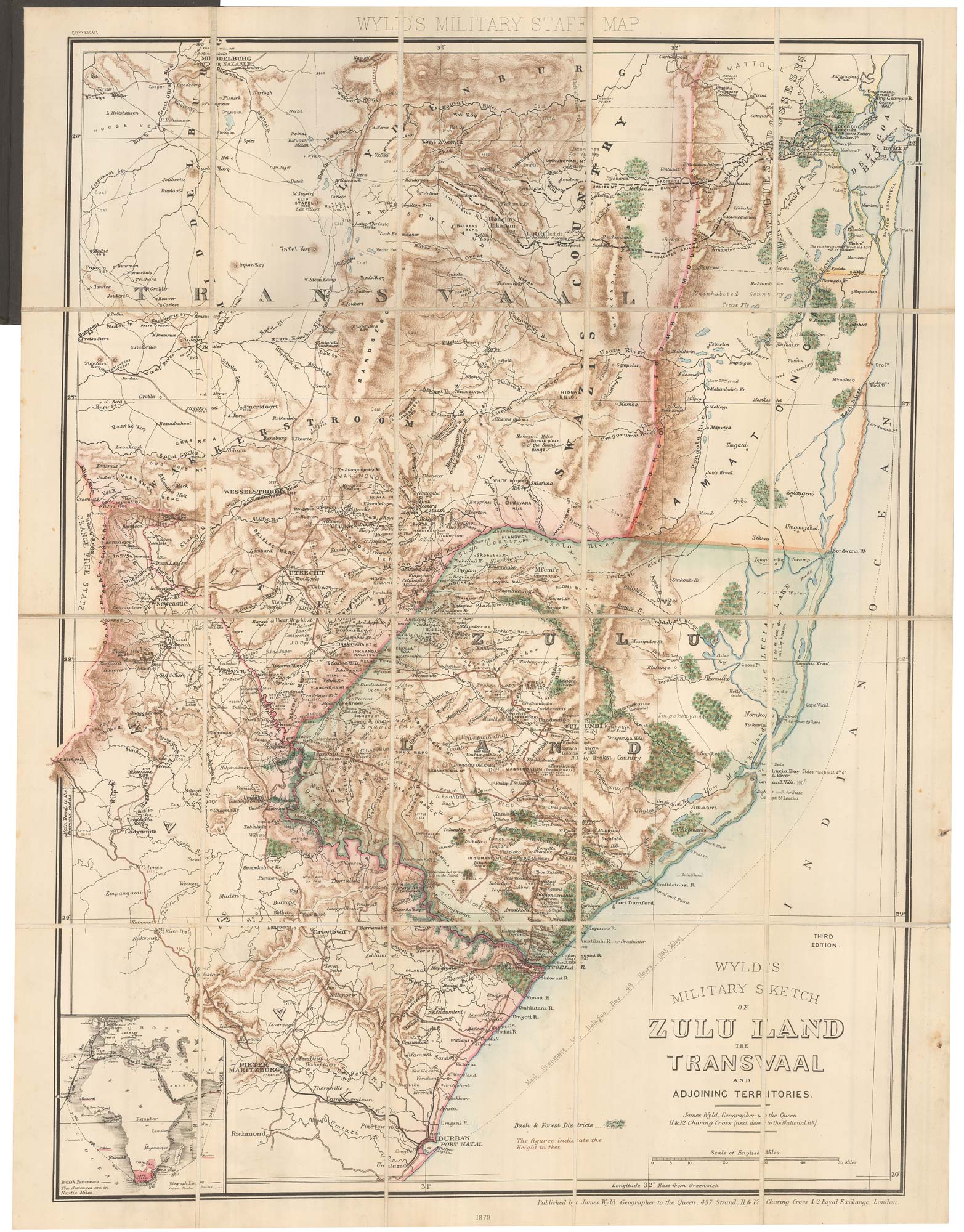
A contemporary military folding map for the Anglo-Zulu War of 1879.
WYLD, James. Date: 1879 Stock #: 22989 £650.00
Add to Wishlist
Add to Wishlist