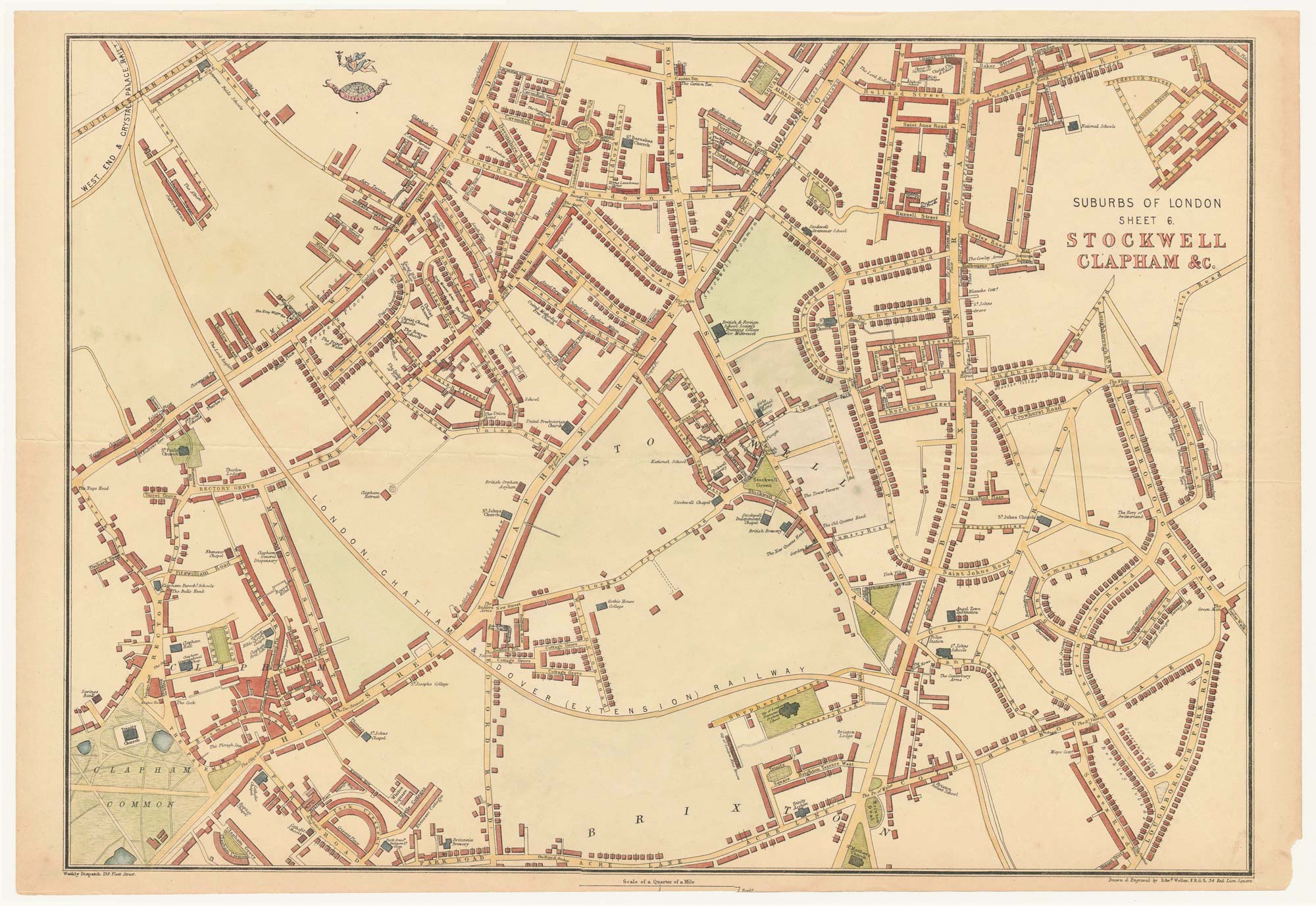


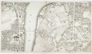
Highly detailed local plan of Stockwell and Clapham
Suburbs of London Sheet 6 Stockwell Clapham
London: The Weekly Dispatch Atlas. c.1863. Coloured. 330 x 480mm.
£200.00
1 in stock
x
Question About This Item?
Highly detailed local plan of Stockwell and Clapham & WELLER, Edward.Stock #: 24078
Add to Wishlist
Export as PDFEnquireSimilar to Sell?Add to Wishlist
Description
A highly detailed local plan of Stockwell, Clapham and includes part of the Brixton area. Featuring Clapham common and Clapham Rise. Between 1857 and 1863, the Weekly Dispatch Atlas published a series of maps. Cassell then published the collection as a atlas in 1863. Maps from this atlas bear the distinctive image of half a globe with a winged Mercury above.
Condition:
A good example.Related products
-
A plan of Covent Garden at the end of the 17th century
BLOME, Richard. Date: 1720Stock #: 25282 £400.00 -
Bromley-by-Bow and the East India Docks
WELLER, Edward. Date: 1863Stock #: 24802 £200.00 -
Nash’s plan to redevelop Charing Cross
ARROWSMITH, Aaron. Date: 1826Stock #: 21685 £400.00 -
A rare map of Mile End
GASCOYNE, Joel. Date: 1636Stock #: 21198 £3,500.00 -

A plan for the Regent’s Canal
BASIRE, James. Date: 1812Stock #: 21670 £340.00 -
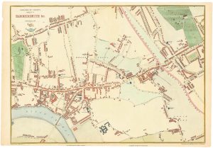
Victorian map of Hammersmith
WELLER, Edward. Date: 1863Stock #: 24800 £250.00 -
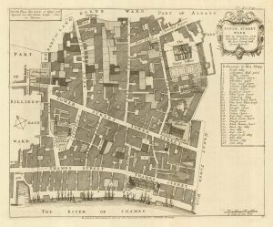
A detailed plan of Tower Street Ward
STOW, John. Date: 1720Stock #: 22004 £200.00 -
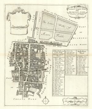
The wards of Coleman Street and Bassishaw at the end of the 17th century
BLOME, Richard. Date: 1720Stock #: 25162 £200.00 -
Westminster and Lambeth from an important large-scale survey of London
HORWOOD, Richard. Date: 1799Stock #: 12670 £1,100.00
Items by the same author
Add to Wishlist
Add to Wishlist

Bromley-by-Bow and the East India Docks
WELLER, Edward. Date: 1863 Stock #: 24802 £200.00
Add to Wishlist
Add to Wishlist
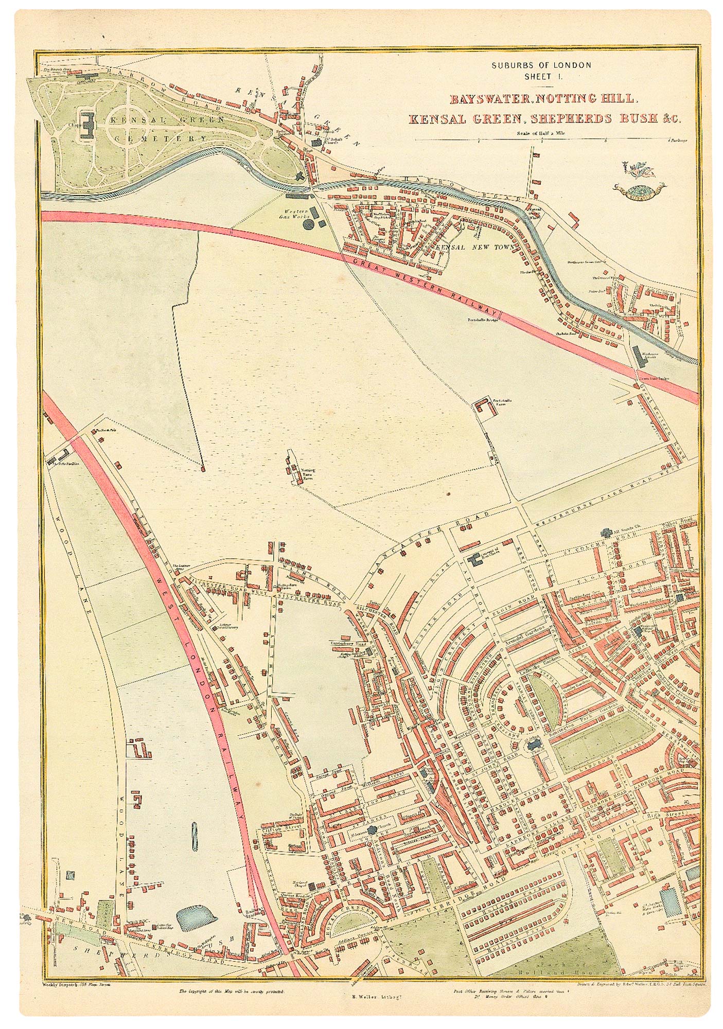
The development of Bayswater
WELLER, Edward. Date: 1863 Stock #: 24803 £250.00
Add to Wishlist
Add to Wishlist
