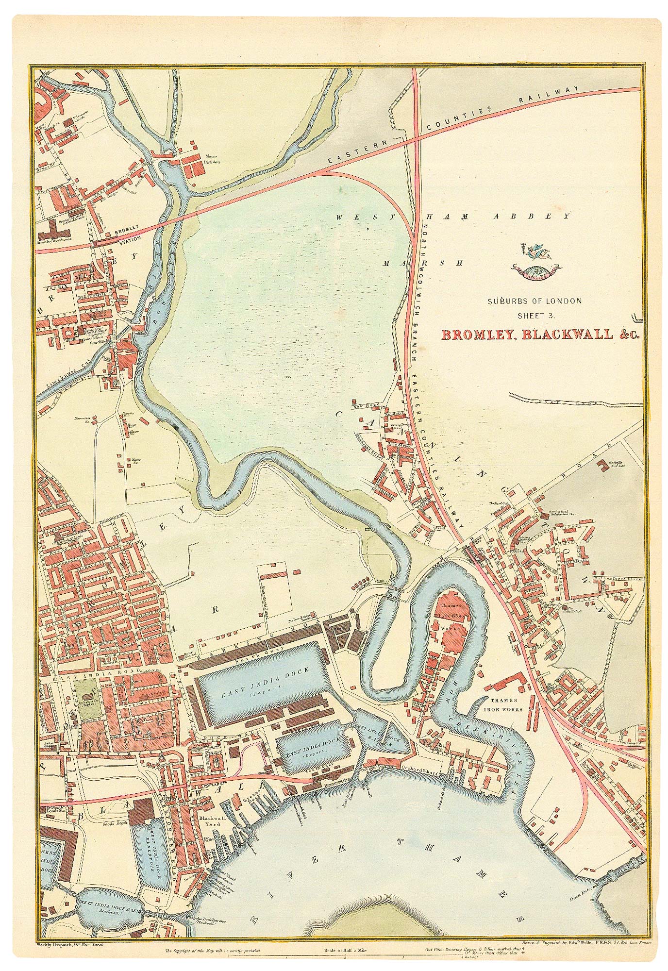


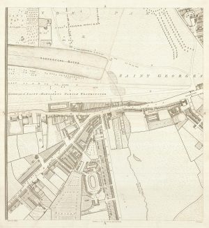
Bromley-by-Bow and the East India Docks
Suburbs of London Sheet 3. Bromley, Blackwall &c.
London; Weekly Dispatch Atlas, c.1863. Coloured lithograph, 450 x 320mm.
£200.00
Description
A detailed map of Bromley-By-Bow, Blackwall and Canning Town, with the River Lea and the East India Docks.
The map was drawn and engraved by Weller for the 'Weekly Dispatch Atlas', which was published in series from 1857 to 1863, when Cassell published the complete atlas.
Condition:
A good example.Related products
-
The Isle of Dogs from Booth’s Poverty Map of London
BOOTH, Charles. Date: 1900Stock #: 16083 £280.00 -
Nash’s plan to redevelop Charing Cross
ARROWSMITH, Aaron. Date: 1826Stock #: 21685 £400.00 -
Knightsbridge from an important large-scale survey of London
HORWOOD, Richard. Date: 1794Stock #: 24401 £1,500.00 -
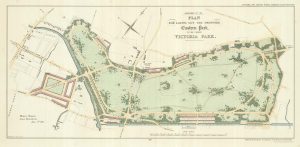
A plan of the proposed Victoria Park
Anonymous. Date: 1817Stock #: 25316 £650.00 -
Covent Garden and Soho from an important large-scale survey of London
HORWOOD, Richard. Date: 1799Stock #: 24405 £1,600.00 -

Walworth from an important large-scale survey of London
HORWOOD, Richard. Date: 1799Stock #: 12672 £550.00 -
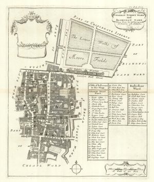
The wards of Coleman Street and Bassishaw at the end of the 17th century
BLOME, Richard. Date: 1720Stock #: 25162 £200.00 -
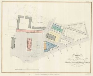
The planned redevelopment of Charing Cross
NASH, John. Date: 1826Stock #: 18494 £450.00 -
One of the few Georgian maps of Hampstead
NEWTON, J. & W. Date: 1814Stock #: 24765 £1,500.00
Items by the same author
Add to Wishlist
Add to Wishlist
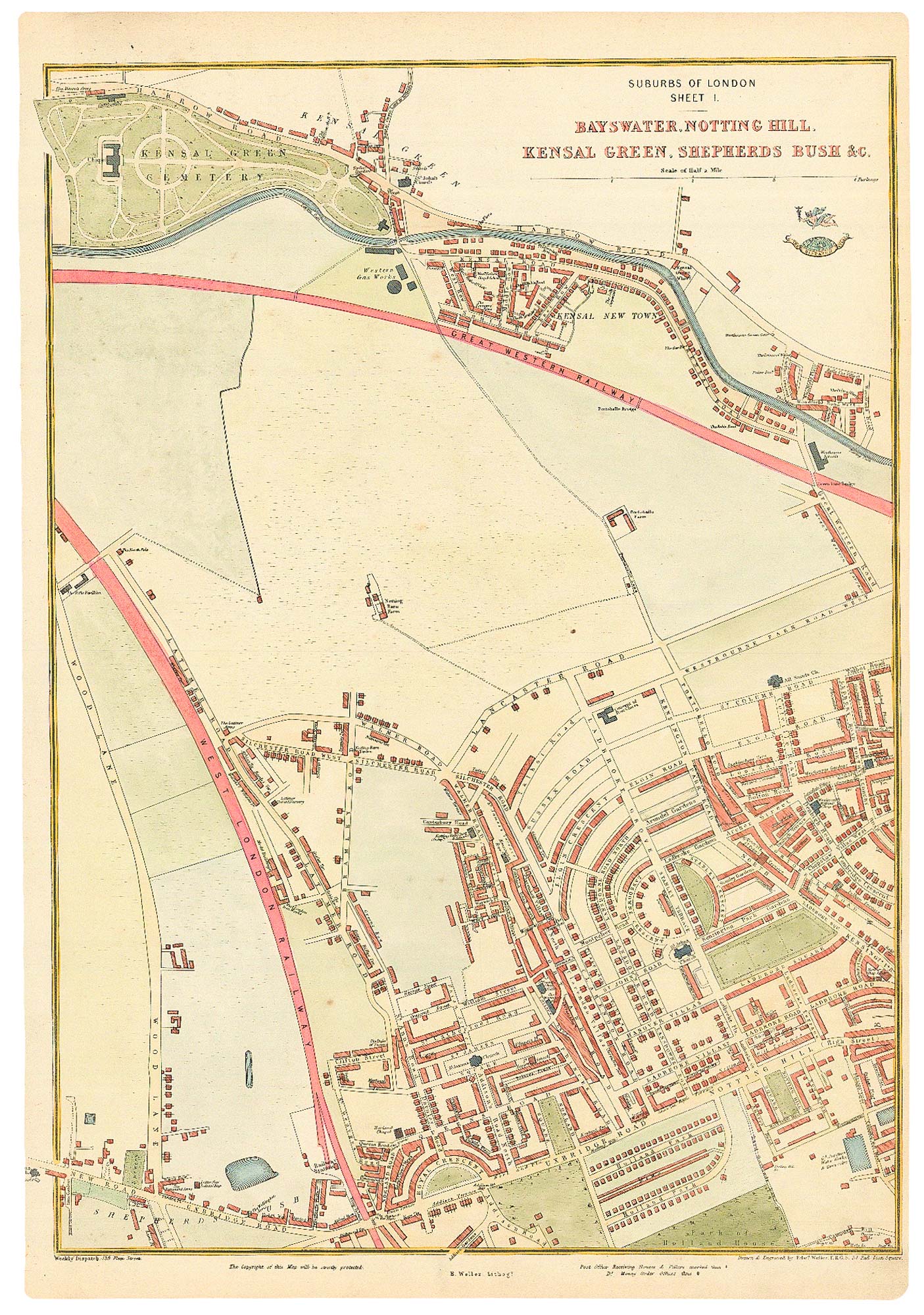
The development of Bayswater
WELLER, Edward. Date: 1863 Stock #: 24803 £250.00
Add to Wishlist
Add to Wishlist

Victorian map of Hammersmith
WELLER, Edward. Date: 1863 Stock #: 24800 £250.00
Add to Wishlist
Add to Wishlist