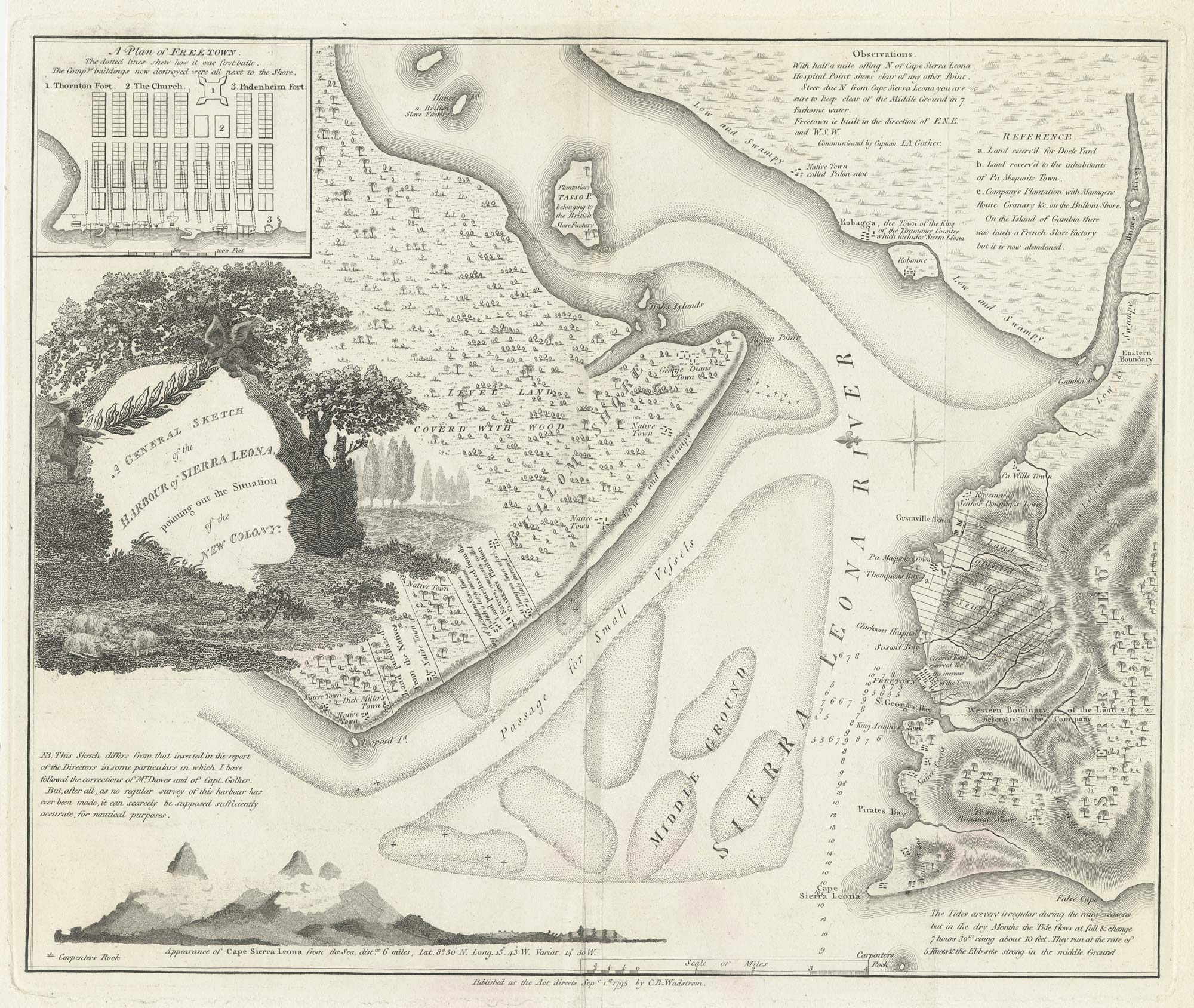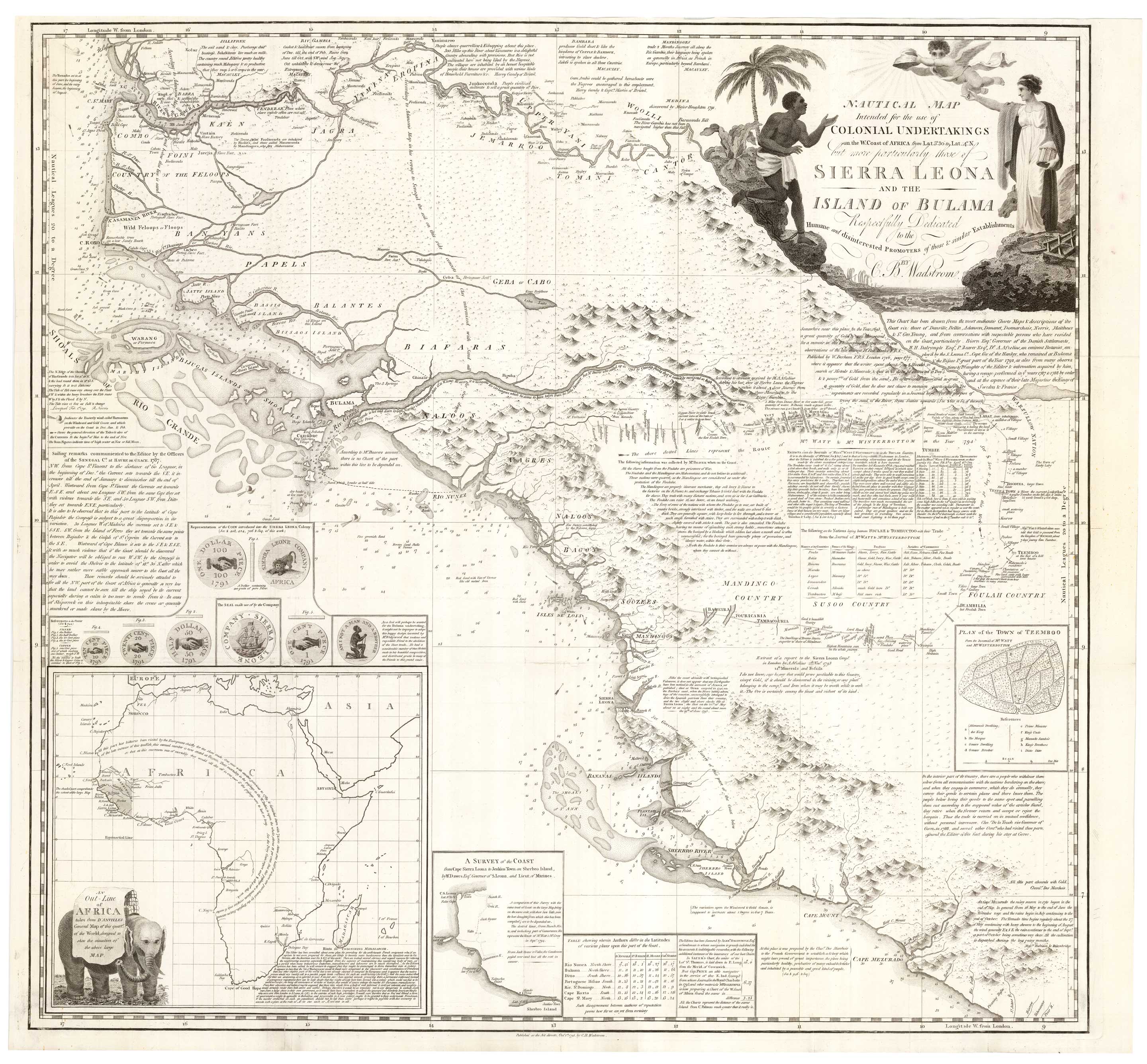


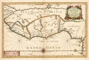
An Abolitionist’s map of Sierra Leone
Nautical Map Intended for the use of Colonial Undertakings on the W. Coast of Africa from Lat. 5.º 30 to Lat.14.º N, but more particularly those of Sierra Leona and the Island of Bulama Respectfully Dedicated to the Humane and disinterested Promoters of these & similar Establishments.
London: Harvey and Darton for Wadstrom, 1795. 690 x 745mm.
£3,500.00
1 in stock
x
Question About This Item?
An Abolitionist’s map of Sierra Leone & WADSTROM, Carl Bernard.Stock #: 25184
Add to Wishlist
Export as PDFEnquireSimilar to Sell?Add to Wishlist
Description
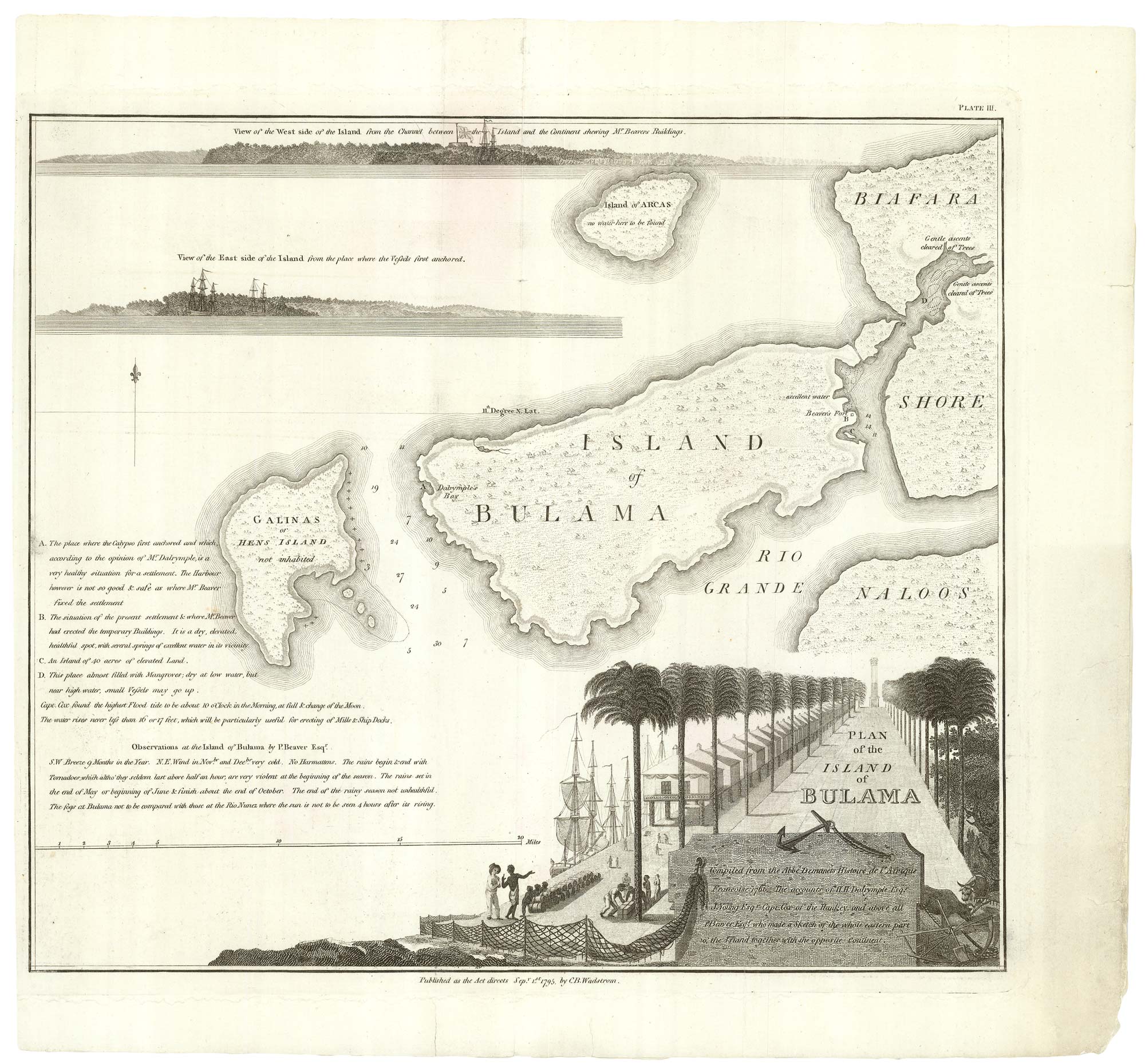
A rare map of West Africa from the Gambia River south through Senegal, Guinea-Bissau, Guinea, Sierra Leone to Cape Mezuradi in Liberia, where Monrovia was founded a quarter of a century later. Text and insets give a wealth of informative detail about the slave trade.
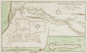
The map was published in ''An Essay on Colonisation Particularly Applied to the Western Coast of Africa'', by Swedish abolitionist Carl Bernhard Wadström (1746-99). In this work he argued that a colony would profit more from trade with the locals than exploited them as slaves. It contained descriptions of the attempts by the Sierra Leone Company to found colonies of former slaves from the Americas, at Freetown in Sierra Leone and, unsuccessfully, on the island of Bolama in Guinea-Bissau.
Of interest is the plan of Timbo, Guinea, one of the very few maps of an indigenous town; the route of an expedition through the interior by Thomas Masterman Winterbottom (1766-1859), the physician to the colony of the Sierra Leone Company in 1792; and depictions of the coins issued by the company for use in the colony.
Condition:
Minor repairs to binding folds.Related products
-
Large map of West Africa published at the end of the 18th century
DELISLE, Guillaume. Date: 1798Stock #: 14029 £300.00 -
A 16th century miniature map of Guinea
LANGENES, Barent. Date: 1599Stock #: 21296 £120.00 -
Du Val’s folio map of the slave forts of the Gulf of Guinea
DU VAL, Pierre. Date: 1671Stock #: 23256 £480.00 -
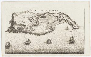
Map of the island of Gorée to illustrate news of the Seven Years’ War
Anonymous. Date: 1759Stock #: 14901 £100.00 -
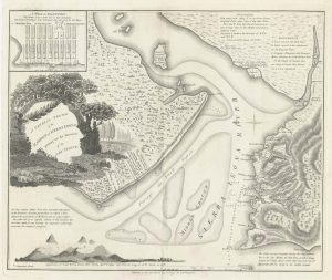
One of the first maps of Freetown
WADSTROM, Carl Bernard. Date: 1795Stock #: 25179 £750.00 -
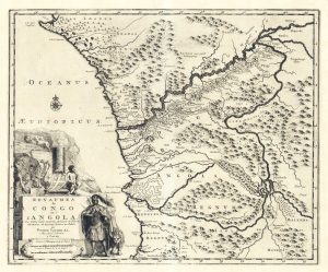
Early 18th century map of Congo & Angola
AA, Pieter van der. Date: 1720Stock #: 19131 £220.00 -
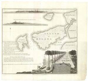
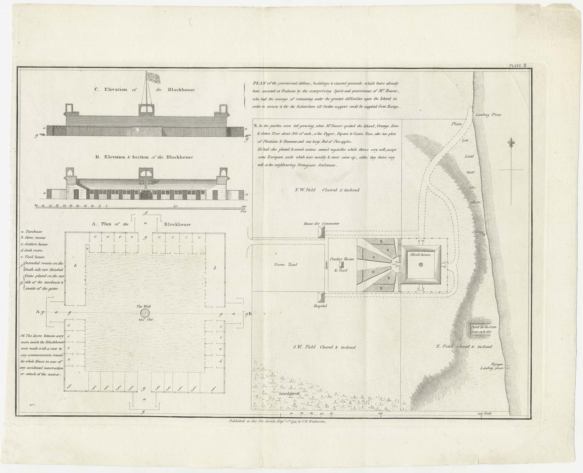
The Nova Scotian Settlers on Bolama
WADSTROM, Carl Bernard. Date: 1795Stock #: 25181 £600.00 -
The British attack on the French Colony of St Louis, Senegal
RASPE, Gabriel Nikolaus. Date: 1760Stock #: 12902 £200.00 -
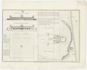
Housing the Nova Scotian Settlers on Bolama
WADSTROM, Carl Bernard. Date: 1795Stock #: 25182 £400.00
Items by the same author
Add to Wishlist
Add to Wishlist
Housing the Nova Scotian Settlers on Bolama
WADSTROM, Carl Bernard. Date: 1795 Stock #: 25182 £400.00
Add to Wishlist
Add to Wishlist
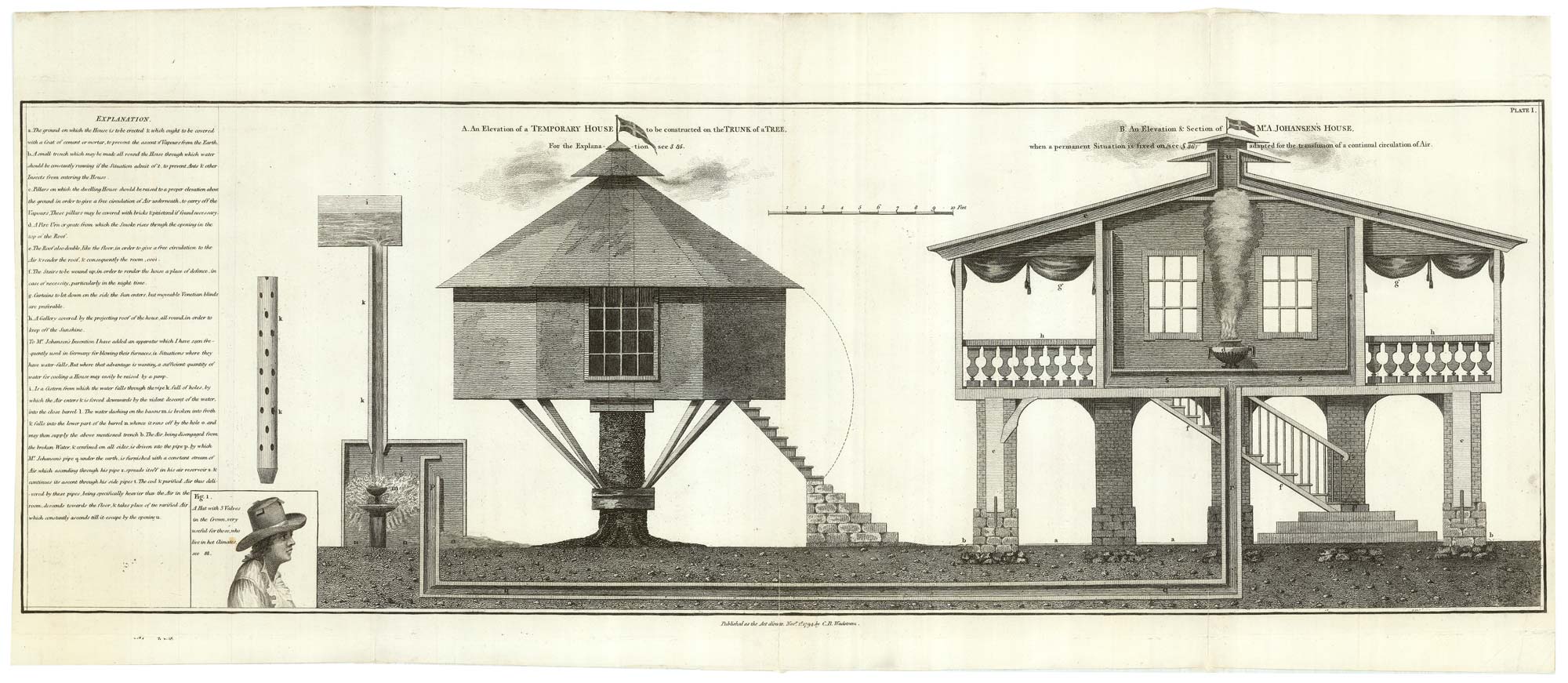
Designs of houses for use in the Sierra Leone colony
WADSTROM, Carl Bernard. Date: 1795 Stock #: 25251 £250.00
Add to Wishlist
Add to Wishlist
The Nova Scotian Settlers on Bolama
WADSTROM, Carl Bernard. Date: 1795 Stock #: 25181 £600.00
Add to Wishlist
Add to Wishlist