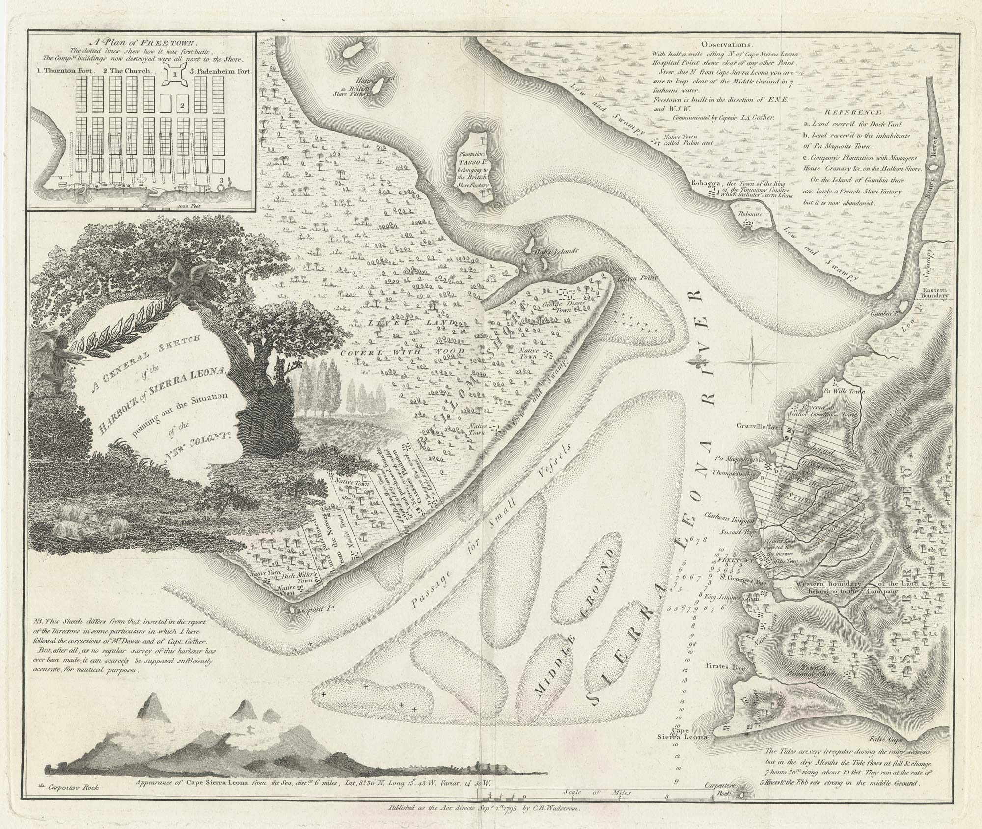


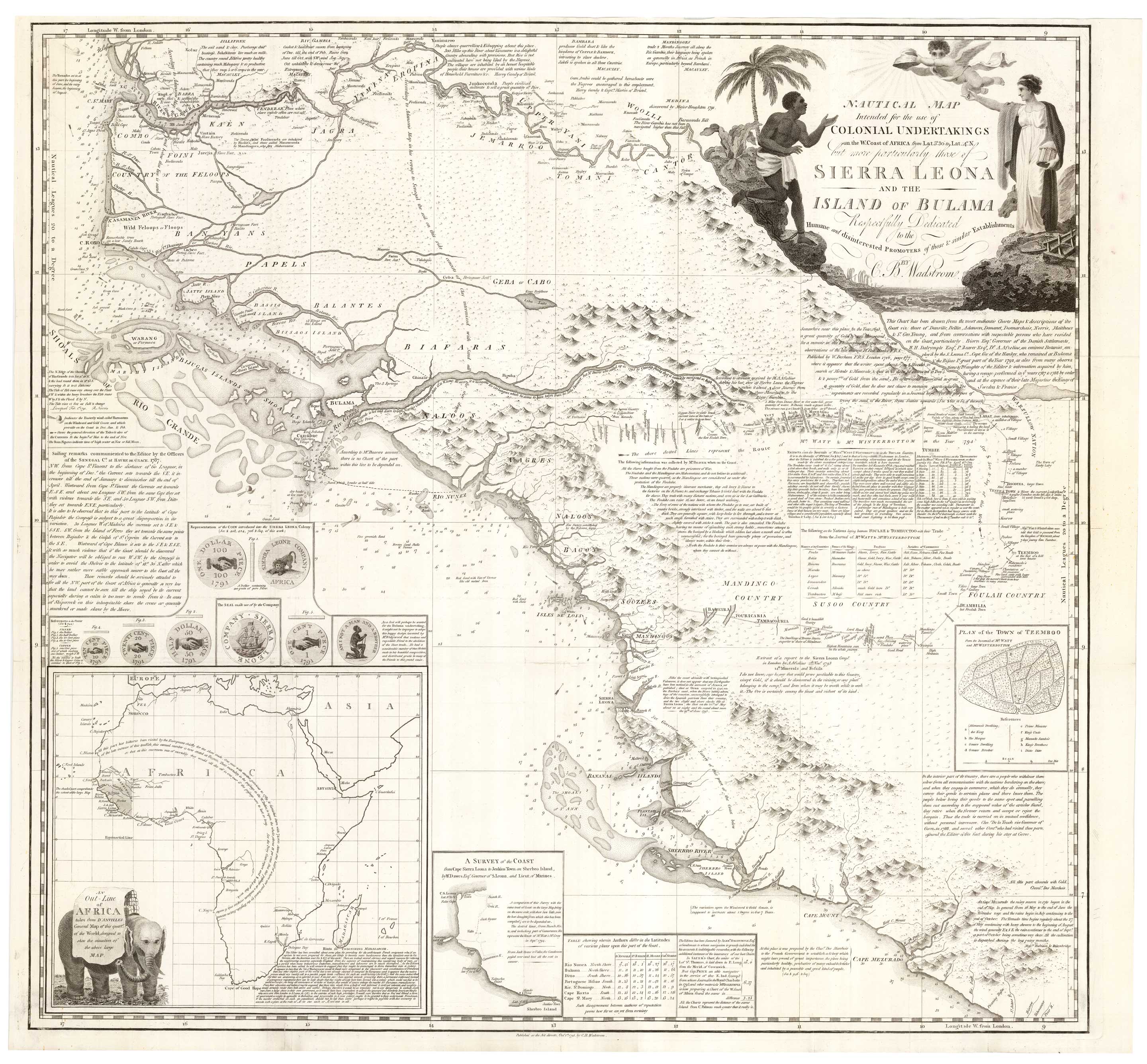
One of the first maps of Freetown
A General Sketch of the Harbour of Sierra Leona, pointing out the Situation of the New Colony.
London: Harvey and Darton for Wadstrom, 1795. 265 x 320mm.
£750.00
Description
A map of the mouth of the Sierra Leone River, orientated with north to the right. marking the positions of Granville Town, the first colony founded by the 'Sierra Leone Company' in the area (1787) and the second, more successful site of Freetown (1792). An inset shows the layout of the streets; a coastal profile illustrates the approaches,
The map was published three years after the foundation of Freetown, in ''An Essay on Colonisation Particularly Applied to the Western Coast of Africa'', by Swedish abolitionist Carl Bernhard Wadström (1746-99). In this work he argued that a colony would profit more from trade with the locals than exploited them as slaves.
Condition:
Narrow left margin, binding folds flattened.Related products
-
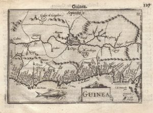
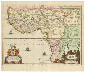
A 16th century miniature map of Guinea
LANGENES, Barent. Date: 1599Stock #: 21296 £120.00 -
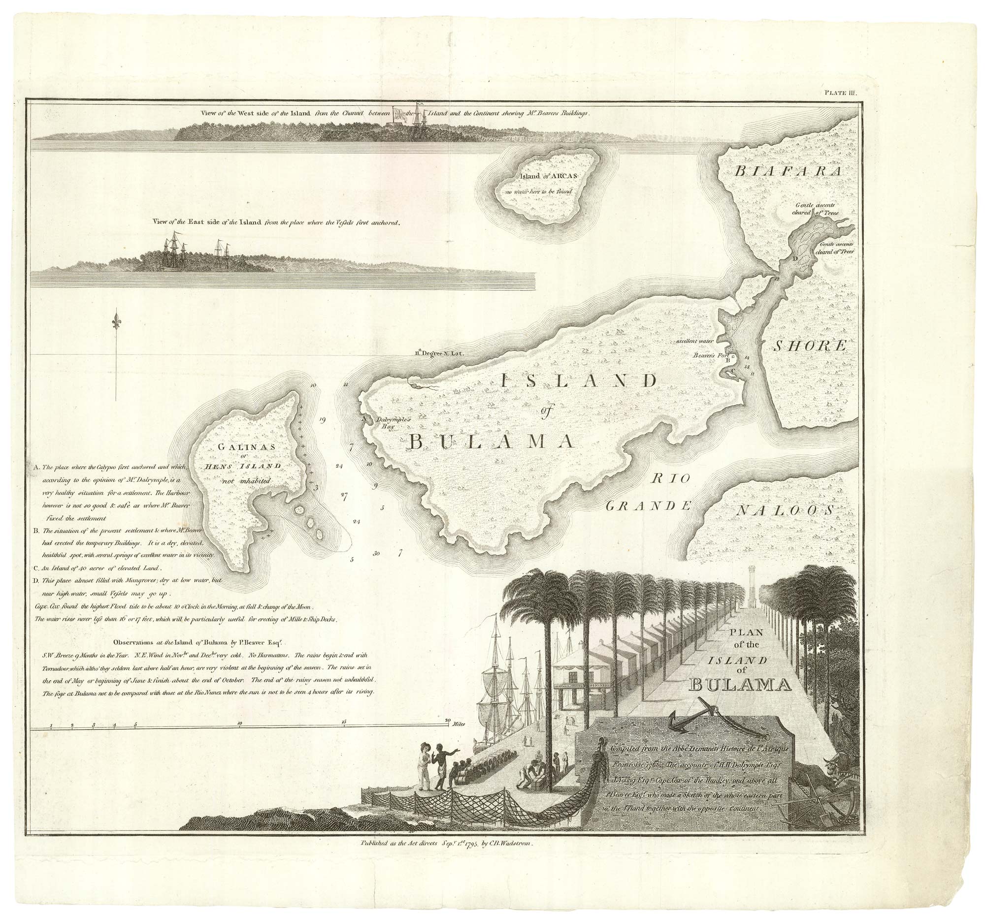
Housing the Nova Scotian Settlers on Bolama
WADSTROM, Carl Bernard. Date: 1795Stock #: 25182 £400.00 -
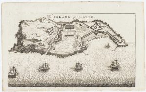
Map of the island of Gorée to illustrate news of the Seven Years’ War
Anonymous. Date: 1759Stock #: 14901 £100.00 -
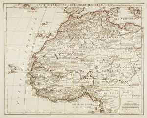
Large map of West Africa published at the end of the 18th century
DELISLE, Guillaume. Date: 1798Stock #: 14029 £300.00 -
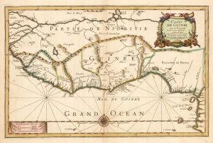
Du Val’s folio map of the slave forts of the Gulf of Guinea
DU VAL, Pierre. Date: 1671Stock #: 23256 £480.00 -
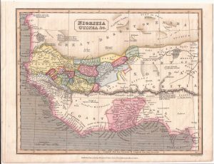
West Africa with the infamous ‘Mountains of Kong’
NEELE & SON. Date: 1838Stock #: 22432 £110.00 -
An uncommon Spanish sea chart of Gabon, the Congo and Angola
BREGANTE, S. Date: 1870Stock #: 18238 £700.00 -
A 17th century old map of the Gulf of Guinea in West Africa
JANSSON, Jan. Date: 1680Stock #: 23630 £500.00 -
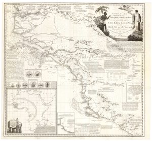
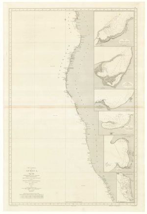
An Abolitionist’s map of Sierra Leone
WADSTROM, Carl Bernard. Date: 1795Stock #: 25184 £3,500.00
Items by the same author
Add to Wishlist
Add to Wishlist
An Abolitionist's map of Sierra Leone
WADSTROM, Carl Bernard. Date: 1795 Stock #: 25184 £3,500.00
Add to Wishlist
Add to Wishlist
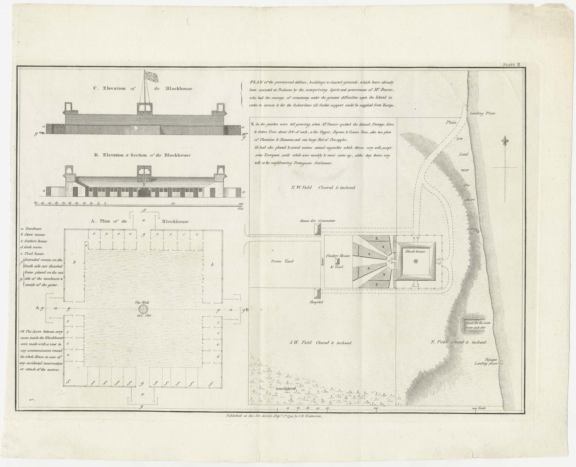
Housing the Nova Scotian Settlers on Bolama
WADSTROM, Carl Bernard. Date: 1795 Stock #: 25182 £400.00
Add to Wishlist
Add to Wishlist
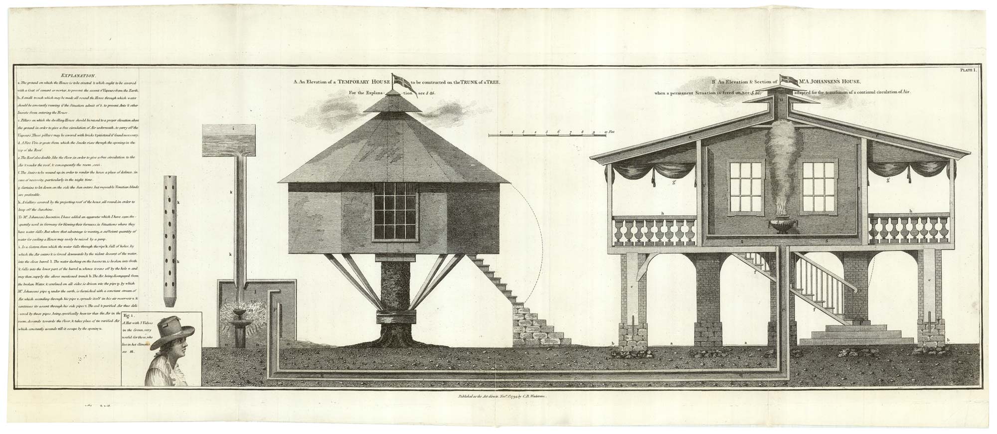
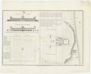
Designs of houses for use in the Sierra Leone colony
WADSTROM, Carl Bernard. Date: 1795 Stock #: 25251 £250.00
Add to Wishlist
Add to Wishlist