


A 16th century woodcut map of Lesbos
[De l'Isle de Metelin, dicte des Anciens Lesbos.]
Paris, 1575. Coloured woodcut, printed area 135 x 160mm, set in a page of French text.
£300.00
Description
A map of Lesbos, with a letterpress description, from which the title is taken. There is no lettering on the map: instead the island is villed with illustrations, including , Doric columns and a battle scene of pikemen.
The map was published in the 'Cosmographie Universelle' by André Thevet (1516-90), a Franciscan priest who travelled to the Near East and Brazil. Thevet began writing his cosmography with François de Belleforest but, after a dispute, Bellforest left and published his own version three years before Thevet.
Condition:
A good example.References:
ZACHERAKIS: 2290, plate 512.Related products
-

A prospect of Rhodes in the 17th century by a professional artist
BRUYN, Cornelis de. Date: 1714Stock #: 23084 £250.00 -
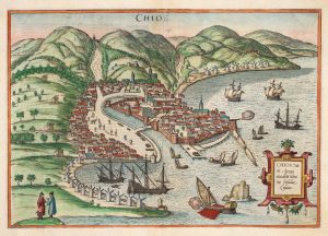
An early town plan of Chios
BRAUN, Georg & HOGENBERG, Frans. Date: 1588Stock #: 20280 £700.00 -
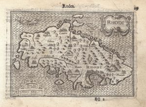
A 16th century miniature map of Rhodes
LANGENES, Barent. Date: 1599Stock #: 21334 £180.00 -
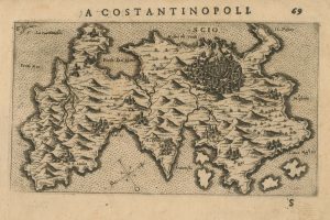
A 16th century Italian map of Chios
ROSACCIO, Giuseppe. Date: 1598Stock #: 25046 £500.00 -

The medieval Castle of Pandeli on Leros
CORONELLI, Vincenzo Maria. Date: 1700Stock #: 23366 £350.00 -

A prospect of Rhodes in the 17th century by a professional artist
BRUYN, Cornelis de. Date: 1714Stock #: 23085 £250.00 -
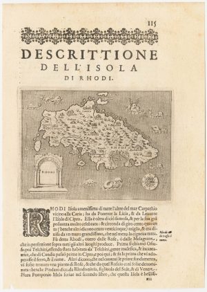
A 16th century map of Rhodes
PORCACCHI, Tomaso. Date: 1590Stock #: 23213 £120.00 -

A scarce map of Kos
CORONELLI, Vincenzo Maria. Date: 1700Stock #: 23371 £350.00 -
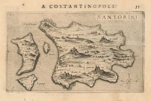
A 16th century Italian map of Santorini
ROSACCIO, Giuseppe. Date: 1598Stock #: 25047 £450.00