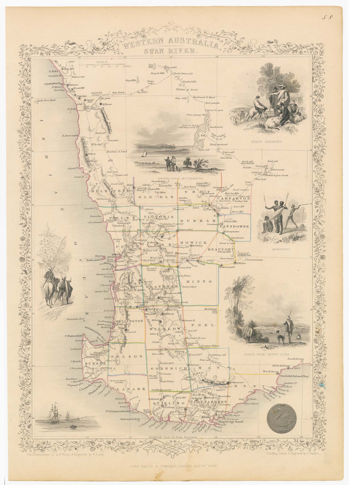


A mid 19th century map of Western Australia with vignettes
Western Australia, Swan River.
London: John Tallis & Co., c.1851. Steel engraving with original outline colour. 345 x 240mm.
£180.00
1 in stock
x
Question About This Item?
A mid 19th century map of Western Australia with vignettes & TALLIS, John.Stock #: 21789
Add to Wishlist
Export as PDFEnquireSimilar to Sell?Add to Wishlist
Description
A detailed map of Western Australia, with an ornate border and decorated with vignettes including an views of Perth, Aborigines sheep shearing and droving.
The map was drawn and engraved by John Rapkin for the 'The Illustrated Atlas, and Modern History of the World, Geographical Political, Commercial & Statistical', edited by Montgomery Martin, which was one of the last decorative atlases to be published.
Condition:
Paper lightly toned.Related products
-
Cook’s maps of Botany Bay and the Endeavour River
COOK, James. Date: 1774Stock #: 23585 £180.00 -
19th century Australia
WEILAND, Carl Ferdinand. Date: 1850Stock #: 20927 £300.00 -
An important chart of Sydney Harbour
LA TOUANNE, Edmond Bigot de. Date: 1837Stock #: 25096 £1,600.00 -
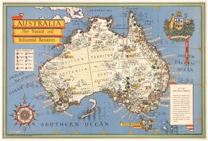
A pictorial map of Australia at the end of the Second World War
GILL, Leslie MacDonald. Date: 1946Stock #: 25191 £1,750.00 -
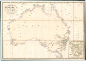
Folding map of Australia with fine colour
WYLD, James. Date: 1833Stock #: 24071 £980.00 -
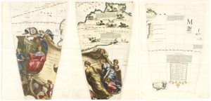
Set of three gores covering Australia from Coronelli’s 42 inch globe
CORONELLI, Vincenzo Maria. Date: 1693Stock #: 23726 £4,500.00 -
An unusual Italian map of Australia
MARMOCCHI, Francesco C. Date: 1858Stock #: 23588 £650.00 -
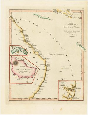
An 18th century map of New South Wales
WILKINSON, Robert. Date: 1794Stock #: 23692 £320.00 -
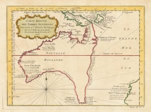
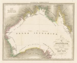
A pre-Cook discoveries map of Australia
BELLIN, Jacques-Nicolas. Date: 1753Stock #: 25052 £1,000.00
Items by the same author
Add to Wishlist
Add to Wishlist

Mid 19th century map of Ireland with decorative vignettes
TALLIS, John. Date: 1851 Stock #: 21568 £240.00
Add to Wishlist
Add to Wishlist

A mid-19th century map of Germany with decorative vignettes
TALLIS, John. Date: 1851 Stock #: 23486 £120.00
Add to Wishlist
Add to Wishlist

Map of France with vignette scenes
TALLIS, John. Date: 1851 Stock #: 17766 £100.00
Add to Wishlist
Add to Wishlist

London during the Great Exhibition of 1851
TALLIS, John. Date: 1851 Stock #: 25662 £2,400.00
Add to Wishlist
Add to Wishlist

Mid 19th century map of Greece with decorative vignettes
TALLIS, John. Date: 1851 Stock #: 23523 £140.00
Add to Wishlist
Add to Wishlist
