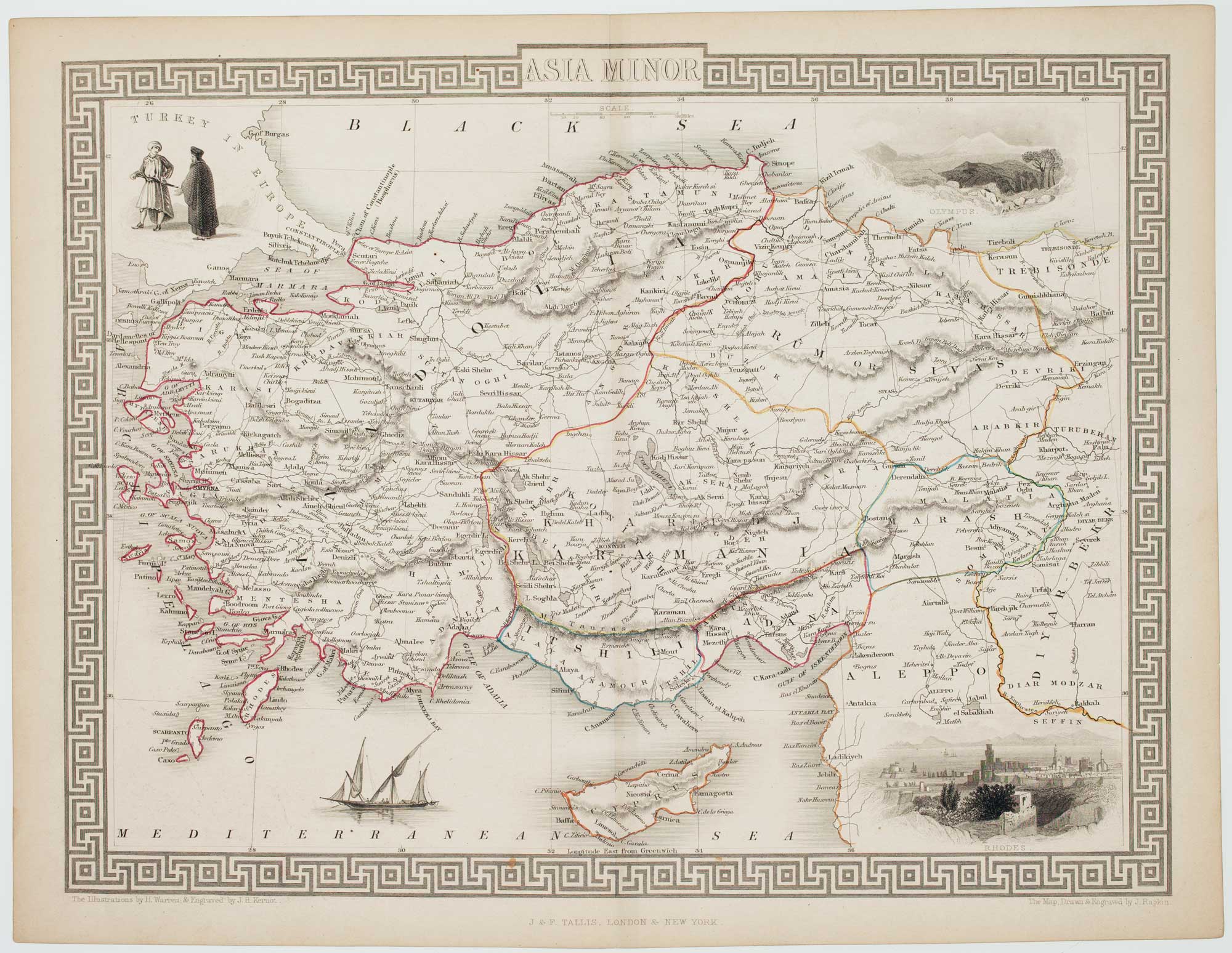


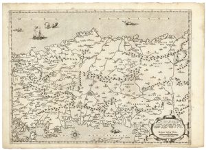
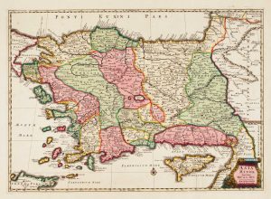
Mid-19th century map of Turkey with decorative vignettes
Asia Minor.
London, John Tallis & Co., c.1851. Steel engraving with original outline colour. Printed area 330 x 260mm.
£125.00
1 in stock
x
Question About This Item?
Mid-19th century map of Turkey with decorative vignettes & TALLIS, John.Stock #: 16133
Add to Wishlist
Export as PDFEnquireSimilar to Sell?Add to Wishlist
Description
A detailed Victorian map of Turkey and Cyprus, within an ornate geometrical border, decorated with vignettes including views of Rhodes and Mount Olympus on Cyprus.
The map was drawn and engraved by John Rapkin for the 'The Illustrated Atlas, and Modern History of the World, Geographical Political, Commercial & Statistical', edited by Montgomery Martin, which was one of the last decorative atlases to be published.
Condition:
A good example.Related products
-
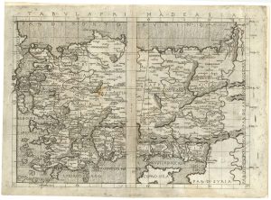
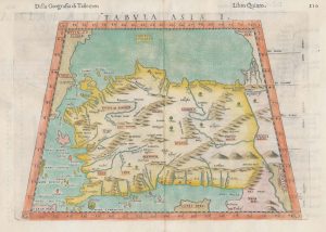
An incunable map of Turkey from a landmark edition of Ptolemy
BERLINGHIERI, Francesco de Nicola. Date: 1482Stock #: 25241 £11,000.00 -
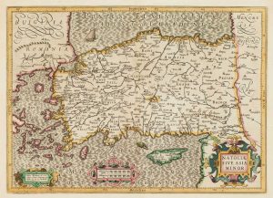
A map of Classical Turkey and Cyprus
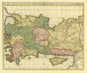
SANSON, Nicolas. Date: 1731Stock #: 17597 £650.00 -
17th century map of Turkey with Cyprus
HONDIUS, Jodocus. Date: 1628Stock #: 16468 £550.00 -
A 16th century separate-issue map of Turkey
ZALTIERI, Bolognino. Date: 1570Stock #: 25249 £3,600.00 -
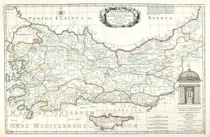
Early 18th century map of Turkey
VISSCHER, Nicolas. Date: 1705Stock #: 20555 £450.00 -
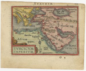
A 16th century miniature map of the Turkish Empire
ORTELIUS, Abraham. Date: 1593Stock #: 24464 £280.00 -
A 16th century map of Turkey according to Claudius Ptolemy
RUSCELLI, Girolamo. Date: 1598Stock #: 20498 £250.00 -
Map of classical Turkey in vibrant original colour
DE LA RUE, Philippe. Date: 1692Stock #: 14911 £480.00 -
A 16th century miniature map of Turkey
LANGENES, Barent. Date: 1599Stock #: 21263 £140.00
Items by the same author
Add to Wishlist
Add to Wishlist

Mid 19th century map of Ireland with decorative vignettes
TALLIS, John. Date: 1851 Stock #: 21568 £240.00
Add to Wishlist
Add to Wishlist

A mid-19th century map of Germany with decorative vignettes
TALLIS, John. Date: 1851 Stock #: 23486 £120.00
Add to Wishlist
Add to Wishlist

Map of France with vignette scenes
TALLIS, John. Date: 1851 Stock #: 17766 £100.00
Add to Wishlist
Add to Wishlist

London during the Great Exhibition of 1851
TALLIS, John. Date: 1851 Stock #: 25662 £2,400.00
Add to Wishlist
Add to Wishlist

Mid 19th century map of Greece with decorative vignettes
TALLIS, John. Date: 1851 Stock #: 23523 £140.00
Add to Wishlist
Add to Wishlist
