

Mid 19th century map of Tibet, Mongolia and Manchuria
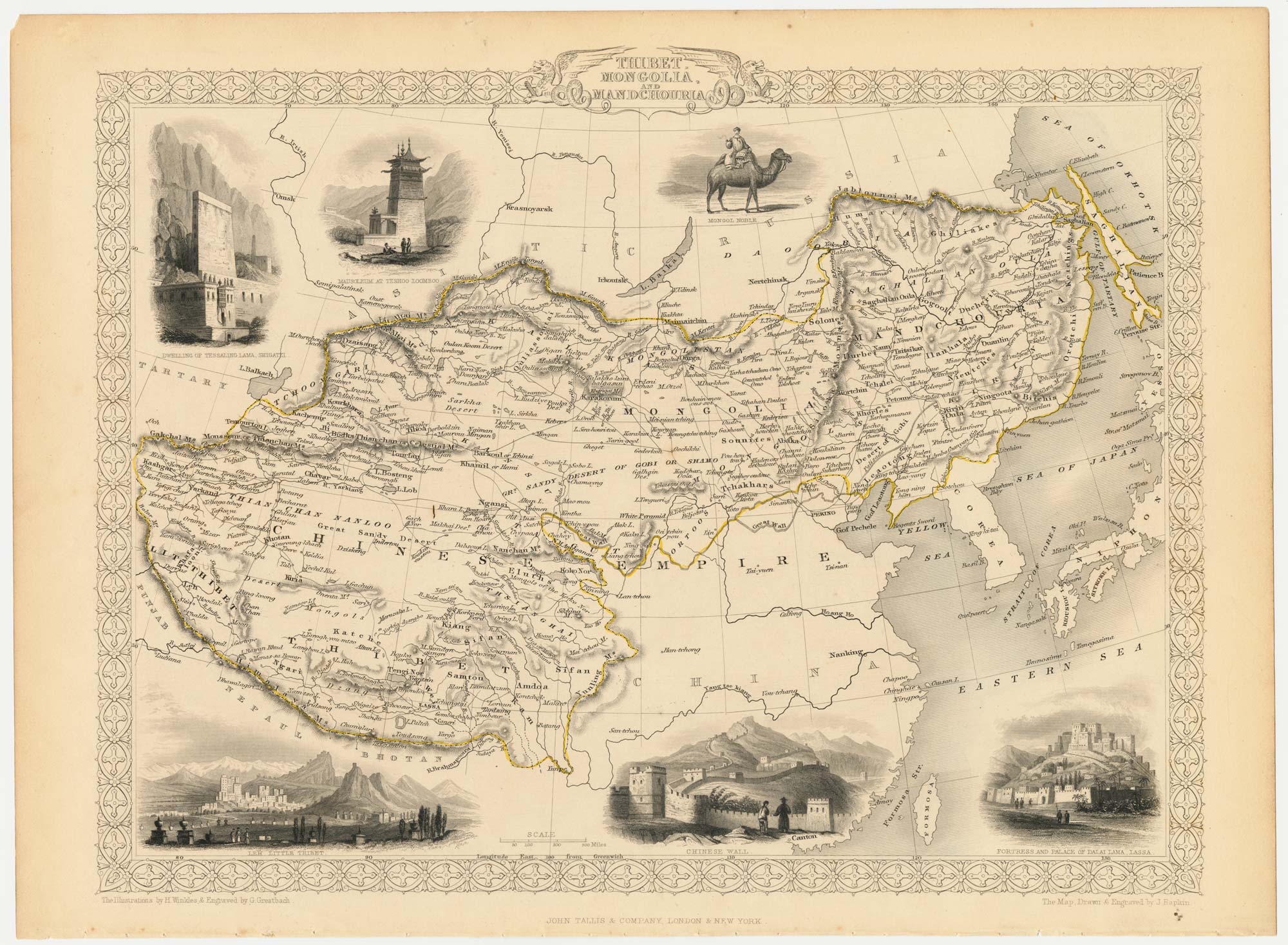
Thibet, Mongolia and Mandchouria.
London, John Tallis & Co., c.1851. Steel engraving with original outline colour, 330 x 260mm.
£160.00
1 in stock
x
Question About This Item?
Mid 19th century map of Tibet, Mongolia and Manchuria & TALLIS, John.Stock #: 21614
Add to Wishlist
Export as PDFEnquireSimilar to Sell?Add to Wishlist
Description
A detailed Victorian map of Tibet, Mongolia and Manchuria, within an ornate border, decorated with six vignette scenes, including views of Lhasa, Leh (now part of Ladakh in India) and the Great Wall of China.
The map was drawn and engraved by John Rapkin for the 'The Illustrated Atlas, and Modern History of the World, Geographical Political, Commercial & Statistical', edited by Montgomery Martin, which was one of the last decorative atlases to be published.
Condition:
A good example.Related products

Items by the same author
Add to Wishlist
Add to Wishlist

Mid 19th century map of Ireland with decorative vignettes
TALLIS, John. Date: 1851 Stock #: 21568 £240.00
Add to Wishlist
Add to Wishlist

A mid-19th century map of Germany with decorative vignettes
TALLIS, John. Date: 1851 Stock #: 23486 £120.00
Add to Wishlist
Add to Wishlist

Map of France with vignette scenes
TALLIS, John. Date: 1851 Stock #: 17766 £100.00
Add to Wishlist
Add to Wishlist

London during the Great Exhibition of 1851
TALLIS, John. Date: 1851 Stock #: 25662 £2,400.00
Add to Wishlist
Add to Wishlist

Mid 19th century map of Greece with decorative vignettes
TALLIS, John. Date: 1851 Stock #: 23523 £140.00
Add to Wishlist
Add to Wishlist
