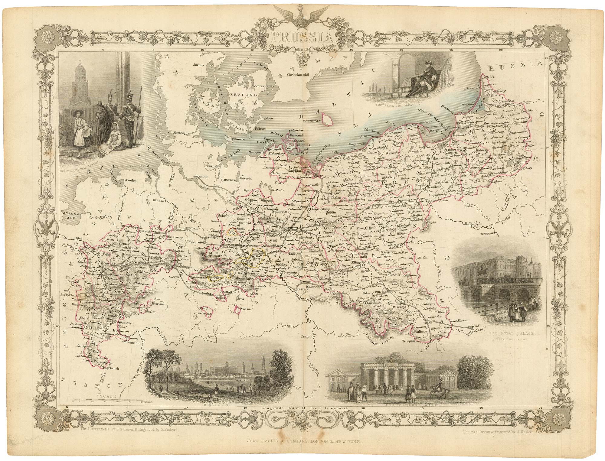


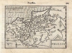
Mid-19th century map of Prussia with decorative vignettes
Prussia.
London: John Tallis & Co., c.1851. Original outline colour. Steel engraving, printed area 265 x 330mm.
£120.00
1 in stock
x
Question About This Item?
Mid-19th century map of Prussia with decorative vignettes & TALLIS, John.Stock #: 19450
Add to Wishlist
Export as PDFEnquireSimilar to Sell?Add to Wishlist
Description
A detailed Victorian map of Prussia, within an ornate printed border, decorated with five vignettes including a portrait of Frederick the Great, a prospect and three views of Berlin.
The map was drawn and engraved by John Rapkin for the 'The Illustrated Atlas, and Modern History of the World, Geographical Political, Commercial & Statistical', edited by Montgomery Martin, which was one of the last decorative atlases to be published.
Condition:
Closely trimmed top marginRelated products
-
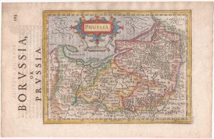
Prussia from the first English Edition of the ‘Atlas Minor’
HONDIUS, Jodocus. Date: 1635Stock #: 22382 £220.00 -
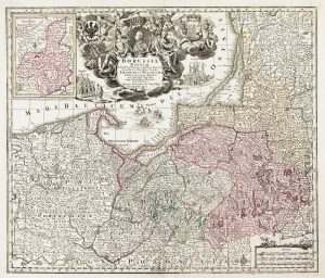
Detailed map of Prussia
SEUTTER, Matthaus. Date: 1730Stock #: 10985 £390.00 -
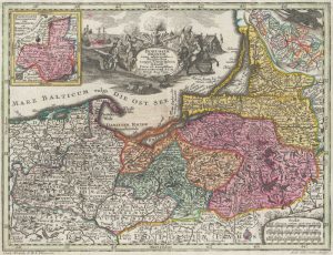
Prussia
SEUTTER, Matthaus. Date: 1744Stock #: 18936 £220.00 -
A 16th century miniature map of Prussia
LANGENES, Barent. Date: 1599Stock #: 21324 £140.00
Items by the same author
Add to Wishlist
Add to Wishlist

Mid 19th century map of Ireland with decorative vignettes
TALLIS, John. Date: 1851 Stock #: 21568 £240.00
Add to Wishlist
Add to Wishlist

A mid-19th century map of Germany with decorative vignettes
TALLIS, John. Date: 1851 Stock #: 23486 £120.00
Add to Wishlist
Add to Wishlist

Map of France with vignette scenes
TALLIS, John. Date: 1851 Stock #: 17766 £100.00
Add to Wishlist
Add to Wishlist

London during the Great Exhibition of 1851
TALLIS, John. Date: 1851 Stock #: 25662 £2,400.00
Add to Wishlist
Add to Wishlist

Mid 19th century map of Greece with decorative vignettes
TALLIS, John. Date: 1851 Stock #: 23523 £140.00
Add to Wishlist
Add to Wishlist
