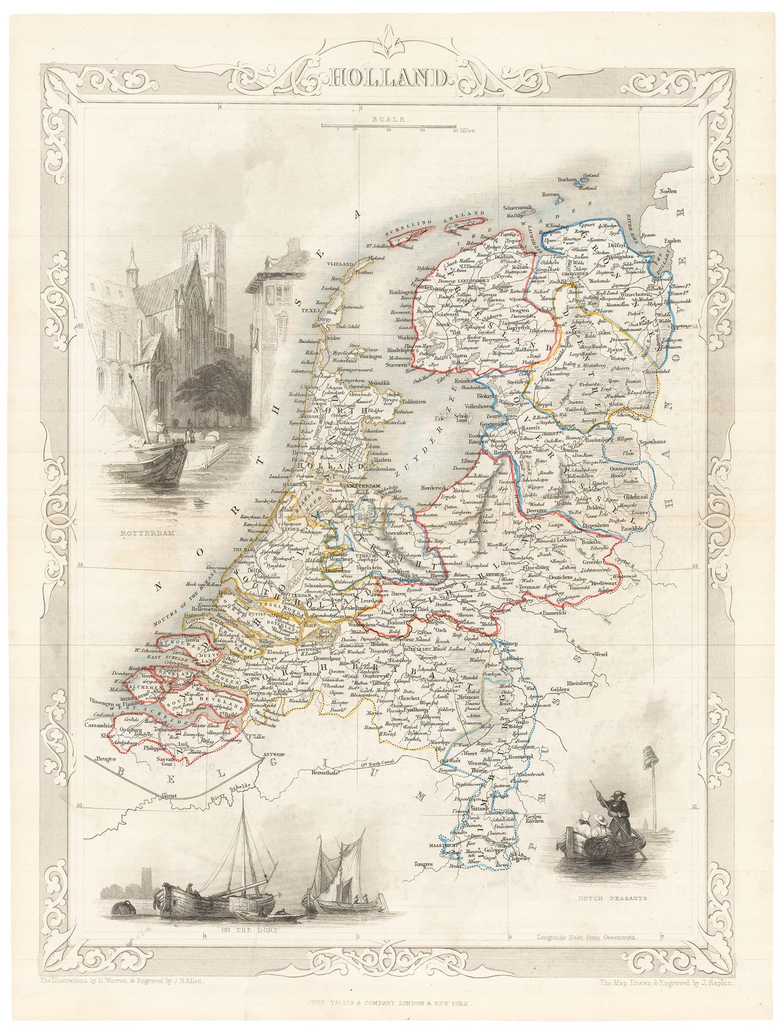


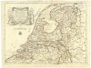
19th century map of Holland with vignettes
Holland.
London, John Tallis & Co., c.1851. original outline colour. Steel engraving, printed area 355 x 255mm.
£100.00
Description
A very detailed map, with three decorative vignettes including a view of Rotterdam.
The map was drawn and engraved by John Rapkin for the 'The Illustrated Atlas, and Modern History of the World, Geographical Political, Commercial & Statistical', edited by Montgomery Martin, which was one of the last decorative atlases to be published.
Condition:
A good example.Related products
-
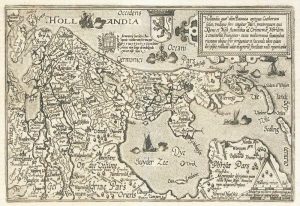
Holland
QUAD, Matthias. Date: 1600Stock #: 9094 £400.00 -
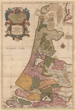
A two-sheet map of Holland in fine original colour
JAILLOT, Alexis-Hubert. Date: 1696Stock #: 22713 £1,100.00 -
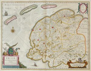
Friesland
JANSSON, Jan. Date: 1666Stock #: 8433 £250.00 -
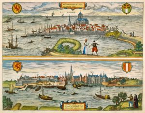
16th century town plans of Rotterdam & Gouda
BRAUN, Georg & HOGENBERG, Frans. Date: 1588Stock #: 22690 £650.00 -
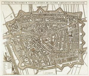
A town plan of Leiden in the 17th century
DE WIT, Frederick. Date: 1740Stock #: 22686 £800.00 -
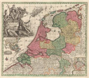
A decorative 18th century map of the Netherlands and East Indies
SEUTTER, Matthaus. Date: 1730Stock #: 20406 £500.00 -
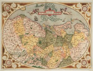
The Netherlands ‘Egg’ Map by Ortelius
ORTELIUS, Abraham. Date: 1574Stock #: 12887 £850.00 -
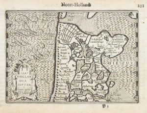
A 16th century miniature map of North Holland
LANGENES, Barent. Date: 1599Stock #: 21160 £70.00 -
The Netherlands during the Anglo-Dutch War of 1672
DU VAL, Pierre. Date: 1672Stock #: 20503 £900.00
Items by the same author
Add to Wishlist
Add to Wishlist

Mid 19th century map of Ireland with decorative vignettes
TALLIS, John. Date: 1851 Stock #: 21568 £240.00
Add to Wishlist
Add to Wishlist

A mid-19th century map of Germany with decorative vignettes
TALLIS, John. Date: 1851 Stock #: 23486 £120.00
Add to Wishlist
Add to Wishlist

Map of France with vignette scenes
TALLIS, John. Date: 1851 Stock #: 17766 £100.00
Add to Wishlist
Add to Wishlist

London during the Great Exhibition of 1851
TALLIS, John. Date: 1851 Stock #: 25662 £2,400.00
Add to Wishlist
Add to Wishlist

Mid 19th century map of Greece with decorative vignettes
TALLIS, John. Date: 1851 Stock #: 23523 £140.00
Add to Wishlist
Add to Wishlist
