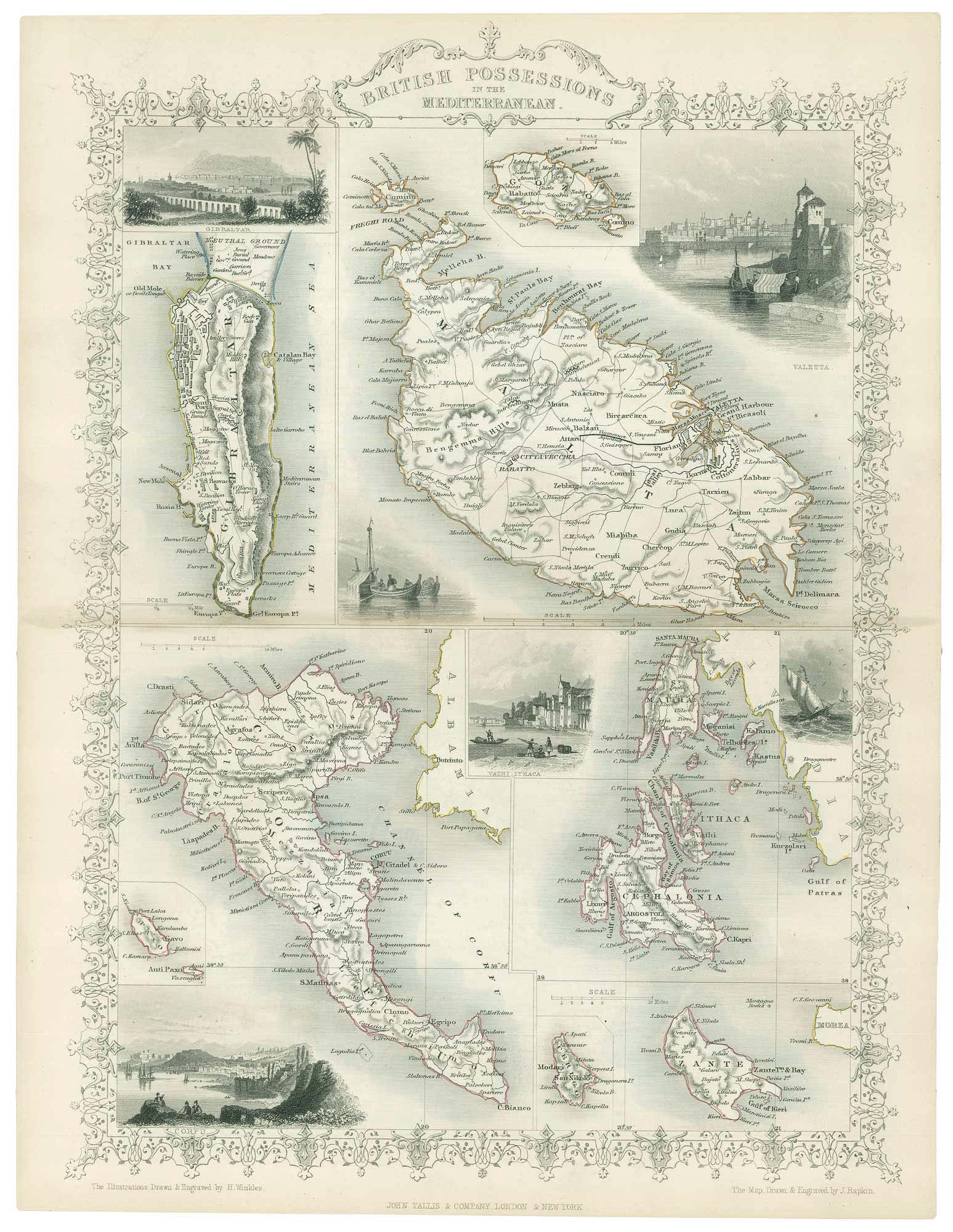


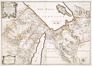
Mid 19th map of British possessions in the Mediterranean
British Possessions in the Mediterranean.
London, John Tallis & Co., c.1851. Steel engraving with original outline colour. 350 x 250mm.
£170.00
1 in stock
x
Question About This Item?
Mid 19th map of British possessions in the Mediterranean & TALLIS, John.Stock #: 17748
Add to Wishlist
Export as PDFEnquireSimilar to Sell?Add to Wishlist
Description
Eight maps on one sheet, showing British possessions in the Mediterranean: Gibraltar, Malta & Gozo, and the islands of the 'United States of the Ionian Islands', including Corfu, Paxos, Zakynthos and Ithica, Cephalonia, The six vignettes include view of Corfu City, Valletta and Gibraltar.
The map was drawn and engraved by John Rapkin for the 'The Illustrated Atlas, and Modern History of the World, Geographical Political, Commercial & Statistical', edited by Montgomery Martin, which was one of the last decorative atlases to be published.
Condition:
A good example.Related products
-
16th century woodblock map of Cyprus
MUNSTER, Sebastian. Date: 1578Stock #: 21647 £350.00 -
A scarce German edition of Pocock’s map of Cyprus
POCOCKE, Richard. Date: 1745Stock #: 23804 £650.00 -

A rare 16th century miniature map of Cyprus
FERRETTI, Francesco. Date: 1579Stock #: 21835 £1,400.00 -
A rare edition of the Cyprus map in classical times
MORTIER, Pierre. Date: 1725Stock #: 19732 £2,800.00 -
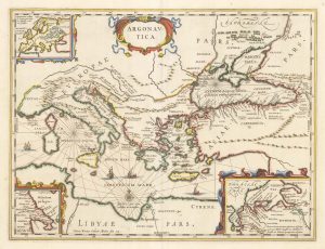
A map illustrating ‘Jason and the Argonauts’
JANSSON, Jan. Date: 1700Stock #: 22875 £600.00 -
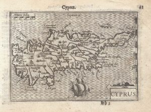
A 16th century miniature map of Cyprus
LANGENES, Barent. Date: 1599Stock #: 21327 £550.00 -
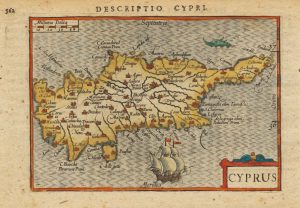
Early 17th century miniature map of Cyprus
BERTIUS, Petrus. Date: 1603Stock #: 20994 £380.00 -
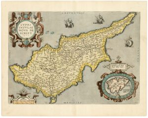
A classic 16th century Dutch map of Cyprus
ORTELIUS, Abraham. Date: 1595Stock #: 23815 £1,600.00 -
A map of the monastics of the Eastern Mediterranean
MICHALET, Etienne. Date: 1695Stock #: 8480 £700.00
Items by the same author
Add to Wishlist
Add to Wishlist

Mid 19th century map of Ireland with decorative vignettes
TALLIS, John. Date: 1851 Stock #: 21568 £240.00
Add to Wishlist
Add to Wishlist

A mid-19th century map of Germany with decorative vignettes
TALLIS, John. Date: 1851 Stock #: 23486 £120.00
Add to Wishlist
Add to Wishlist

Map of France with vignette scenes
TALLIS, John. Date: 1851 Stock #: 17766 £100.00
Add to Wishlist
Add to Wishlist

London during the Great Exhibition of 1851
TALLIS, John. Date: 1851 Stock #: 25662 £2,400.00
Add to Wishlist
Add to Wishlist

Mid 19th century map of Greece with decorative vignettes
TALLIS, John. Date: 1851 Stock #: 23523 £140.00
Add to Wishlist
Add to Wishlist
