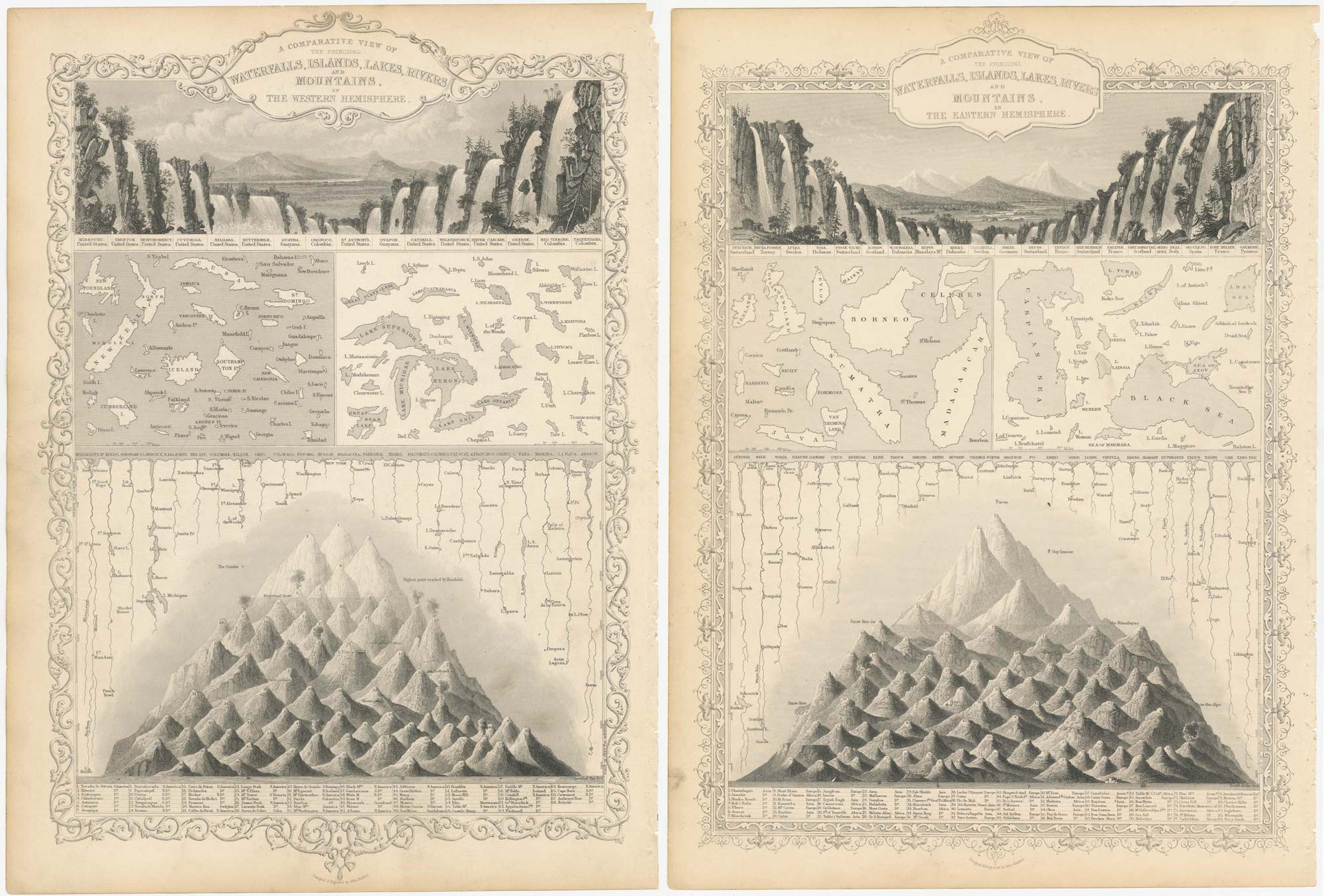


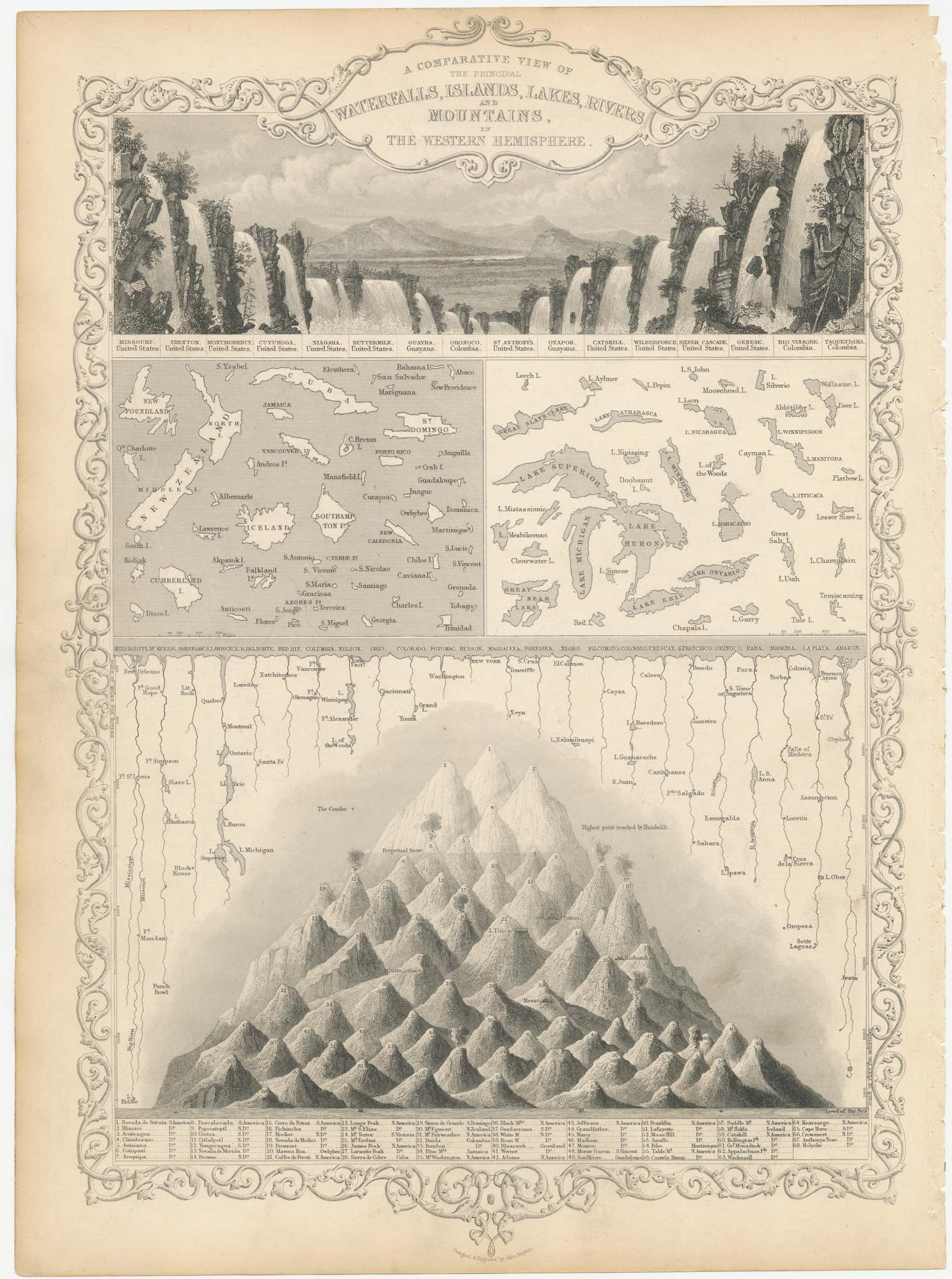
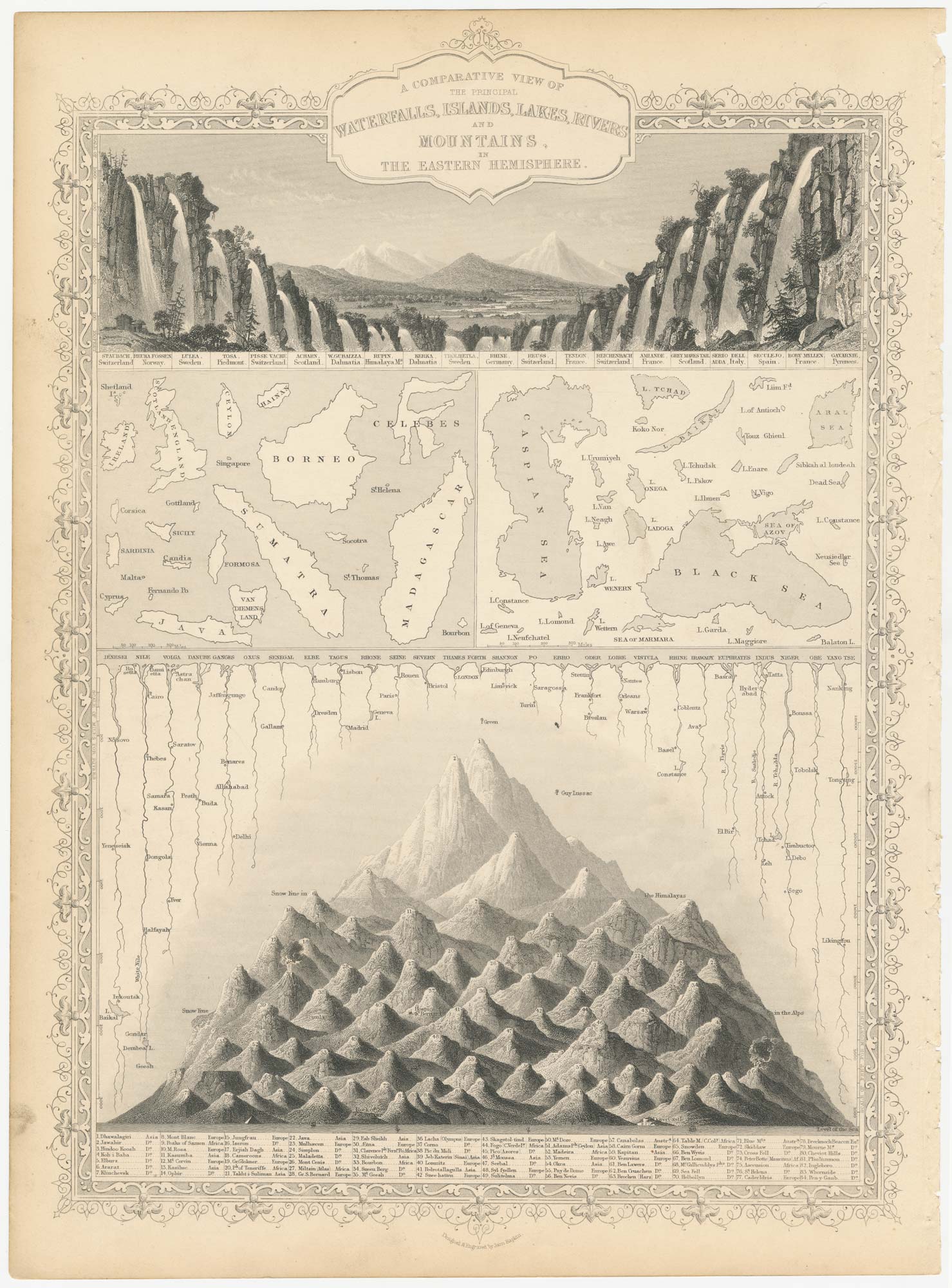
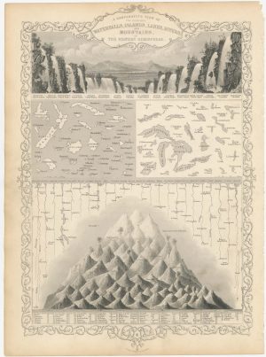
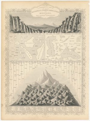
Pair of charts comparing the geographic features of each hemisphere
A Comparative View of the Principal Waterfalls, Islands, Lakes, Rivers and Mountains, in the Western Hemisphere. [&] A Comparative View of the Principal Waterfalls, Islands, Lakes, Rivers and Mountains, in the Eastern Hemisphere.
London, John Tallis & Co., c.1851. Pair of steel engravings, printed area c.350 x 250mm.
£240.00
1 in stock
x
Question About This Item?
Pair of charts comparing the geographic features of each hemisphere & TALLIS, John.Stock #: 23548
Add to Wishlist
Export as PDFEnquireSimilar to Sell?Add to Wishlist
Description
Two plates showing comparative illustrations of geographical features in each hemisphere, within decorative borders. In the Eastern Hemisphere the highest mountain is stated as Dhaulagiri, now counted as the seventh highest; a small balloon marks the altitude reached by Joseph Louis Gay-Lussac in 1804. In the Western Hemisphere the tallest is 'Nevada de Sorata' (Nevado Illampu), now known to be only the fourth highest mountain in Bolivia. Aconcagua, the actual highest, is only ranked third.
Condition:
A good example.Related products
-

Albrecht Dürer’s vision of the Apocalypse.
GREFF, Hieronymus. Date: 1502Stock #: 25410 £1,400.00 -
Colour-printed examples of George Morland’s famous anti-slavery scenes
MORLAND, George. Date: 1814Stock #: 22500 £4,000.00 -
A 17th century ilIllustration of a narwhal
KIRCHER, Athanasius. Date: 1682Stock #: 23704 £150.00 -
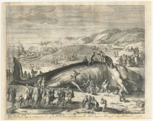
A sperm whale beached near Scheveningen in 1598
MATHAM, Jacob. Date: 1700Stock #: 24030 £450.00 -
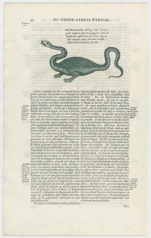
The Dragon of Bologna
KIRCHER, Athanasius. Date: 1682Stock #: 24696 £450.00 -

Two majestic still life mezzotints after a Dutch Old Master
VAN HUYSUM, Jan. Date: 1781Stock #: 21956 £3,500.00 -

Scarce Italian playing card depicting the rivers of South Europe
Anonymous. Date: 1790Stock #: 24233 £250.00 -

Early ‘Underground’ 27″ diameter external station roundel
LONDON TRANSPORT. Date: 1950Stock #: 24954 £4,500.00 -

A superb 20″ diameter Bank tube station roundel
LONDON TRANSPORT. Date: 1950Stock #: 24627 £3,900.00
Items by the same author
Add to Wishlist
Add to Wishlist

Mid 19th century map of Ireland with decorative vignettes
TALLIS, John. Date: 1851 Stock #: 21568 £240.00
Add to Wishlist
Add to Wishlist

A mid-19th century map of Germany with decorative vignettes
TALLIS, John. Date: 1851 Stock #: 23486 £120.00
Add to Wishlist
Add to Wishlist

Map of France with vignette scenes
TALLIS, John. Date: 1851 Stock #: 17766 £100.00
Add to Wishlist
Add to Wishlist

London during the Great Exhibition of 1851
TALLIS, John. Date: 1851 Stock #: 25662 £2,400.00
Add to Wishlist
Add to Wishlist

Mid 19th century map of Greece with decorative vignettes
TALLIS, John. Date: 1851 Stock #: 23523 £140.00
Add to Wishlist
Add to Wishlist
