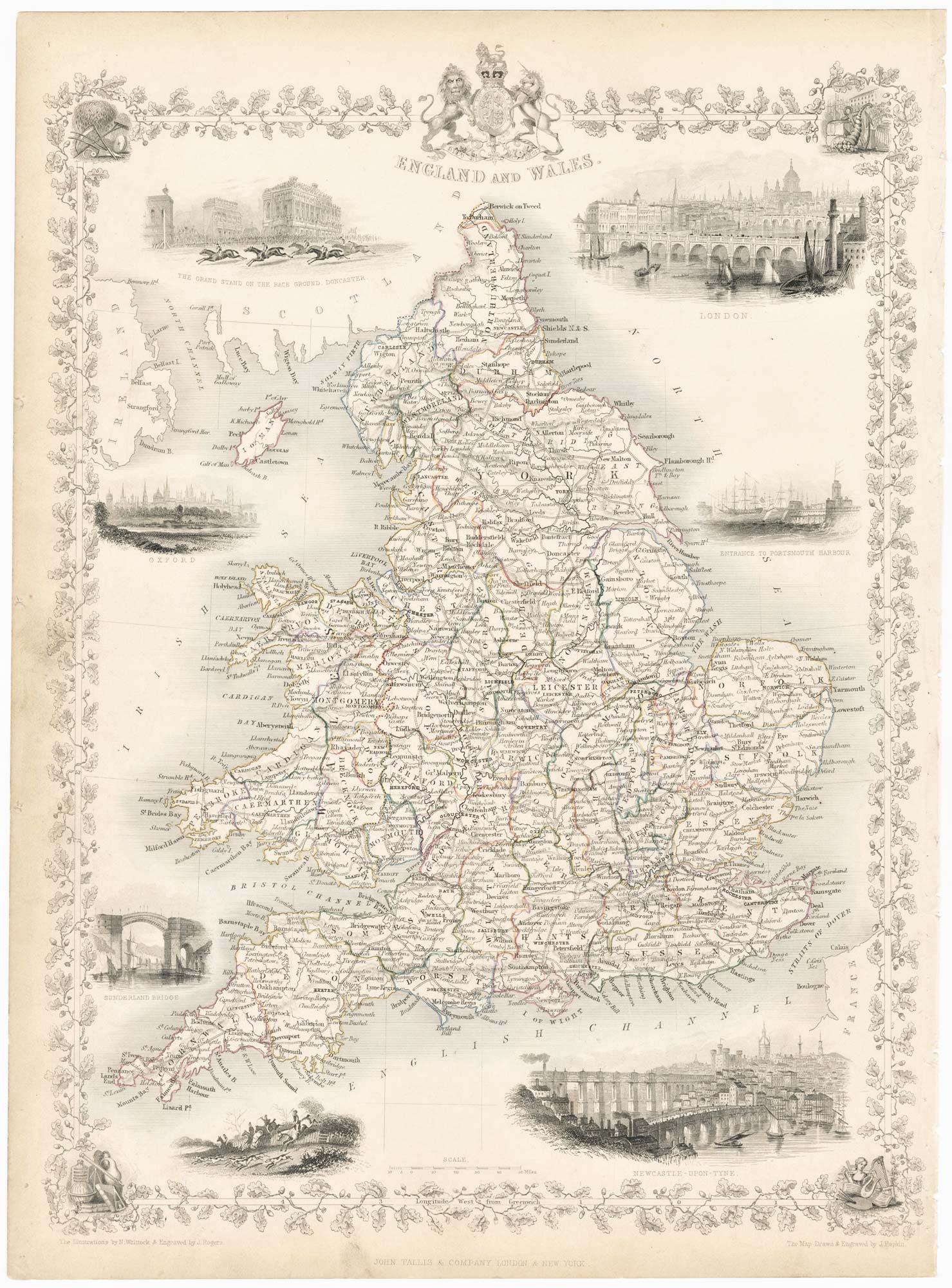


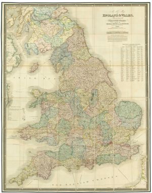
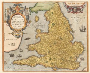
Map of England and Wales with vignettes
England and Wales.
London: J. & F. Tallis, c.1851. Steel engraving, printed area 350 x 260mm.
£180.00
Description
A detailed map of England and Wales with attractive printed borders of entwined oak leaves and seven decorative vignettes of London, Oxford, Sunderland Newcastle, and scenes of hunting and racing at Doncaster.
The map was drawn and engraved by John Rapkin for the 'The Illustrated Atlas, and Modern History of the World, Geographical Political, Commercial & Statistical', edited by Montgomery Martin, which was one of the last decorative atlases to be published.
Condition:
Stitch holes in right margin.Related products
-
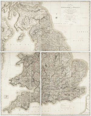
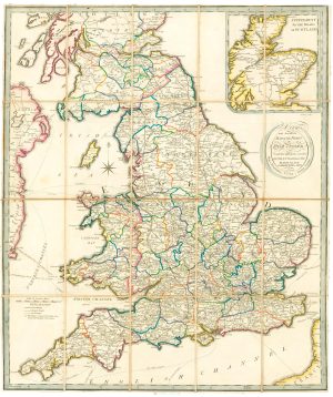
Georgian wall map of England & Wales
CARY, John. Date: 1820Stock #: 22666 £1,250.00 -
A leaf of Saxton’s ‘Traveller’s Guide’ of England and Wales
SAXTON, Christopher. Date: 1700Stock #: 24050 £900.00 -
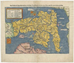
An early woodcut map of England
MUNSTER, Sebastian. Date: 1546Stock #: 25504 £1,000.00 -
A large folding map of England and Wales in fine colour
FADEN, William. Date: 1830Stock #: 21859 £500.00 -
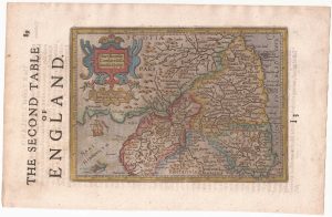
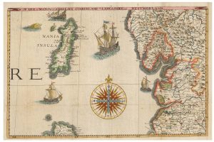
Northern England from the first English Edition of the ‘Atlas Minor’
HONDIUS, Jodocus. Date: 1635Stock #: 22444 £100.00 -
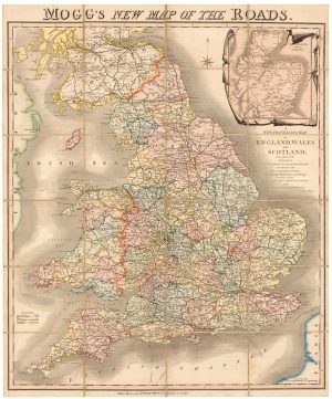
A colourful Georgian map of the roads of England & Wales
MOGG, Edward Slatford. Date: 1838Stock #: 22986 £250.00 -
A scarce road map of England and Wales published in Dublin
ALLEN, Mark. Date: 1832Stock #: 24777 £450.00 -
The Ortelius/Lhuyd map of England
ORTELIUS, Abraham. Date: 1584Stock #: 22262 £1,250.00 -
An unrecorded state of Saxton’s map of South East England
SAXTON, Christopher. Date: 1690Stock #: 22260 £3,000.00
Items by the same author
Add to Wishlist
Add to Wishlist

Mid 19th century map of Ireland with decorative vignettes
TALLIS, John. Date: 1851 Stock #: 21568 £240.00
Add to Wishlist
Add to Wishlist

A mid-19th century map of Germany with decorative vignettes
TALLIS, John. Date: 1851 Stock #: 23486 £120.00
Add to Wishlist
Add to Wishlist

Map of France with vignette scenes
TALLIS, John. Date: 1851 Stock #: 17766 £100.00
Add to Wishlist
Add to Wishlist

London during the Great Exhibition of 1851
TALLIS, John. Date: 1851 Stock #: 25662 £2,400.00
Add to Wishlist
Add to Wishlist

Mid 19th century map of Greece with decorative vignettes
TALLIS, John. Date: 1851 Stock #: 23523 £140.00
Add to Wishlist
Add to Wishlist
