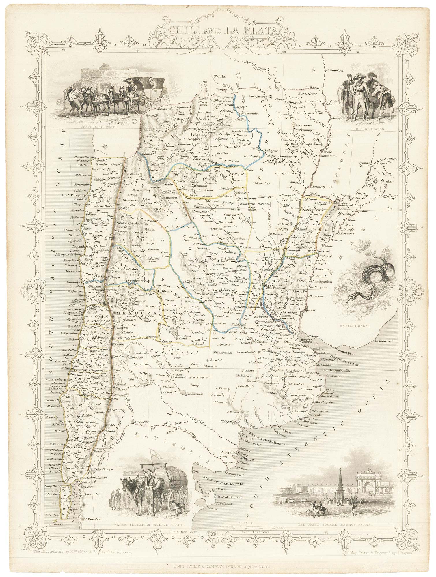


Map of Chile and Argentina with vignettes
Chili and La Plata.
London, John Tallis & Co., c.1851. Original outline colour. Steel engraving, 355 x 250mm.
£120.00
Description
Map of Chile and Argentina, with an ornate printed border and vignettes including a view of the Grand Square, Buenos Ayres and a rattlesnake.
The map was drawn and engraved by John Rapkin for the 'The Illustrated Atlas, and Modern History of the World, Geographical Political, Commercial & Statistical', edited by Montgomery Martin, which was one of the last decorative atlases to be published.
Condition:
Small tear repaired.Related products
Items by the same author
Add to Wishlist
Add to Wishlist

Mid 19th century map of Ireland with decorative vignettes
TALLIS, John. Date: 1851 Stock #: 21568 £240.00
Add to Wishlist
Add to Wishlist

A mid-19th century map of Germany with decorative vignettes
TALLIS, John. Date: 1851 Stock #: 23486 £120.00
Add to Wishlist
Add to Wishlist

Map of France with vignette scenes
TALLIS, John. Date: 1851 Stock #: 17766 £100.00
Add to Wishlist
Add to Wishlist

London during the Great Exhibition of 1851
TALLIS, John. Date: 1851 Stock #: 25662 £2,400.00
Add to Wishlist
Add to Wishlist

Mid 19th century map of Greece with decorative vignettes
TALLIS, John. Date: 1851 Stock #: 23523 £140.00
Add to Wishlist
Add to Wishlist
