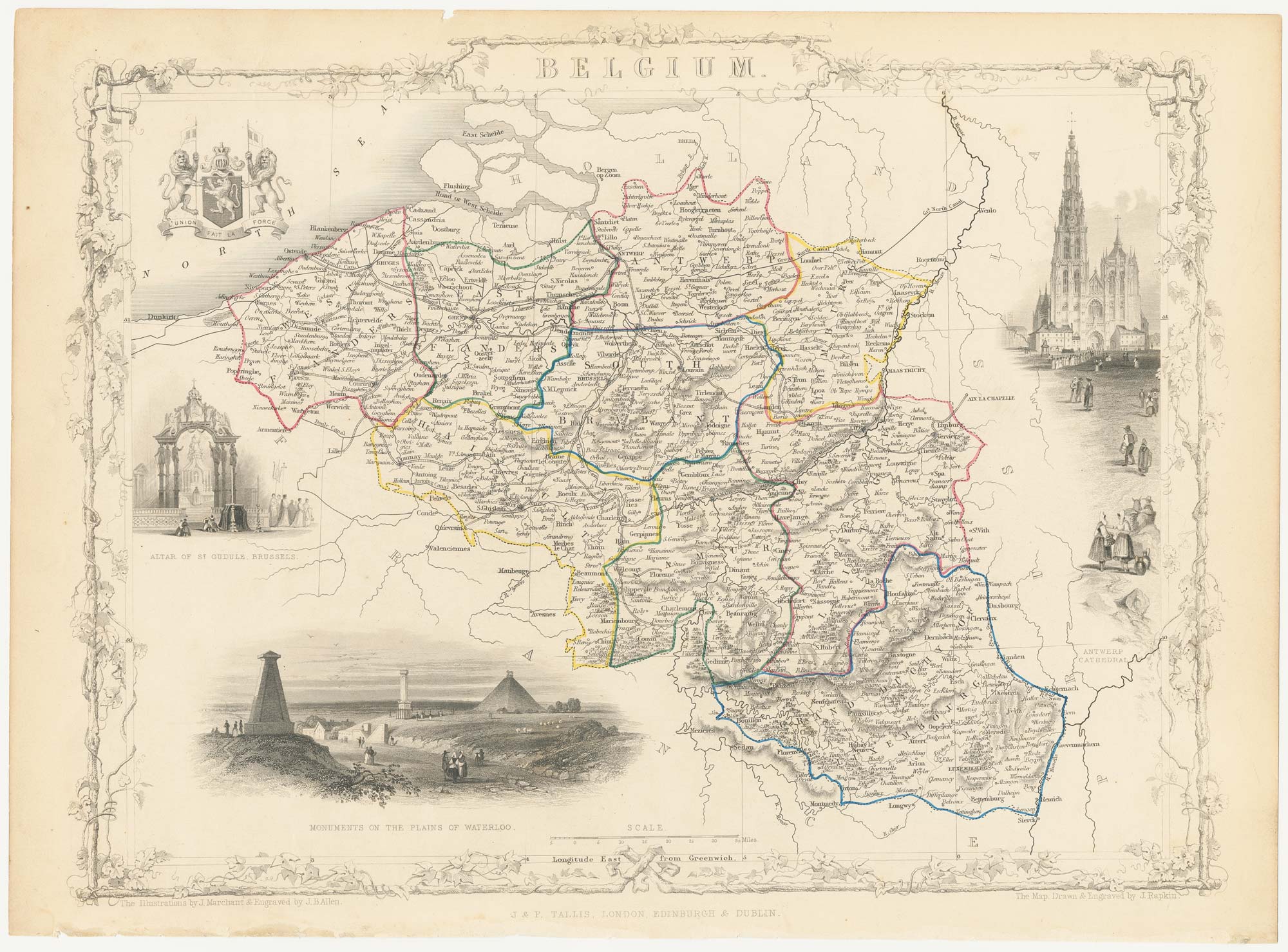


Mid 19th century map of Belgium with decorative vignettes
Belgium.
London: J. & F. Tallis, c.1851. Steel engraving with original outline colour, printed area 270 x 350mm.
£120.00
1 in stock
x
Question About This Item?
Mid 19th century map of Belgium with decorative vignettes & TALLIS, John.Stock #: 21637
Add to Wishlist
Export as PDFEnquireSimilar to Sell?Add to Wishlist
Description
A detailed Victorian map of Belgium, within an ornate printed border and decorated with vignettes of Antwerp Cathedral, the church of St Gudule in Brussels and the Waterloo monument.
The map was drawn and engraved by John Rapkin for the 'The Illustrated Atlas, and Modern History of the World, Geographical Political, Commercial & Statistical', edited by Montgomery Martin, which was one of the last decorative atlases to be published.
Condition:
Small notch in top edge.Related products
-
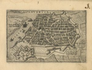
A 16th century town plan of Antwerp
VALEGIO, Francesco. Date: 1598Stock #: 24203 £250.00 -
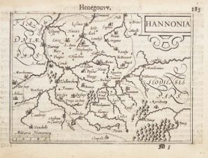
A 16th century miniature map of Hainaut
LANGENES, Barent. Date: 1599Stock #: 21153 £50.00 -

A 16th century town plan of Bruges
VALEGIO, Francesco. Date: 1598Stock #: 24204 £240.00 -
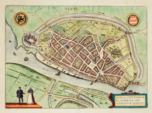
Early townplan of Sluis in Belgium
BRAUN, Georg & HOGENBERG, Frans. Date: 1581Stock #: 9914 £220.00 -

Early 18th century plan of Brussels
FER, Nicolas de. Date: 1705Stock #: 18426 £250.00 -
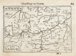
A 16th century miniature map of Namur
LANGENES, Barent. Date: 1599Stock #: 21151 £55.00 -

An unusual 17th century prospect of Mons
MEISNER, Daniel. Date: 1640Stock #: 24686 £100.00 -

16th century town plan of Brussels
BRAUN, Georg & HOGENBERG, Frans. Date: 1572Stock #: 14660 £900.00 -
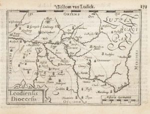
A 16th century miniature map of the Diocese of Liège
LANGENES, Barent. Date: 1599Stock #: 21152 £55.00
Items by the same author
Add to Wishlist
Add to Wishlist

Mid 19th century map of Ireland with decorative vignettes
TALLIS, John. Date: 1851 Stock #: 21568 £240.00
Add to Wishlist
Add to Wishlist

A mid-19th century map of Germany with decorative vignettes
TALLIS, John. Date: 1851 Stock #: 23486 £120.00
Add to Wishlist
Add to Wishlist

Map of France with vignette scenes
TALLIS, John. Date: 1851 Stock #: 17766 £100.00
Add to Wishlist
Add to Wishlist

London during the Great Exhibition of 1851
TALLIS, John. Date: 1851 Stock #: 25662 £2,400.00
Add to Wishlist
Add to Wishlist

Mid 19th century map of Greece with decorative vignettes
TALLIS, John. Date: 1851 Stock #: 23523 £140.00
Add to Wishlist
Add to Wishlist
