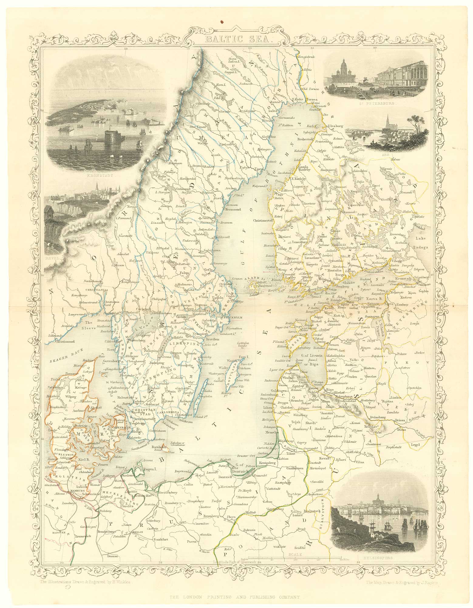


Mid 19th century map of the Baltic Sea
Baltic Sea
London, London Printing and Publishing Co., c.1860 original outline colour. Printed area 340 x 260mm.
£100.00
Description
An attractive steel engraving, drawn and engraved by John Rapkin, by one of the last publishers of decorative atlases, with vignesttes of Kronstadt, St. Petersburg and Helsingfors.
Condition:
A good example.Related products
-
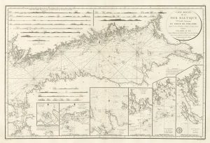
A sea chart of the Gulf of Finland published the year of Waterloo
Dépôt des Cartes et Plans de la Marine. Date: 1815Stock #: 18865 £1,000.00 -
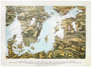
A map-view of the Baltic Sea during the Crimean War
READ & Co. Date: 1855Stock #: 20828 £750.00 -
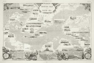
A pictorial map of the Baltic theatre of the Crimean War
ILLUSTRATED LONDON NEWS. Date: 1856Stock #: 10369 £325.00
Items by the same author
Add to Wishlist
Add to Wishlist

Mid 19th century map of Ireland with decorative vignettes
TALLIS, John. Date: 1851 Stock #: 21568 £240.00
Add to Wishlist
Add to Wishlist

A mid-19th century map of Germany with decorative vignettes
TALLIS, John. Date: 1851 Stock #: 23486 £120.00
Add to Wishlist
Add to Wishlist

Map of France with vignette scenes
TALLIS, John. Date: 1851 Stock #: 17766 £100.00
Add to Wishlist
Add to Wishlist

London during the Great Exhibition of 1851
TALLIS, John. Date: 1851 Stock #: 25662 £2,400.00
Add to Wishlist
Add to Wishlist

Mid 19th century map of Greece with decorative vignettes
TALLIS, John. Date: 1851 Stock #: 23523 £140.00
Add to Wishlist
Add to Wishlist
