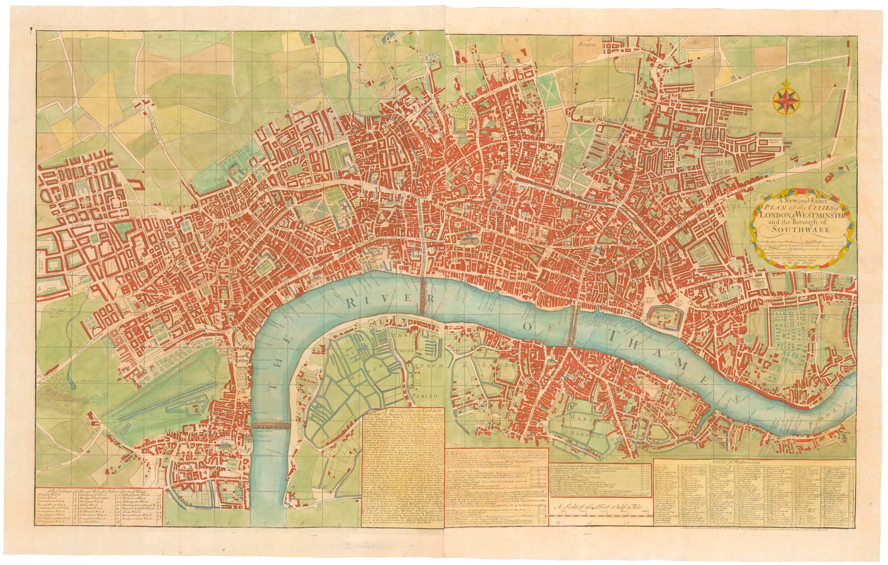


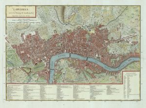
A two-sheet map of 18th century London
A New and Exact Plan of the Cities of London & Westminster and the Borough of Southwark.
London: Bowles & Carver, c.1795. Coloured. Two sheets conjoined, total. 580 x 975mm.
£2,200.00
Description
A large plan of London of George I, original published in Joseph Smith's 'Nouveau Theatre de la Grande Bretagne' (which also contained Kip's monumental prospects of London & Westminster) in 1724. The extents are New River Head in the north, clockwise to Ratcliff, Bermondsey and Hyde Park.
Bowles and Carver (a partnership of Henry Carington Bowles and Samuel Carver) were in business from 1793-1832, so this map was issued at least 70 years after it first appeared. Despite this the only attempt to update the map is the addition of Westminster Bridge and Blackfriars Bridge, without including the approach roads.
Condition:
A few repairs.References:
HOWGEGO 71, state iii of iii.Related products
-
Detailed plan of London under William IV
FADEN, William. Date: 1830Stock #: 22893 £3,000.00 -
Facsimile of Rocque’s 16-Sheet Map of London
ROCQUE, John. Date: 1971Stock #: 15133 £400.00 -
A four-sheet wall map of London
STOCKDALE, John. Date: 1797Stock #: 19537 £9,000.00 -
A French edition of Rocque’s map of London
TARDIEU, Pierre François. Date: 1765Stock #: 22729 £800.00 -
A readable study of London maps
BARBER, Peter. Date: 2012Stock #: 18272 £45.00 -

An 18th century two-sheet plan of London
FOSTER, George. Date: 1778Stock #: 18487 £3,800.00 -
Early woodblock map of Elizabethan London
MUNSTER, Sebastian. Date: 1628Stock #: 24366 £1,600.00 -
Map of London at the beginning of the 18th century
FER, Nicolas de. Date: 1705Stock #: 23204 £400.00 -

A map of London with vignettes
Society for the Diffusion of Useful Knowledge. Date: 1836Stock #: 15496 £700.00