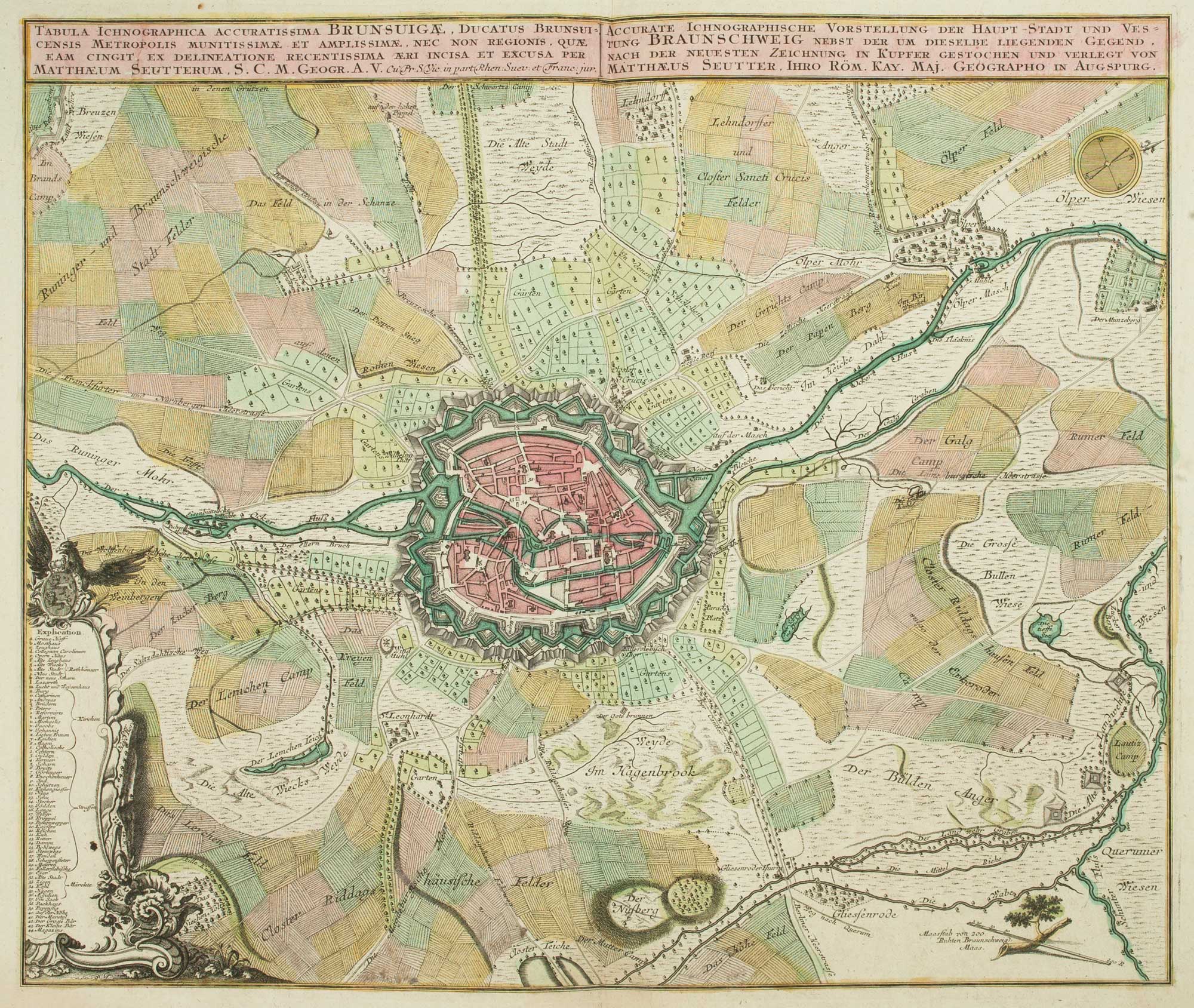


18th century map of Brunswick and its environs
Tabula Ichnographica Accuratissima Brunsuigae, ducatus Brunsuicensis Metropolis Munitissimae et Amplissimae, Nec Non Regionis, Quae Eam Cingit.
Augsburg, c. 1735. Original colour. 500 x 580mm
£260.00
1 in stock
x
Question About This Item?
18th century map of Brunswick and its environs & SEUTTER, Matthaus.Stock #: 9404
Add to Wishlist
Export as PDFEnquireSimilar to Sell?Add to Wishlist
Description
An plan of Brunswick highlighting the defensive walls, with the surrounding countryside, with a rococo cartouche at the bottom left hand side with a key to all locations marked on the town plan.
Condition:
A good example.Related products
-
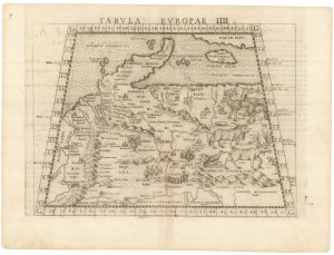
Ruscelli’s map of Germany according to Ptolemy, First State
RUSCELLI, Girolamo. Date: 1557Stock #: 22241 £220.00 -
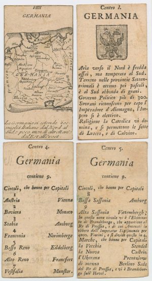
Four scarce Italian playing cards depicting Germany
Anonymous. Date: 1790Stock #: 24244 £280.00 -
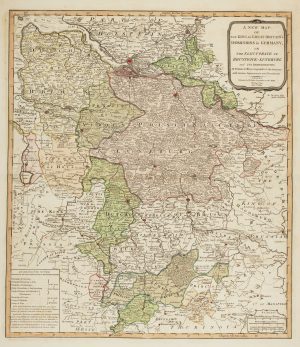
The German possessions of the Georgian monarchs
JEFFERYS, Thomas. Date: 1789Stock #: 7964 £280.00 -
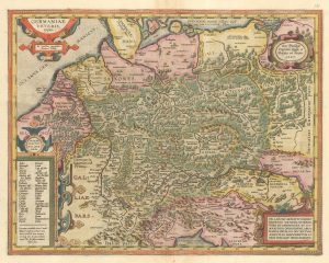
Ortelius’s map of Ancient Germany in fine colour
ORTELIUS, Abraham. Date: 1603Stock #: 23810 £600.00 -
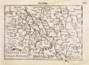
A 16th century miniature map of Saxony, Thuringia & Meissen
LANGENES, Barent. Date: 1599Stock #: 21173 £50.00 -
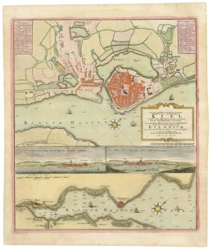
A 18th century plan of Kiel
HOMANN HEIRS. Date: 1735Stock #: 25100 £600.00 -
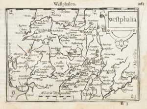
A 16th century miniature map of Westphalia
LANGENES, Barent. Date: 1599Stock #: 21168 £50.00 -
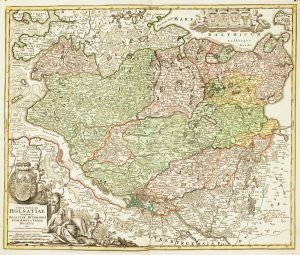
18th century map of Holstein
HOMANN, Johann Baptist. Date: 1720Stock #: 11370 £200.00 -
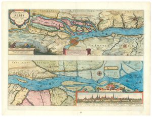
Map of the River Elbe with a prospect of Hamburg
JANSSON, Jan. Date: 1630Stock #: 24816 £500.00
Items by the same author
Add to Wishlist
Add to Wishlist

The Far East, with an elaborate title cartouche
SEUTTER, Matthaus. Date: 1741 Stock #: 18156 £1,400.00
Add to Wishlist
Add to Wishlist

A 18th century plan of Regensburg
SEUTTER, Matthaus. Date: 1730 Stock #: 25104 £600.00
Add to Wishlist
Add to Wishlist
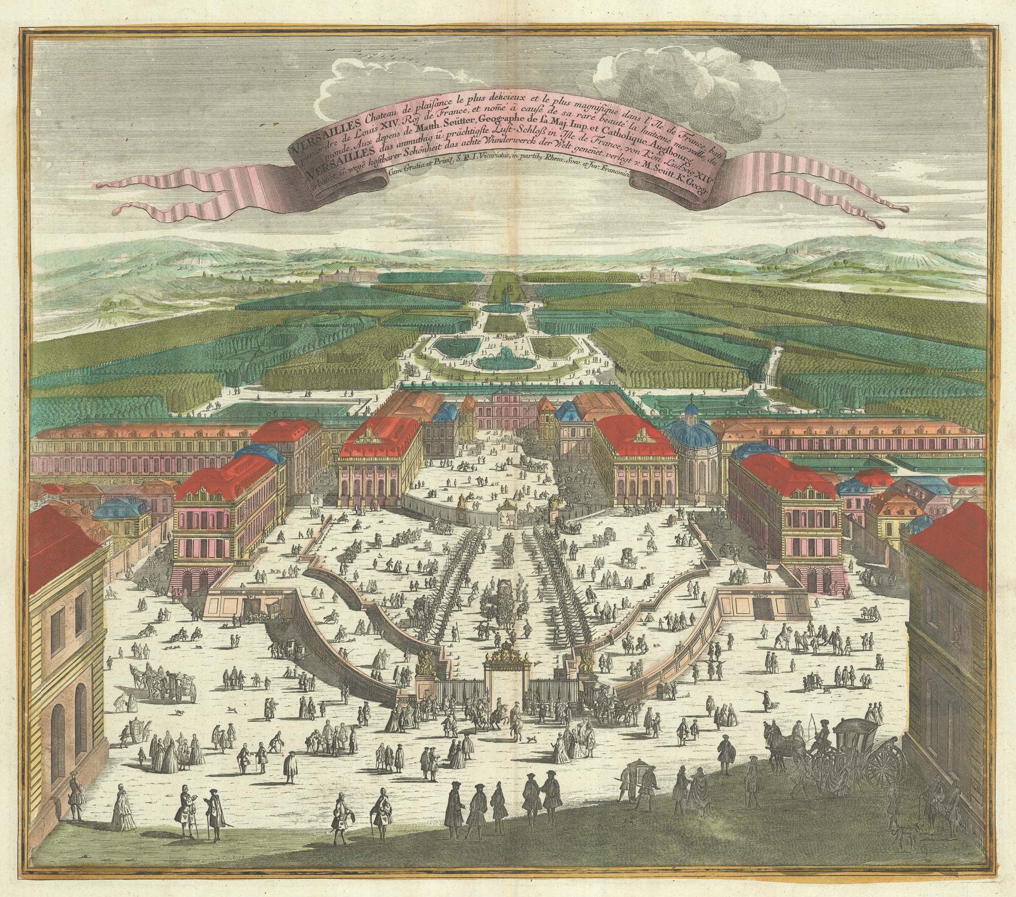
A bird's-eye view of Louis XIV's court at Versailles
SEUTTER, Matthaus. Date: 1735 Stock #: 23735 £700.00
Add to Wishlist
Add to Wishlist
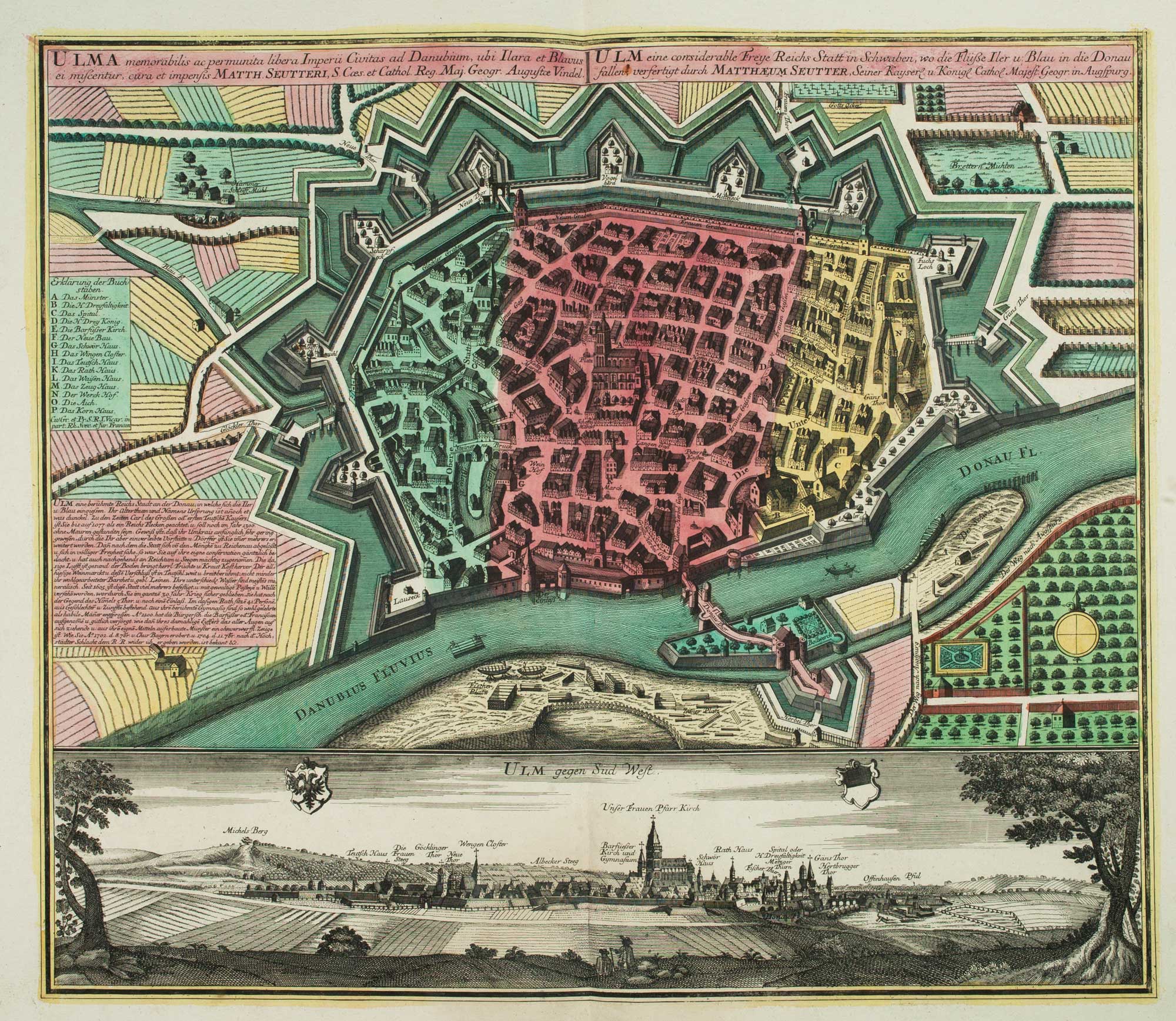
18th century town plan of Ulm
SEUTTER, Matthaus. Date: 1741 Stock #: 9406 £550.00
Add to Wishlist
Add to Wishlist
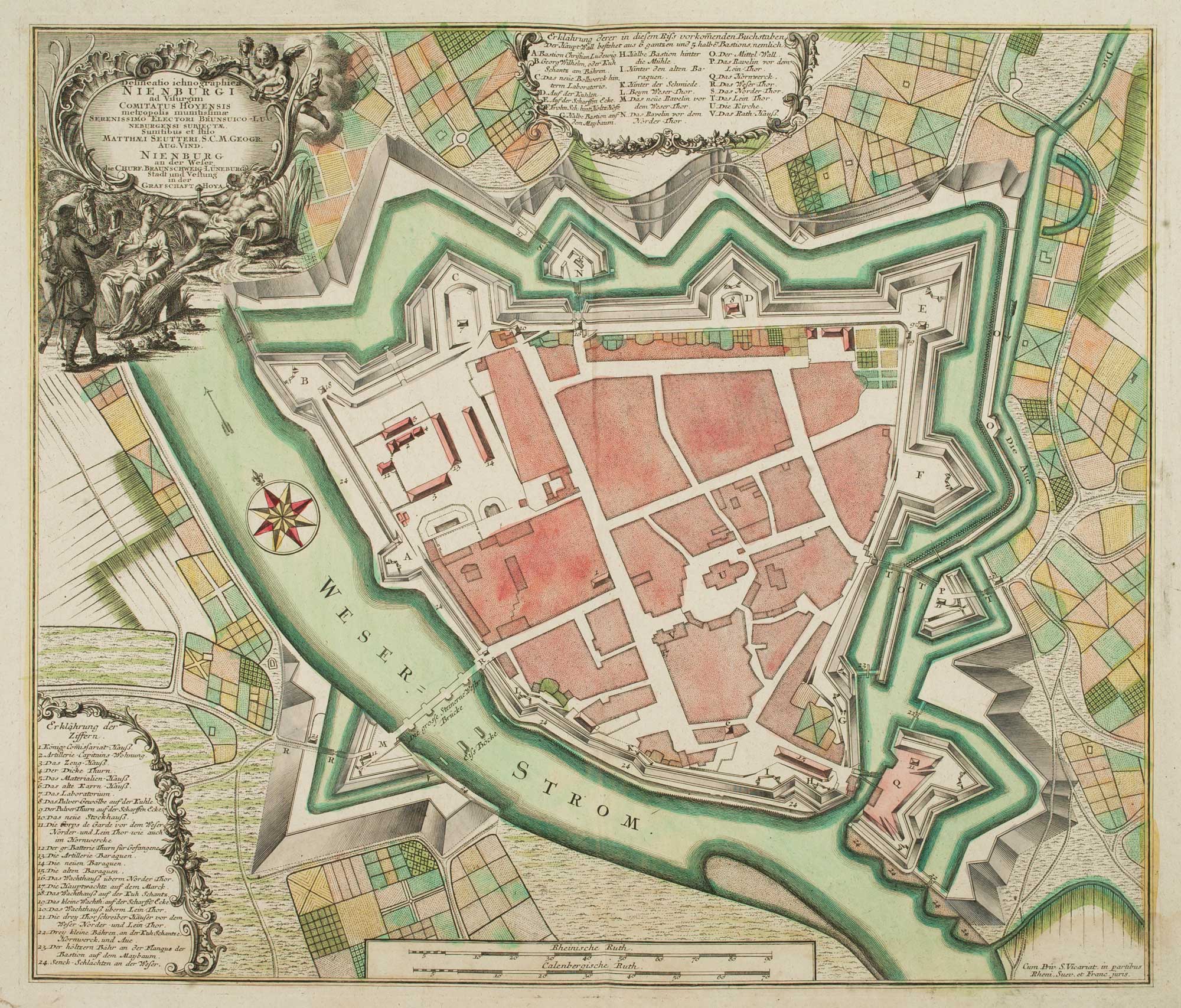
18th century town plan of Nienburg
SEUTTER, Matthaus. Date: 1741 Stock #: 9316 £350.00
Add to Wishlist
Add to Wishlist
