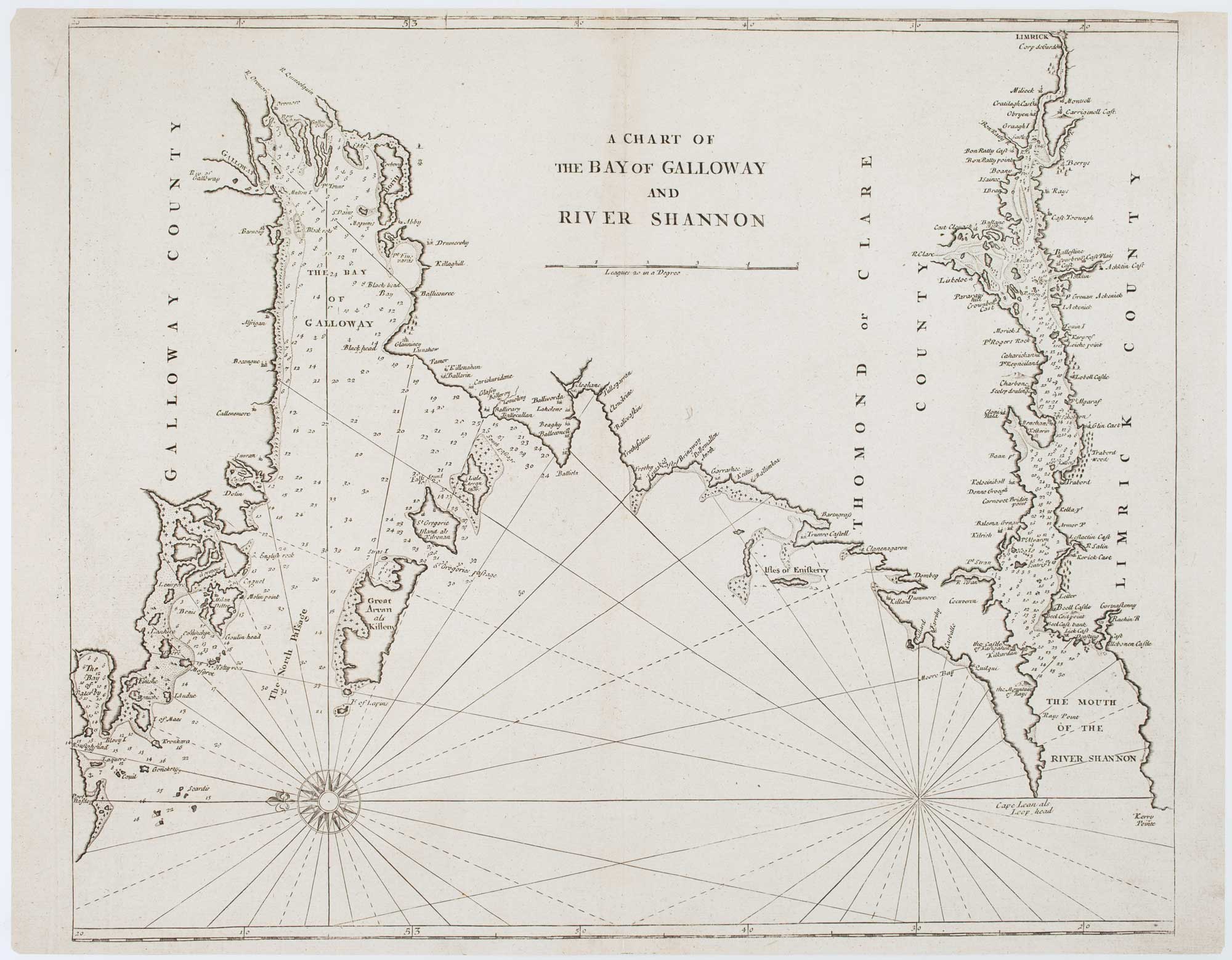


An 18th century chart of Western Ireland
A Chart of the Bay of Galloway and River Shannon.
London: W. & J. Mount and T. Page, 1748. 435 x 530mm.
£225.00
Description
A sea chart covering the north coast of Galway Bay and the River Shannon to Limerick, orientated with north to the right. Engraved c. 1690, this example was published in Mount & Page's reissue of Seller's 'The English Pilot'.