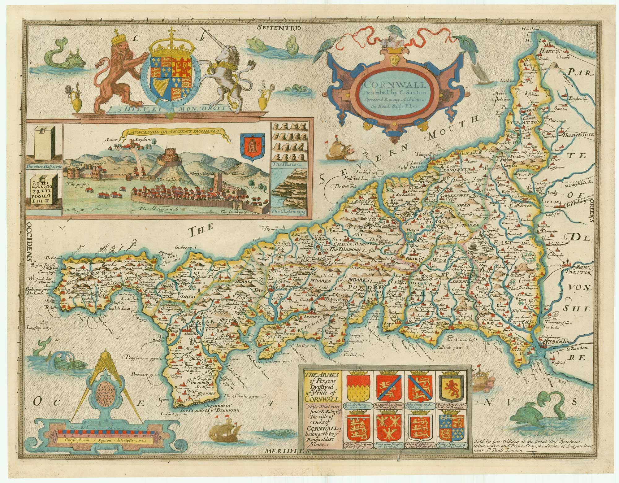


Saxton’s map of Cornwall as revised by Philip Lea
Cornwall Described by C. Saxton Corrected and many Additions as the Roads &c. by P. Lea.
London: George Willdey, c.1732. Old colour. 380 x 490mm.
£2,800.00
1 in stock
x
Question About This Item?
Saxton’s map of Cornwall as revised by Philip Lea & SAXTON, Christopher.Stock #: 20074
Add to Wishlist
Export as PDFEnquireSimilar to Sell?Add to Wishlist
Description
The first map of the county of Cornwall, here published one and a half centuries after its original publication.
Over the years a number of changes had been made to the plate: the original title was replaced by the view of Launceston c.1665; the arms of Elizabeth I were replaced by those of Charles I then Charles II; the panel of armorials were added c.1665 by an unknown publisher; Lea added his name and Ogilby's roads in 1689 and changed the title for the second time in 1694; and Willdey added his address c.1732. Willdey seems to have been a jack-of-all-trades: his address reads 'the Great Toy, Spectacle, China Ware, and Print Shop, the corner of Ludgate Street near St Pauls London'.
Still this was not the end of the Saxton plates: they were issued again by Thomas Jefferys and Cluer Dicey into the 1770s.
Despite the number of editions any example of Saxton's map of Cornwall is uncommon.
Condition:
Evidence of a crack in the printing plate, affecting armorials.Related products
-
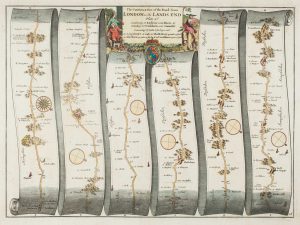
An early road map of Monmouth to Llanbeder
OGILBY, John. Date: 1675Stock #: 15334 £240.00 -
Early map of the roads from Stilton to Tuxford
OGILBY, John. Date: 1675Stock #: 15349 £240.00 -
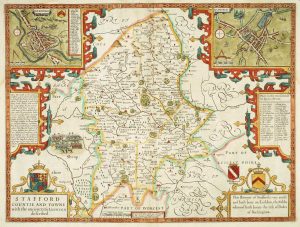
Staffordshire
SPEED, John. Date: 1676Stock #: 9870 £620.00 -
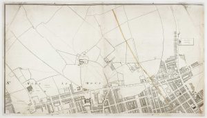
Marylebone & St Pancras from an important large-scale survey of London
HORWOOD, Richard. Date: 1799Stock #: 12668 £900.00 -
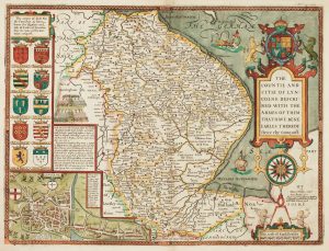
17th century English map of Lincolnshire
SPEED, John. Date: 1676Stock #: 9869 £800.00 -
An early map of the roads from Andover to Crewkerne
OGILBY, John. Date: 1675Stock #: 15313 £320.00 -
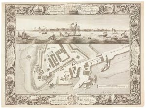
Fine plan of the naval dockyard at Sheerness, Kent
MILTON, Thomas. Date: 1755Stock #: 8492 £600.00 -
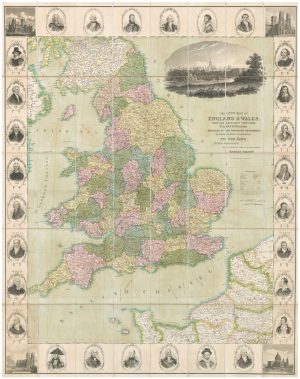
A decorative wall map of England & Wales
SEATON, Robert. Date: 1835Stock #: 10838 £1,500.00 -
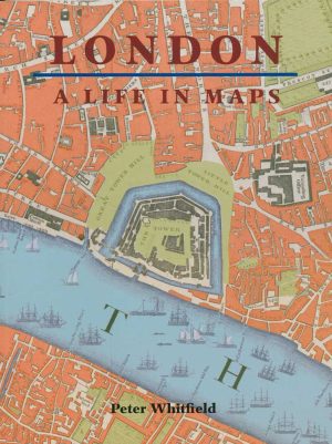
A history of London through maps
WHITFIELD, Peter. Date: 2006Stock #: 12441 £20.00
Items by the same author
Add to Wishlist
Add to Wishlist
A leaf of Saxton's 'Traveller's Guide' of England and Wales
SAXTON, Christopher. Date: 1700 Stock #: 24050 £900.00
Add to Wishlist
Add to Wishlist
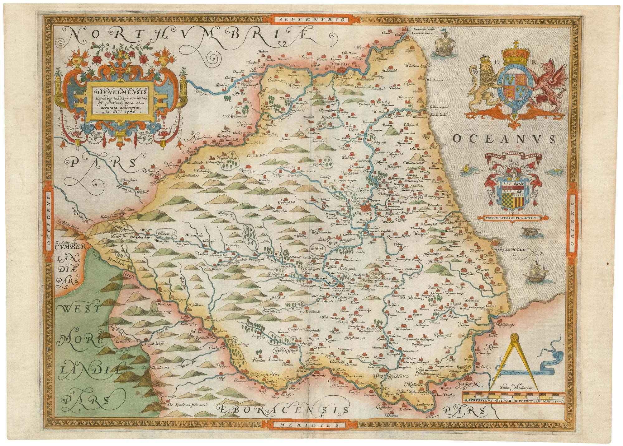
The first printed map of County Durham
SAXTON, Christopher. Date: 1579 Stock #: 22583 £3,000.00
Add to Wishlist
Add to Wishlist
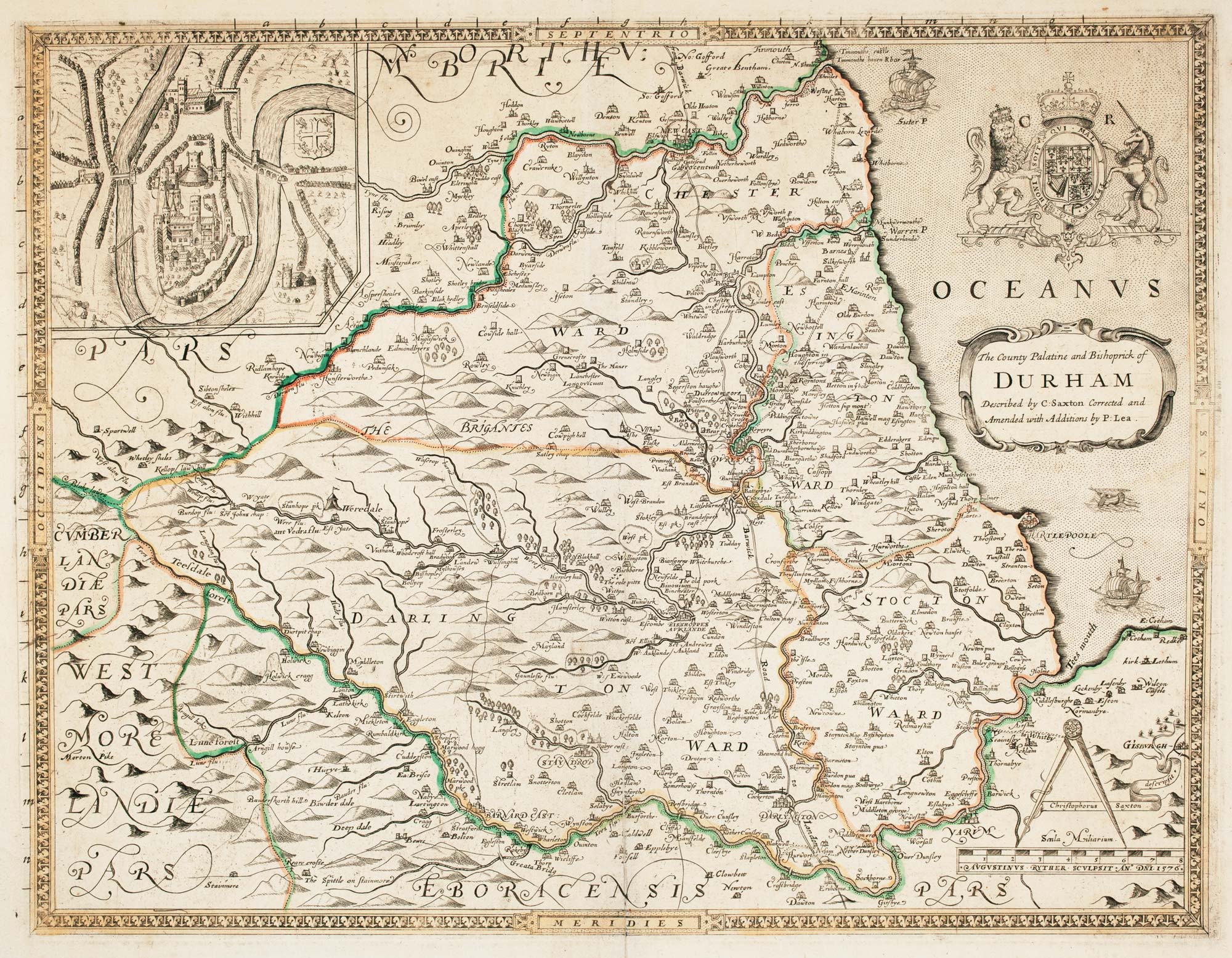
Saxton's map of Durham as revised by Philip Lea
SAXTON, Christopher. Date: 1694 Stock #: 22702 £1,250.00
Add to Wishlist
Add to Wishlist

An unrecorded state of Saxton's map of South East England
SAXTON, Christopher. Date: 1690 Stock #: 22260 £3,000.00
Add to Wishlist
Add to Wishlist