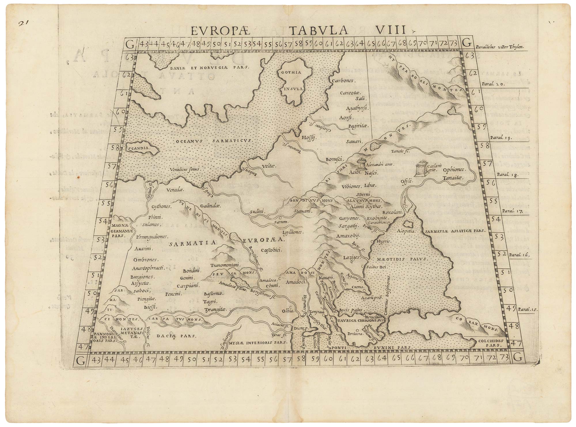


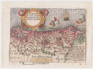
A 16th century map of eastern Europe according to Ptolemy
Europae Tabula VIII.
Venice: Vincenzo Valgrisi, 1561, First State. 200 x 265mm.
£220.00
1 in stock
x
Question About This Item?
A 16th century map of eastern Europe according to Ptolemy & RUSCELLI, Girolamo.Stock #: 22245
Add to Wishlist
Export as PDFEnquireSimilar to Sell?Add to Wishlist
Description
A Ptolemaic map of Europe east of the Vistula, with eastern Poland, Lithuania, Belarus, Ukraine and Moldova. In the Baltic are Scania and Gotland. At the bottom is the Crimea, with the Sea of Azov much too large.
This map was published in Ruscelli's 'La Geographi di Claudio Tolomeo'. A feature of this First State is that there is no platemark at the top: two maps were engraved on the same plate and the resulting sheet halved. Later the plate was cut in two.
Condition:
A good example.Related products
-
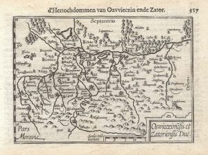
A 16th century miniature map of Oswiecim & Zator
LANGENES, Barent. Date: 1599Stock #: 21317 £110.00 -
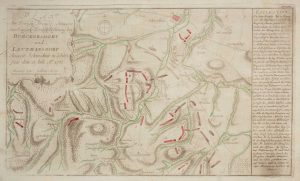
The Battle of Burkersdorf during the Seven Years’ War
RASPE, Gabriel Nikolaus. Date: 1762Stock #: 12939 £250.00 -
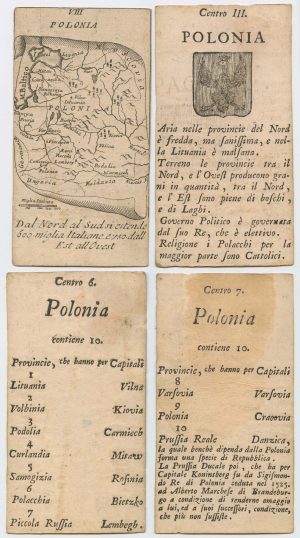
Four scarce Italian playing cards depicting Poland
Anonymous. Date: 1790Stock #: 24241 £850.00 -

A pirated edition of the Ortelius Epitome map of Poland
ORTELIUS, Abraham. Date: 1655Stock #: 21727 £180.00 -

A 17th century prospect of Krakow
MALLET, Alain Manesson. Date: 1683Stock #: 24768 £250.00 -
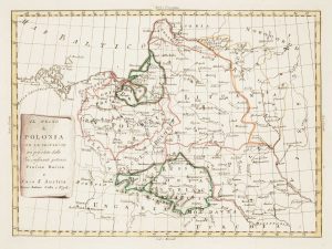
Uncommon map of Poland with the First Partition
ZATTA, Antonio. Date: 1780Stock #: 13853 £160.00 -
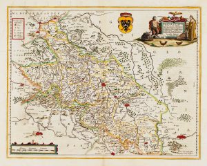
Detailed map of Silesia
JANSSON, Jan. Date: 1645Stock #: 14909 £450.00 -
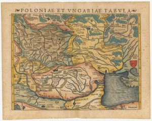
A 16th century woodcut map of Poland, Lithuania and Hungary
MUNSTER, Sebastian. Date: 1572Stock #: 24574 £700.00 -
A pirated edition of the Ortelius Epitome map of eastern Pomerania
ORTELIUS, Abraham. Date: 1655Stock #: 21723 £160.00
Items by the same author
Add to Wishlist
Add to Wishlist

Ruscelli's map of Germany according to Ptolemy, First State
RUSCELLI, Girolamo. Date: 1557 Stock #: 22241 £220.00
Add to Wishlist
Add to Wishlist
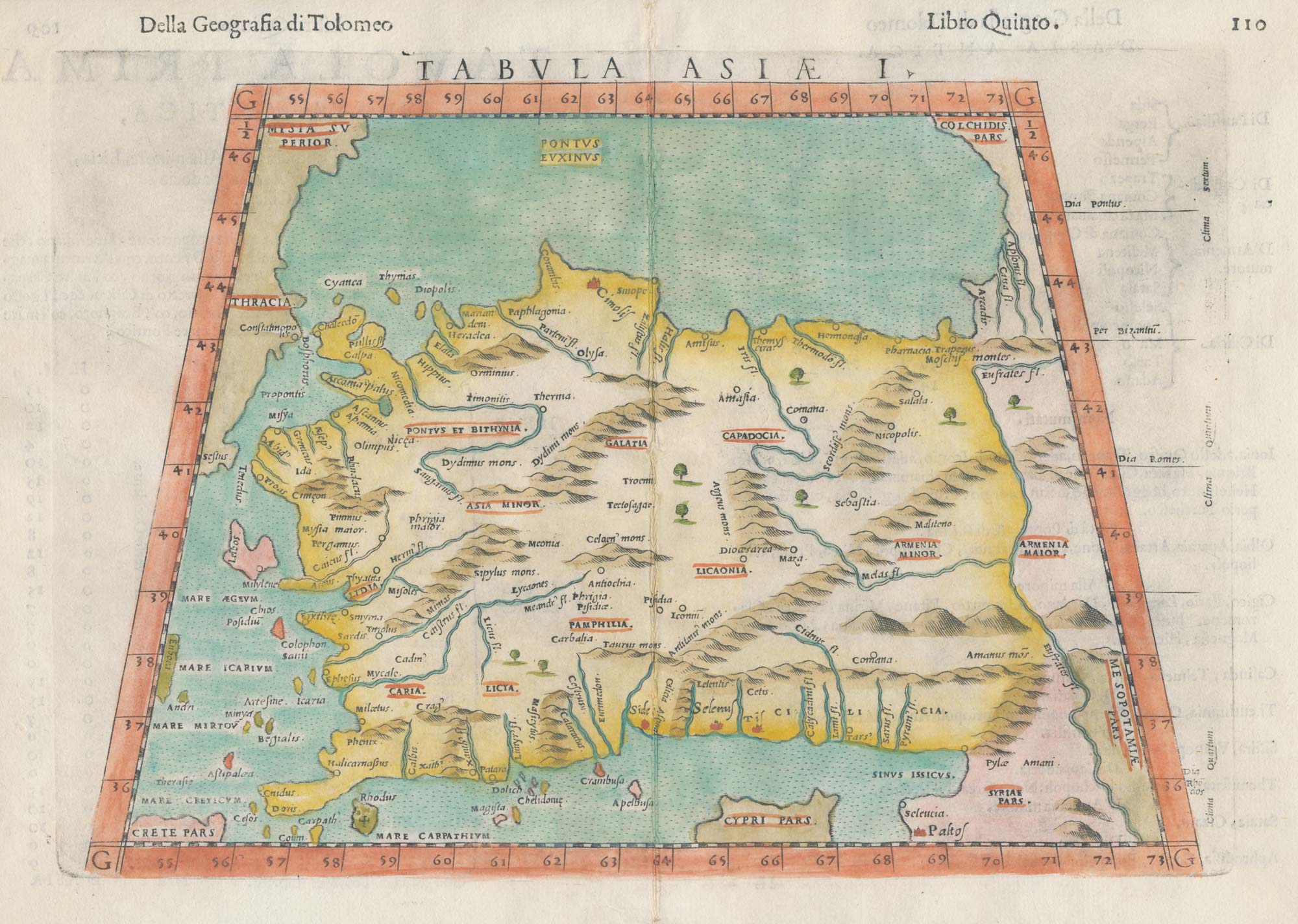
A 16th century map of Turkey according to Claudius Ptolemy
RUSCELLI, Girolamo. Date: 1598 Stock #: 20498 £250.00
Add to Wishlist
Add to Wishlist
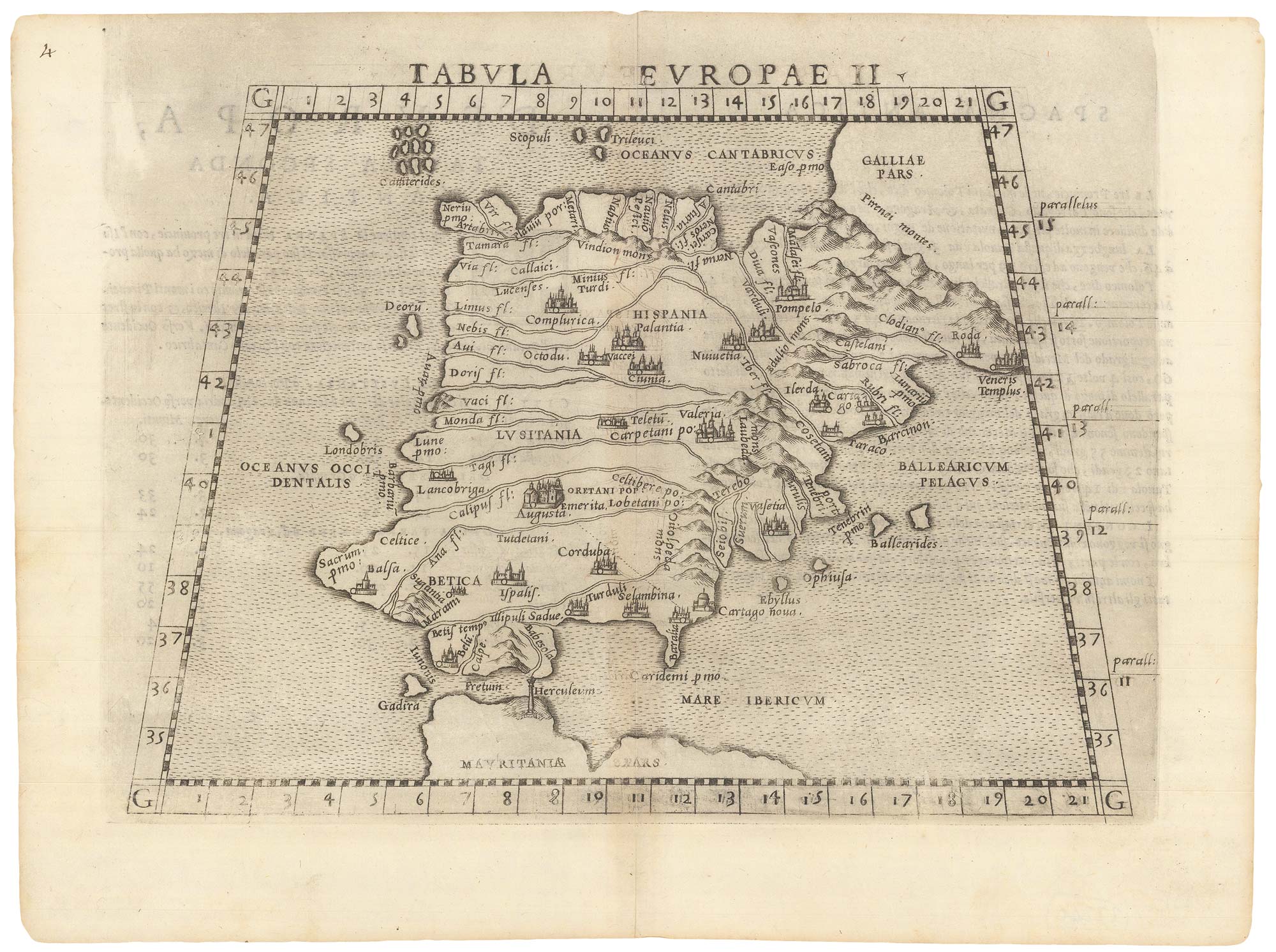
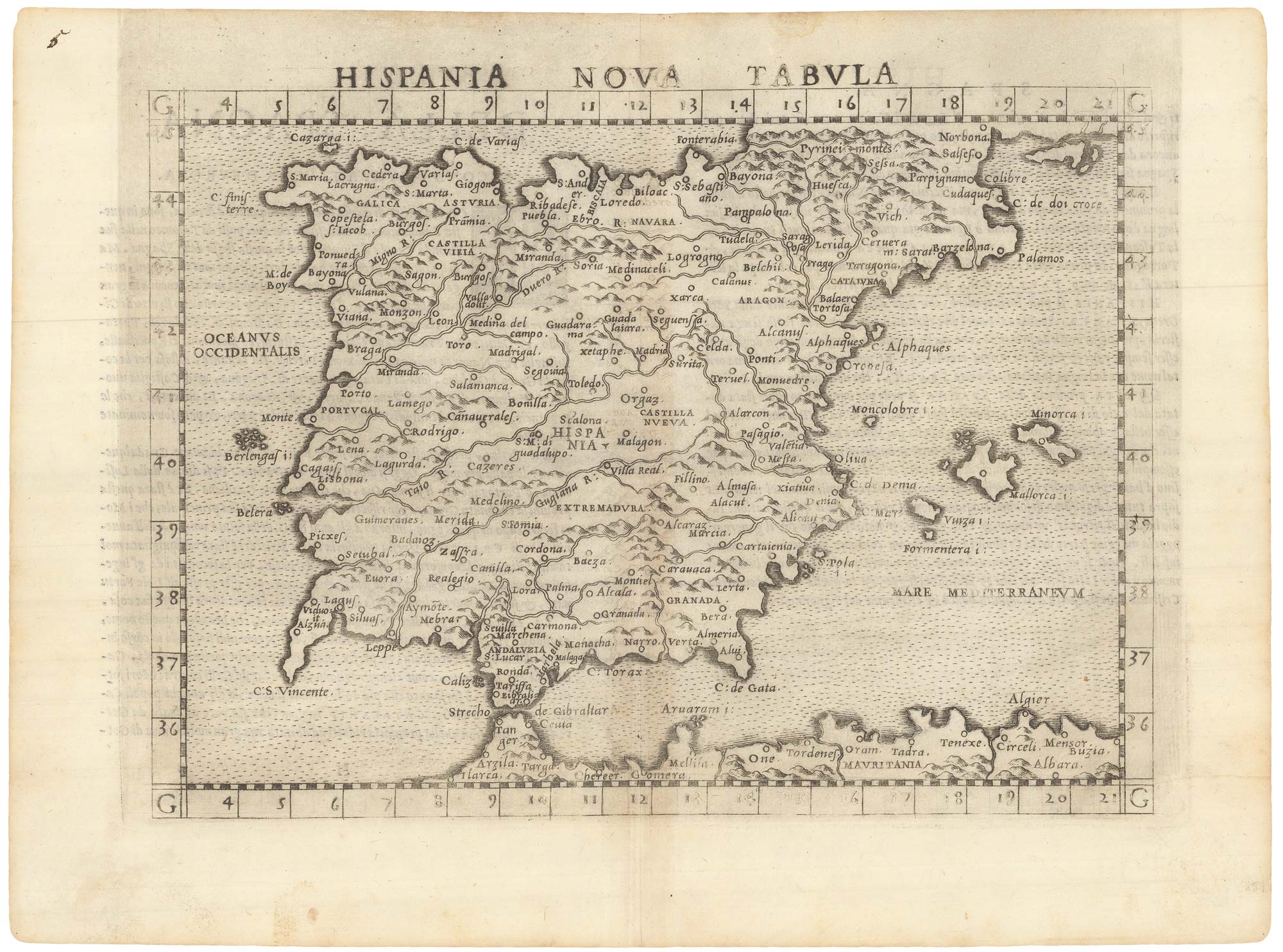
Ruscelli's map of Ptolemaic Iberia, first state.
RUSCELLI, Girolamo. Date: 1557 Stock #: 22240 £220.00
Add to Wishlist
Add to Wishlist
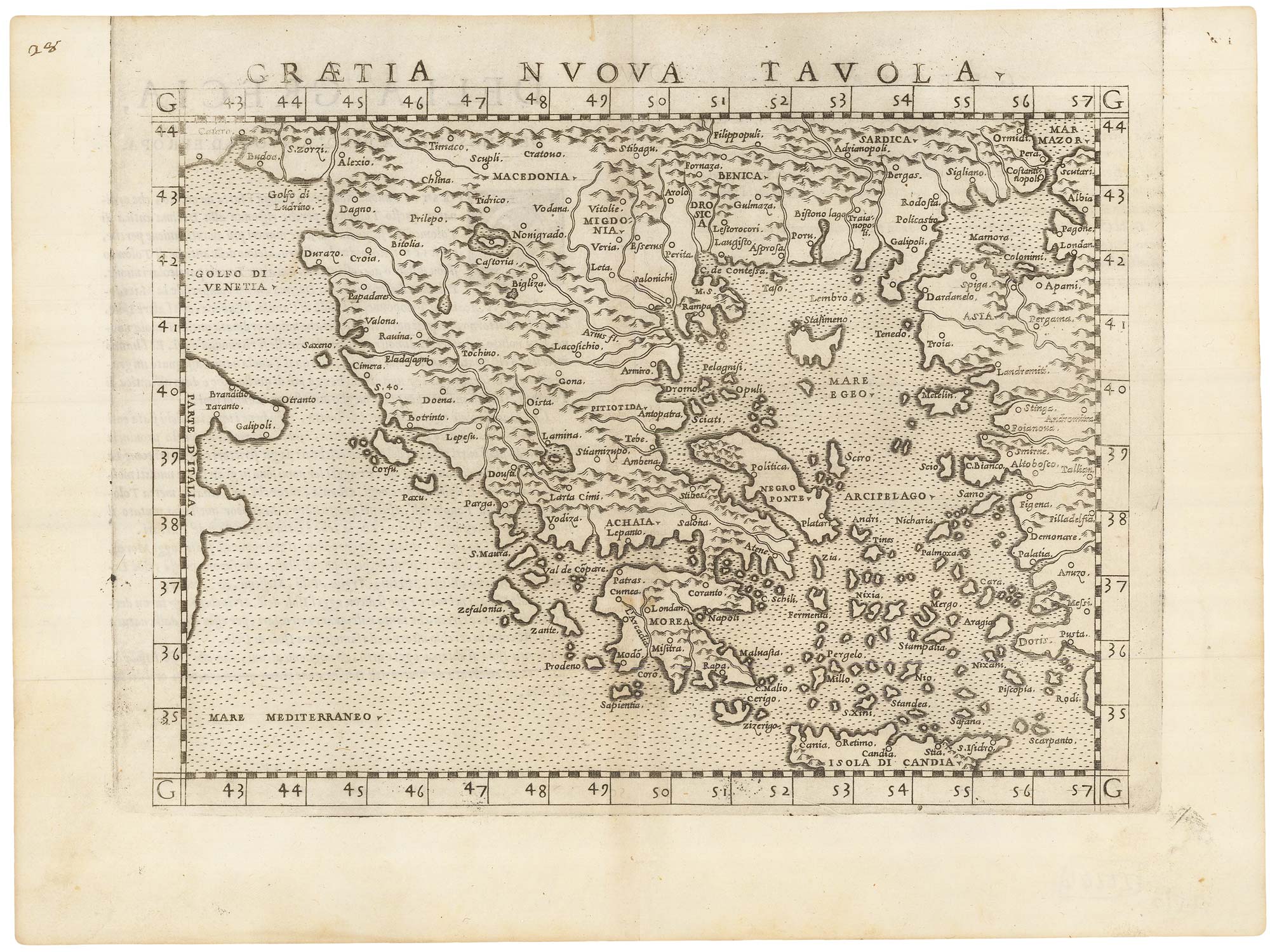
A 16th century map of Greece.
RUSCELLI, Girolamo. Date: 1557 Stock #: 22244 £200.00
Add to Wishlist
Add to Wishlist
A 16th century map of Spain and Portugal
RUSCELLI, Girolamo. Date: 1557 Stock #: 22239 £260.00
Add to Wishlist
Add to Wishlist