


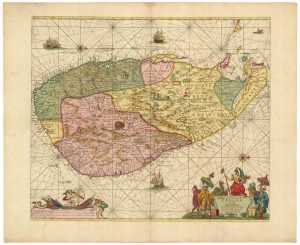
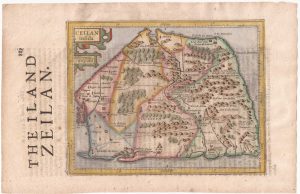
An 17th century map of Sri Lanka
Ceilon olim Taprobana.
Hamburg, 1969. Coloured. 115 x 145mm, set in letterpress text.
£240.00
1 in stock
x
Question About This Item?
An 17th century map of Sri Lanka & ROTHGIESSER, Andres Lorensen.Stock #: 21644
Add to Wishlist
Export as PDFEnquireSimilar to Sell?Add to Wishlist
Description
A map of Sri Lanka, orientated with north to the left, published in an account of the travels of Johann Albrecht von Mandelslo (1616-44) from Hamburg to India (1635-9), as edited by Adam Olearius.
After travelling with Olearius to Russia and Persia, Mandelslo continued separately, visiting India and Sri Lanka, before returning by Madagascar, the Cape of Good Hope, and St. Helena
Condition:
A little toning.Related products
-
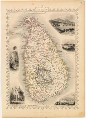
A mid-19th century map of Sri Lanka decorated with vignettes
TALLIS, John. Date: 1851Stock #: 21784 £190.00 -
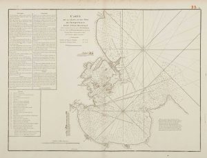
18th century chart of Trincomalee
APRÈS DE MANNEVILLETTE, Jean Baptiste d'. Date: 1775Stock #: 17489 £600.00 -
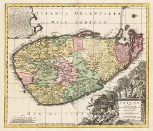
A large and colourful map of Sri Lanka
VISSCHER, Nicolas. Date: 1680Stock #: 22571 £1,000.00 -
A fine example of this 17th century Dutch sea chart of Sri Lanka
KEULEN, Johannes van. Date: 1710Stock #: 21873 £2,200.00 -
Sri Lanka from the first English Edition of the ‘Atlas Minor’
HONDIUS, Jodocus. Date: 1635Stock #: 22398 £220.00 -
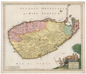
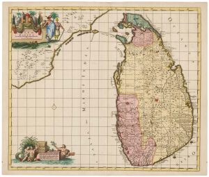
18th century map of Sri Lanka in fine original colour
SEUTTER, Matthaus. Date: 1730Stock #: 22407 £980.00 -
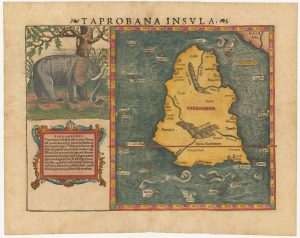
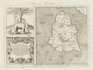
16th century woodcut map of Sri Lanka as Taprobana
MUNSTER, Sebastian. Date: 1574Stock #: 24578 £500.00 -
A scarce map of Sri Lanka in full original colour.
DE RAM, Johannes. Date: 1730Stock #: 22572 £980.00 -
16th century map of Taprobana
MAGINI, Giovanni Antonio. Date: 1596Stock #: 18783 £250.00