


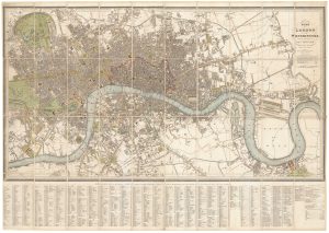
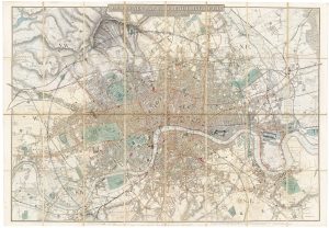
A large plan of London in 1863
Laurie's Plan of London, Westminster, and Southwark, Trigonometrically Surveyed by John Outhett. 1863.
London: Richard Holmes Laurie, 1863. Original colour. Dissected and laid on linen as issued, total 660 x 1100mm.
£1,600.00
Description
Detailed plan of London, extending to Hammersmith in the west clockwise to Shepherd's Bush, Cricklewood, Stoke Newington, Hackney Marshes, The East India Docks and the Isle of Dogs, Greenwich, Camberwell, Battersea & Barn Elms. Marked on the map are Kensal Green Cemetery (1833); Brompton Cemetery (1840); Brunel's Hungerford Suspension Bridge (1845); the planned layout of Battersea Park (Act of Parliament passed that year, opened 1858); and the proposed Lambeth Bridge (1862). Already the Ladbroke Estate is laid out over the Kensington Hippodrome racecourse (closed 1842), although Notting Hill Gate is still 'Kensington Gravel Pits'. Of interest is the scale in the bottom and bottom borders, marking the time difference in seconds from Greenwich Mean Time: Hammersmith is a whopping 55 seconds west!
Condition:
A good example.References:
HOWGEGO: 361, later state.Related products
-
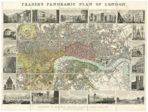
Plan of London during the reign of William IV
FRASER, James. Date: 1831Stock #: 19889 £1,100.00 -
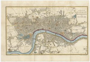
Detailed plan of London under William IV
FADEN, William. Date: 1830Stock #: 22893 £3,000.00 -
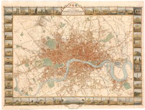
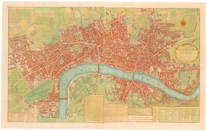
London during the Great Exhibition of 1851
TALLIS, John. Date: 1851Stock #: 25662 £2,400.00 -

A map of London with vignettes
Society for the Diffusion of Useful Knowledge. Date: 1836Stock #: 15496 £700.00 -
Nineteenth century townplan of London
BAKER, B. Date: 1810Stock #: 24770 £450.00 -
Map of the environs of London in fine colour
DAVIES, Benjamin Rees. Date: 1860Stock #: 22252 £1,300.00 -
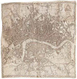
A very scarce handkerchief map of London
Anonymous. Date: 1832Stock #: 20799 £2,800.00 -
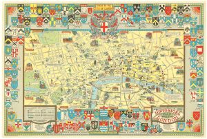
A colourful map of the history of London
BULLOCK, George Leslie. Date: 1970Stock #: 20617 £650.00 -
A two-sheet map of 18th century London
SMITH, Joseph. Date: 1795Stock #: 23337 £2,200.00