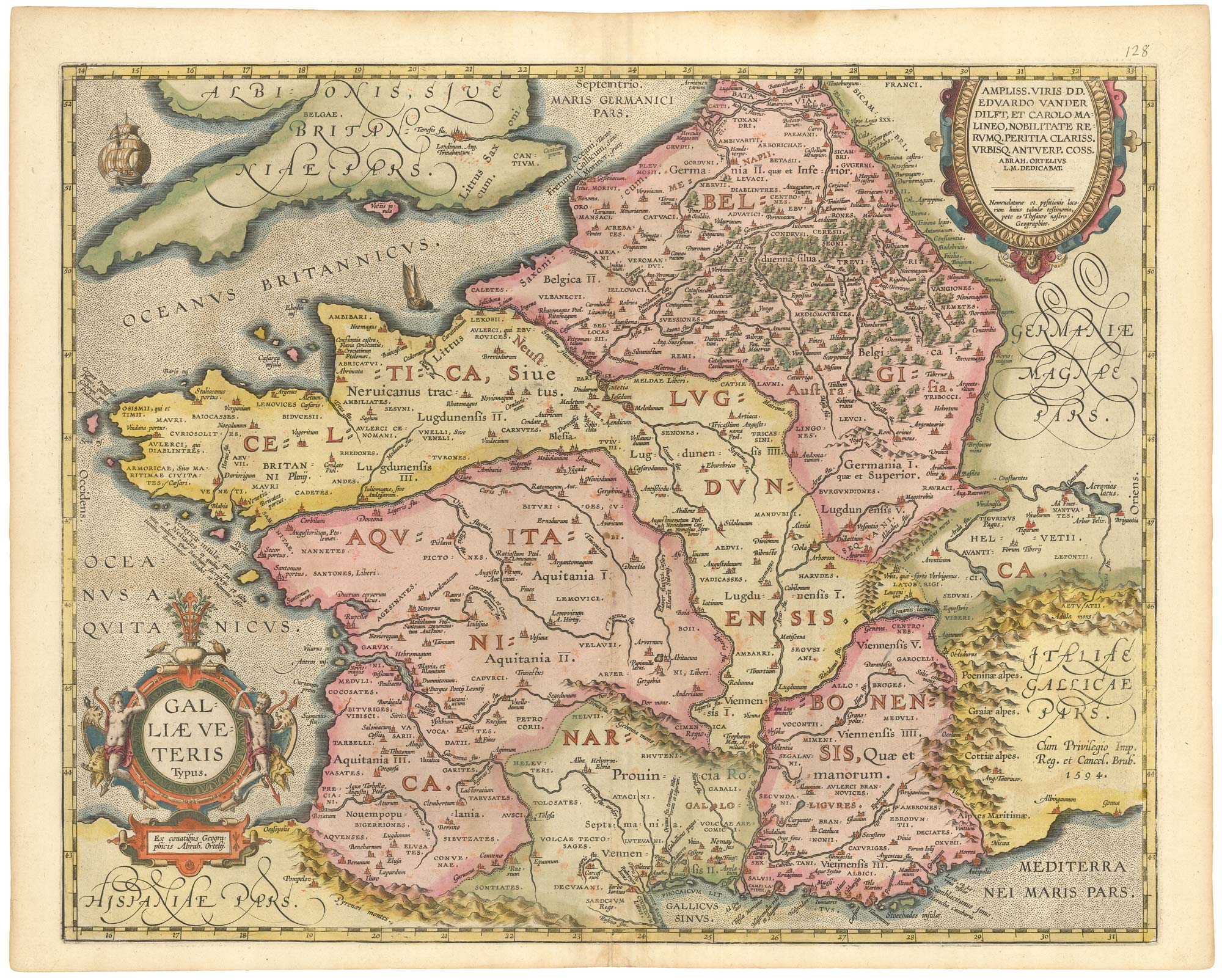


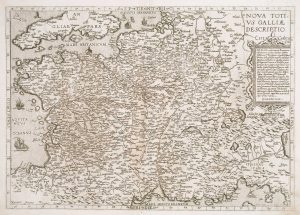
An early edition of Ortelius’s map of France
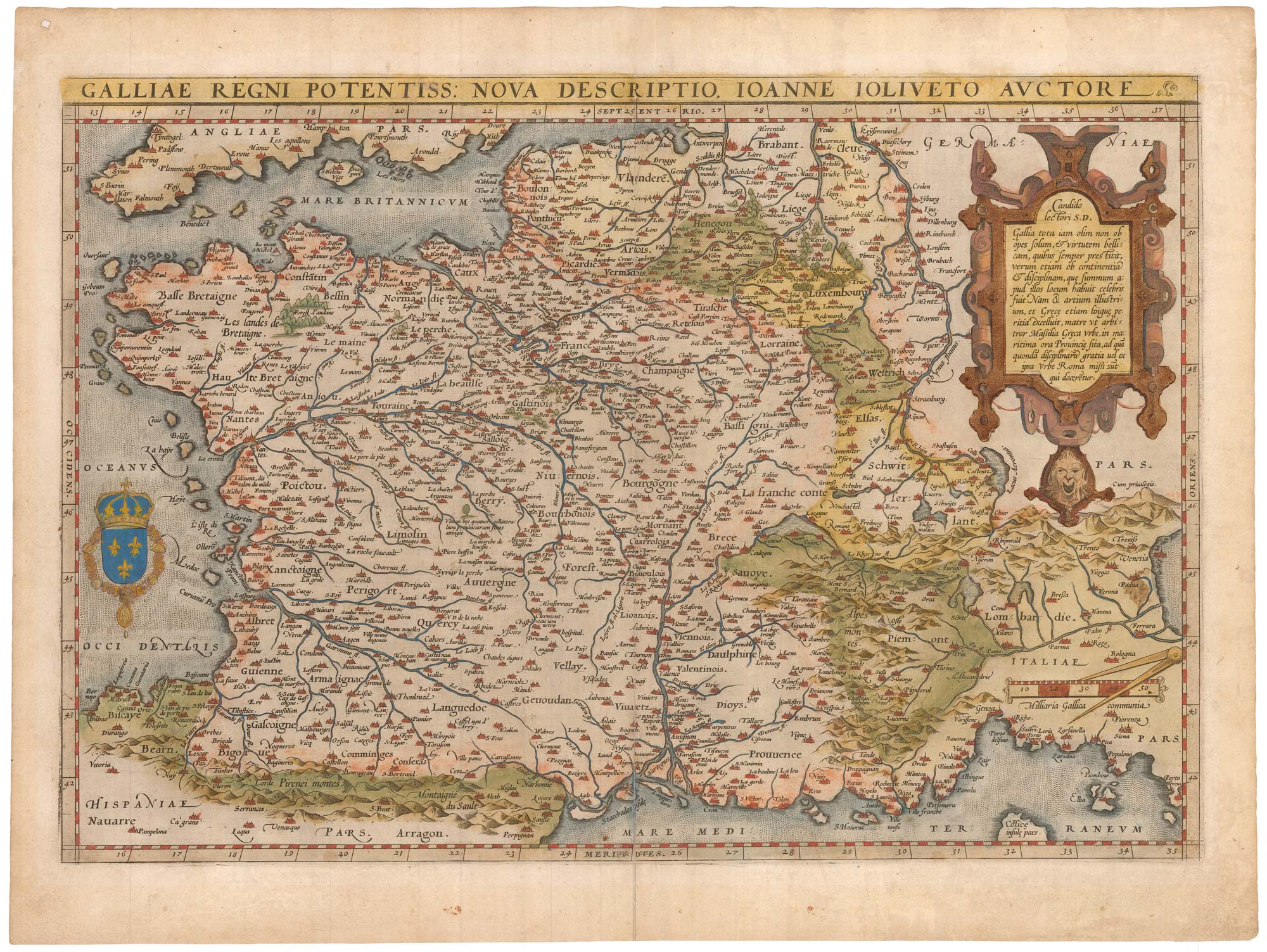
Galliae Regni Potentiss Nova Descriptio, Ioanne Ioliveto Auctore.
Antwerp, 1570, Latin text edition. Original colour. 340 x 495mm.
£650.00
1 in stock
x
Question About This Item?
An early edition of Ortelius’s map of France & ORTELIUS, Abraham.Stock #: 23234
Add to Wishlist
Export as PDFEnquireSimilar to Sell?Add to Wishlist
Description
A classic 16th century map of France, derived from Jean Jolivet's four-sheet woodcut map of 1560. This example was issued in the 'B' variant of the First Edition of 1570.
Condition:
Split in centre folds repaired.References:
VAN DEN BROECKE: 34, 1570B, estimated 100 copies printed.Related products
-

16th century woodblock map of France
MUNSTER, Sebastian. Date: 1572Stock #: 24580 £380.00 -
A 17th century map of France with rare gazzetteer side-panels
VISSCHER, Nicolas. Date: 1690Stock #: 23744 £750.00 -

A 17th century English panelled map of France
SPEED, John. Date: 1665Stock #: 23995 £1,000.00 -
France
AA, Pieter van der. Date: 1715Stock #: 9943 £340.00 -
A scarce 16th century map of France
DE JODE, Gerard. Date: 1578Stock #: 15515 £1,000.00 -
The new Departements of France
ZATTA, Antonio. Date: 1792Stock #: 9534 £350.00 -
A fine 18th century miniature atlas of the coasts of France
BONNE, Rigobert. Date: 1778Stock #: 21944 £2,700.00 -

French Post Roads
LOTTER, Tobias Conrad. Date: 1750Stock #: 8713 £280.00 -

A decorative 18th century map of France
BRION DE LA TOUR, Louis. Date: 1770Stock #: 15529 £200.00
Items by the same author
Add to Wishlist
Add to Wishlist

The rarest Ortelius atlas map of England and Wales
ORTELIUS, Abraham. Date: 1603 Stock #: 25643 £2,000.00
Add to Wishlist
Add to Wishlist

A 16th century miniature map of Turkey
ORTELIUS, Abraham. Date: 1593 Stock #: 24465 £140.00
Add to Wishlist
Add to Wishlist

A 16th century miniature map of the Turkish Empire
ORTELIUS, Abraham. Date: 1593 Stock #: 24464 £280.00
Add to Wishlist
Add to Wishlist
A 16th century miniature map of Ireland
ORTELIUS, Abraham. Date: 1593 Stock #: 24458 £270.00
Add to Wishlist
Add to Wishlist