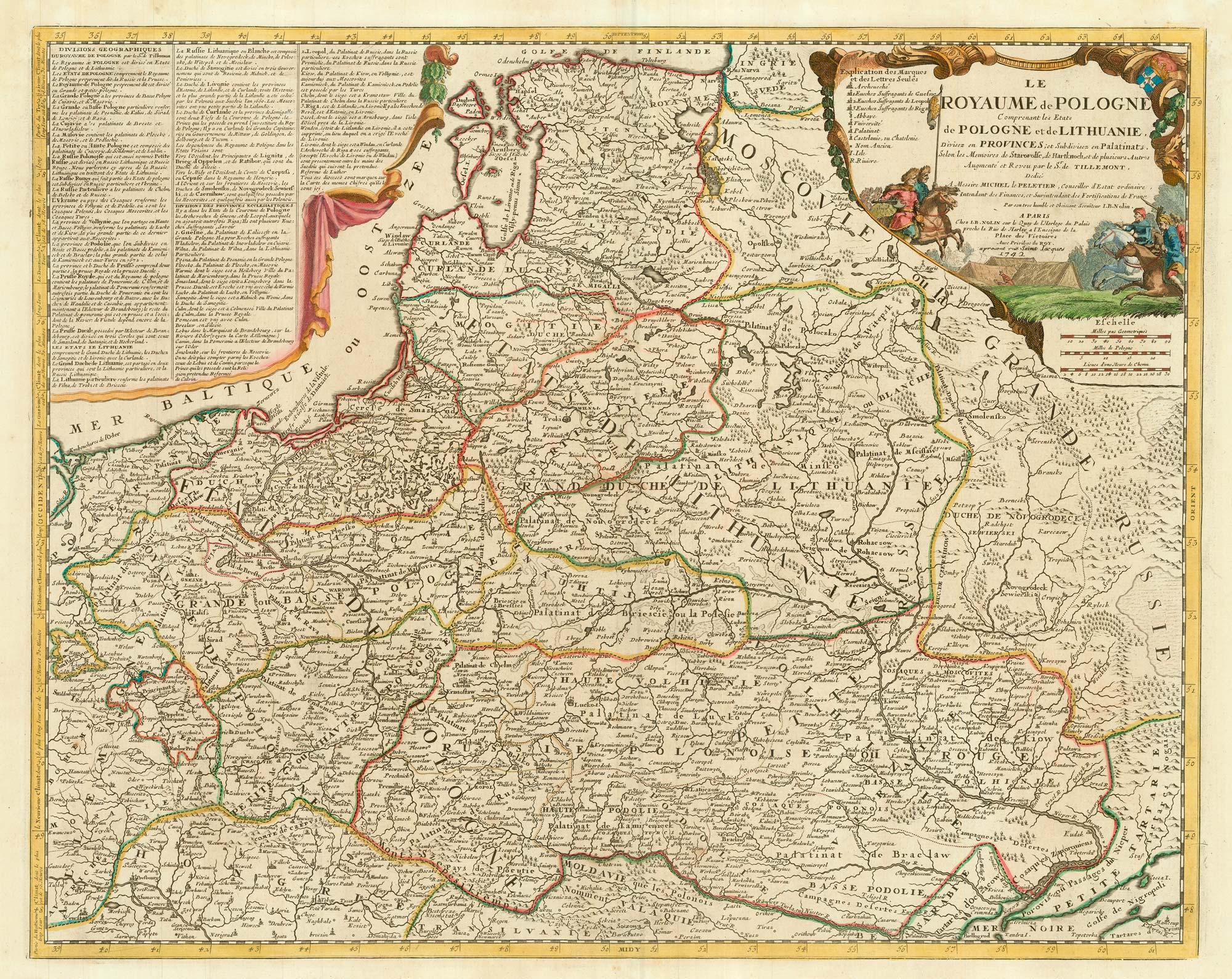


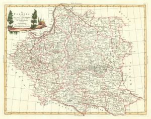
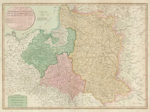
A scarce 18th century map of the Polish-Lithuanian Commonwealth
Le Royaume de Pologne Comprenant les Etats de Polo gnes et de Lithuanie, Divisez en Provinces; et Subdivisez en Palatinats, Selon les Memoires de Starovolfe, de Hartknoch, et de plusiers Autres Augmenté et Revue par le S.r de Tillemont.
Paris, 1742. Coloured. 475 x 600mm, with wide margins.
£950.00
1 in stock
x
Question About This Item?
A scarce 18th century map of the Polish-Lithuanian Commonwealth & NOLIN, Jean Baptiste jnr.Stock #: 24544
Add to Wishlist
Export as PDFEnquireSimilar to Sell?Add to Wishlist
Description
An uncommon map of Poland and Lithuania, drawn by Jean Nicolas Du Tralage (Sieur du Tillemon) and based on the work of Polish writers Christoph Hartknoch (1644-87) & Szymon Starowolski (1588-1656).
Condition:
A good example.Related products
-
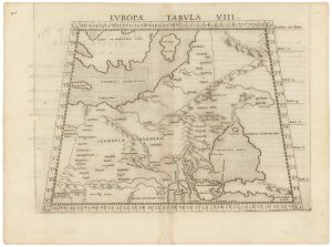
A 16th century map of eastern Europe according to Ptolemy
RUSCELLI, Girolamo. Date: 1599Stock #: 22245 £220.00 -
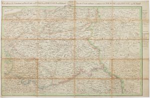
The Prussian and Russian occupation of the Duchy of Warsaw
KNITTEL, Johann Ernst. Date: 1812Stock #: 17231 £1,100.00 -
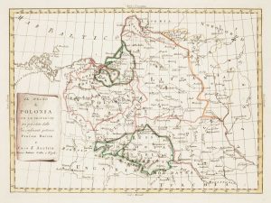
Uncommon map of Poland with the First Partition
ZATTA, Antonio. Date: 1780Stock #: 13853 £160.00 -
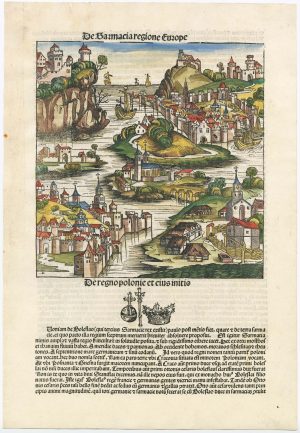
An incunable ‘view’ of Poland
SCHEDEL, D. Hartmann. Date: 1493Stock #: 23232 £650.00 -
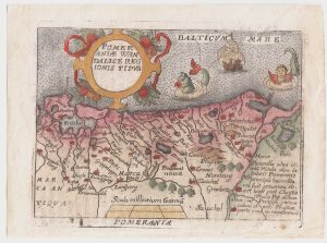
A pirated edition of the Ortelius Epitome map of eastern Pomerania
ORTELIUS, Abraham. Date: 1655Stock #: 21723 £160.00 -
An 18th century Italian map of Poland
ZATTA, Antonio. Date: 1782Stock #: 18353 £320.00 -
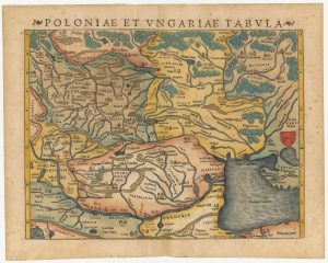
A 16th century woodcut map of Poland, Lithuania and Hungary
MUNSTER, Sebastian. Date: 1572Stock #: 24574 £700.00 -
A map of the Partition of Poland
VALLARDI, Antonio. Date: 1863Stock #: 20570 £700.00 -
Map of the Partitions of Poland
LAURIE & WHITTLE. Date: 1799Stock #: 19028 £450.00