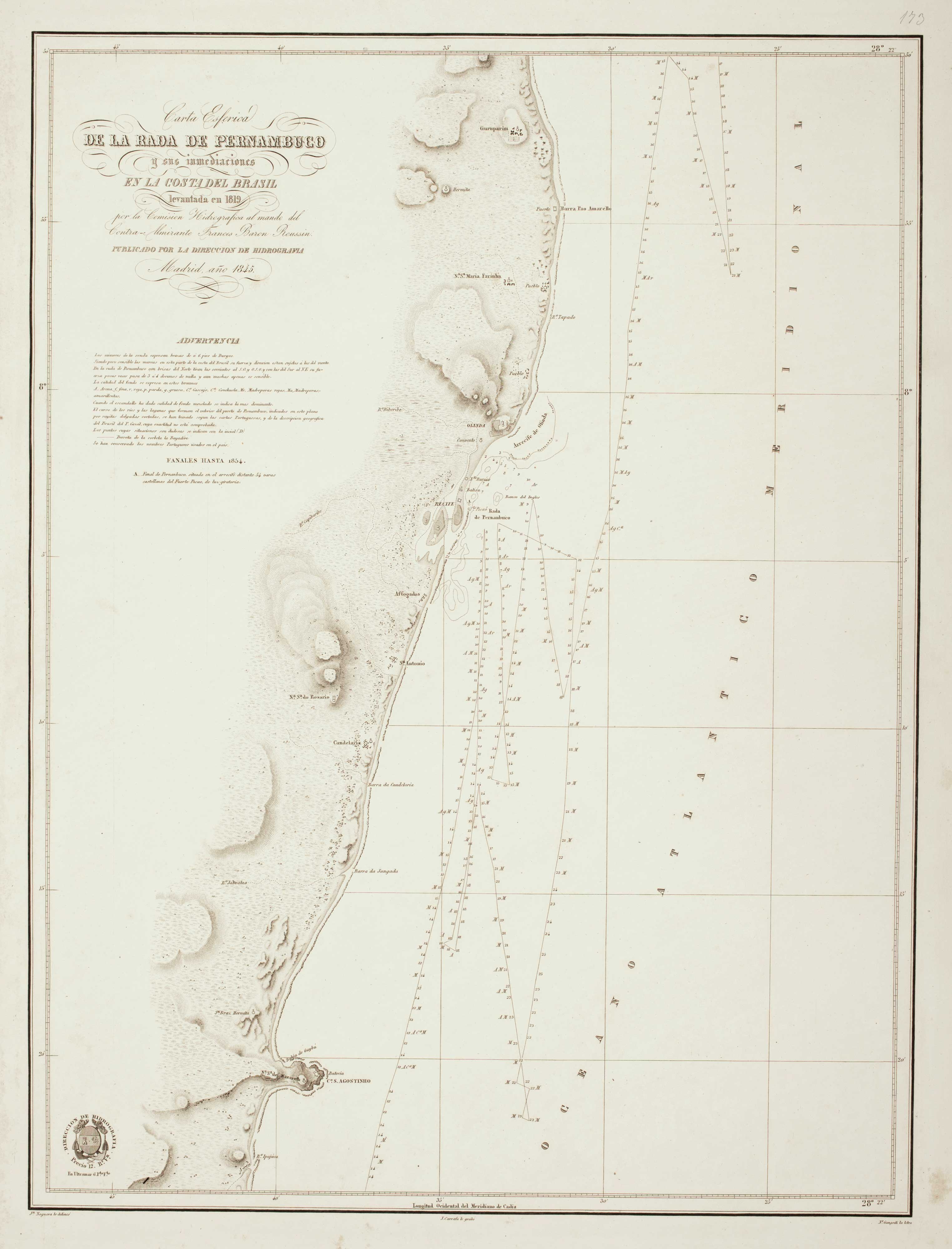


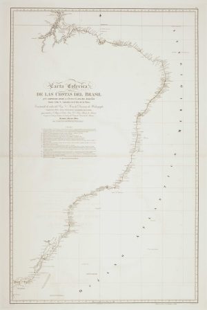
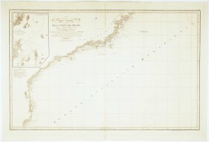
An uncommon 19th century Spanish sea chart of Pernambuco
Carta Esferica de la Rada de Pernambuco y sus inmediaciones en la Costa del Brasil levantada en 1819 por la Comison Hidrografica al mando del Contra-Almirante Francis Baron Roussin.
Madrid: Direccion de Hidrografia, 1845-54. 630 x 480mm.
£360.00
1 in stock
x
Question About This Item?
An uncommon 19th century Spanish sea chart of Pernambuco & NOGUERA, Juan.Stock #: 12507
Add to Wishlist
Export as PDFEnquireSimilar to Sell?Add to Wishlist
Description
A detailed chart of the coastline of the Brazilian Province of Pernambuco, based on the survey of 1819 by Albin Reine Roussin (1781-1854), the French admiral and statesman, but updated to 1854. Such is the scale that the charts shows only from just north of Olinda to Santo Agostino, with Recife.
Condition:
Some spotting in margins.Related products
-
Sea chart of Espiritu Santo
MOUCHEZ, Amédée Ernest Barthémy. Date: 1870Stock #: 12509 £300.00 -
An uncommon Spanish sea chart of Bahia de Todos os Santos
NOGUERA, Juan. Date: 1845Stock #: 12508 £380.00 -
Mid-19th century map of Brazil with decorative vignettes
TALLIS, John. Date: 1851Stock #: 21590 £150.00 -
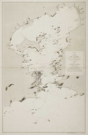
An uncommon 19th century Spanish sea chart of the Bay of Rio de Janeiro
TUBAU, I. Date: 1869Stock #: 12499 £1,200.00 -
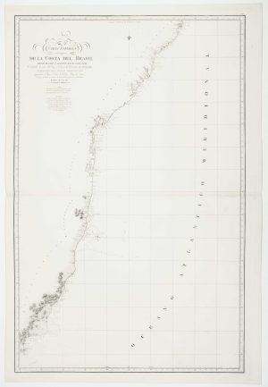
An uncommon 19th century Spanish sea chart of the Brazilian coast
MASSA, Gaspar. Date: 1827Stock #: 12511 £850.00 -
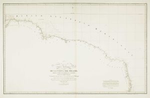
19th century Spanish sea chart of the north Brazilian coast
MASSA, Gaspar. Date: 1827Stock #: 12510 £750.00 -
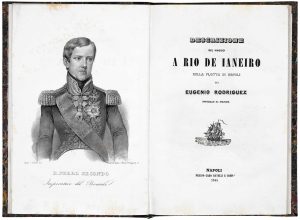
An account of an Italian voyage to Brazil with a fine prospect of Rio de Janeiro
RODRIGUEZ, Eugenio. Date: 1844Stock #: 19347 £3,950.00 -
An uncommon 19th century Spanish sea chart of the Brazilian coast
MASSA, Gaspar. Date: 1830Stock #: 12514 £850.00 -
Sea chart of the Brazilian coast, with Rio de Janeiro
MASSA, Gaspar. Date: 1827Stock #: 12512 £950.00
Items by the same author
Add to Wishlist
Add to Wishlist
