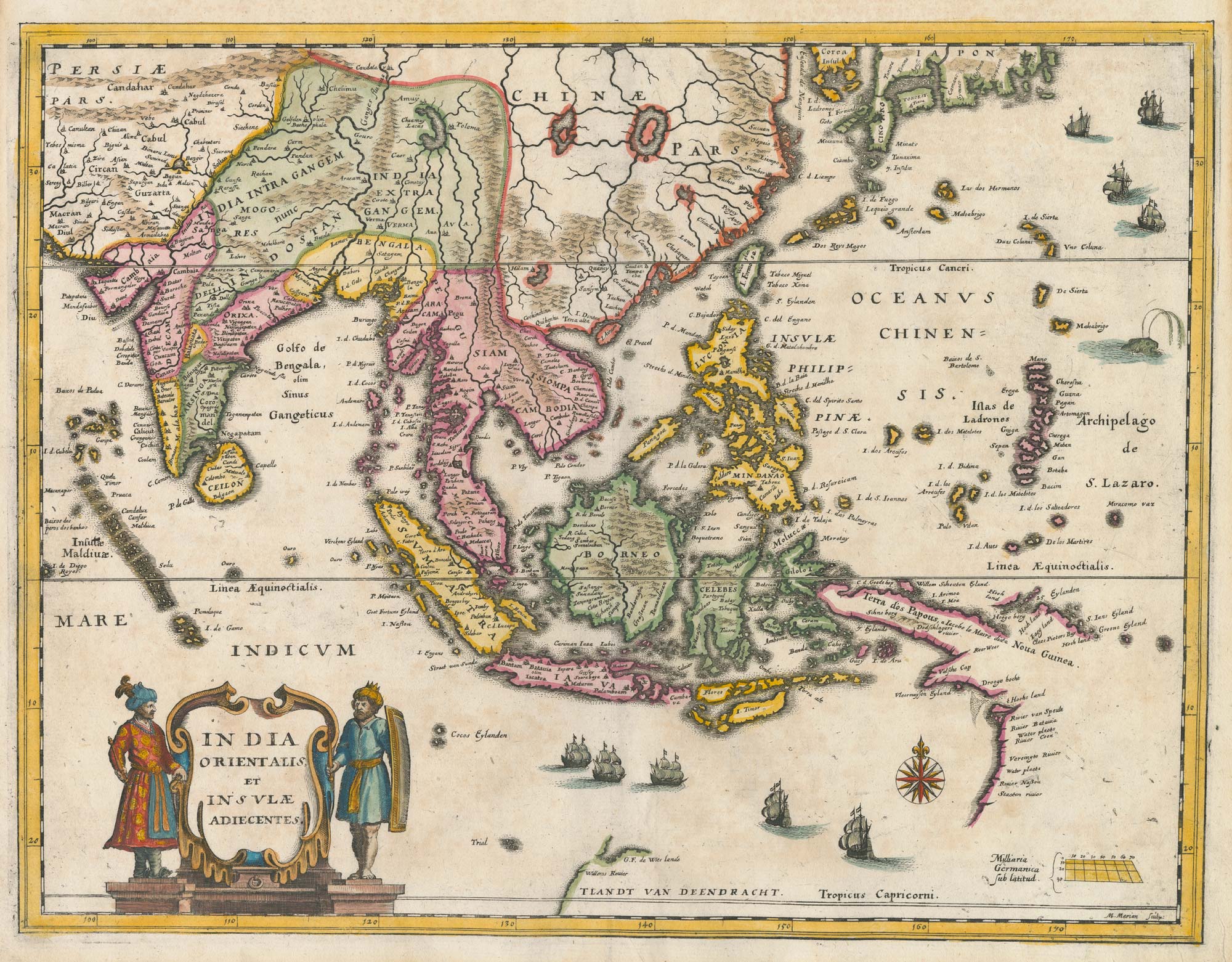


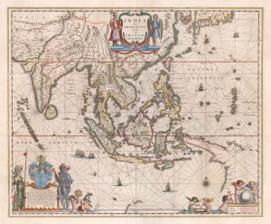
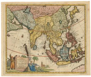
A mid-17th century map of the Far East
India Orientalis et Insulae Adiecentes.
Frankfurt, c.1650. Coloured. 270 x 355mm.
£700.00
Description
A map of the East Indies based on Blaeu, showing India, Indochina, Indonesia and the Philippines, with the southern coast of Japan. It also shows the Dutch East India Company's discoveries in northern Australia, including the Cape York Peninsula and de Witt's Land.
Condition:
A good example.Related products
-
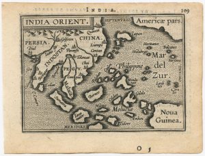
The scarce second Galle plate for the Far East used in the ‘Epitome’
ORTELIUS, Abraham. Date: 1598Stock #: 23197 £450.00 -
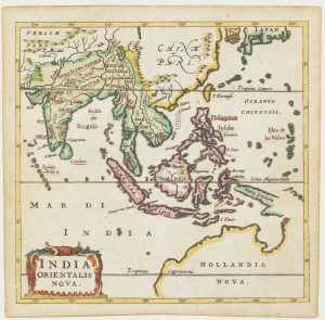
17th century miniature map of the East Indies
CLUVER, Philip. Date: 1659Stock #: 18843 £650.00 -
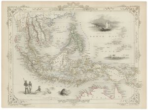
A mid-19th century map of the East Indies with decorative vignettes
TALLIS, John. Date: 1851Stock #: 21611 £240.00 -
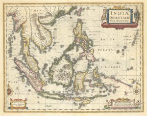
A 17th century map of the trading empire of the Dutch East India Company
BLAEU, Willem Janszoon. Date: 1650Stock #: 22918 £1,650.00 -
The East Indies with early evidence of the Dutch discovery of Australia
JANSSON, Jan. Date: 1807Stock #: 25082 £1,700.00 -
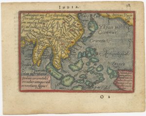
A 16th century miniature map of South East Asia
ORTELIUS, Abraham. Date: 1593Stock #: 24460 £350.00 -
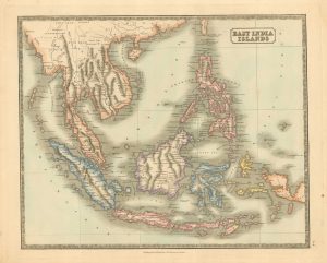
Mid 19th century map of the East India Islands
GELLATLY, John. Date: 1843Stock #: 19952 £175.00 -
Early 18th century map of South East Asia
AA, Pieter van der. Date: 1719Stock #: 21650 £400.00 -
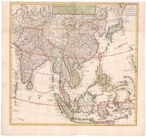
Early 18th century map of the East Indies
DELISLE, Guillaume. Date: 1705Stock #: 23907 £980.00
Items by the same author
Add to Wishlist
Add to Wishlist
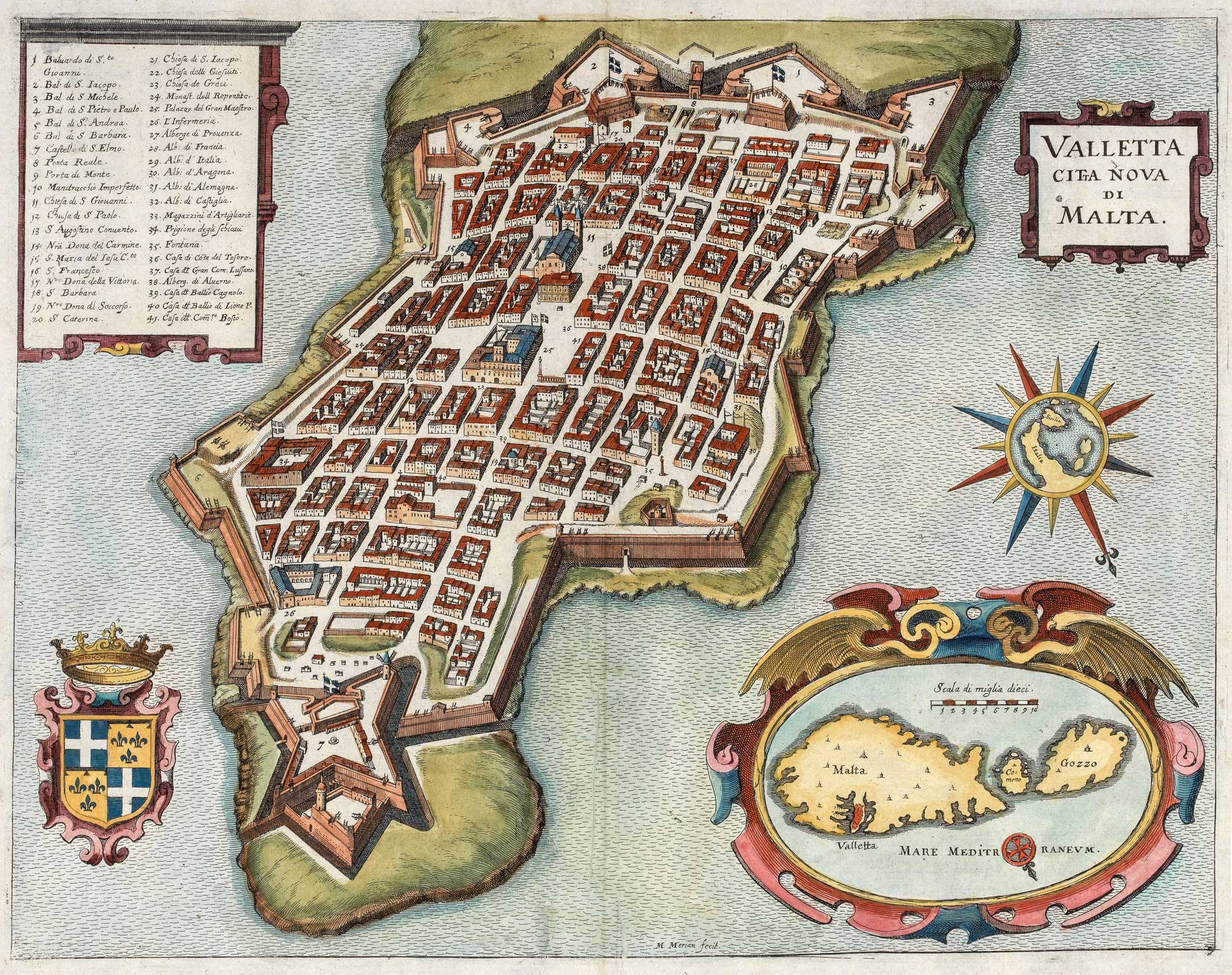
A 17th century plan of Valletta
MERIAN, Matthaus. Date: 1638 Stock #: 20690 £650.00
Add to Wishlist
Add to Wishlist
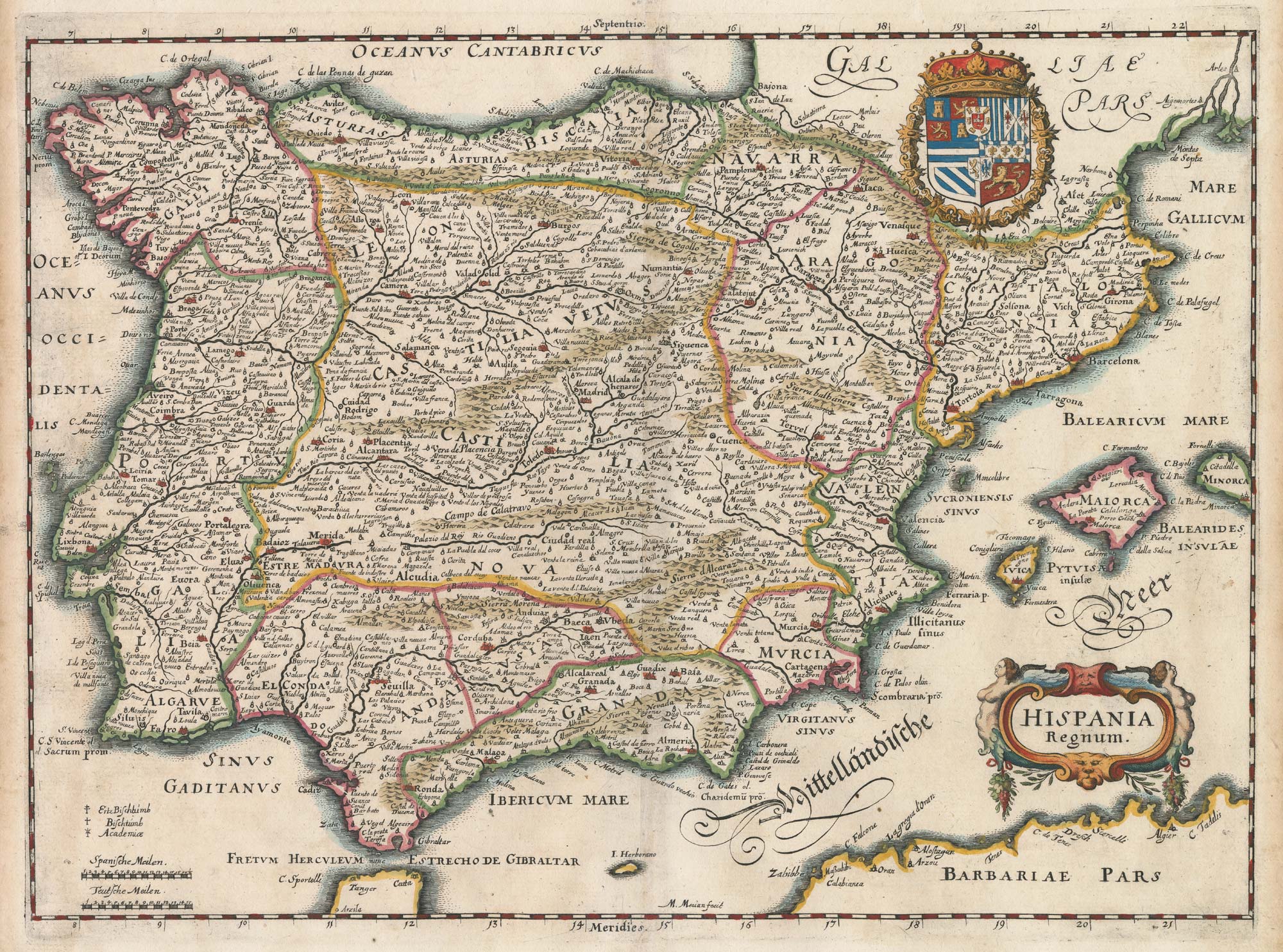
17th century map of Spain and Portugal
MERIAN, Matthaus. Date: 1640 Stock #: 22805 £300.00
Add to Wishlist
Add to Wishlist

17th century bird's-eye view of Siena
MERIAN, Matthaus. Date: 1640 Stock #: 24820 £480.00
Add to Wishlist
Add to Wishlist
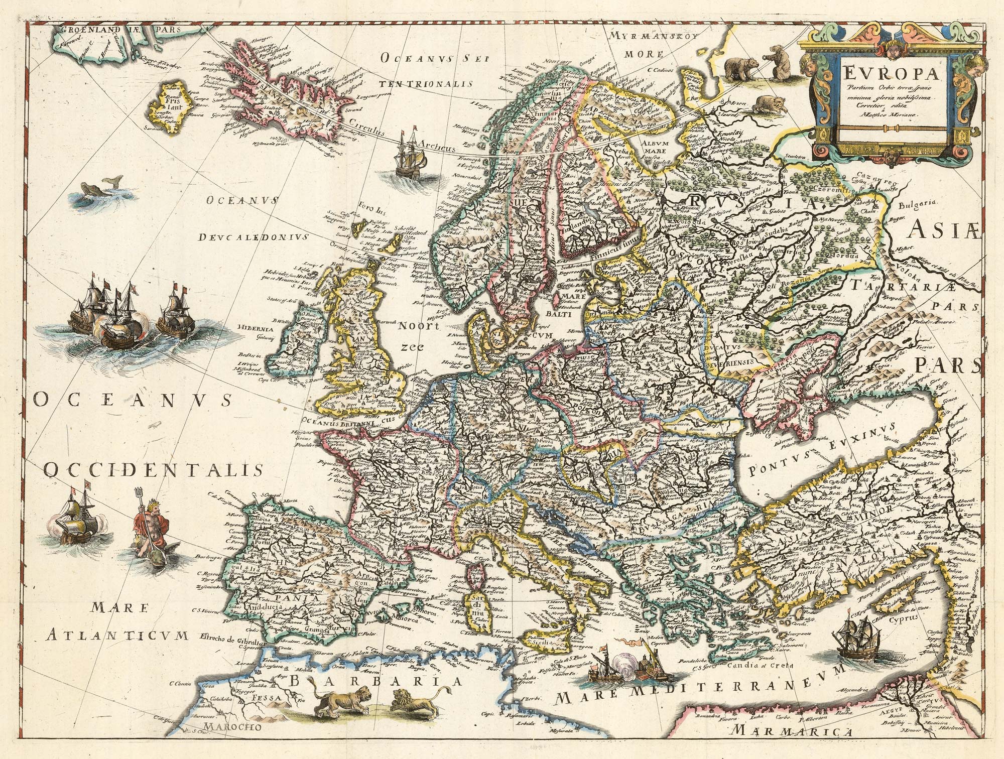
An uncommon 17th century map of Europe
MERIAN, Matthaus. Date: 1640 Stock #: 22936 £750.00
Add to Wishlist
Add to Wishlist
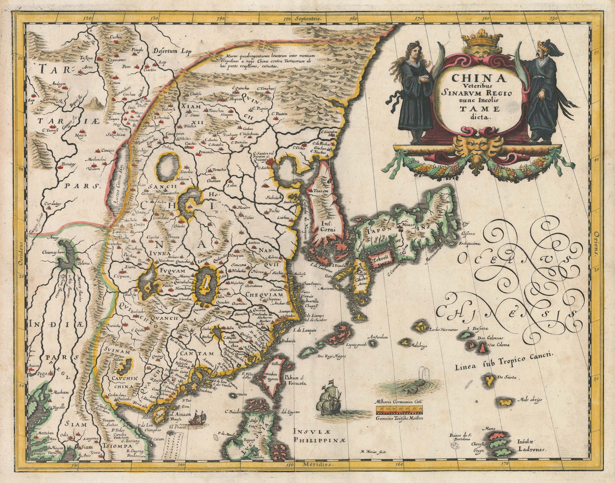
A mid-17th century map of China
MERIAN, Matthaus. Date: 1650 Stock #: 22922 £750.00
Add to Wishlist
Add to Wishlist
