

A Ptolemaic map of Italy
Tab. VI. Europae Totam Italiam ob Oculos Ponens.
Utrecht, François Halma, c.1695. Coloured. 345 x 470mm.
£900.00
Description
A Ptolemaic map of Italy, drawn by Mercator for his edition of Ptolemy's 'Geography', with the maps updated to Mercator's Projection. This example is of the second state, with a new title cartouche replacing the original strapwork one.
Condition:
A good example.Related products
-

Ortelius’s map of Italy in classical times
ORTELIUS, Abraham. Date: 1595Stock #: 23778 £1,200.00 -

18th century decorative map of Italy
SEUTTER, Matthaus. Date: 1740Stock #: 24614 £550.00 -

Munster’s classic woodcut map of Italy
MUNSTER, Sebastian. Date: 1572Stock #: 24562 £850.00 -

The first carte-à-figure map of Italy
BLAEU, Willem Janszoon. Date: 1640Stock #: 15244 £9,000.00 -

A mid-19th century map of the post roads of Italy
GARLATO, Giambattista. Date: 1844Stock #: 20642 £600.00 -

A very unusual ‘vertical’ map of Italy
RIZZI-ZANNONI, Giovanni Antonio. Date: 1814Stock #: 25053 £1,250.00 -

Italy divided into the Augustinian provinces
SEUTTER, Matthaus. Date: 1740Stock #: 24823 £425.00 -

Classic 16th century map of Italy in fine colour
ORTELIUS, Abraham. Date: 1595Stock #: 24917 £1,400.00 -

A map of classical Italy, in fine colour
SEUTTER, Matthaus. Date: 1740Stock #: 24829 £500.00
Items by the same author
Add to Wishlist
Add to Wishlist

Mercator's Ptolemaic map of Arabia
MERCATOR, Gerard. Date: 1695 Stock #: 19745 £1,200.00
Add to Wishlist
Add to Wishlist
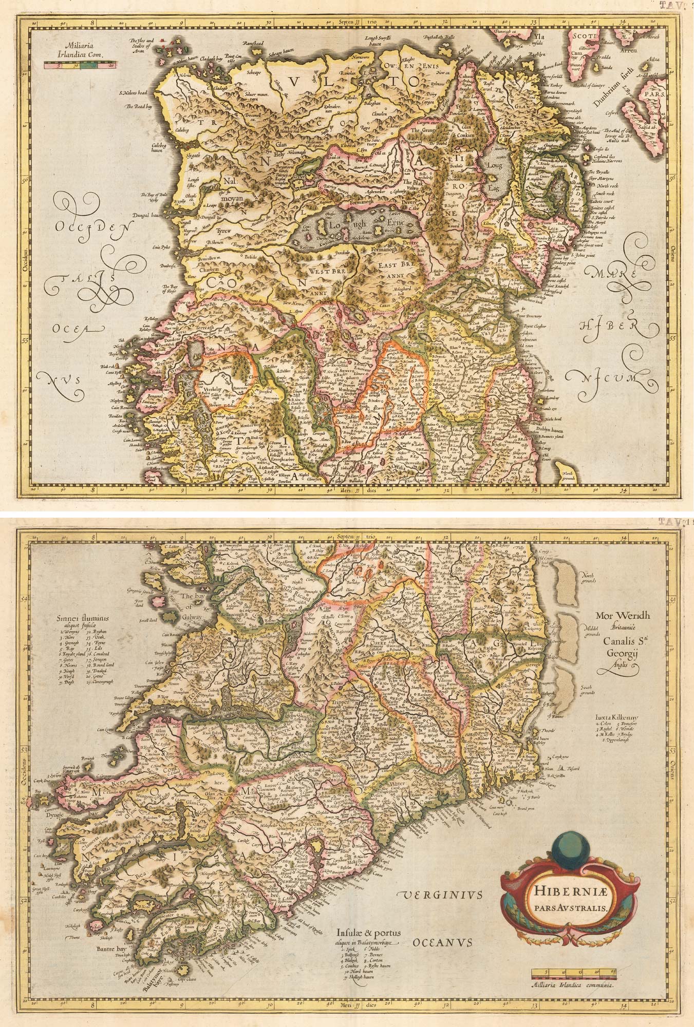
An uncommon state of Mercator's pair of maps of Ireland
MERCATOR, Gerard. Date: 1638 Stock #: 23864 £1,250.00
Add to Wishlist
Add to Wishlist
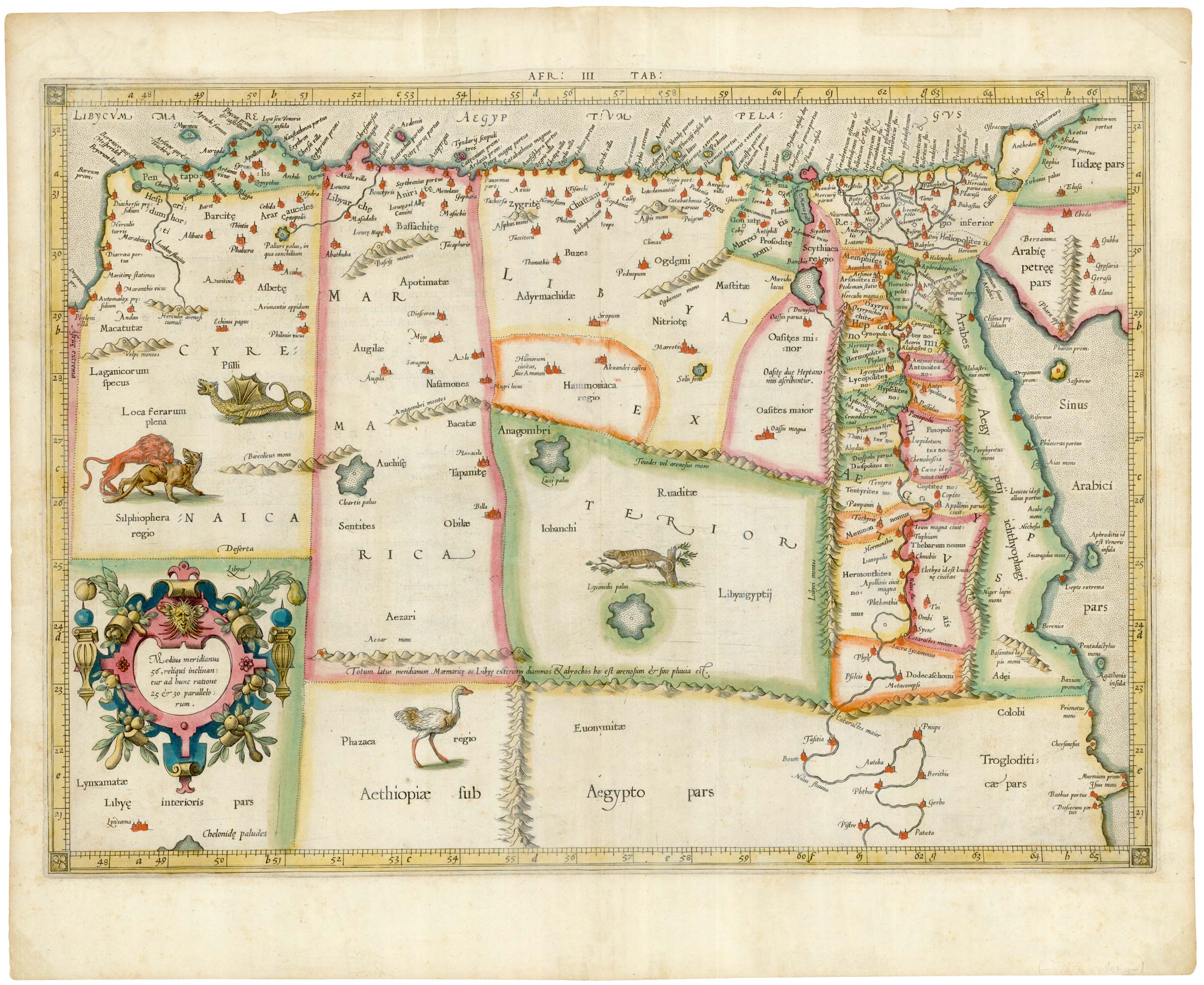
Ancient Libya and Egypt in superb original colour
MERCATOR, Gerard. Date: 1618 Stock #: 24952 £750.00
Add to Wishlist
Add to Wishlist
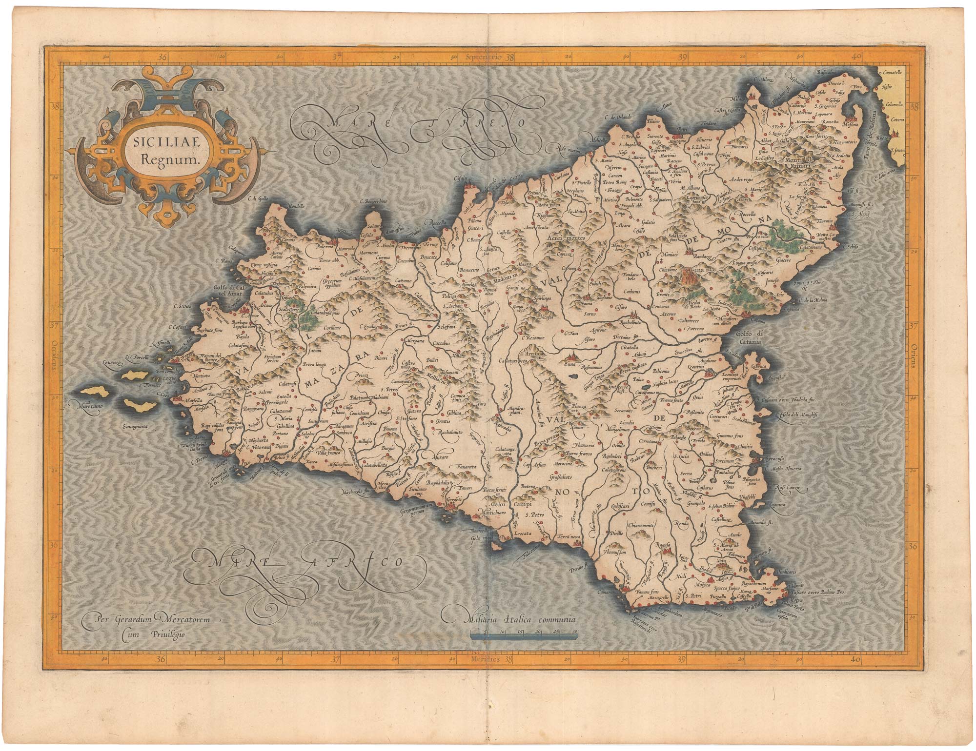
Mercator's first issue folio map of Sicily in original colour
MERCATOR, Gerard. Date: 1628 Stock #: 23392 £1,400.00
Add to Wishlist
Add to Wishlist
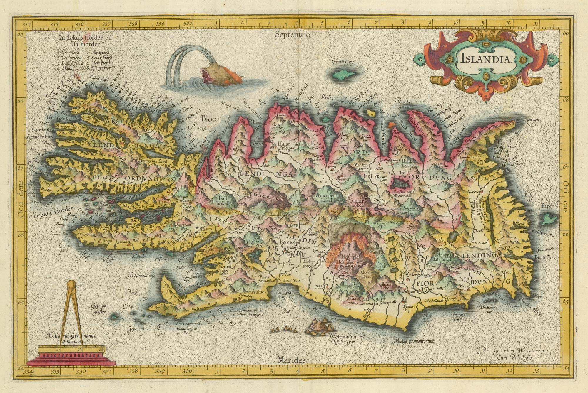
Early 17th century map of Iceland in fabulous early colour
MERCATOR, Gerard. Date: 1608 Stock #: 23475 £1,800.00
Add to Wishlist
Add to Wishlist