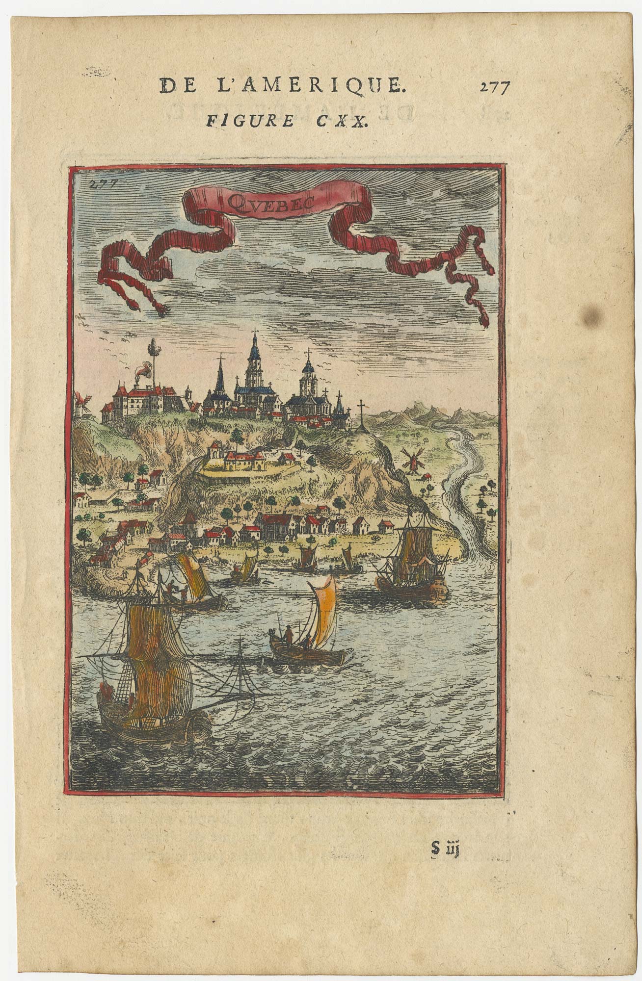


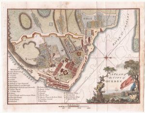
A 17th century prospect of Quebec
Quebec.
Paris, 1683. Coloured. 140 x 100mm, set in text.
£220.00
Description
A miniature view of Quebec from the St Lawrence River, published in the 'Description de l'Univers'
Condition:
A good example.Related products
-
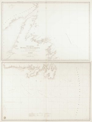
A scarce Spanish chart of Newfoundland
MORENO, Miguel. Date: 1860Stock #: 11852 £1,200.00 -
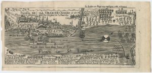
A plan of the British attack on Quebec in October 1690 by a defender
LAHONTAN, Louis-Armande de. Date: 1741Stock #: 22562 £550.00 -
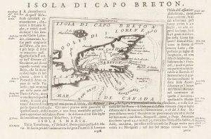
A 17th century map of Cape Breton Island
CORONELLI, Vincenzo Maria. Date: 1696Stock #: 21640 £160.00 -
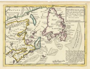
A map of Newfoundland according to the Treaty of Utrecht
MOLL, Herman. Date: 1732Stock #: 25654 £400.00 -
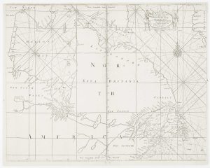
An early English chart of northern Canada with Hudson Bay
THORNTON, John. Date: 1748Stock #: 15550 £300.00 -

A French edition of an important map of the St Lawrence valley
CARVER, Jonathan. Date: 1777Stock #: 23477 £1,600.00 -
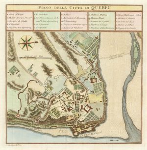
An 18th century Italian plan of Quebec
GAZZETTIERE AMERICANO. Date: 1763Stock #: 22467 £250.00 -
A detailed plan of Quebec
ANDREWS, John. Date: 1798Stock #: 22463 £160.00 -
A detailed 18th century plan of the St Lawrence River
HARRISON, John. Date: 1784Stock #: 22812 £420.00
Items by the same author
Add to Wishlist
Add to Wishlist
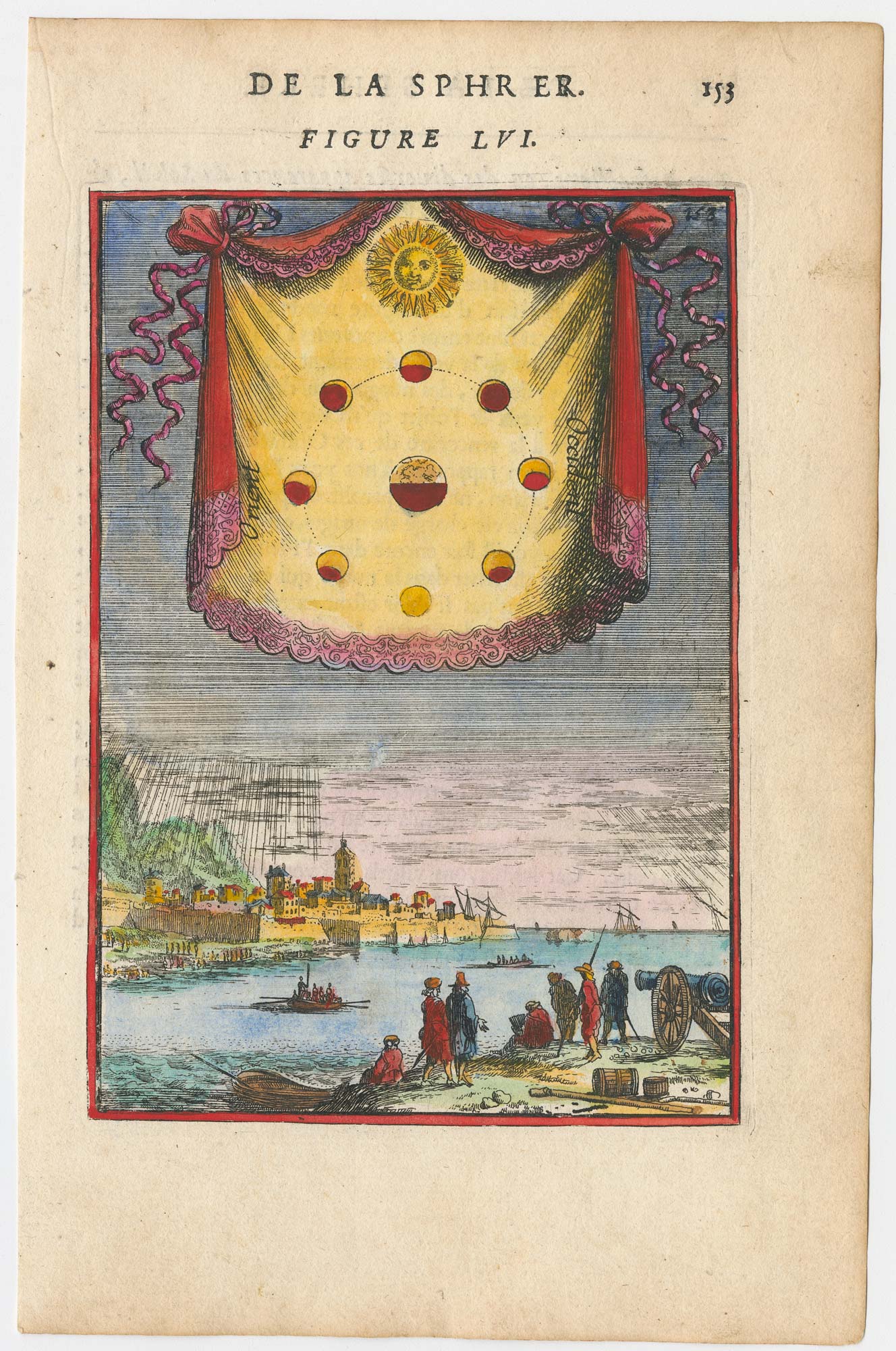
A 17th century plate illustrating the Moon phases
MALLET, Alain Manesson. Date: 1683 Stock #: 23933 £180.00
Add to Wishlist
Add to Wishlist

A pair of 17th century celestial hemispheres
MALLET, Alain Manesson. Date: 1683 Stock #: 25073 £350.00
Add to Wishlist
Add to Wishlist
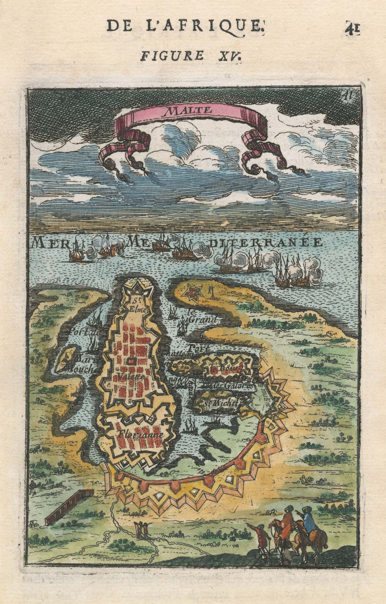
A 17th century miniature plan of Valletta
MALLET, Alain Manesson. Date: 1683 Stock #: 22329 £220.00
Add to Wishlist
Add to Wishlist
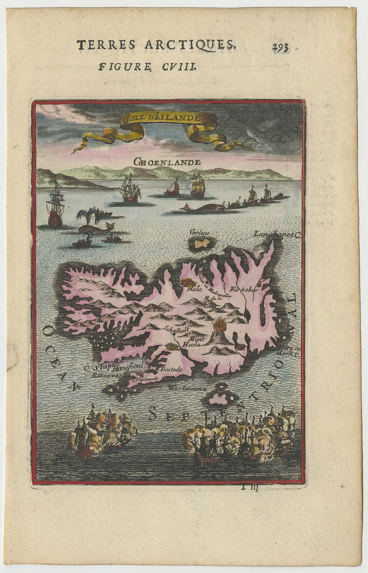
17th century miniature map of Iceland
MALLET, Alain Manesson. Date: 1683 Stock #: 24706 £225.00
Add to Wishlist
Add to Wishlist
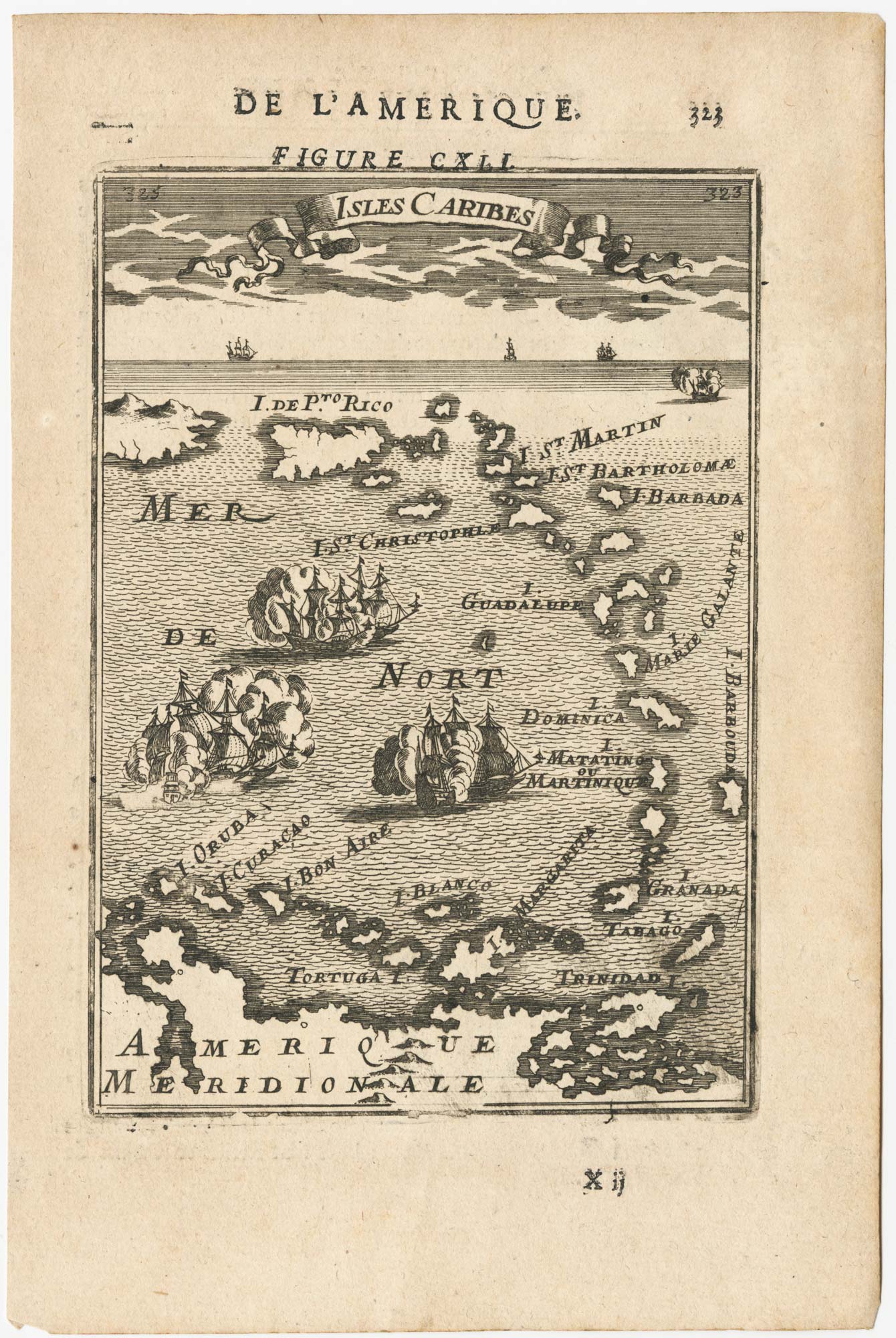
17th century miniature map of the Antilles
MALLET, Alain Manesson. Date: 1683 Stock #: 24840 £180.00
Add to Wishlist
Add to Wishlist