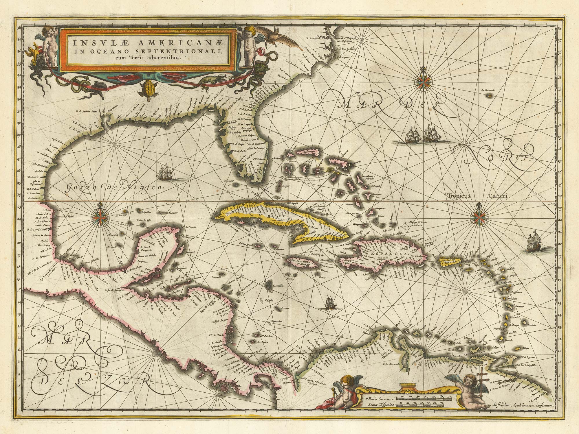


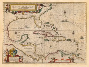
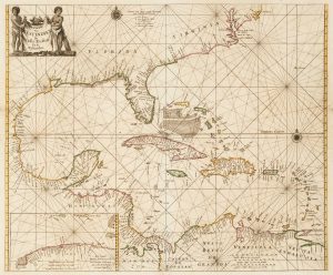
17th century chart of the West Indies
Insulae Americanae in Oceano Septentrionali, cum Terris Adiacentibus.
Amsterdam, 1638, Latin text edition. Original colour. 380 x 515mm.
£1,300.00
Description
An early sea chart of the West Indies and the coastline of America north to Chesapeake, with the Gulf of Mexico and Florida. decorated with three large cartouches in full colour and compass roses.
Condition:
A good example.References:
BURDEN: 248.Related products
-
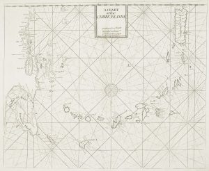
A British chart of the Lesser Antilles
MOUNT & PAGE. Date: 1748Stock #: 15696 £700.00 -
British possessions at the end of the Napoleonic War
THOMSON, John. Date: 1816Stock #: 24863 £200.00 -
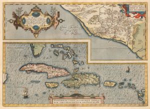
Ortelius’s map of the West Indies and Culiacán in Mexico
ORTELIUS, Abraham. Date: 1584Stock #: 23599 £1,250.00 -
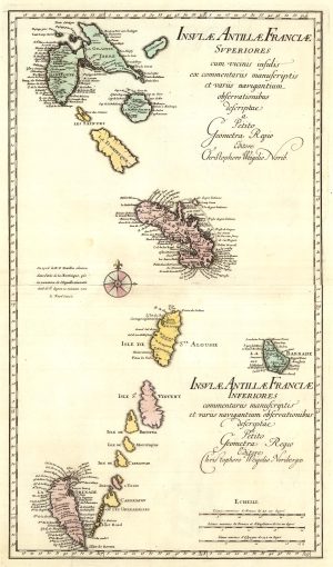
A two-sheet map of the Lesser Antilles
WEIGEL, Christoph. Date: 1747Stock #: 25324 £500.00 -
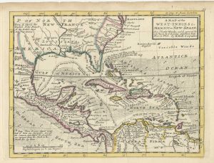
18th century English map of the West Indies
MOLL, Herman. Date: 1732Stock #: 25667 £450.00 -
Classic 17th century map of the West Indies
BLAEU, Willem Janszoon. Date: 1662Stock #: 22717 £1,800.00 -
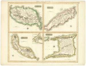
The English possessions in the West Indies
SENEX, John. Date: 1721Stock #: 23423 £850.00 -
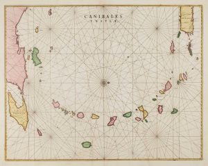
17th century chart of the Lesser Antilles
BLAEU, Johannes. Date: 1662Stock #: 15193 £850.00 -
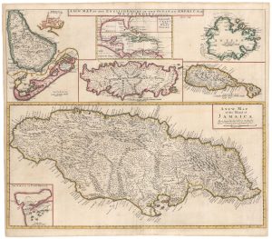
17th century sea-chart of the West Indies
GOOS, Pieter. Date: 1666Stock #: 11906 £2,500.00
Items by the same author
Add to Wishlist
Add to Wishlist

A magnificent example of the first folio sea atlas of the World
JANSSON, Jan. Date: 1650 Stock #: 23074 £47,500.00
Add to Wishlist
Add to Wishlist
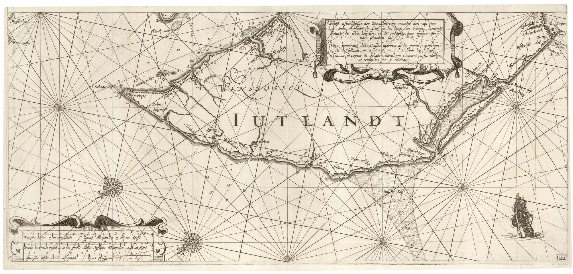
A rare 17th century sea chart of Jutland
JANSSON, Jan. Date: 1620 Stock #: 25262 £2,000.00
Add to Wishlist
Add to Wishlist

A 17th century map of Ireland from a pocket atlas
JANSSON, Jan. Date: 1631 Stock #: 25065 £325.00
Add to Wishlist
Add to Wishlist

An early issue of Jansson's map of Ireland
JANSSON, Jan. Date: 1638 Stock #: 23865 £950.00
Add to Wishlist
Add to Wishlist

Map of the River Elbe with a prospect of Hamburg
JANSSON, Jan. Date: 1630 Stock #: 24816 £500.00
Add to Wishlist
Add to Wishlist
