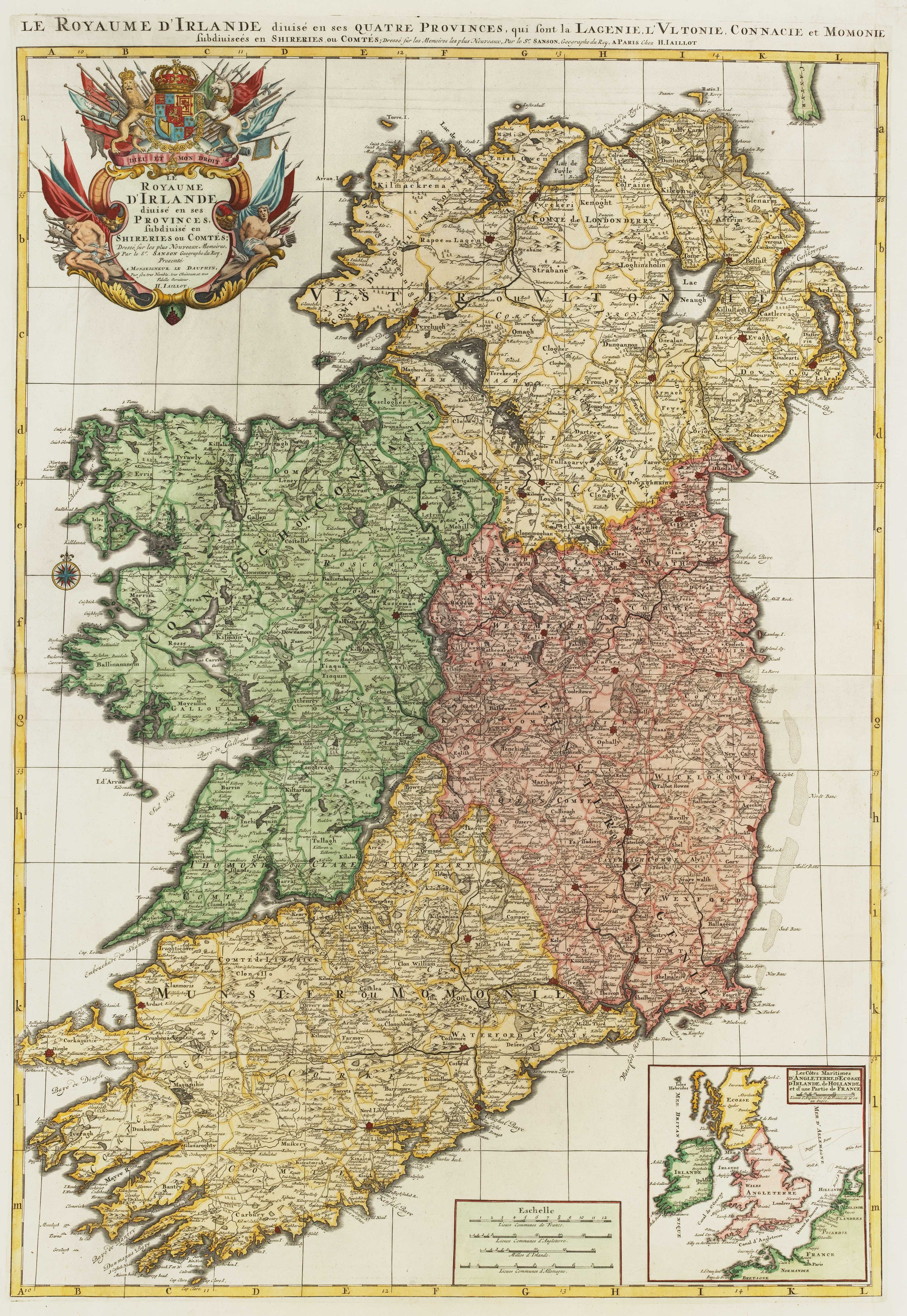


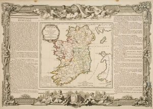
A two-sheet map of Ireland
Royaume d'Irlande divisée en ses Provinces...
Amsterdam, Pieter Mortier, c.1700. Coloured. Two sheets conjoined, total 900 x 620mm.
£1,300.00
Description
A large and decorative map of Ireland, from Mortier's issue of Jaillot's 'Atlas Nouveau', with fine baroque title and scale cartouches and an inset showing Ireland's position it relation to the rest of the British Isles.
It is based on Sanson's map, which Jaillot had redrawn on a larger scale at the request of Sanson's heirs.
Condition:
Trimmed within printed borders at sides, false margins added with mss. fill.References:
BONAR LAW: 40, state iii of iv.Related products
-
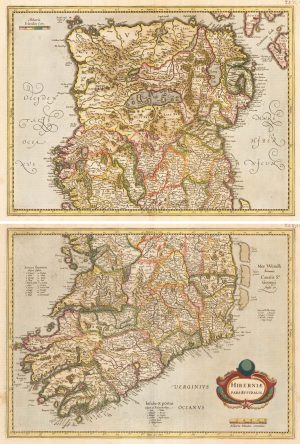
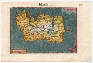
An uncommon state of Mercator’s pair of maps of Ireland
MERCATOR, Gerard. Date: 1638Stock #: 23864 £1,250.00 -
Uncommon Italian produced map of Ireland
SOCIETA CALCOGRAFICA. Date: 1803Stock #: 16615 £1,100.00 -
18th century decorative map of Ireland
BRION DE LA TOUR, Louis. Date: 1766Stock #: 7547 £260.00 -
Early 17th century miniature map of Ireland
BERTIUS, Petrus. Date: 1609Stock #: 24845 £240.00 -
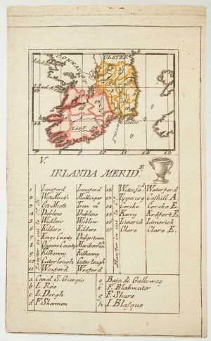
An 18th century playing-card map of southern Ireland
RABATTA, Augusto & BAILOU, Jean Baptist de. Date: 1779Stock #: 12959 £180.00 -
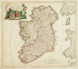
An early issue of Jansson’s map of Ireland
JANSSON, Jan. Date: 1638Stock #: 23865 £950.00 -
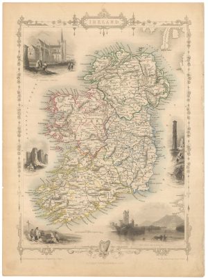
Mid 19th century map of Ireland with decorative vignettes
TALLIS, John. Date: 1851Stock #: 21568 £240.00 -
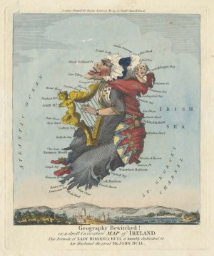
The famous caricature map of Ireland
DIGHTON, Robert. Date: 1793Stock #: 25512 £725.00 -
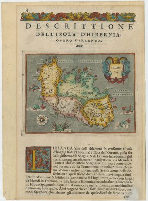
A 16th century map of Ireland with sea-monsters
PORCACCHI, Tomaso. Date: 1576Stock #: 24013 £300.00
Items by the same author
Add to Wishlist
Add to Wishlist
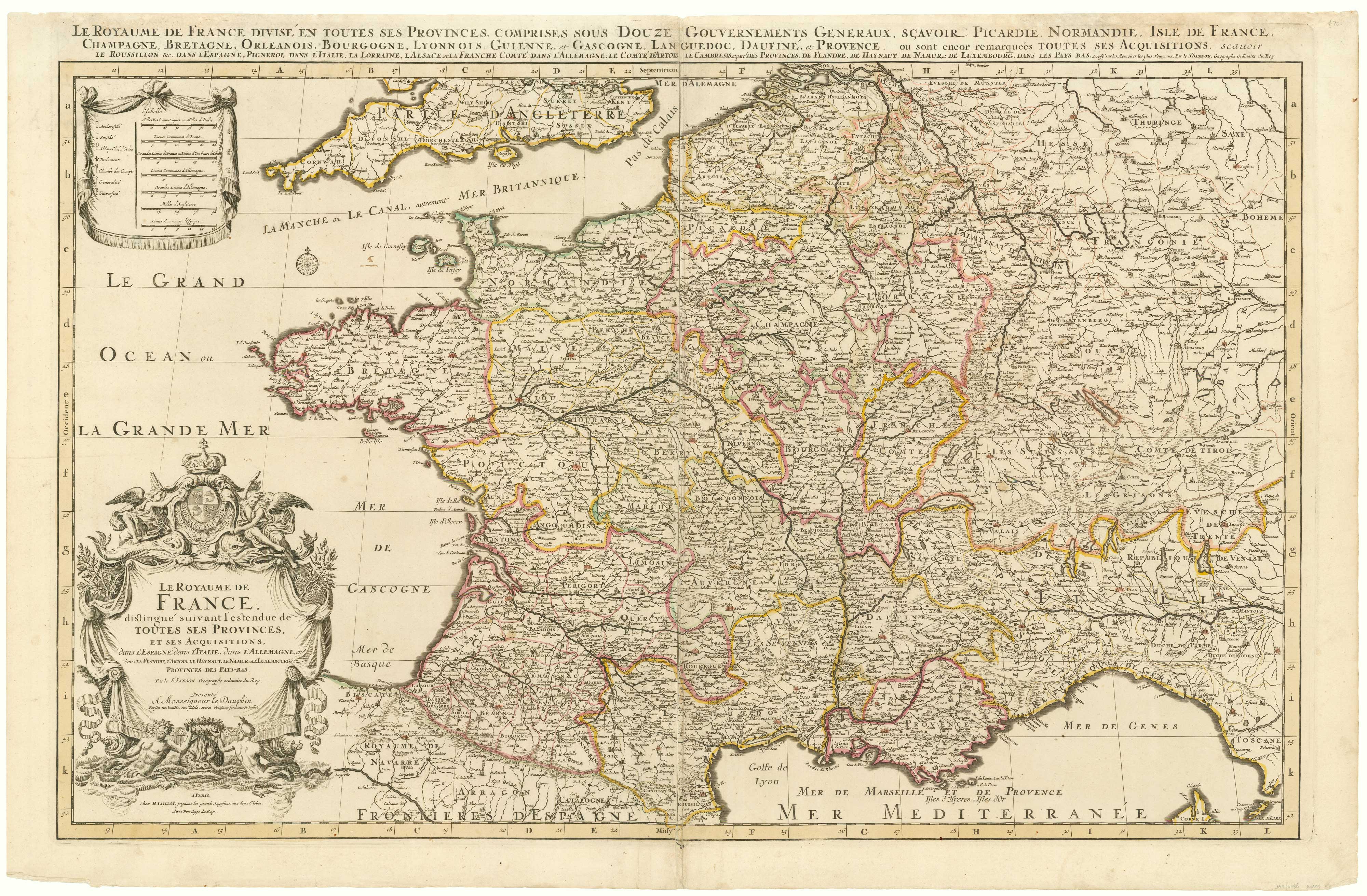
A two-sheet map of France
JAILLOT, Alexis-Hubert. Date: 1705 Stock #: 8440 £700.00
Add to Wishlist
Add to Wishlist
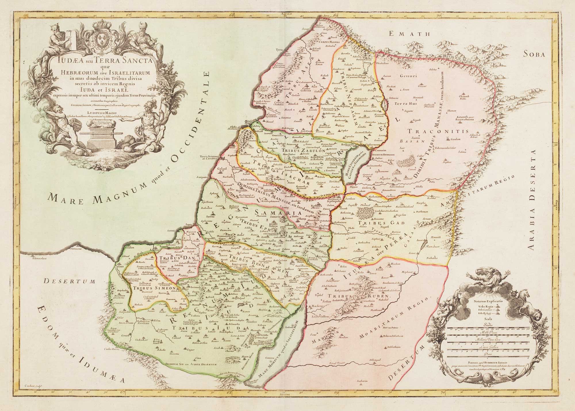
18th century map of the Holy Land in fine colour
JAILLOT, Alexis-Hubert. Date: 1781 Stock #: 14768 £450.00
Add to Wishlist
Add to Wishlist
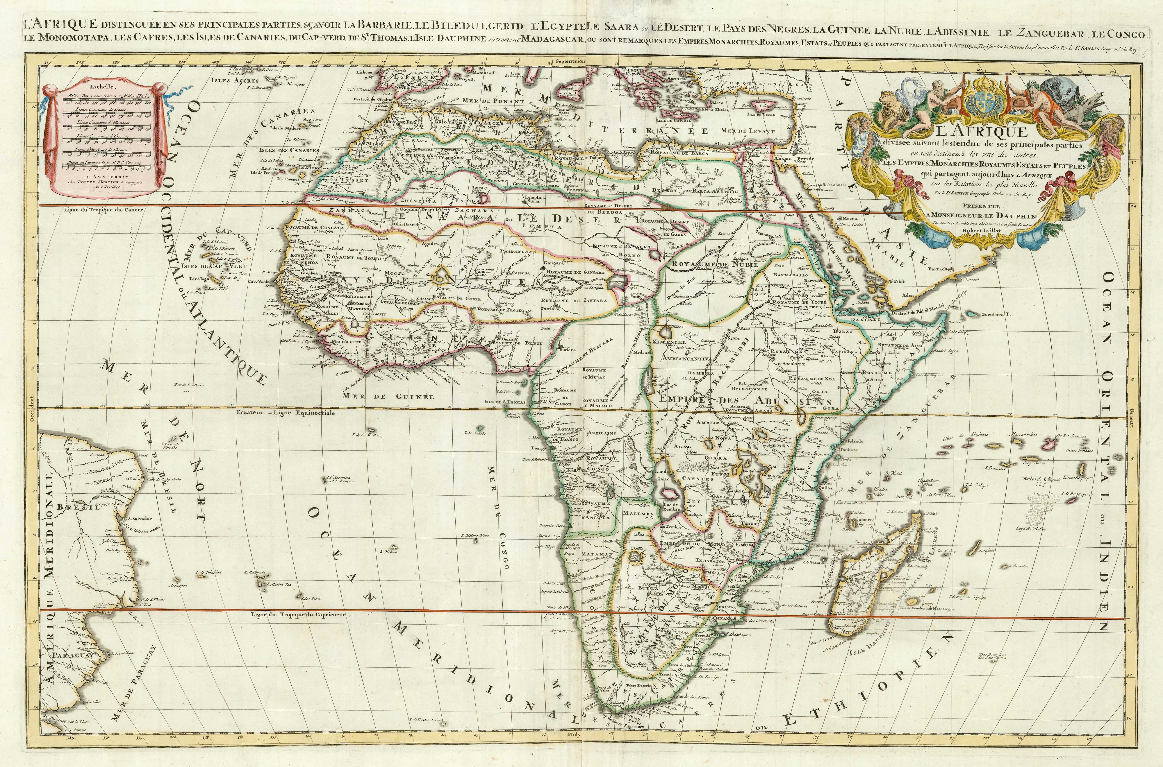
Two-sheet map of Africa
JAILLOT, Alexis-Hubert. Date: 1705 Stock #: 24063 £1,200.00
Add to Wishlist
Add to Wishlist
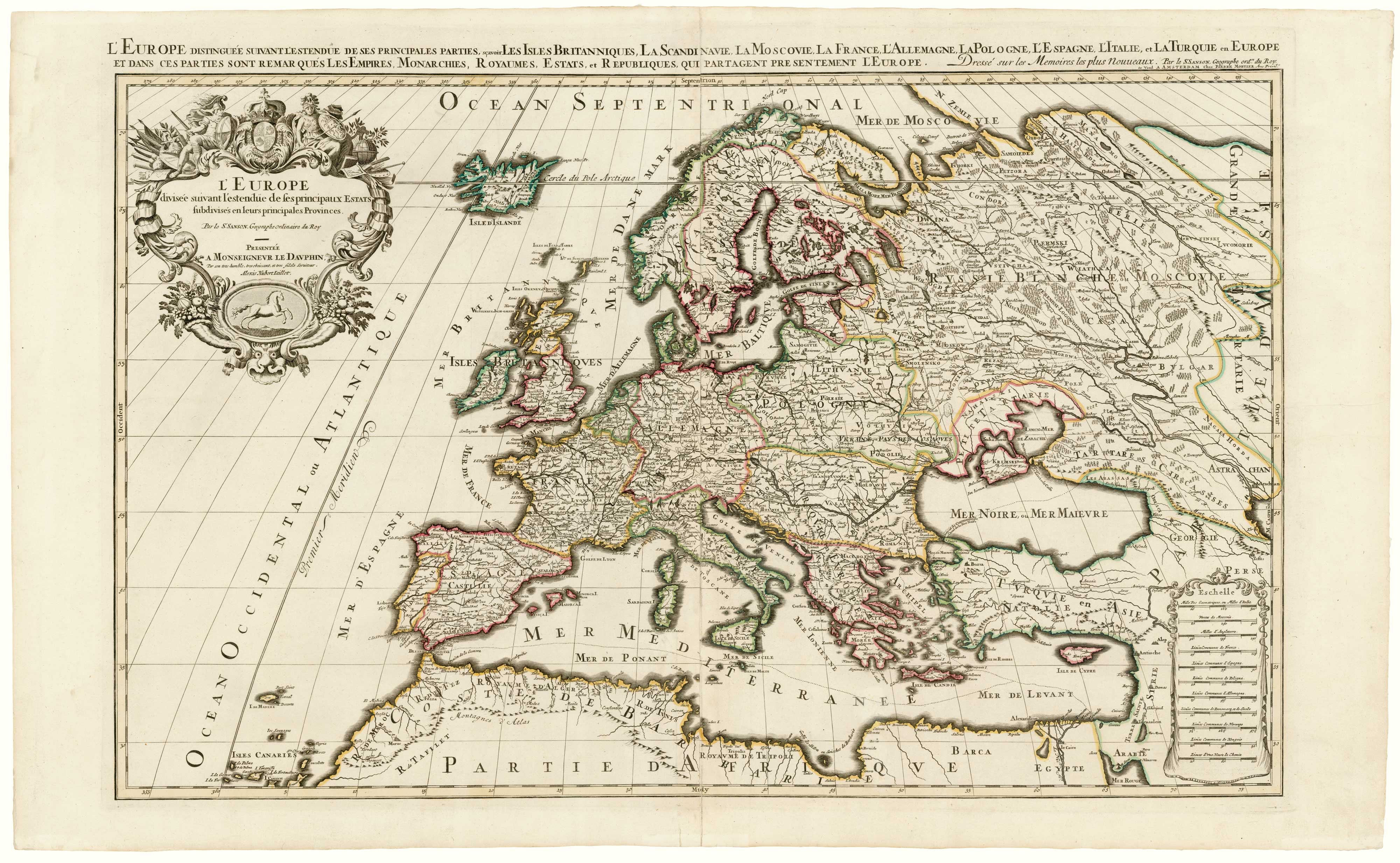
A two-sheet map of Europe
JAILLOT, Alexis-Hubert. Date: 1705 Stock #: 24059 £1,000.00
Add to Wishlist
Add to Wishlist
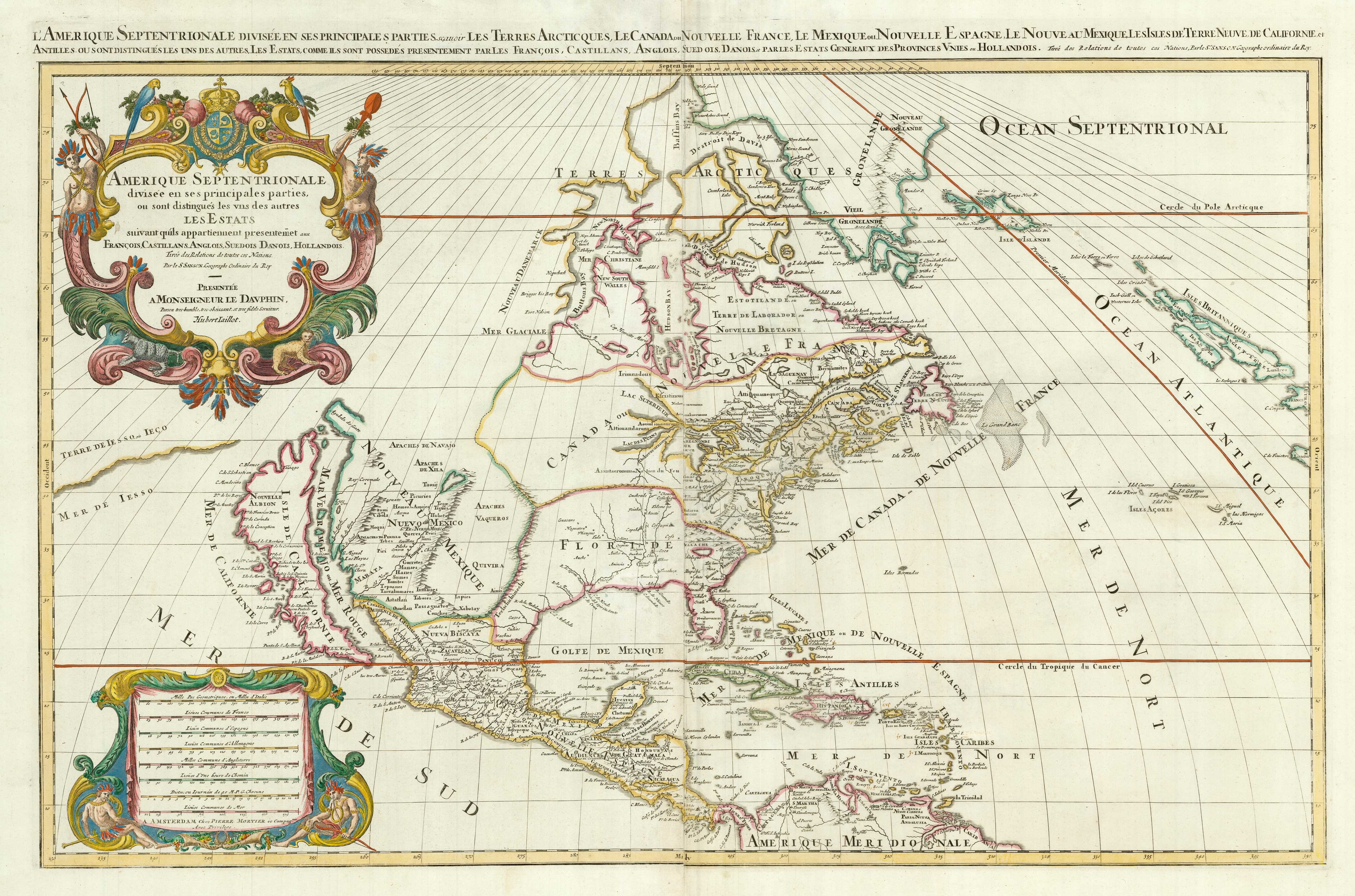
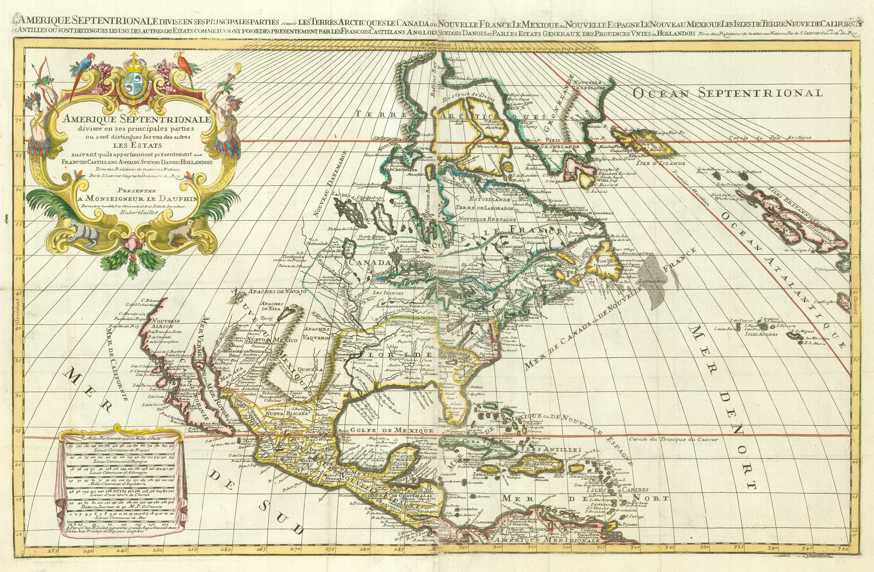
A two-sheet map of North America
JAILLOT, Alexis-Hubert. Date: 1705 Stock #: 24062 £2,950.00
Add to Wishlist
Add to Wishlist