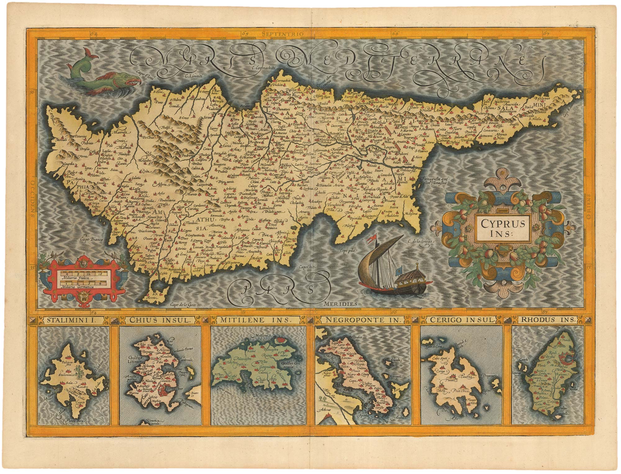


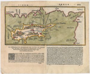
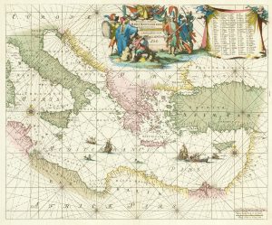
17th century map of Cyprus and the islands of the Aegean in fabulous colour
Cyprus Ins.; Stalimini I.; Chius Insul.; Mitilene Ins.; Negroponte In.; Cerigo Insul.; Rhodus Ins.
Amsterdam: Henricus Hondius, 1623, Latin text edition. Original colour. 355 x 490mm.
£1,800.00
1 in stock
x
Question About This Item?
17th century map of Cyprus and the islands of the Aegean in fabulous colour & HONDIUS, Jodocus.Stock #: 23015
Add to Wishlist
Export as PDFEnquireSimilar to Sell?Add to Wishlist
Description
An early example of this map of Cyprus with six inset maps of other Aegean islands underneath: Lemnos, Chios, Mitiline, Euboea, Kythira & Rhodes. In the seas of the main map are two strapwork cartouches, a sea-monster and a galley flying a Crescent Moon flag.
Condition:
A good example.References:
KOEMAN: 1:105.; BAYNTON-WILLIAMS & SCUTARI: 48.xi.Related products
-
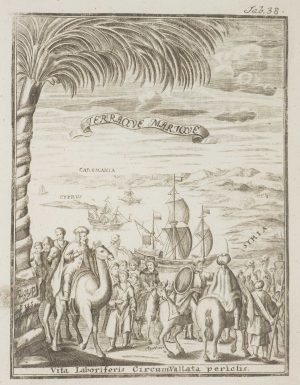
Frontispiece from ‘Peregrinus in Jerusalem’
MYLLER, Angelicus Maria. Date: 1735Stock #: 17187 £160.00 -
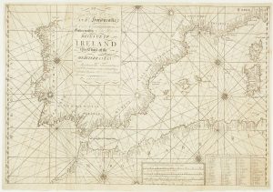
A scarce Irish chart of the Western part of the Mediterranean
GRIERSON, George Date: 1735Stock #: 14456 £2,000.00 -
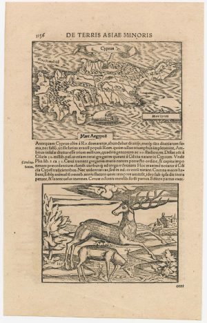
16th century woodblock map of Cyprus
MUNSTER, Sebastian. Date: 1572Stock #: 23057 £280.00 -
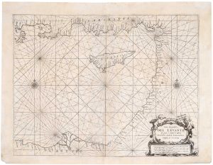
A 17th century sea chart of the Eastern Mediterranean Sea
LEVANTO, Francesco Maria. Date: 1696Stock #: 19694 £1,200.00 -
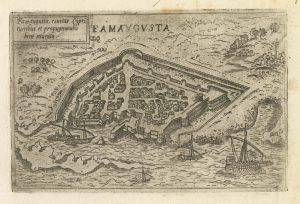
A rare 16th century Italian plan of Famagusta
VALEGIO, Francesco. Date: 1598Stock #: 24148 £950.00 -
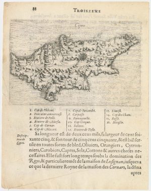
The second printed map of Cyprus
BORDONE, Benedetto. Date: 1565Stock #: 23466 £3,600.00 -
A 17th century chart of the eastern Mediterranean in fine colour.
DE WIT, Frederick. Date: 1745Stock #: 24490 £1,600.00 -
A scarce miniature map of Cyprus
BEAUVAU, Henri de. Date: 1615Stock #: 23468 £1,600.00 -
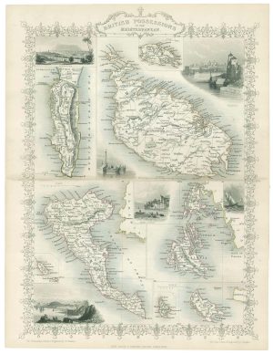
Mid 19th map of British possessions in the Mediterranean
TALLIS, John. Date: 1851Stock #: 17748 £170.00
Items by the same author
Add to Wishlist
Add to Wishlist
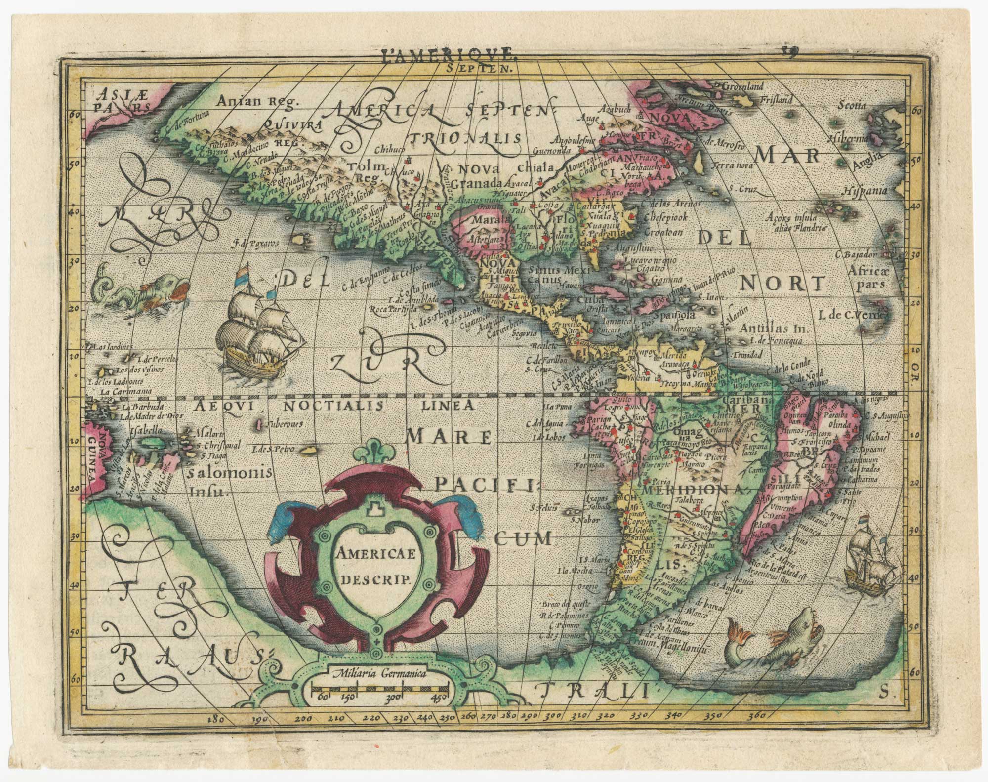
Early 17th century miniature map of America
HONDIUS, Jodocus. Date: 1610 Stock #: 25064 £750.00
Add to Wishlist
Add to Wishlist
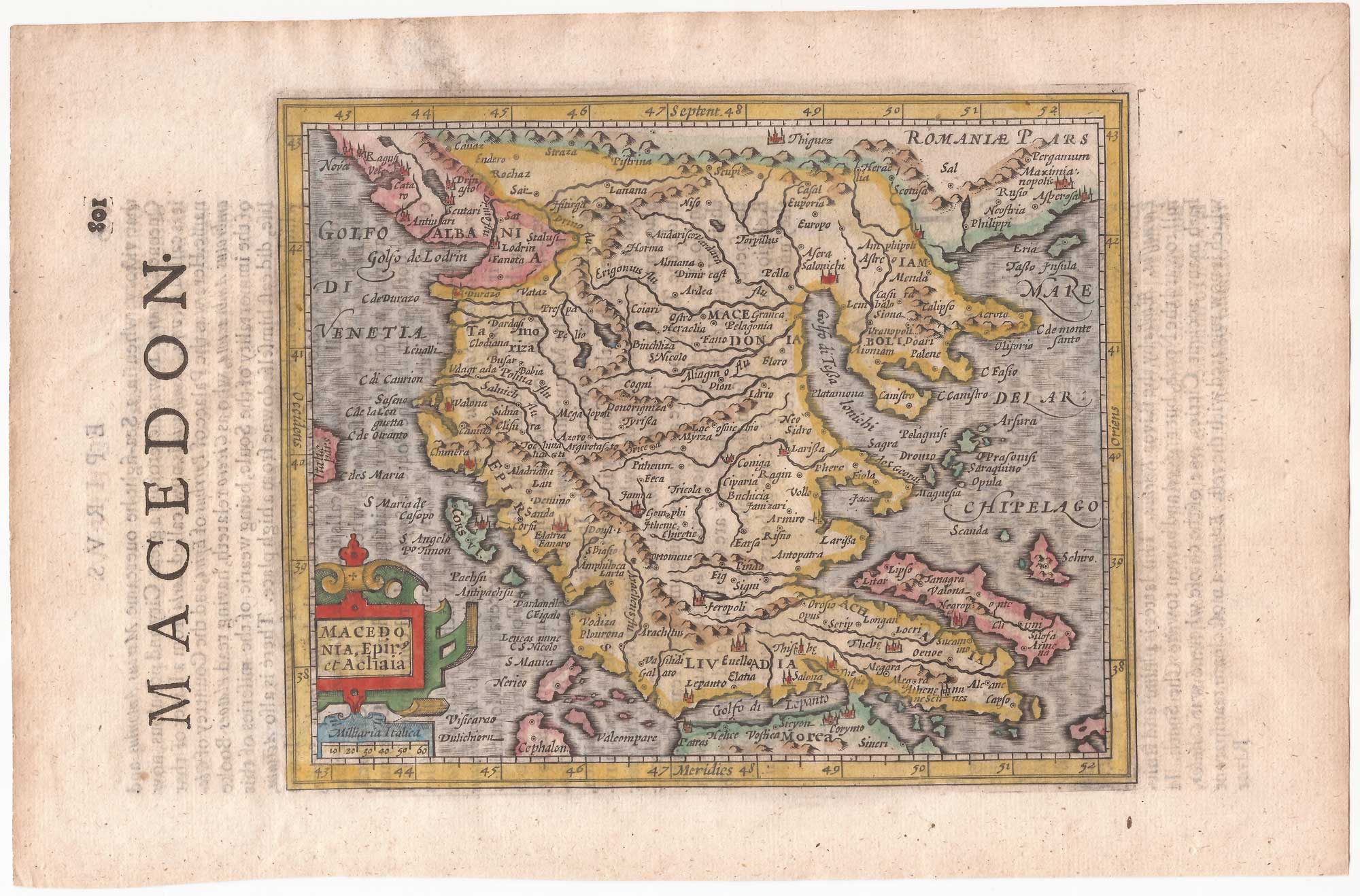
Northern Greece from the first English Edition of the 'Atlas Minor'
HONDIUS, Jodocus. Date: 1635 Stock #: 22452 £110.00
Add to Wishlist
Add to Wishlist
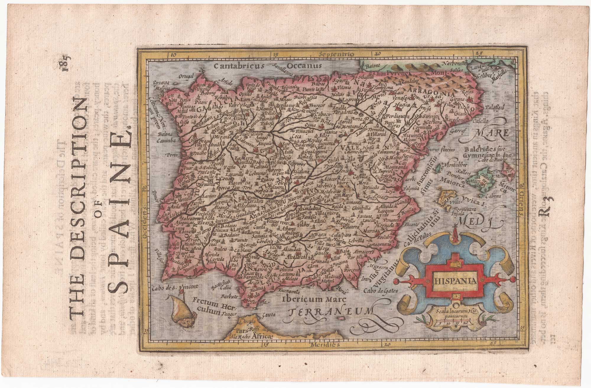
Spain from the first English Edition of the 'Atlas Minor'
HONDIUS, Jodocus. Date: 1635 Stock #: 22394 £240.00
Add to Wishlist
Add to Wishlist
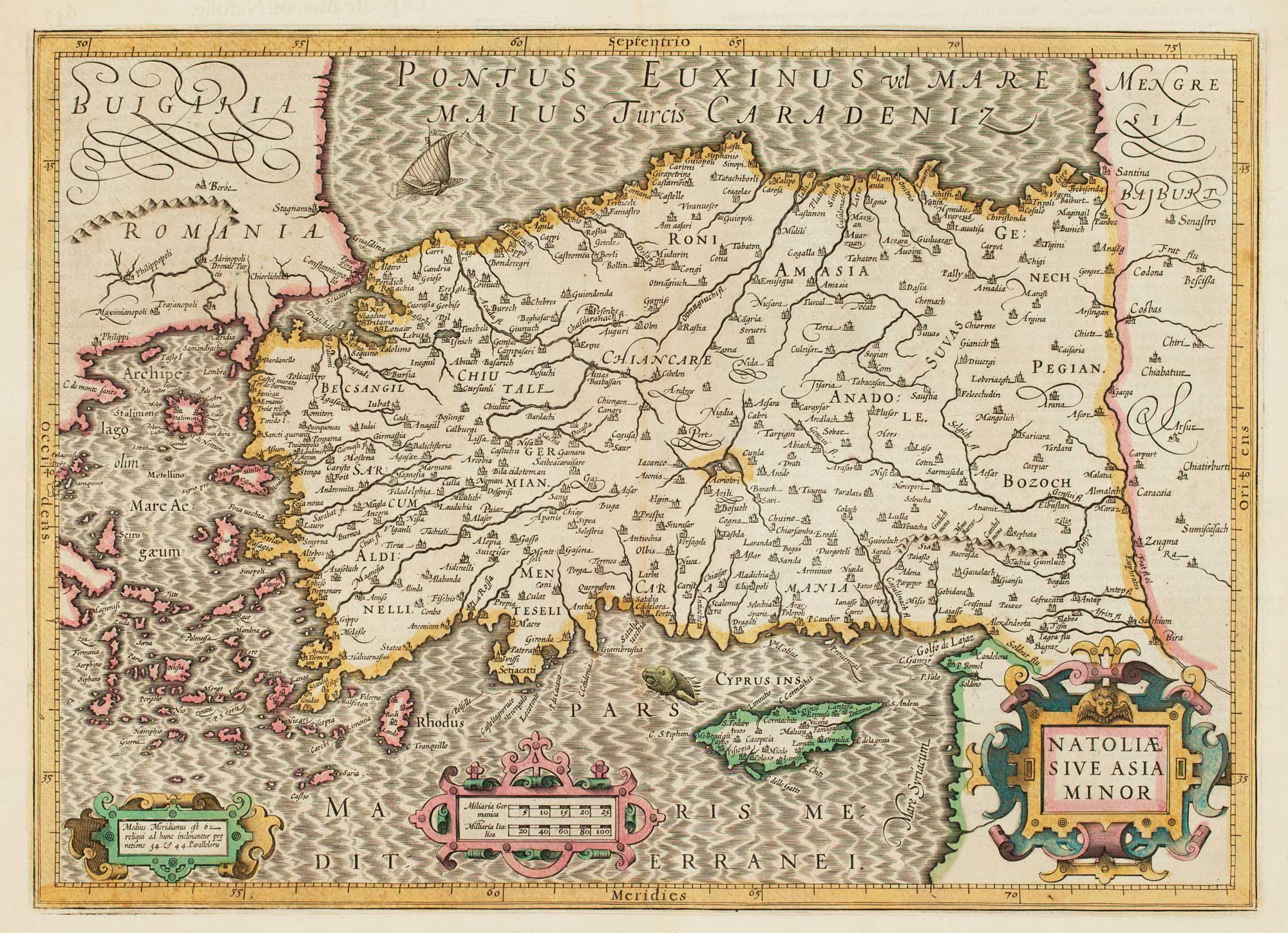
17th century map of Turkey with Cyprus
HONDIUS, Jodocus. Date: 1628 Stock #: 16468 £550.00
Add to Wishlist
Add to Wishlist
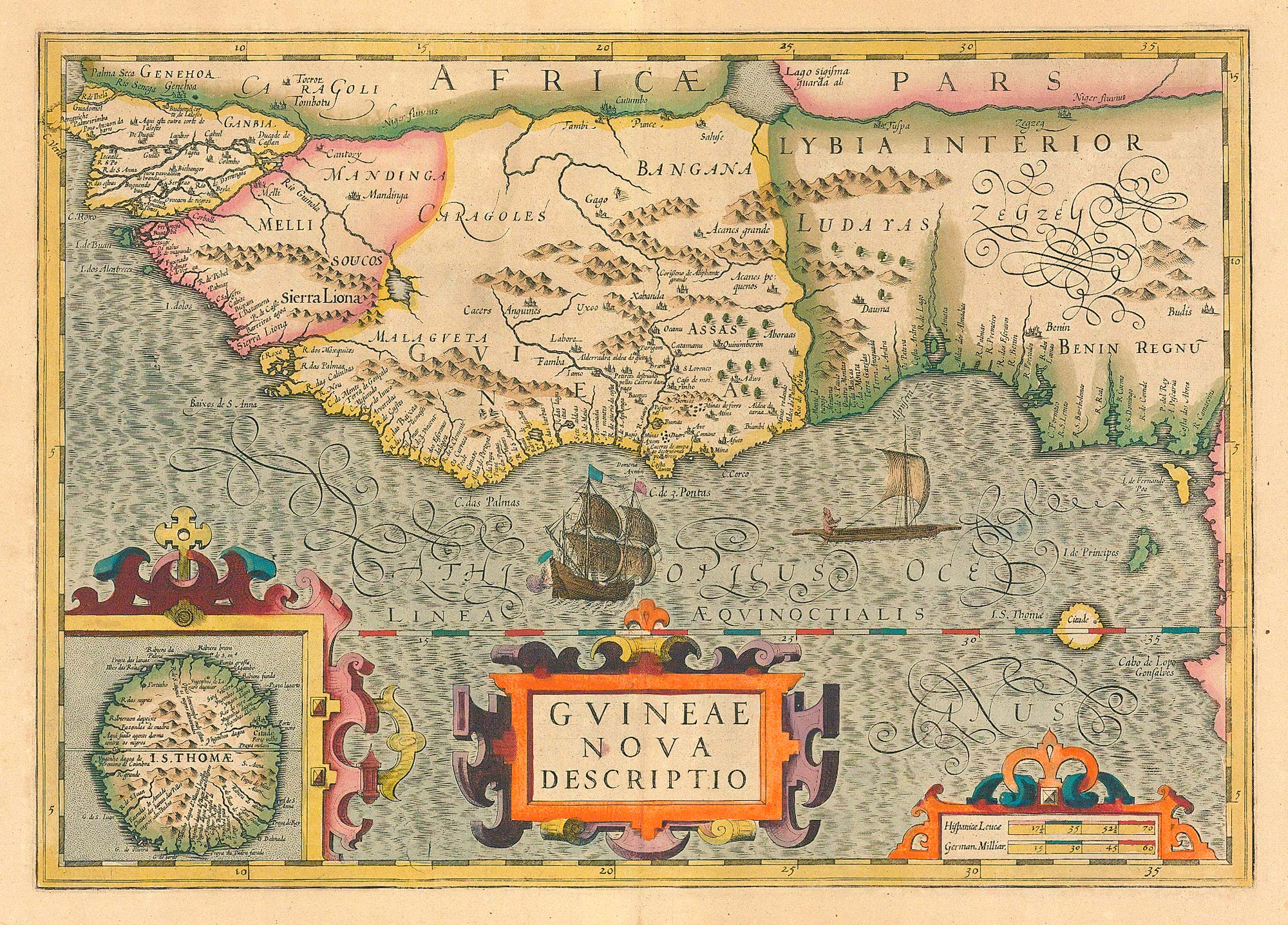
Early 17th century map of the Guinea coast.
HONDIUS, Jodocus. Date: 1636 Stock #: 24809 £450.00
Add to Wishlist
Add to Wishlist