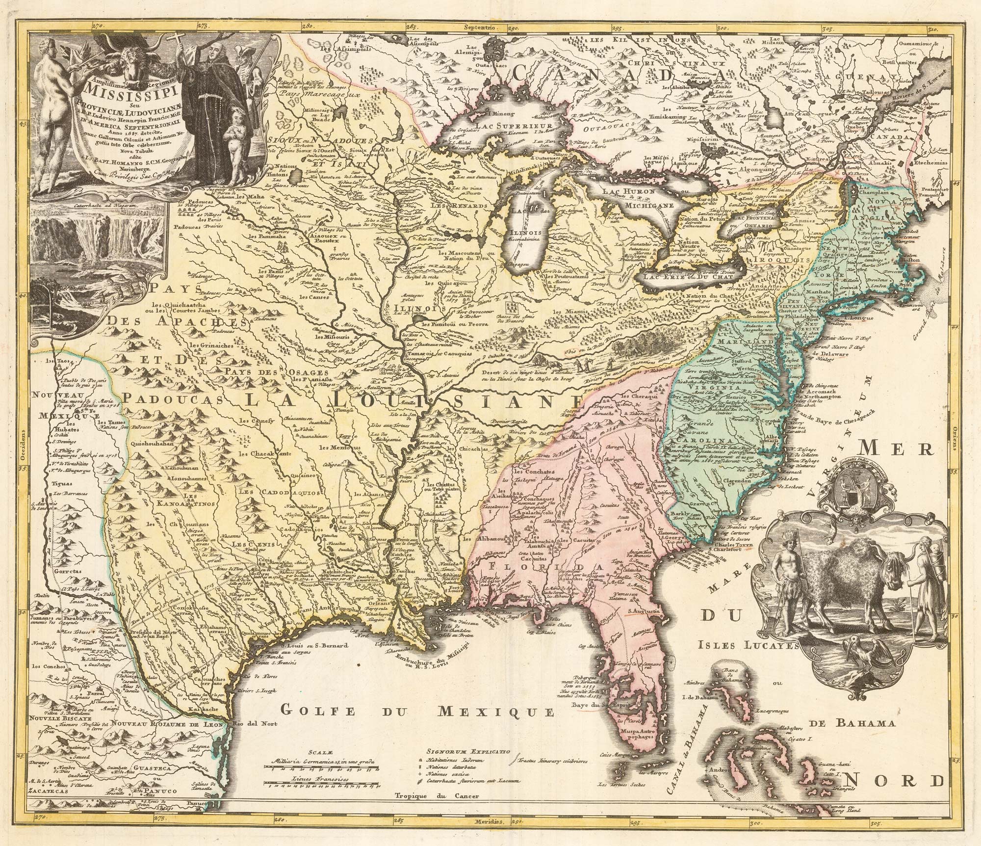


‘The Buffalo map’ of the Mississippi
Amplissimae Regionis Mississipi seu Provinciae Ludovicianae..
Nuremberg, c.1720. Original colour. 480 x 590mm.
£2,000.00
1 in stock
x
Question About This Item?
‘The Buffalo map’ of the Mississippi & HOMANN, Johann Baptist.Stock #: 24427
Add to Wishlist
Export as PDFEnquireSimilar to Sell?Add to Wishlist
Description
A decorative map designed to show the course of the Mississippi based on Hennepin, but also showing the English colonies in the East, the Spanish in Florida, and the edges of Mexico and Canada. The title is on a buffalo hide, with figures of a native American, a missionary priest and a soldier, with a view of Niagara Falls (described by Hennepin in his book, 'A New Discovery' in 1683) underneath. In the Atlantic near the Bahamas is another vignette of a bison, two natives and a pelican. Avery fine example.
Condition:
A good example.Related products
-
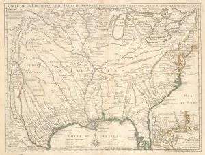
Delisle’s influential map of Louisiana.
DELISLE, Guillaume. Date: 1745Stock #: 25319 £2,500.00 -
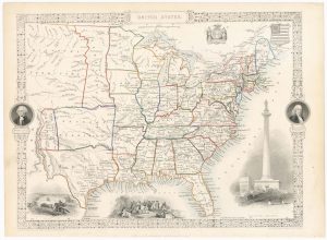
Map of the United States with decorative vignettes
TALLIS, John. Date: 1851Stock #: 23481 £300.00 -
A British military atlas for the American War of Independence
SAYER, Robert & BENNETT, John. Date: 1776Stock #: 18436 £16,000.00 -
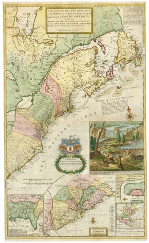
The famous ‘Beaver Map’ of the British Colonies in America
MOLL, Herman. Date: 1731Stock #: 25405 £8,500.00 -
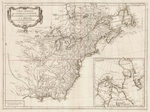
The Eastern Seaboard of North America
SANTINI, Francesco & Paolo. Date: 1776Stock #: 22824 £600.00 -
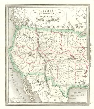
An uncommon Italian map of the western United States
MARMOCCHI, Francesco C. Date: 1858Stock #: 24374 £450.00
Items by the same author
Add to Wishlist
Add to Wishlist

A 18th century plan of Würzburg
HOMANN, Johann Baptist. Date: 1723 Stock #: 25102 £650.00
Add to Wishlist
Add to Wishlist
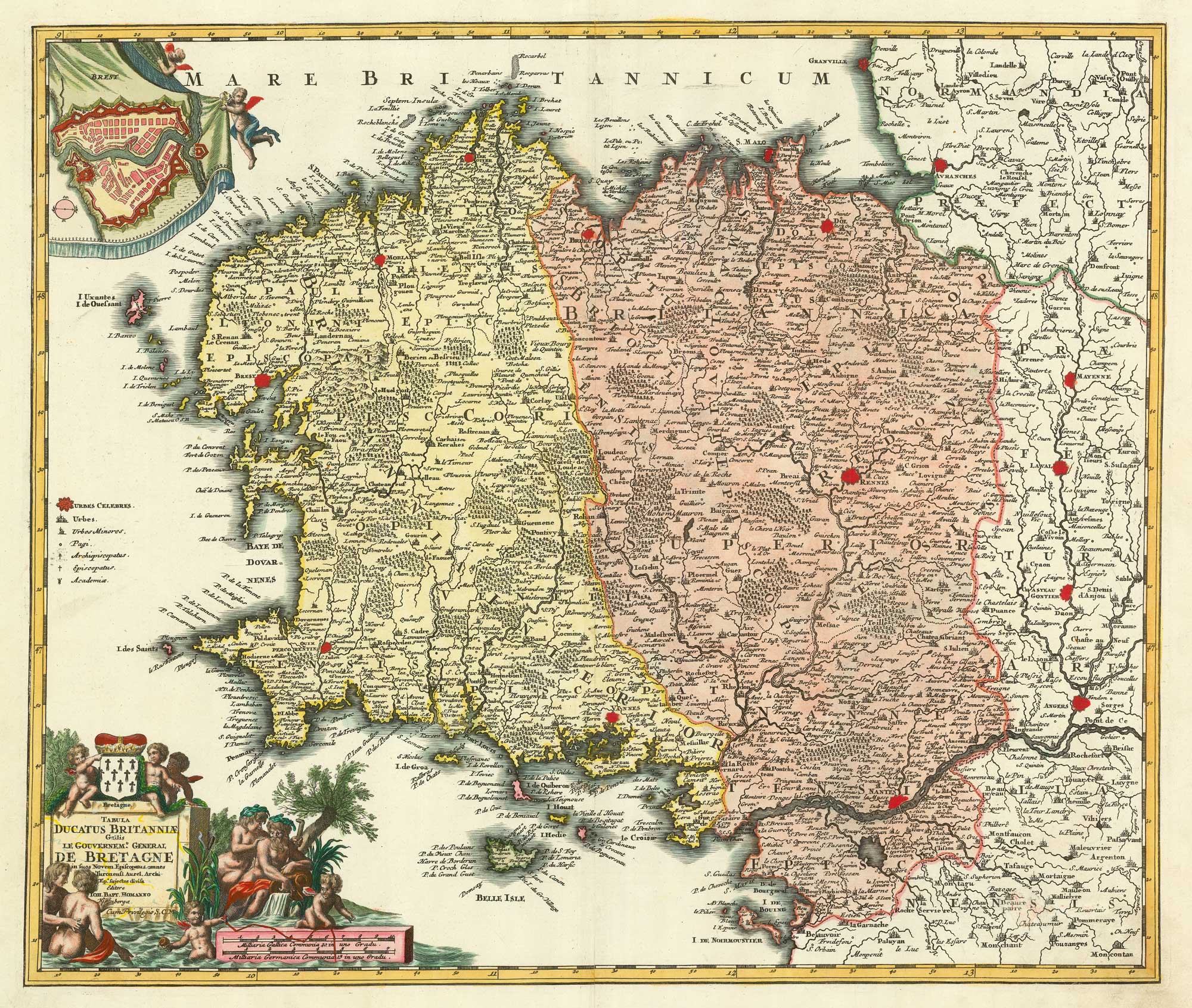
A detailed 18th century map of Brittany
HOMANN, Johann Baptist. Date: 1720 Stock #: 21195 £420.00
Add to Wishlist
Add to Wishlist
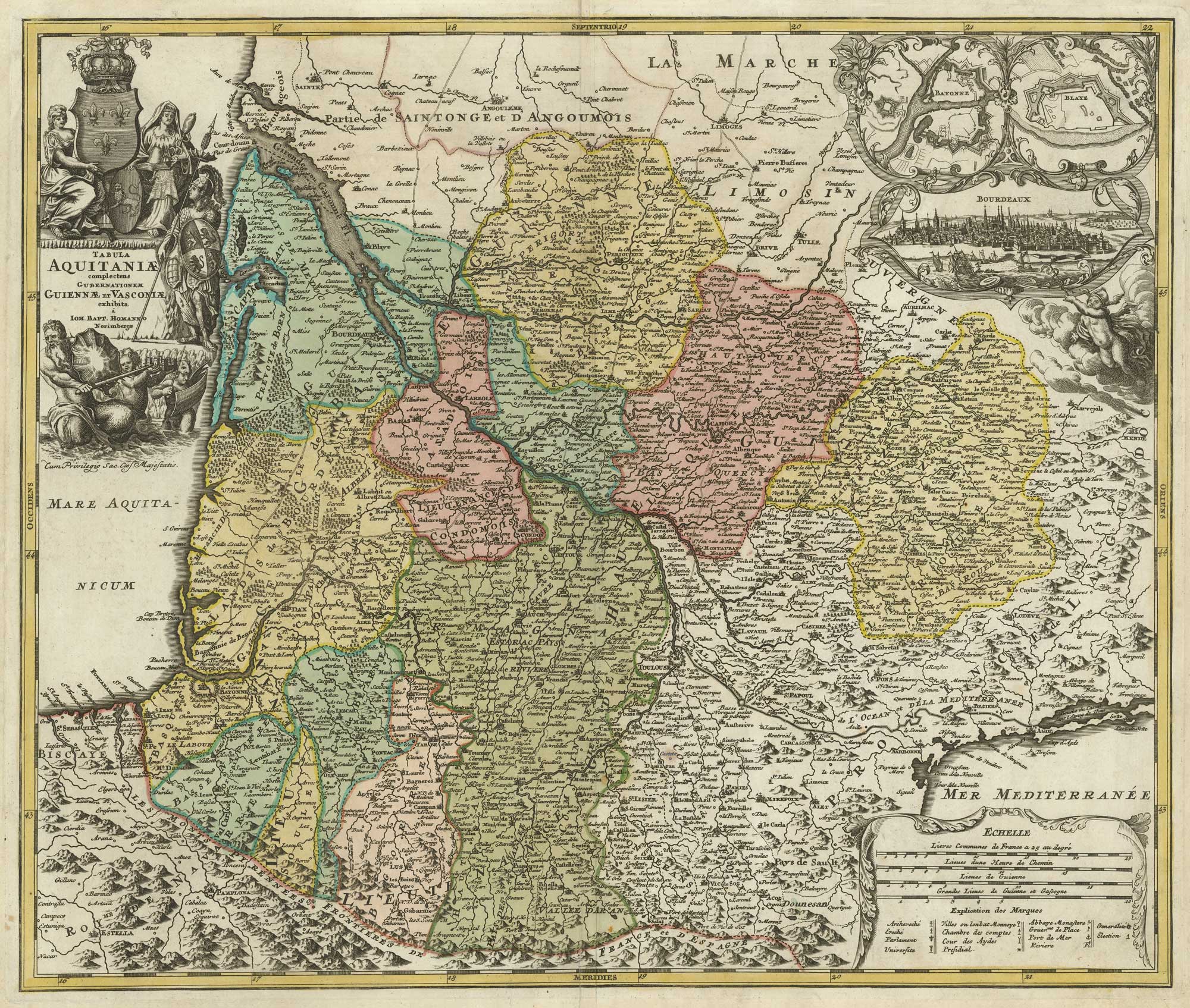
A map of Aquitaine in fine colour
HOMANN, Johann Baptist. Date: 1720 Stock #: 21233 £350.00
Add to Wishlist
Add to Wishlist

18th century map of Holstein
HOMANN, Johann Baptist. Date: 1720 Stock #: 11370 £200.00
Add to Wishlist
Add to Wishlist

18th century map of the Turkish Empire
HOMANN, Johann Baptist. Date: 1720 Stock #: 25258 £650.00
Add to Wishlist
Add to Wishlist