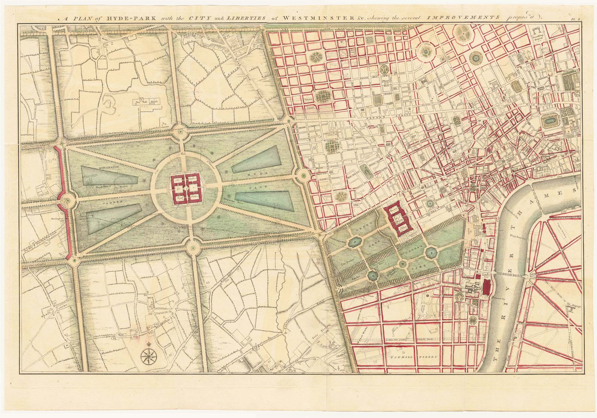


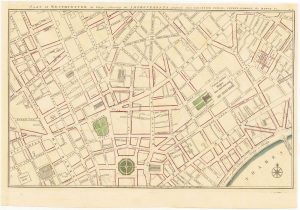
Gwynn’s proposed improvements to Hyde Park and City of Westminster
A Plan of Hyde-Park with the City and Liberties of Westminster &c. shewing the several Improvements propos'd.
London, 1766. Original colour. 330 x 510mm.
£1,250.00
1 in stock
x
Question About This Item?
Gwynn’s proposed improvements to Hyde Park and City of Westminster & GWYNN, JohnStock #: 24085
Add to Wishlist
Export as PDFEnquireSimilar to Sell?Add to Wishlist
Description
Rare plan showing John Gwynn's proposed improvements to Hyde Park and Westminster and the areas around it, including Mayfair, St. James's, Marylebone, Bloomsbury, Covent Garden and a part of South Bank. He plans two royal palaces, one in the middle of Hyde Park and one between Green Park and St. James Street. The red lines show an intention to regularize the street plan, replacing the irregular streets with a gridlike formation.
This map is one of four plans published by the Architect John Gwynn in his work 'London and Westminster Improved, Illustrated by Plans', in which he advocates a completely new street layout involving huge efforts and demolition of many buildings in the area. He calls for the commissioning of public works from British artists, and integrated urban planning for London. According to the Royal Academy "his proposals and maps foreshadow such developments as Regent Street, Waterloo Bridge, the Thames Embankment and Trafalgar Square".
Condition:
Trimmed to platemark on left and top edge. Minor repairs, cracks in old folds.Related products
-
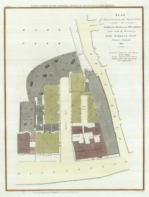
A plan to redevelop the corner of Park Lane and Piccadilly
BASIRE, James. Date: 1809Stock #: 21673 £500.00 -
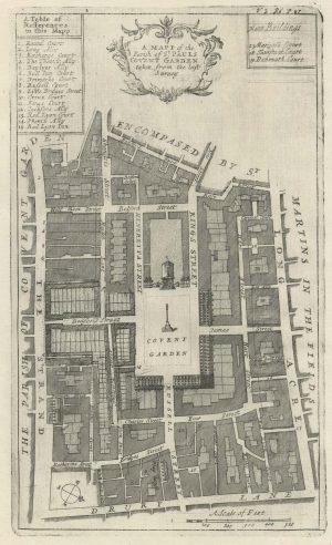
A plan of Covent Garden at the end of the 17th century
BLOME, Richard. Date: 1720Stock #: 25170 £200.00 -

A detailed plan of Fitzrovia with a view of the ‘New Road’
HORWOOD, Richard. Date: 1794Stock #: 16924 £750.00 -
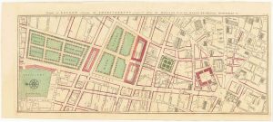
Gwynn’s proposed improvements for modern Leicester-Square and Covent Garden.
GWYNN, John Date: 1766Stock #: 24129 £700.00 -
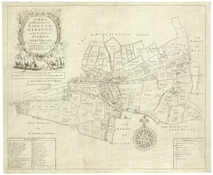
A rare map of Mile End
GASCOYNE, Joel. Date: 1636Stock #: 21198 £3,500.00 -
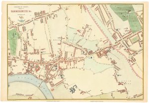
Victorian map of Hammersmith
WELLER, Edward. Date: 1863Stock #: 24800 £250.00 -
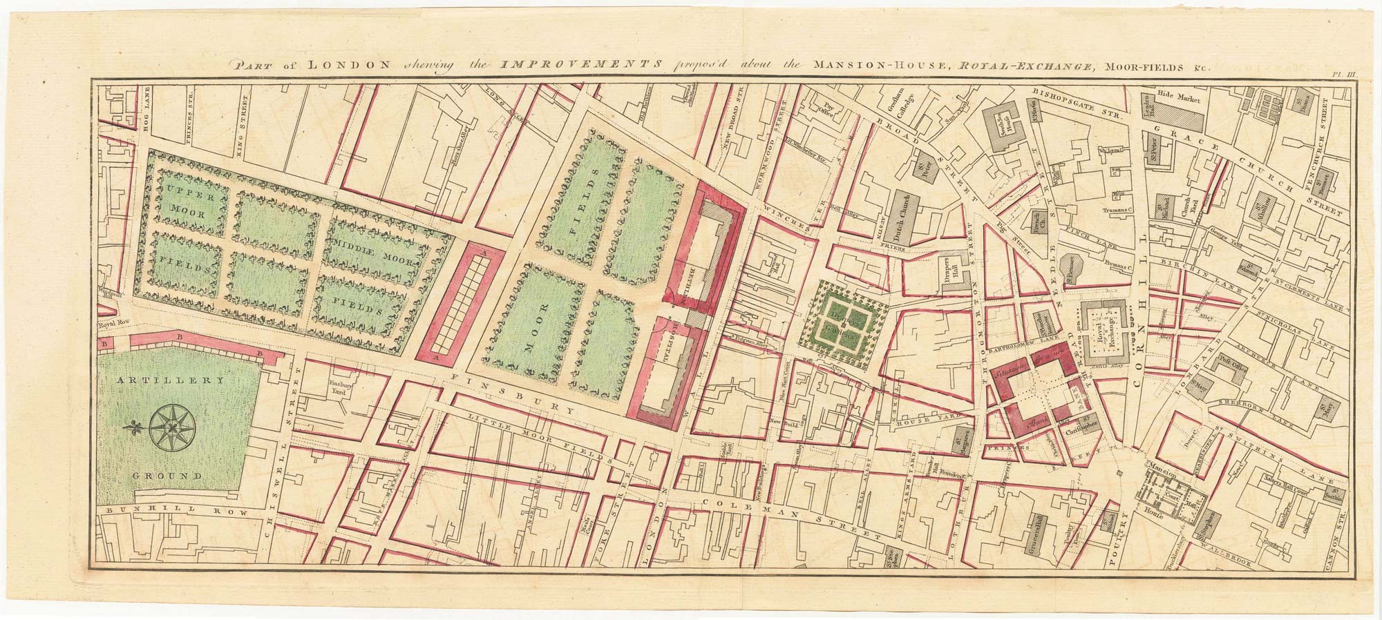
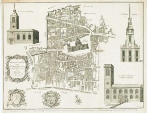
Gwynn’s proposed improvements between modern Moorgate and Bank.
GWYNN, John Date: 1766Stock #: 24084 £300.00 -
Ward map of Baynards Castle & Faringdon Ward showing St Pauls
COLE, Benjamin. Date: 1755Stock #: 17009 £280.00 -
A detailed plan of Tower Street Ward
STOW, John. Date: 1720Stock #: 22004 £200.00
Items by the same author
Add to Wishlist
Add to Wishlist

Gwynn's proposed improvements for modern Leicester-Square and Covent Garden.
GWYNN, John Date: 1766 Stock #: 24129 £700.00
Add to Wishlist
Add to Wishlist

Gwynn's proposed improvements to London Bridge and Custom House
GWYNN, John Date: 1766 Stock #: 24128 £500.00
Add to Wishlist
Add to Wishlist