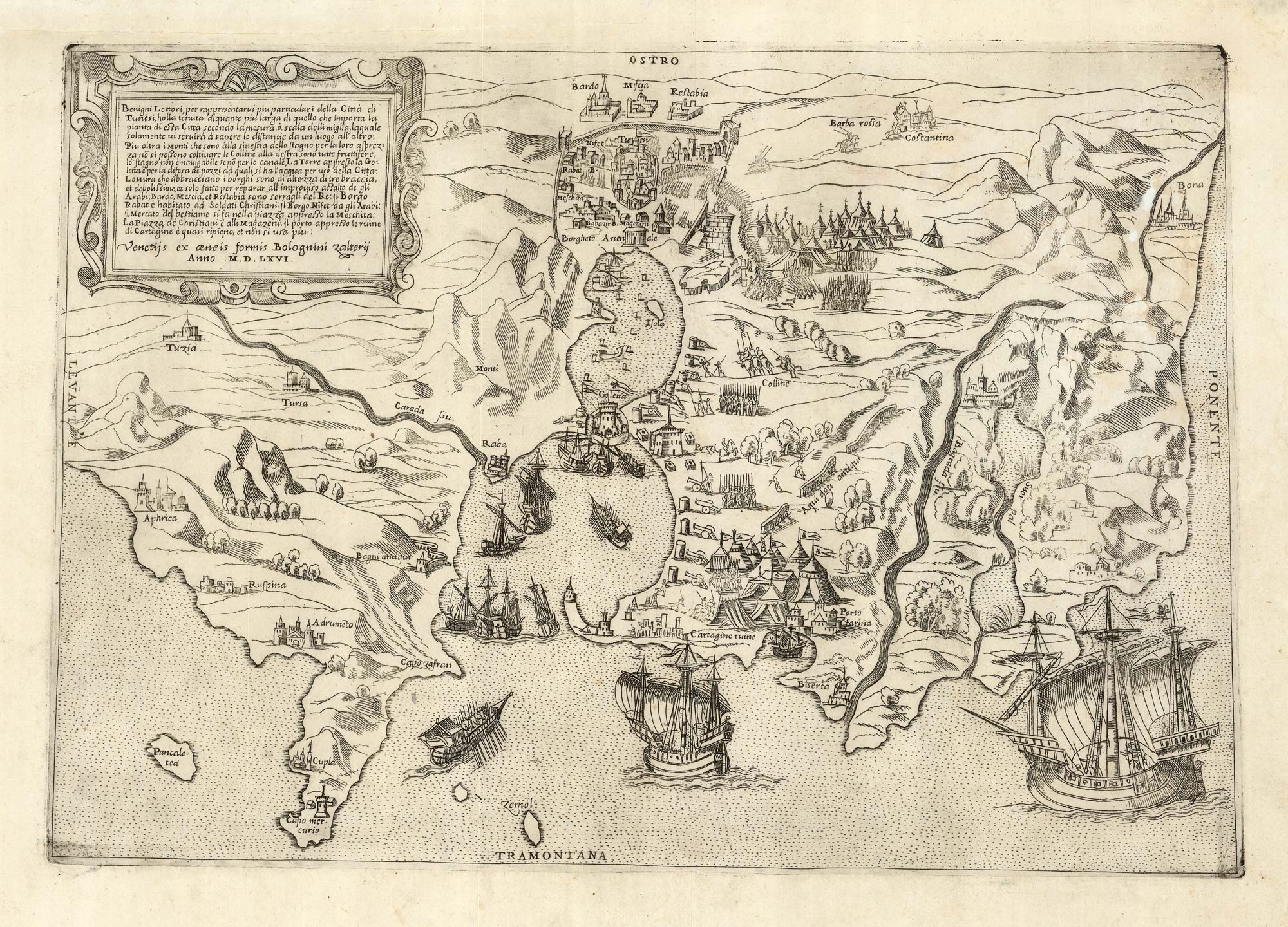


A 16th century plan of Tunis besieged by the Spanish in 1535
... Città di Tunesi ...
Venice: Bolognino Zaltieri, 1566. 270 x 390mm.
£1,500.00
1 in stock
x
Question About This Item?
A 16th century plan of Tunis besieged by the Spanish in 1535 & FORLANI, Paolo.Stock #: 25209
Add to Wishlist
Export as PDFEnquireSimilar to Sell?Add to Wishlist
Description
A bird's-eye view of Tunis, orientated with north to the bottom, showing the city under siege by Holy Roman Emperor Charles V . The harbour and approaches are filled with European galleons and galleys, with Ottoman camps and batteries around the city. Also marked are the ruins of Carthage and the location of a ruined aqueduct.
The map was engraved by Paolo Forlani from a map by Agostino de Musi published shortly after the siege. This version was published during renewed Ottoman activity in the area: in 1569, less than three years later, Occhiali, the Italian admiral of the Ottoman navy, retook the city.
Condition:
Tear in top margin taped.References:
BIFOLCO & RONCA: Tav 146, state ii of iv, first published state.Related products
-
An 18th century chart of Tunis
ROUX, Joseph. Date: 1764Stock #: 21743 £75.00 -
An 18th century map of Northwest Africa
CHATELAIN, Henri Abraham. Date: 1720Stock #: 22881 £340.00 -
Early 17th century map of central Africa
HONDIUS, Jodocus. Date: 1608Stock #: 23220 £200.00 -
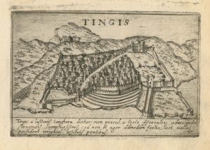
A 16th century town plan of Tangier
VALEGIO, Francesco. Date: 1598Stock #: 24217 £220.00 -
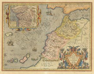
A 16th century map of Morocco
ORTELIUS, Abraham. Date: 1601Stock #: 23718 £700.00 -
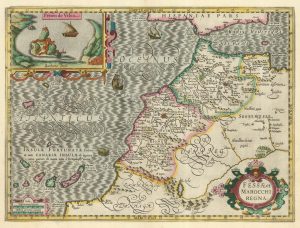
A 17th century map of Morocco in fine original colour
HONDIUS, Jodocus. Date: 1630Stock #: 22653 £650.00 -
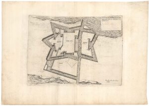
A plan of Philip II’s fortress of Goletta in Tunis
LAFRERI, Antonio. Date: 1698Stock #: 25314 £750.00 -
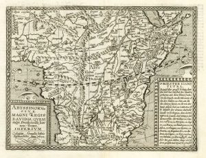
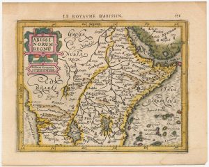
Map of Abyssinia with the Kingdom of Prester John
QUAD, Matthias. Date: 1600Stock #: 18351 £500.00 -

Miniature map of Mauretania & the Sahara
DU VAL, Pierre. Date: 1682Stock #: 10828 £80.00
Items by the same author
Add to Wishlist
Add to Wishlist