


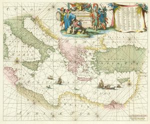
A detailed 18th century chart of the Mediterranean Sea
Carte de la Mer Méditerranée. 1785.
Paris, 1785. Two sheets conjoined, dissected and laid on linen as issued. 550 x 1070mm.
£1,200.00
1 in stock
x
Question About This Item?
A detailed 18th century chart of the Mediterranean Sea & DUPUIS, Louis André.Stock #: 18383
Add to Wishlist
Export as PDFEnquireSimilar to Sell?Add to Wishlist
Description
A large and detailed sea-chart of the Mediterranean. The same year Dupuis published similar charts of the Baltic, Black Sea and the Danube.
Condition:
A good example.Related products
-
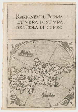
A rare 16th century miniature map of Cyprus
FERRETTI, Francesco. Date: 1579Stock #: 21835 £1,400.00 -
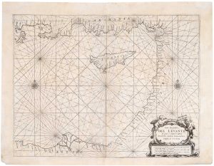
A 17th century sea chart of the Eastern Mediterranean Sea
LEVANTO, Francesco Maria. Date: 1696Stock #: 19694 £1,200.00 -
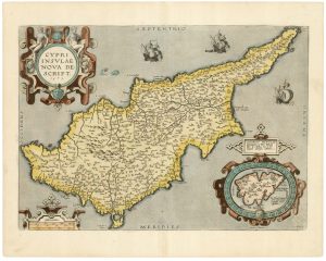
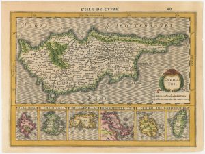
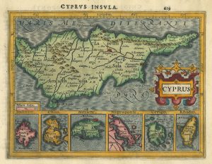
A classic 16th century Dutch map of Cyprus
ORTELIUS, Abraham. Date: 1595Stock #: 23815 £1,600.00 -
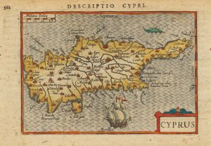
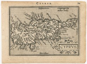
Early 17th century miniature map of Cyprus
BERTIUS, Petrus. Date: 1603Stock #: 20994 £380.00 -
A 17th century chart of the eastern Mediterranean in fine colour.
DE WIT, Frederick. Date: 1745Stock #: 24490 £1,600.00 -
The scarce second Galle plate for Cyprus used in the ‘Epitome’
ORTELIUS, Abraham. Date: 1598Stock #: 23195 £500.00 -
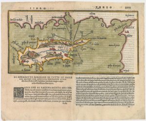
The second printed map of Cyprus
BORDONE, Benedetto. Date: 1565Stock #: 23466 £3,600.00 -
The first issue of a scarce 17th century miniature map of Cyprus
CLOPPENBURG, Johannes. Date: 1630Stock #: 23014 £720.00 -
Miniature map of Cyprus and the islands of the Aegean
HONDIUS, Jodocus II. Date: 1610Stock #: 24510 £350.00
Items by the same author
Add to Wishlist
Add to Wishlist
