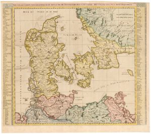
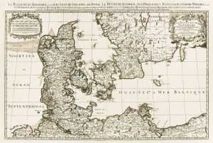
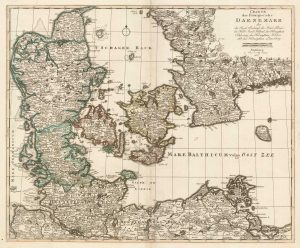
17th century French map of Denmark
Carte du Royaume de Danemarq, et de la partie Meridionale de la Gotie.
Paris, 1686. Original colour. 410 x 550mm.
£200.00
Description
Detailed map of Denmark, including both Schleswig & Holstein.
Condition:
A good example.Related products
-
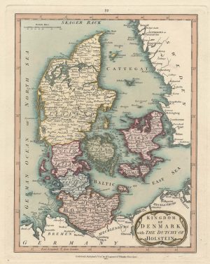
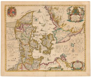
An early 18th century map of Denmark
CHATELAIN, Henri Abraham. Date: 1719Stock #: 22887 £320.00 -
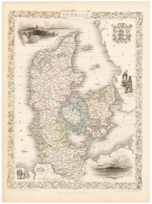
A mid 19th century map of Denmark with decorative vignettes
TALLIS, John. Date: 1851Stock #: 21622 £125.00 -
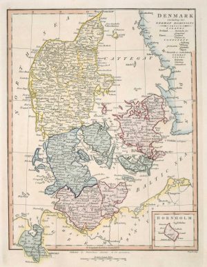
Map of Denmark
WILKINSON, Robert. Date: 1828Stock #: 17580 £50.00 -
An early 19th century map of Denmark in fine colour
LAURIE & WHITTLE. Date: 1801Stock #: 22819 £160.00 -
A two-sheet map of Denmark
JAILLOT, Alexis-Hubert. Date: 1700Stock #: 8323 £450.00 -
An 18th century map of Denmark
SEUTTER, Matthaus. Date: 1730Stock #: 24692 £200.00 -
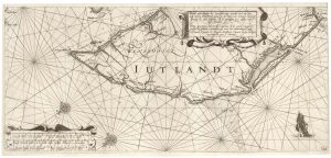
A rare 17th century sea chart of Jutland
JANSSON, Jan. Date: 1620Stock #: 25262 £2,000.00 -
Scarce map of Denmark
WALCH, Johann. Date: 1820Stock #: 21119 £400.00 -
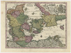
A separately-issued map of Denmark, the earliest dated map by de Wit
DE WIT, Frederick. Date: 1659Stock #: 23255 £750.00
Items by the same author
Add to Wishlist
Add to Wishlist
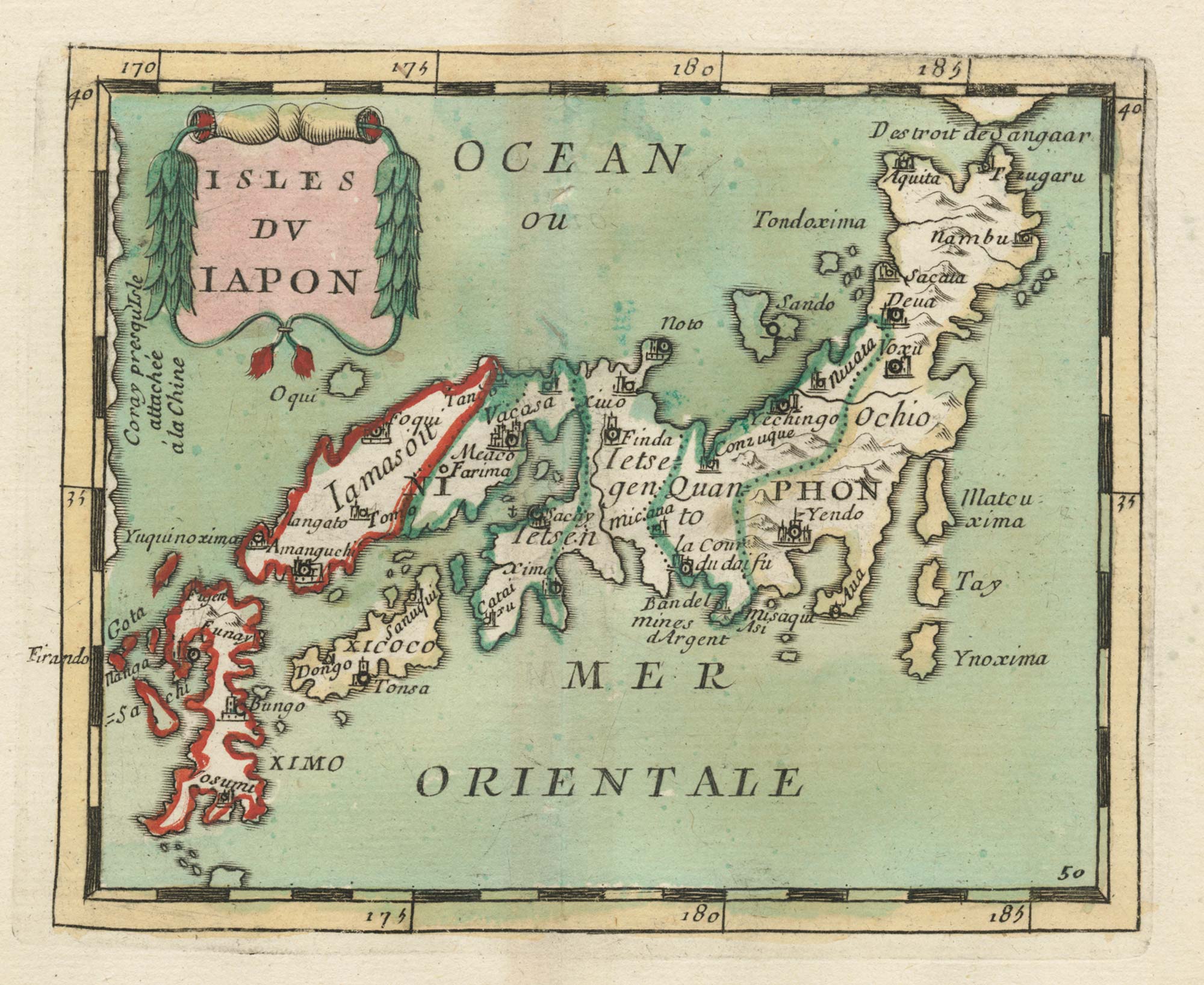
17th century miniature map of Japan
DU VAL, Pierre. Date: 1690 Stock #: 24849 £380.00
Add to Wishlist
Add to Wishlist

Crete with a plan of Heraklion under siege by the Ottomans
DU VAL, Pierre. Date: 1677 Stock #: 24834 £550.00
Add to Wishlist
Add to Wishlist
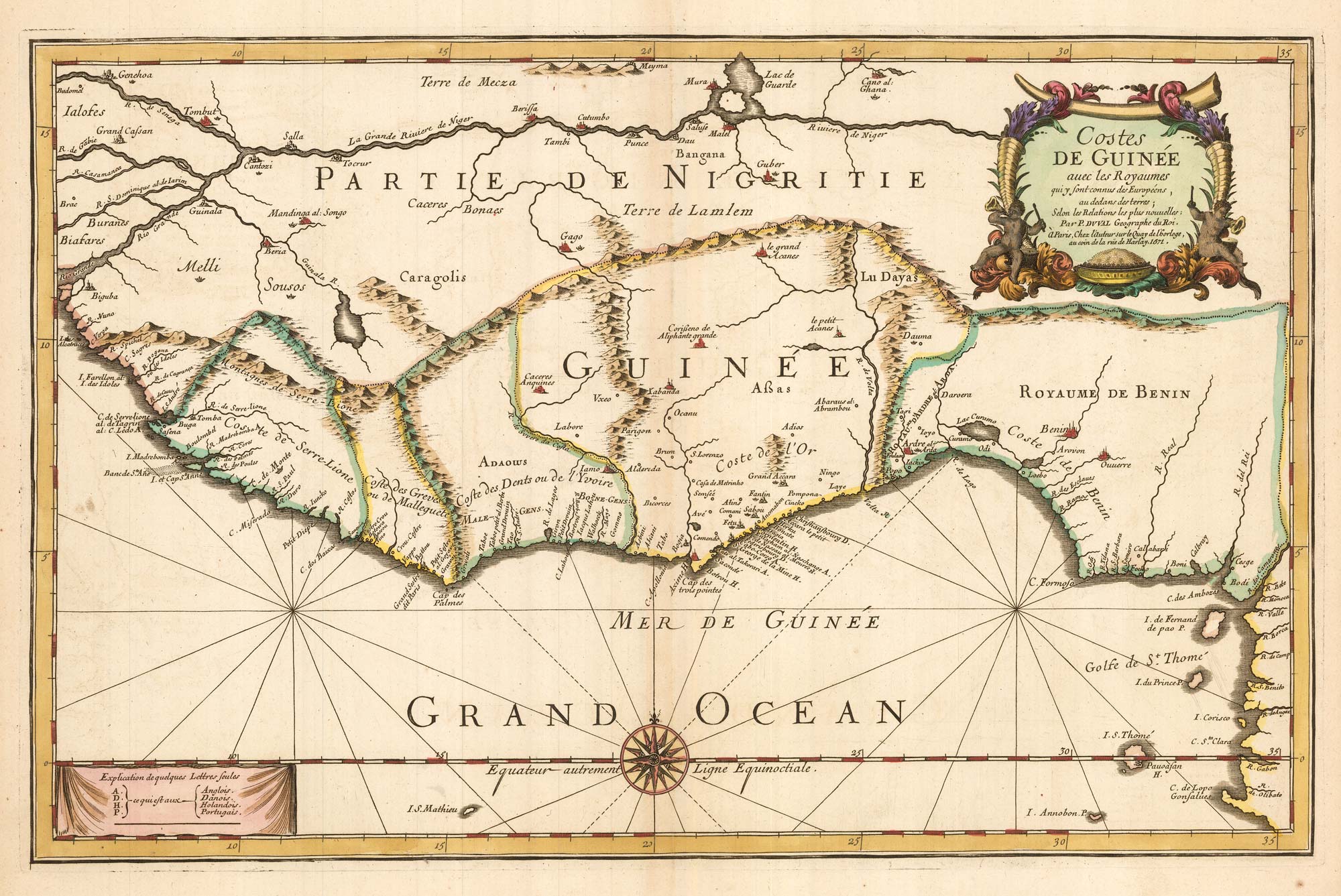
Du Val's folio map of the slave forts of the Gulf of Guinea
DU VAL, Pierre. Date: 1671 Stock #: 23256 £480.00
Add to Wishlist
Add to Wishlist
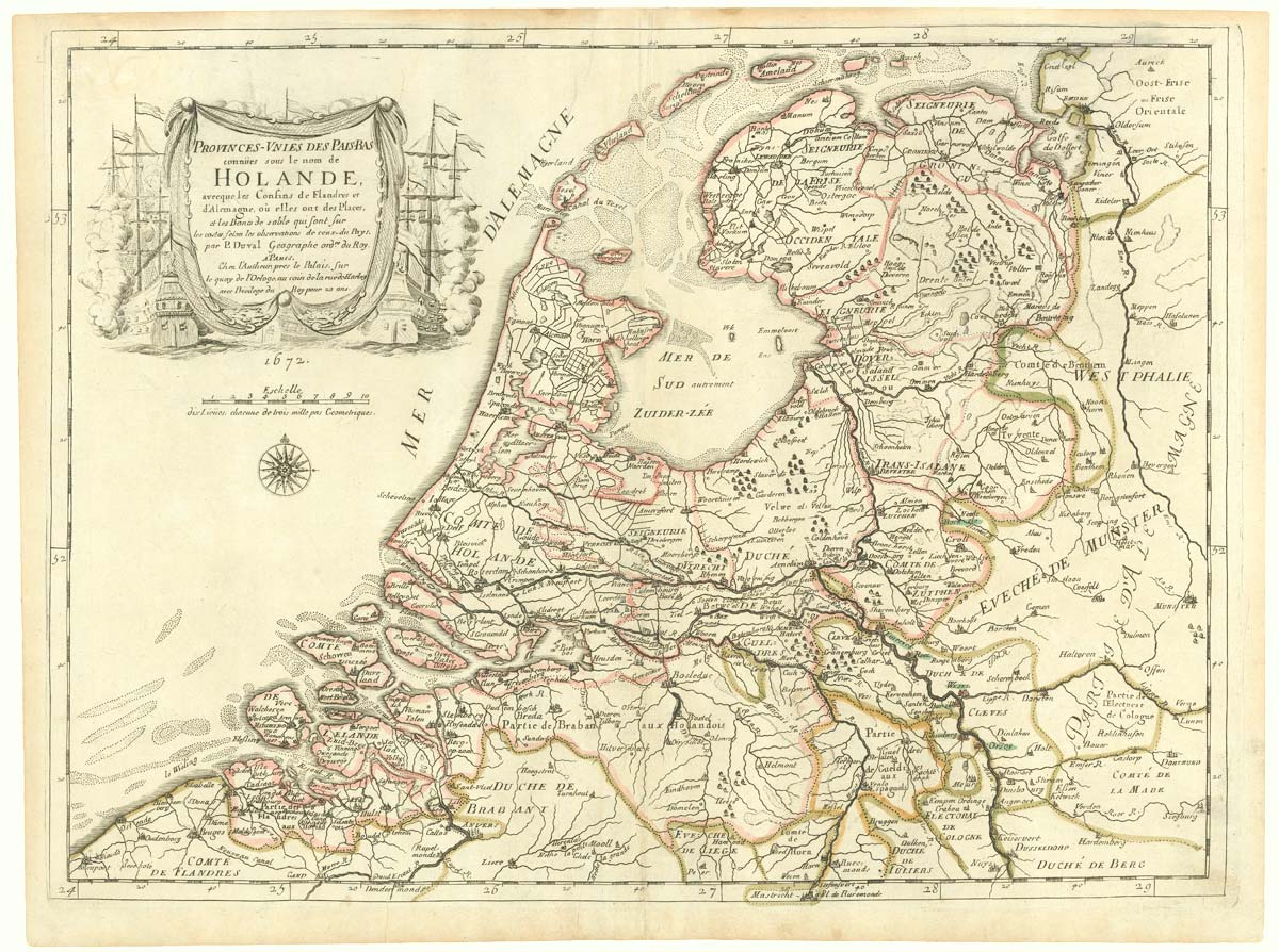
The Netherlands during the Anglo-Dutch War of 1672
DU VAL, Pierre. Date: 1672 Stock #: 20503 £900.00
Add to Wishlist
Add to Wishlist