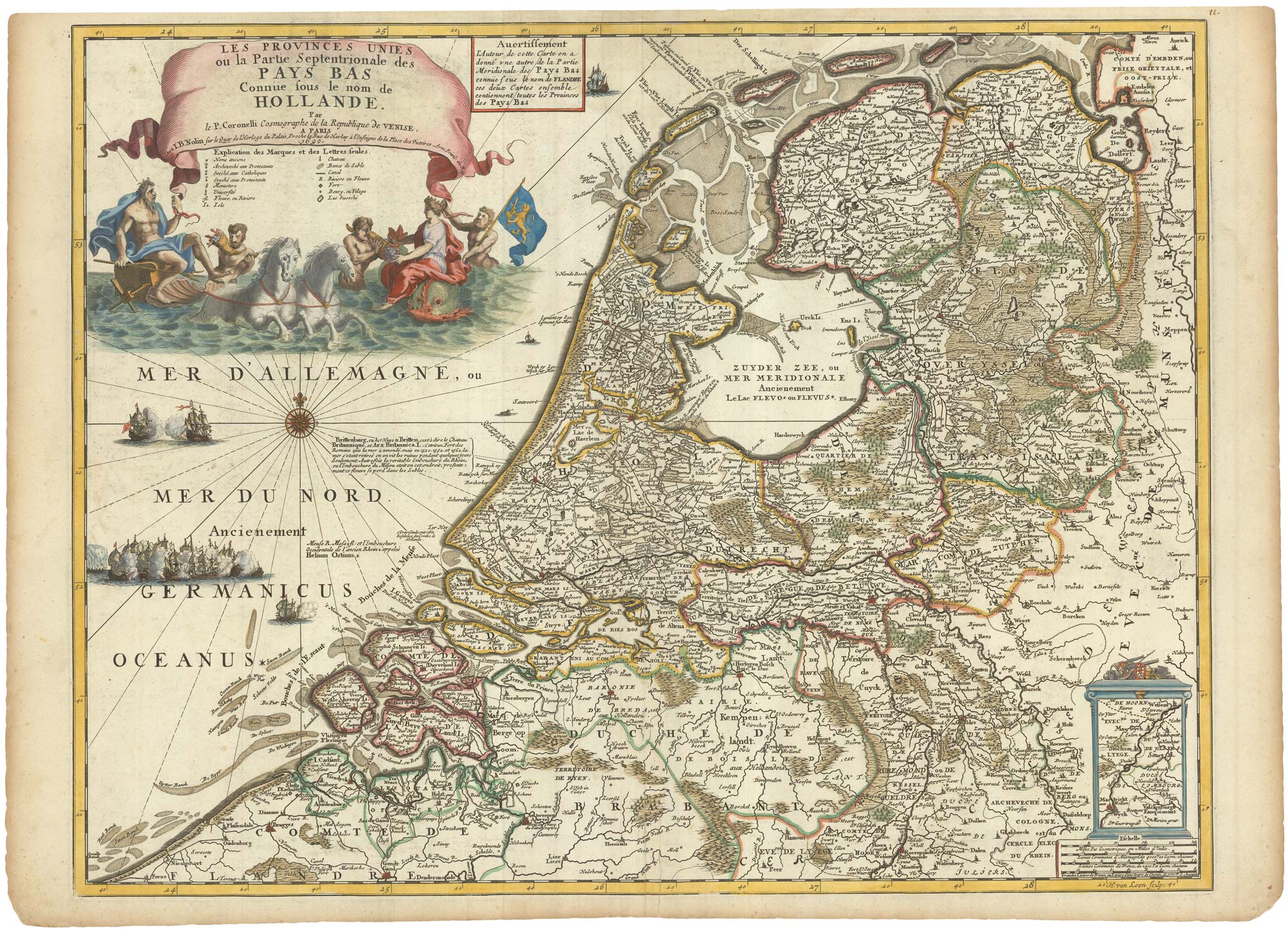


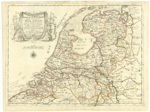
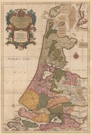
Scarce map of the Netherlands, with a fine maritime cartouche
Les Provinces Unies ou la Partie Septentrionale des Pays Bas Conue sous le nom de Hollande.
Paris, Jean Baptiste Nolin, 1690. Coloured. 460 x 605mm.
£900.00
1 in stock
x
Question About This Item?
Scarce map of the Netherlands, with a fine maritime cartouche & CORONELLI, Vincenzo Maria.Stock #: 23087
Add to Wishlist
Export as PDFEnquireSimilar to Sell?Add to Wishlist
Description
Map of Holland engraved by van Loon, with an allegorical cartouche featuring Neptune in his sea-chariot, with a vignette sea-battle. The scale cartouche bottom right has an inset map of Leige marking Maastrict.
Coronelli (1650-1718), a Minorite friar, was official cartographer to both the Republic of Venice and to Louis XIV of France, for whom he made a pair of 3.85 metre diameter globes. Because of this dual interest, many of Coronelli's maps were published by Nolin in Paris, which are generally scarcer than Coronelli's own publications. Engraved by van Loon and first published in 1689, this Africa map pre-dates Coronelli's magnificent two-sheet version by two years.
Condition:
Minor repairs to centre fold.Related products
-
A 16th century miniature plan of a Roman fort
LANGENES, Barent. Date: 1599Stock #: 21306 £290.00 -
Classic carte-à-figure map of the Netherlands & Belgium
SPEED, John. Date: 1665Stock #: 23992 £1,300.00 -
The Netherlands during the Anglo-Dutch War of 1672
DU VAL, Pierre. Date: 1672Stock #: 20503 £900.00 -
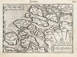
A 16th century miniature map of Zeeland
LANGENES, Barent. Date: 1599Stock #: 21159 £70.00 -
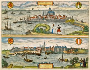
16th century town plans of Rotterdam & Gouda
BRAUN, Georg & HOGENBERG, Frans. Date: 1588Stock #: 22690 £650.00 -
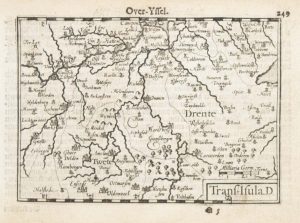
A 16th century miniature map of Overijssel
LANGENES, Barent. Date: 1599Stock #: 21165 £55.00 -
A two-sheet map of Holland in fine original colour
JAILLOT, Alexis-Hubert. Date: 1696Stock #: 22713 £1,100.00 -
A 17th century town plan of Rotterdam
JANSSON, Jan. Date: 1698Stock #: 22687 £980.00 -
16th century town plan of Rotterdam
BRAUN, Georg & HOGENBERG, Frans. Date: 1588Stock #: 22691 £650.00
Items by the same author
Add to Wishlist
Add to Wishlist
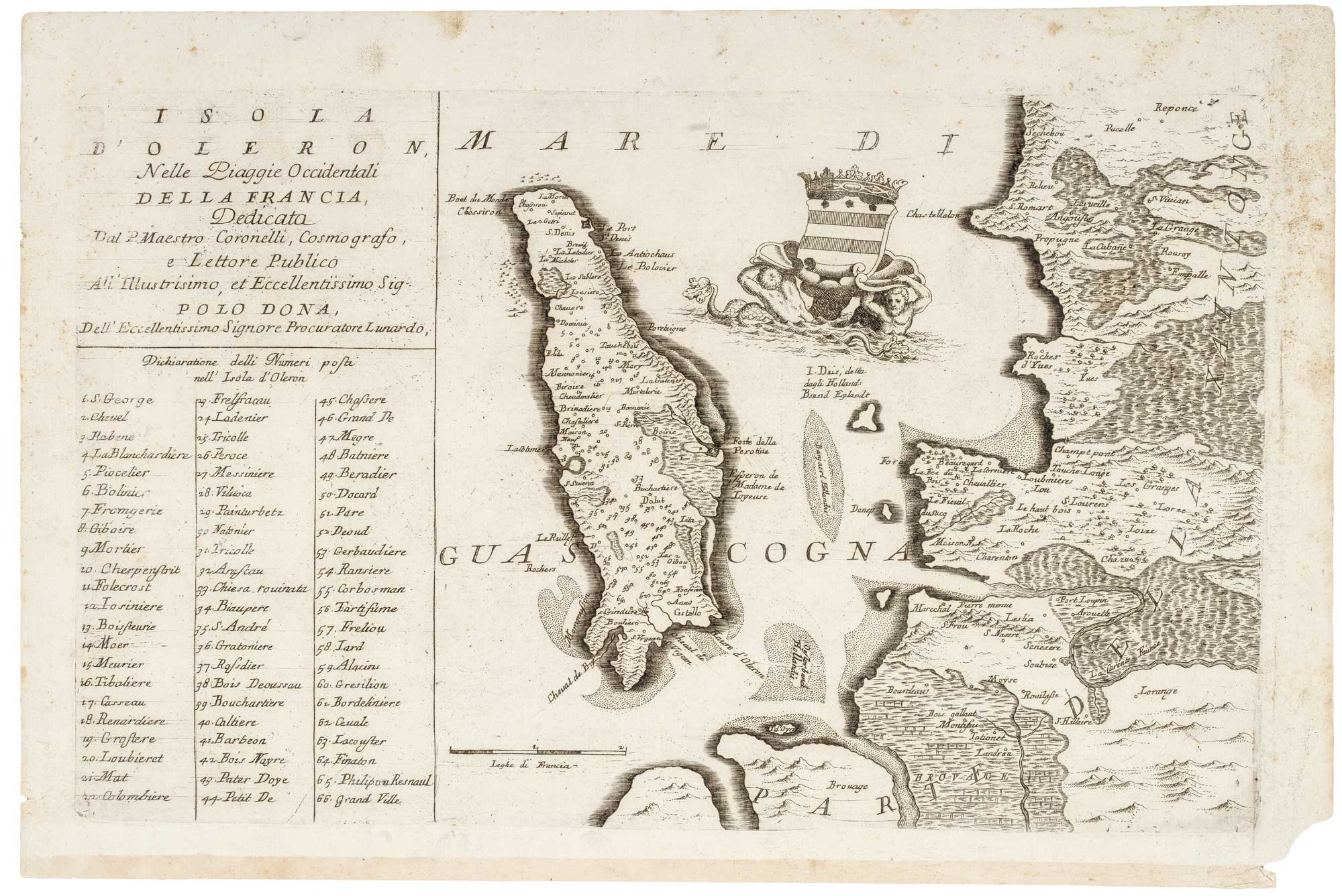
17th century map of Oleron
CORONELLI, Vincenzo Maria. Date: 1690 Stock #: 21090 £240.00
Add to Wishlist
Add to Wishlist
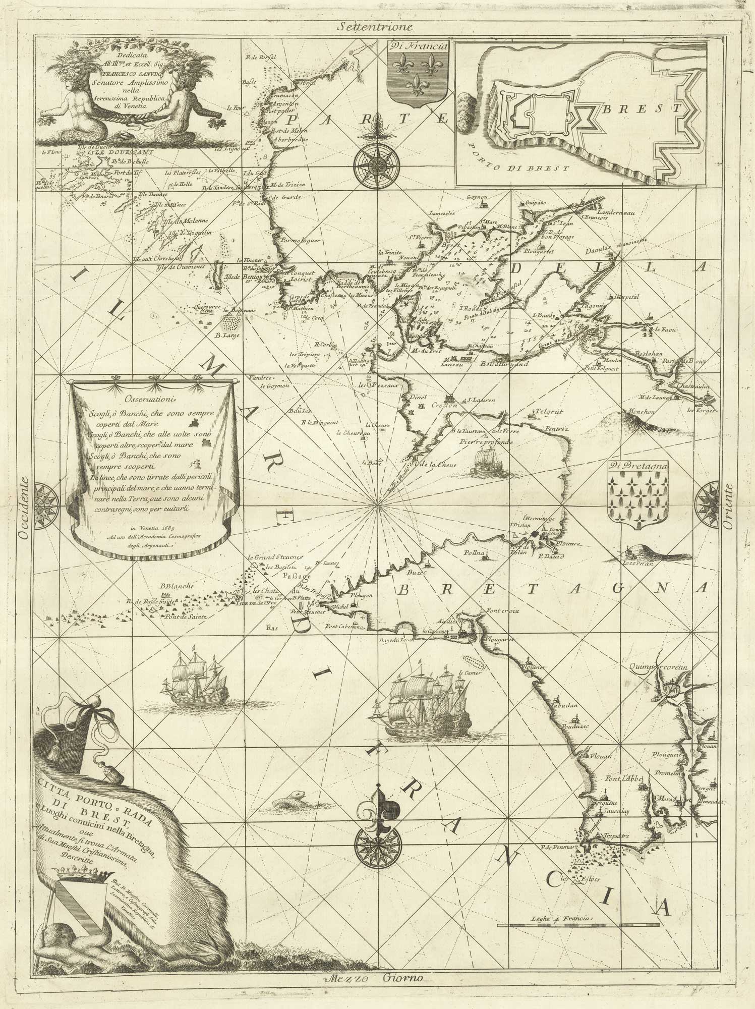
A decorative sea chart of the environs of Brest
CORONELLI, Vincenzo Maria. Date: 1689 Stock #: 21213 £550.00
Add to Wishlist
Add to Wishlist
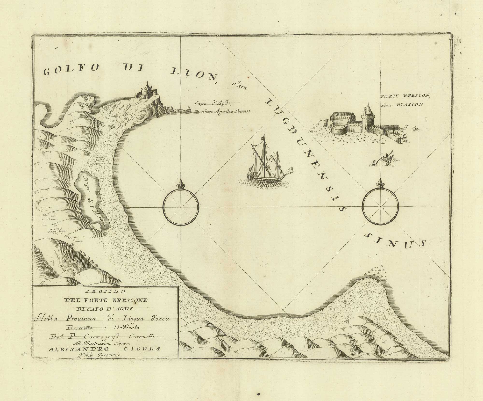
A sketch map of Cap d'Agde and Fort de Brescou
CORONELLI, Vincenzo Maria. Date: 1688 Stock #: 21226 £180.00
Add to Wishlist
Add to Wishlist
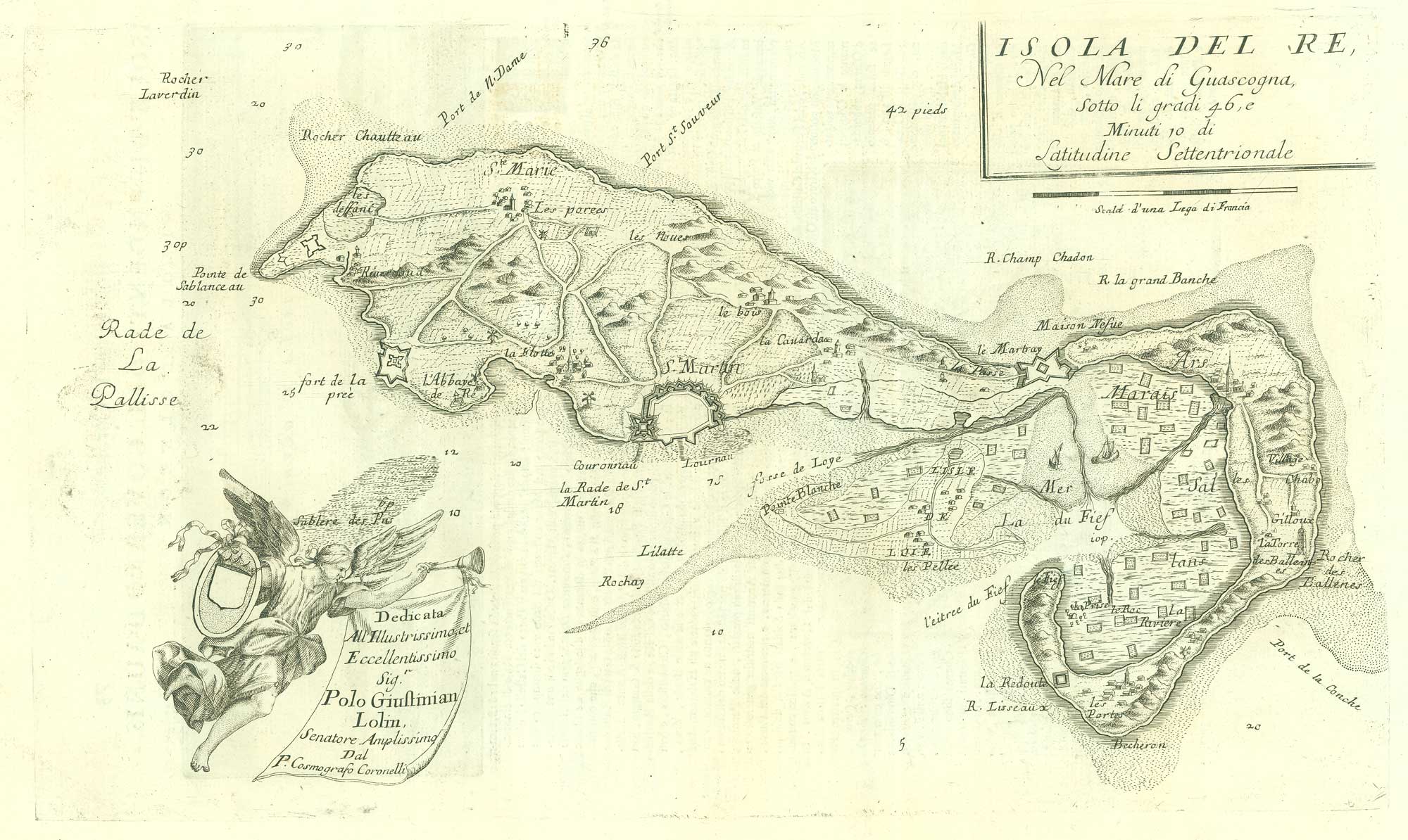
17th century map of the Ile de Ré
CORONELLI, Vincenzo Maria. Date: 1690 Stock #: 19540 £260.00
Add to Wishlist
Add to Wishlist
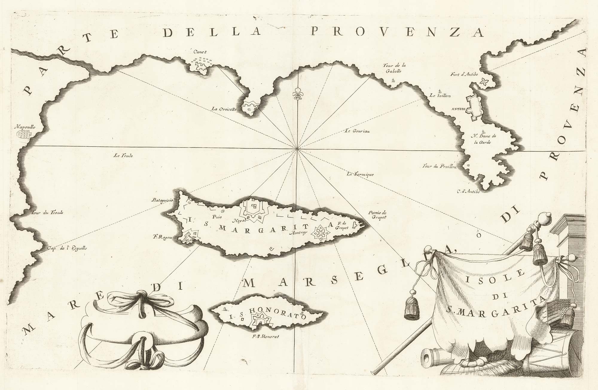
A map of Saint Marguerite with Cannes and Antibes
CORONELLI, Vincenzo Maria. Date: 1690 Stock #: 20625 £280.00
Add to Wishlist
Add to Wishlist